
The finest obtainable Colonial Era map of the Gulf Coast around the Mississippi Delta and Louisiana.

Carte de la Louisiane.
sold
- Digital Map Information
- Suitable for large format printing
- Full resolution TIFF file
- ICC color profile embedded
- Delivered instantly via download link
A flawless example of an extraordinary and important 1732/52 map of the Gulf coast and lower Mississippi River Valley by Jean Baptiste Bourguignon d'Anville. D'Anville's map covers from Sabine Pass (Cabo del Norte), Texas, past the Mississippi River Delta, Mobile ... (more details)
Stunning chromolithograph panorama showing Mt. Fuji.

Tokaido.
sold
- Digital Map Information
- Suitable for large format printing
- File Size: 23.92 MB
- File Type: ZIP / TIFF
- ICC color profile embedded
- Delivered instantly via download link
An absolutely stunning and rare panoramic view of the Tokaido region, Japan dating to Taisho 15 or 1926. Tokaido was originally an old Japanese geographical region that made up the gokishichido system and was situated along the southeastern edge of Honshu. Its ... (more details)
A lovely early decorative map of the American southeast.
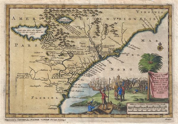
Zee en Land Togten der Franszen Gedaan na, en in't Americaans Gewest van Flordia, aller-eerst door Ioh. Pontius ontdekt.
sold
- Digital Map Information
- Suitable for large format printing
- DPI: 300
- File Size: 2.32 MB
- File Type: ZIP / TIFF
- ICC color profile embedded
- Delivered instantly via download link
A fine first state first edition example of Pieter Van der Aa's 1706 map of the southeast coast of North America. Covering roughly from Cape Romaine (C. de s. Romano) south to St. Augustine (C. Francois), Van der Aa's map includes parts of modern day Florida, ... (more details)
The first published representation of the pre-Columbian Aztec pilgrimage from Aztlan to Chapultepec.

Copia d'una antica dipintura conservata da d. Carlo Siguenza nella qualle sta s egnata, e descritta la strade che tennero gli antichi Mexicani, quando da'monti vennero ad abitare nella Lacuna, che oggidi si dice di Mesico; co geroglifici significanti inomi de' luoghi, ed altro.
sold
- Digital Map Information
- Suitable for large format printing
- DPI: 300
- File Size: 8.72 MB
- File Type: ZIP / TIFF
- ICC color profile embedded
- Delivered instantly via download link
This unusual 1704 map, drawn by Giovanni Francesco Gemelli Careri, is the first published representation of the legendary Aztec migration from Aztlan, a mysterious paradise somewhere to the northwest of Mexico, to Chapultepec Hill, currently Mexico City. ... (more details)

Wisconsin.
sold
- Digital Map Information
- Suitable for large format printing
- File Size: 21.77 MB
- File Type: ZIP / TIFF
- ICC color profile embedded
- Delivered instantly via download link
This is an attractive Rand McNally and Company's 1889 map of Wisconsin. It covers the entire state of Wisconsin bounded by on the north by Lake Superior, on the east by Lake Michigan and on the west by the Minnesota Territory. Parts of adjoining ... (more details)

Oregon.
sold
- Digital Map Information
- Suitable for large format printing
- File Size: 23.52 MB
- File Type: ZIP / TIFF
- ICC color profile embedded
- Delivered instantly via download link
An attractive 1891 Rand McNally and Company's map of Oregon. It covers the state in its entirety along with parts of adjoining Washington. The map is highly detailed, showing various towns, rivers, cities, railroads, mountains, and other ... (more details)
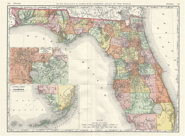
Florida.
sold
- Digital Map Information
- Suitable for large format printing
- File Size: 19.36 MB
- File Type: ZIP / TIFF
- ICC color profile embedded
- Delivered instantly via download link
A beautiful 1892 map of Florida issued by Rand McNally and Company. The map covers the state of Florida in its entirety along with parts of adjacent Georgia. An inset in the lower left quadrant details the southern portion of the state ... (more details)
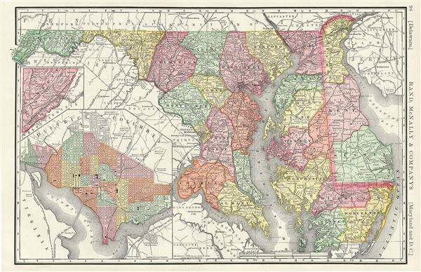
Delaware. Maryland and D.C.
sold
- Digital Map Information
- Suitable for large format printing
- File Size: 9.93 MB
- File Type: ZIP / TIFF
- ICC color profile embedded
- Delivered instantly via download link
This is a fine example of Rand McNally and Company's 1888 map of Maryland and Delaware. It covers both states along with parts of adjacent states. Garret, the western part of Maryland, is detailed in an inset near the left margin. The ... (more details)

Map of Cleveland.
sold
- Digital Map Information
- Suitable for large format printing
- File Size: 8.63 MB
- File Type: ZIP / TIFF
- ICC color profile embedded
- Delivered instantly via download link
This is a beautiful example of the 1892 Rand McNally and Company map or plan of the City of Cleveland, Ohio. It extends southward from Lake Erie and covers the entire city of Cleveland, centered on the Cuyahoga River. The map is highly ... (more details)
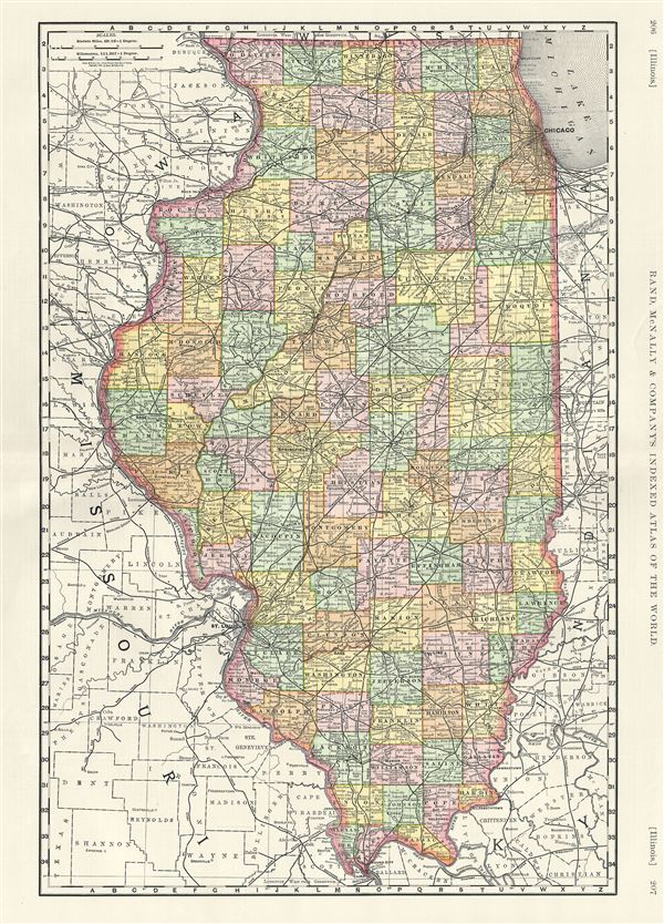
Illinois.
sold
- Digital Map Information
- Suitable for large format printing
- File Size: 21.54 MB
- File Type: ZIP / TIFF
- ICC color profile embedded
- Delivered instantly via download link
This is an attractive 1889 map of Illinois issued by Rand McNally and Company. It covers the state of Illinois in its entirety, along with parts of adjacent Iowa, Missouri, Kentucky and Indiana. The map also delineates survey grids and ... (more details)
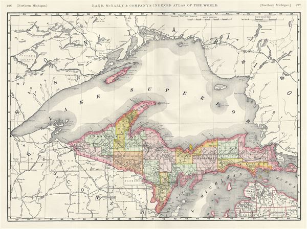
Northern Michigan.
sold
- Digital Map Information
- Suitable for large format printing
- File Size: 18.28 MB
- File Type: ZIP / TIFF
- ICC color profile embedded
- Delivered instantly via download link
A beautiful example of the 1889 Rand McNally and Company map of the northern part of the state of Michigan. This map covers the northern part of the state bounded by Lake Superior in the north and Wisconsin along with lakes Michigan and ... (more details)
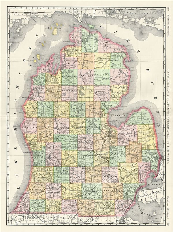
Southern Michigan.
sold
- Digital Map Information
- Suitable for large format printing
- File Size: 20.85 MB
- File Type: ZIP / TIFF
- ICC color profile embedded
- Delivered instantly via download link
An attractive Rand McNally and Company's 1889 map of the southern part of the state of Michigan. The map covers the lower part of the state bounded by Lake Michigan on the west and Lake Huron on the east. Color coded according to ... (more details)
1817 Thomson Map of the Southeastern United States: Georgia, Carolina, Virginia, Tennessee, Kentucky
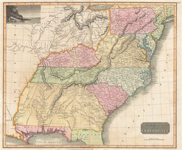
Southern Provinces of the United States.
sold
- Digital Map Information
- Suitable for large format printing
- DPI: 300
- File Size: 18.64 MB
- File Type: ZIP / TIFF
- ICC color profile embedded
- Delivered instantly via download link
A scarce first edition of John Thomson's 1817 map of the southeastern part of the United States. Thomson prepared this map during a transitional period of expansion shortly following the American Revolutionary War and is among most thorough treatments of this region prior to the U.S. Government Surveys. It records early U.S. efforts to acquire and assimilate American Indian territories west of the Appalachian Mountains. (more details)
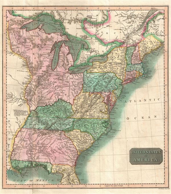
United States of America.
sold
- Digital Map Information
- Suitable for large format printing
- DPI: 300
- File Size: 8.82 MB
- File Type: ZIP / TIFF
- ICC color profile embedded
- Delivered instantly via download link
A particularly bright and beautiful example of John Thomson's important 1814 map of the United States. The map focuses on the United States from the Mississippi River eastward to the Atlantic including the Great Lakes and ... (more details)

Ipswich and Annisquam Harbors Massachusetts.
sold
- Digital Map Information
- Suitable for large format printing
- File Size: 20.51 MB
- File Type: ZIP / TIFF
- ICC color profile embedded
- Delivered instantly via download link
A rare hand colored 1857 nautical chart of Ipswich and Annisquam Harbors. These two important ports are located just north Boston near Cape Ann. Both were centers of for the cod fishing and whaling industries in the 18th ... (more details)

Coast Chart No. 27 From Cape May to Isle of Wight.
sold
- Digital Map Information
- Suitable for large format printing
- File Size: 6.11 MB
- File Type: ZIP / TIFF
- ICC color profile embedded
- Delivered instantly via download link
An unusual 1866 U.S. Coast Survey map of the entrance to Delaware Bay. The map covers the entrance of the bay from Cape May, New Jersey to Assawoman Bay, Delaware. The map offers countless depth soundings throughout as ... (more details)
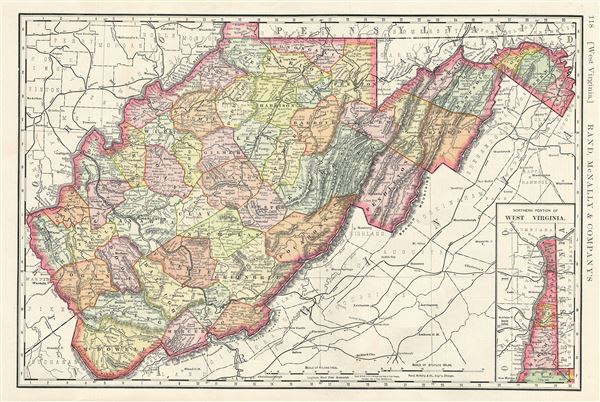
West Virginia.
sold
- Digital Map Information
- Suitable for large format printing
- File Size: 9.75 MB
- File Type: ZIP / TIFF
- ICC color profile embedded
- Delivered instantly via download link
This is a fine example of the 1888 Rand McNally and Company map of West Virginia. It covers the entire state of West Virginia in incredible detail, noting towns, rivers, mountains, cities, railways, and several other ... (more details)

North Carolina.
sold
- Digital Map Information
- Suitable for large format printing
- File Size: 11.02 MB
- File Type: ZIP / TIFF
- ICC color profile embedded
- Delivered instantly via download link
A beautiful 1888 map of North Carolina, United States, issued by Rand McNally and Company. The map covers the entire state of North Carolina, including parts of the neighboring states of Virginia, Kentucky, Georgia, ... (more details)
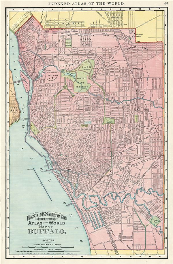
Buffalo.
sold
- Digital Map Information
- Suitable for large format printing
- File Size: 10.42 MB
- File Type: ZIP / TIFF
- ICC color profile embedded
- Delivered instantly via download link
This is a nice example of the 1892 Rand McNally and Company map or Plan of the City of Buffalo, New York. It covers eastward from Lake Erie and the Niagara River and covers the entire city of Buffalo, including part ... (more details)

South Carolina.
sold
- Digital Map Information
- Suitable for large format printing
- File Size: 8.91 MB
- File Type: ZIP / TIFF
- ICC color profile embedded
- Delivered instantly via download link
A 1888 Rand McNally and Company map of South Carolina, United States. Centered on the capital city of Columbia, the map covers the entire state of South Carolina along with parts of neighboring Georgia and North ... (more details)