

A Plan of the Solar System exhibiting its relative Magnitudes and Distances
sold
- Digital Map Information
- Suitable for large format printing
- Full resolution TIFF file
- ICC color profile embedded
- Delivered instantly via download link
This rare chart illustrating the Solar System was engraved W. G. Evans of New York for Burritt's Atlas to Illustrate the Geography of the Heavens . Shows the primary planets in relation to one another both with regard to magnitude and distance from the sun. ... (more details)
Extraordinary Meiji Era Japanese manuscript map of Asia.

Asia.
sold
- Digital Map Information
- Suitable for large format printing
- File Size: 17.83 MB
- File Type: ZIP / TIFF
- ICC color profile embedded
- Delivered instantly via download link
A beautiful Japanese hand drawn or manuscript map of Asia drawn in the Meiji period, c. 1890. The map covers the whole of Asia from Italy and Arabia to Japan and from the Arctic to Singapore and the east Indies. Based on the development of the rail system, ... (more details)
Shows Haussmann's renovations in manuscript.
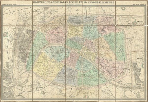
Nouveau Plan de Paris Divise en 20 Arrondissements Dans un rayon de 10 kilometres.
sold
- Digital Map Information
- Suitable for large format printing
- File Size: 55.95 MB
- File Type: ZIP / TIFF
- ICC color profile embedded
- Delivered instantly via download link
This is a large 1860 pocket map of Paris by A. Logerot. It covers the embastilled center of Paris as well as its immediate vicinity, including the Bois de Boulogne and Bois de Vincennes. Fine detail is present throughout the map, with important buildings ... (more details)

Island of Corsica.
sold
- Digital Map Information
- Suitable for large format printing
- File Size: 34.81 MB
- File Type: ZIP / TIFF
- ICC color profile embedded
- Delivered instantly via download link
An appealing British Admiralty nautical chart or maritime map detailing Corsica or Corse. The Admiralty originally issued this map in 1874. The present example has been updated to 1967 though the basic plate remains unchanged. There are countless depth ... (more details)

Sketch D Showing the Progress of the Survey in Section No. IV from 1845 to 1862.
sold
- Digital Map Information
- Suitable for large format printing
- File Size: 21.67 MB
- File Type: ZIP / TIFF
- ICC color profile embedded
- Delivered instantly via download link
This is an exceptional example of the Civil War era 1862 U.S. Coast Survey's progress chart for the coasts of Virginia and North Carolina. Covers from Cape Henry, Virginia, south past the Pamlico Sound and Cape Hatteras, to Cape Fear. It was here, ... (more details)

Sketch D Showing the Progress of the Survey in Section No. IV from 1845 to 1859.
sold
- Digital Map Information
- Suitable for large format printing
- File Size: 18.7 MB
- File Type: ZIP / TIFF
- ICC color profile embedded
- Delivered instantly via download link
This is an exceptional example of the 1859 U.S. Coast Survey's progress chart for the coasts of Virginia and North Carolina. Covers from Cape Henry, Virginia, south past the Pamlico Sound and Cape Hatteras, to Cape Fear. It was here, looking over ... (more details)
Important Civil War Era map illustrating the Battle of Forts Jackson and St. Philip.
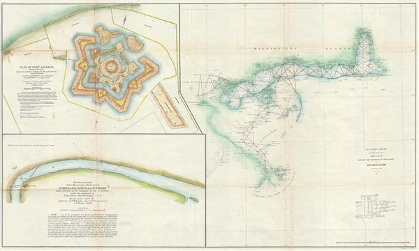
Sketch II Showing the Progress of the Survey in Section No. VIII.
sold
- Digital Map Information
- Suitable for large format printing
- File Size: 20.16 MB
- File Type: ZIP / TIFF
- ICC color profile embedded
- Delivered instantly via download link
An unusual and attractive 1862 Civil War era U.S. Coast Survey map of the Gulf Coast from the Delta of the Mississippi to Mobile Bay and Fort Jackson. The primary map, appearing in the right hand quadrants, is an early triangulation chart of the ... (more details)
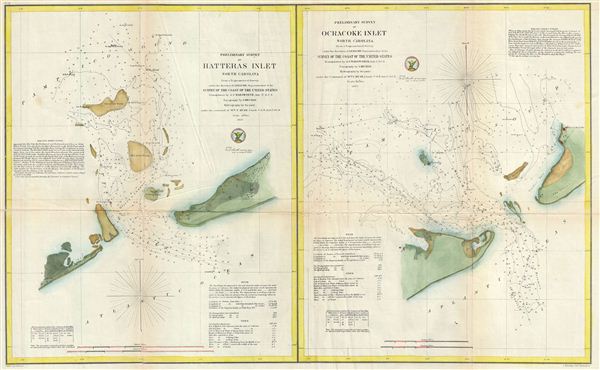
Preliminary Survey of Hatteras Inlet North Carolina. Preliminary Survey of Ocracoke Inlet North Carolina.
sold
- Digital Map Information
- Suitable for large format printing
- File Size: 14.38 MB
- File Type: ZIP / TIFF
- ICC color profile embedded
- Delivered instantly via download link
This is an attractive 1857 map of Hatteras Inlet and Ocracoke Inlet, North Carolina. essentially two maps on a single sheet, Hatters Inlet occupies the left quadrants while Ocracoke Inlet is on the right. Both Hatteras Inlet and Ocracoke Inlet ... (more details)
A particularly beautiful example of this important nautical chart.

Coast Chart No. 20, New York Bay and Harbor, New York.
sold
- Digital Map Information
- Suitable for large format printing
- File Size: 9.59 MB
- File Type: ZIP / TIFF
- ICC color profile embedded
- Delivered instantly via download link
A rare 1866 coastal chart of New York City, its harbor, and environs. One of the first 19th century carts to depict New York City as we know it today, including Manhattan, Queens, Brooklyn, the Bronx and Staten Island. Also includes Jersey ... (more details)
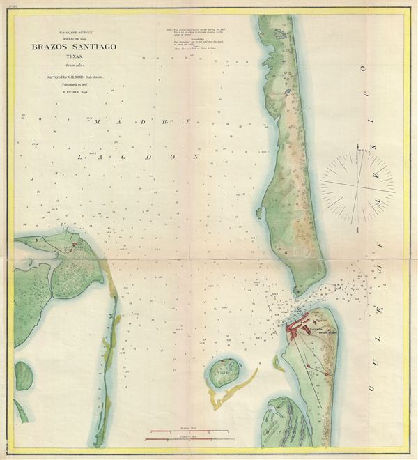
Brazos Santiago, Texas.
sold
- Digital Map Information
- Suitable for large format printing
- File Size: 3.57 MB
- File Type: ZIP / TIFF
- ICC color profile embedded
- Delivered instantly via download link
A fine example of the U.S. Coast Survey's 1867 nautical chart or maritime map of Brazos Santiago, Texas. This map focuses on the Brazos Santiago Pass, a narrow waterway between South Padre Island and Brazos Island. This area provides ... (more details)
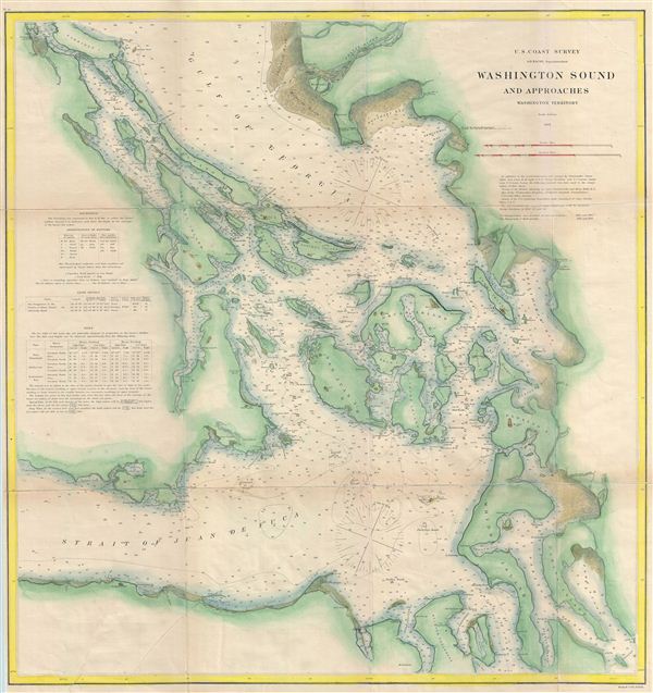
Washington Sound and Approaches Washington Territory.
sold
- Digital Map Information
- Suitable for large format printing
- File Size: 22.81 MB
- File Type: ZIP / TIFF
- ICC color profile embedded
- Delivered instantly via download link
A fine example of the U.S. Coast Survey's 1866 nautical chart or maritime map of Washington Sound, Washington. The map covers the Strait of Juan de Fuca, the Gulf of Georgia, Channel de Haro, Rosario Strait, Admiralty Inlet, the ... (more details)
Scarce map of the Judeo-Christian Fifth Age lasting between the consecration of the Temple of Solomon and the end of the Babylonian Exile.
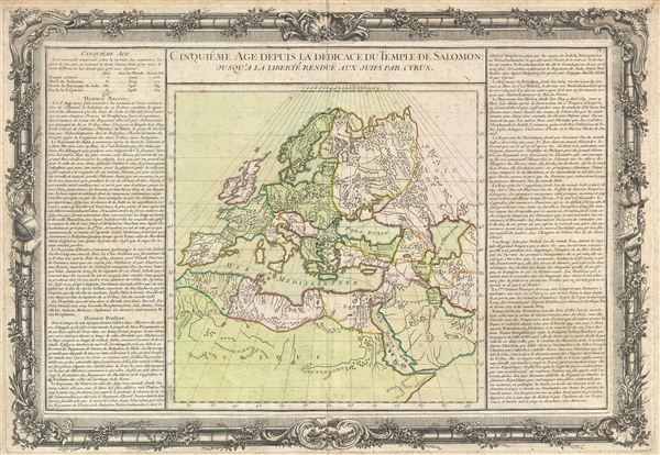
Cinquieme Age Depuis la Dedicace du Temple de Salomon; Jusqu'a la Liberte reconnue aux Juifs par Cyrus.
sold
- Digital Map Information
- Suitable for large format printing
- DPI: 300
- File Size: 12.57 MB
- File Type: ZIP / TIFF
- ICC color profile embedded
- Delivered instantly via download link
An exceptionally scarce c. 1761 map of europe, North Aria, and the Middle east prepared by Desnos in 1761. Desnos drew this map to illustrate the world in the 'Fifth Age.' In Judeo-Christian tradition, this period covers from ... (more details)

Map of British Columbia.
sold
- Digital Map Information
- Suitable for large format printing
- File Size: 11.24 MB
- File Type: ZIP / TIFF
- ICC color profile embedded
- Delivered instantly via download link
This is a beautiful example of Rand McNally and Company's 1894 map of British Columbia, Canada. It covers the region from the Cassiar District to the Strait of Juan de Fuca and Kootenay District. An inset in the upper right ... (more details)
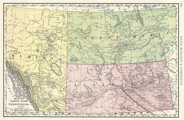
Map of North West Territories.
sold
- Digital Map Information
- Suitable for large format printing
- File Size: 10.46 MB
- File Type: ZIP / TIFF
- ICC color profile embedded
- Delivered instantly via download link
This is a beautiful example of Rand McNally and Company's 1893 map of the Northwest Territories of Canada. It covers Alberta, Saskatchewan and Assiniboia (a historic district). Several Indian Reservation sites are noted. ... (more details)

Map of British America.
sold
- Digital Map Information
- Suitable for large format printing
- File Size: 9.86 MB
- File Type: ZIP / TIFF
- ICC color profile embedded
- Delivered instantly via download link
This is a beautiful example of Rand McNally and Company's 1893 map of British America or Canada. It covers the entire region from Victoria Island to Lake Erie and from the Pacific Ocean and Queen Charlotte Islands (Haida ... (more details)
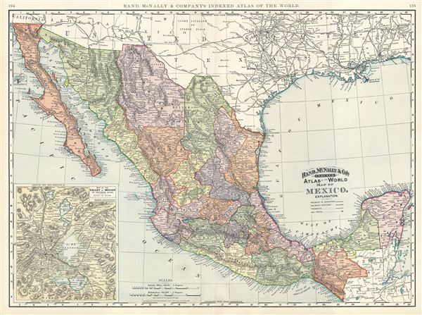
Map of Mexico.
sold
- Digital Map Information
- Suitable for large format printing
- File Size: 23.1 MB
- File Type: ZIP / TIFF
- ICC color profile embedded
- Delivered instantly via download link
This is a beautiful example of Rand McNally and Company's 1891 map of Mexico. It covers all of modern day Mexico along with parts of neighboring United States and Central America. An inset in the lower left quadrant ... (more details)

Map of Argentine Republic, Chile, Paraguay, and Uruguay.
sold
- Digital Map Information
- Suitable for large format printing
- File Size: 19.51 MB
- File Type: ZIP / TIFF
- ICC color profile embedded
- Delivered instantly via download link
This is a beautiful example of Rand McNally and Company's 1892 map of Argentina, Chile, Paraguay and Uruguay. It covers from Tacna in Chile to the Territory of Rio Negro in the Argentine Republic. The southern ... (more details)
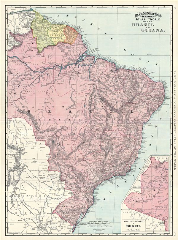
Map of Brazil and Guiana.
sold
- Digital Map Information
- Suitable for large format printing
- File Size: 20.7 MB
- File Type: ZIP / TIFF
- ICC color profile embedded
- Delivered instantly via download link
This is a beautiful example of Rand McNally and Company's 1892 map of Brazil and Guiana. It covers from the Orinoco River in Venezuela to Do Sul, including British, Dutch and French Guiana. In inset in the ... (more details)
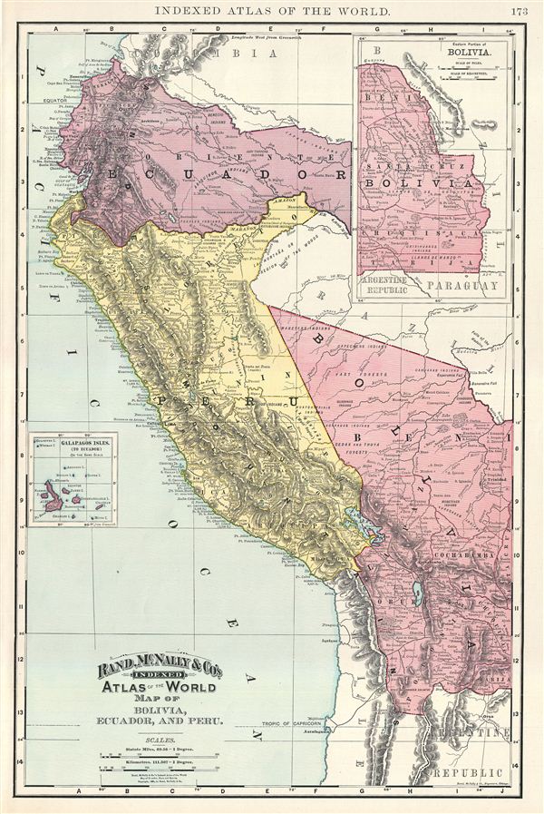
Map of Bolivia, Ecuador, and Peru.
sold
- Digital Map Information
- Suitable for large format printing
- File Size: 9.65 MB
- File Type: ZIP / TIFF
- ICC color profile embedded
- Delivered instantly via download link
This is a beautiful example of Rand McNally and Company's 1892 map of Bolivia, Ecuador and Peru. It covers from Esmeraldas in Ecuador to Potosi in Bolivia. An inset in the top right quadrant features the ... (more details)

Map of Colombia and Venezuela.
sold
- Digital Map Information
- Suitable for large format printing
- File Size: 19.29 MB
- File Type: ZIP / TIFF
- ICC color profile embedded
- Delivered instantly via download link
This is a beautiful example of Rand McNally and Company's 1892 map of Colombia and Venezuela. It covers from Panama (a province of Colombia at the time) to the Delta of the Orinoco River. An inset in the ... (more details)