
Scarce nautical chart of the eastern part of the Florida Keys - specifically Key Largo.

Coast Chart No. 167 Florida Reefs From the Elbow to Lower Matecumbe Key.
sold
- Digital Map Information
- Suitable for large format printing
- File Size: 54.55 MB
- File Type: ZIP / TIFF
- ICC color profile embedded
- Delivered instantly via download link
A scarce 1908 U.S. Coast Survey nautical chart or maritime map of the eastern Florida Keys and Florida Bay. The map covers from The elbow to Matecumbe Bay, but focuses on Key Largo, which occupies the center of the map. Lower Matecumbe Key, Upper Matecumbe Key, ... (more details)
Scarce nautical chart of Charleston Harbor, the North and South Edisto Rivers, and the St. Helena Sound.
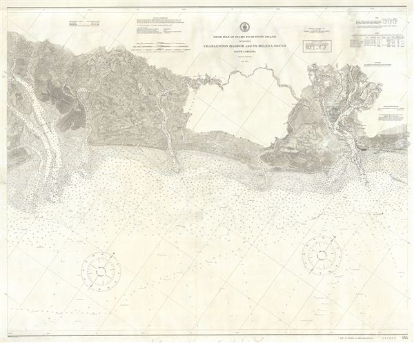
From Isle of Palms to Hunting Island including Charleston Harbor and St. Helena Sound South Carolina.
sold
- Digital Map Information
- Suitable for large format printing
- File Size: 6.65 MB
- File Type: ZIP / TIFF
- ICC color profile embedded
- Delivered instantly via download link
A scarce 1913 U.S. Coast Survey nautical chart or maritime map South Carolina. The map covers from Charleston Harbor to the St. Helena Sound, including the North edisto River and South edisto River. The chart offers a wealth of detail including impressive inland ... (more details)
Scarce nautical chart of Cape Fear, Wilmington, and Shallotte, North Carolina.

United States - East Coast Old Topsaid Inlet to Shallotte Inlet including Cape Fear.
sold
- Digital Map Information
- Suitable for large format printing
- File Size: 49.27 MB
- File Type: ZIP / TIFF
- ICC color profile embedded
- Delivered instantly via download link
A scarce 1913 U.S. Coast Survey nautical chart or maritime map of Cape Fear and vicinity, North Carolina. The map covers from Old Topsail Inset (which appears via an inset in the lower right quadrant) to Cape Fear, then to Shallotte Inlet. It also details the ... (more details)
The first accurate map of the Lower Congo River, Africa.
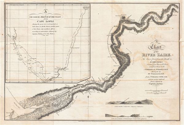
A Chart of the River Zaire, the lower part from the Mouth to Embomma, corrected from Maxwell's Chart, and from thence to the Narrows at Numaza Cove.
sold
- Digital Map Information
- Suitable for large format printing
- DPI: 300
- File Size: 9.39 MB
- File Type: ZIP / TIFF
- ICC color profile embedded
- Delivered instantly via download link
A fine example of James Kingston Tuckey's 1816 map of the Congo River from its mouth to Soondy N'Sanga, or modern day Nsundi. The map features depth soundings at the mouth of the river as well as copiousnotes throughout illustrating indigenous villages, ... (more details)

Hungaria que Asutrie Friderici …
sold
- Digital Map Information
- Suitable for large format printing
- DPI: 300
- File Size: 7.48 MB
- File Type: ZIP / TIFF
- ICC color profile embedded
- Delivered instantly via download link
A scarce page from Hartmann Schedel's 1493 Liber Chronicarum illustrating several imaginary Hungarian towns in a idealized countryside. The Liber Chronicarum or, as it is more commonly known, the Nuremberg Chronicle is alavishly illustrated world ... (more details)

Yokohama Expo.
sold
- Digital Map Information
- Suitable for large format printing
- File Size: 6.83 MB
- File Type: ZIP / TIFF
- ICC color profile embedded
- Delivered instantly via download link
This is a rare example of the 1935 or Showa 10 panoramic view or map of the 1935 Yokohama exposition held in Yokohama, Japan. Featuring a beautifully colored birds-eye view style plan of the exposition grounds, identifying the pavilions of various ... (more details)
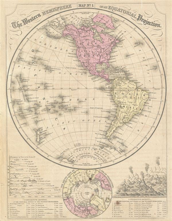
The Western Hemisphere on an Equatorial Projection.
sold
- Digital Map Information
- Suitable for large format printing
- File Size: 4.15 MB
- File Type: ZIP / TIFF
- ICC color profile embedded
- Delivered instantly via download link
This is a fine example of the 1866 Mitchell map of the Western Hemisphere or the Americas. Offering a fascinating snapshot of the world during a period of rapid globalization and discovery, this map of the Western Hemisphere includes North ... (more details)
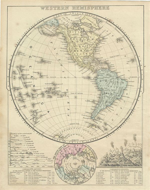
Western Hemisphere.
sold
- Digital Map Information
- Suitable for large format printing
- File Size: 3.85 MB
- File Type: ZIP / TIFF
- ICC color profile embedded
- Delivered instantly via download link
This is a fine example of the 1868 Mitchell map of the Western Hemisphere or the Americas. Offering a fascinating snapshot of the world during a period of rapid globalization and discovery, this map includes North America, South America and ... (more details)

No. 1 The World on an Equatorial Projection. No. 2 The World on a Polar Projection. No. 3 Map of the most recent Antarctic Discoveries.
sold
- Digital Map Information
- Suitable for large format printing
- DPI: 300
- File Size: 4.46 MB
- File Type: ZIP / TIFF
- ICC color profile embedded
- Delivered instantly via download link
This is a beautiful example of Mitchell's 1852 map of the world in hemispheres. Divided into three separate maps, the first map details the world on an equatorial projection, covering the Western and eastern Hemispheres. The route of the ... (more details)
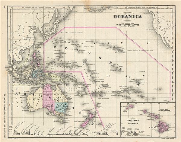
Oceanica.
sold
- Digital Map Information
- Suitable for large format printing
- File Size: 3.62 MB
- File Type: ZIP / TIFF
- ICC color profile embedded
- Delivered instantly via download link
This is a beautiful example of Francis McNally's 1866 map of 'Oceanica' or the Pacific Ocean, including Australia and Polynesia. Covers the region in considerable detail with parts of North America and Asia included. extends as far ... (more details)
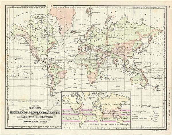
Chart of the Highlands & Lowlands of the Earth Principal Volcanoes and Isothermal Lines.
sold
- Digital Map Information
- Suitable for large format printing
- File Size: 3.3 MB
- File Type: ZIP / TIFF
- ICC color profile embedded
- Delivered instantly via download link
This is a beautiful example of Francis McNally's 1866 map of world, featuring the highlands and lowlands of the earth, important volcanoes and the world's isothermal lines. An inset near the bottom features a wind chart. The map is ... (more details)
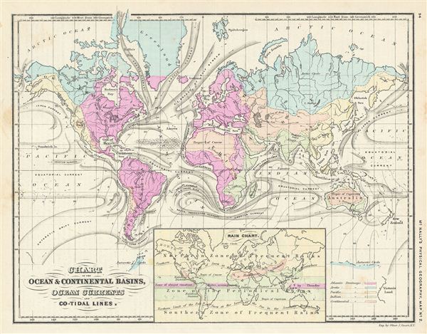
Chart of the Ocean & Continental Basins, Ocean Currents and Co-Tidal Lines.
sold
- Digital Map Information
- Suitable for large format printing
- File Size: 3.41 MB
- File Type: ZIP / TIFF
- ICC color profile embedded
- Delivered instantly via download link
This is a beautiful example of Francis McNally's 1866 map of the World's oceans and ocean currents. It details the various oceans, continental basins, ocean currents and co-tidal lines of the world. An inset map near the lower ... (more details)
Important early Civil War Map illustrating the first major Union victory on the Mississippi River at New Madrid or the Kentucky Bend.
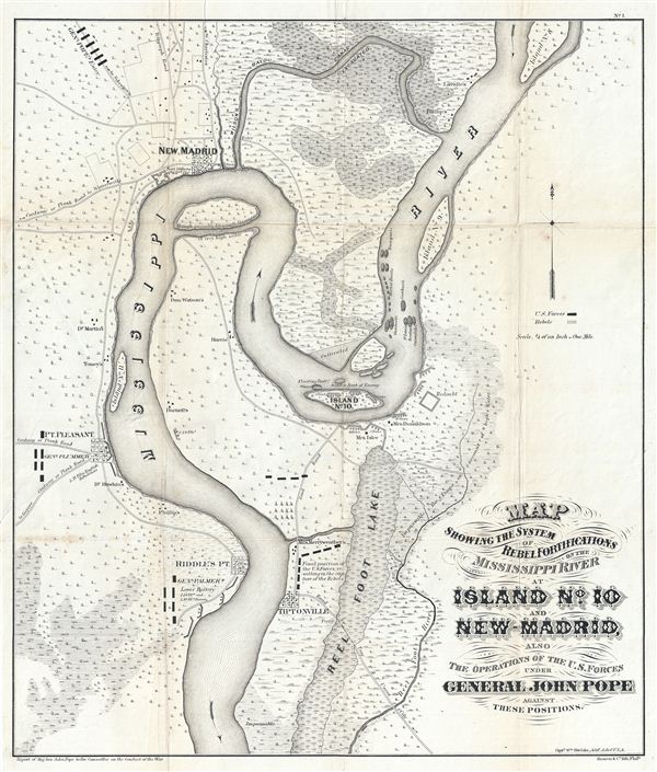
Map showing the system of rebel fortifications on the Mississippi River at Island No. 10 and New Madrid, also the operations of the U.S. forces under General John Pope against these positions.
sold
- Digital Map Information
- Suitable for large format printing
- File Size: 11.68 MB
- File Type: ZIP / TIFF
- ICC color profile embedded
- Delivered instantly via download link
A scarce and important 1862 Civil War map illustrating the course of the Mississippi River in the vicinity of New Madrid, Point Pleasant, Riddles Point, and Tiptonville. This region, collectively known as the Kentucky Bend, is ... (more details)
Art Deco style map of Cape Cod, Massachusetts.
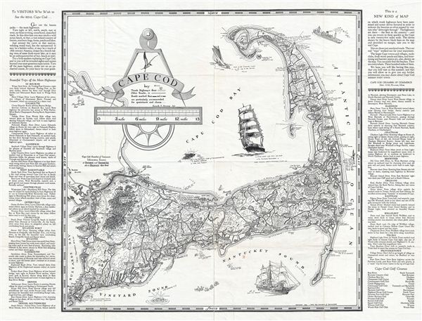
Cape Cod.
sold
- Digital Map Information
- Suitable for large format printing
- File Size: 16.68 MB
- File Type: ZIP / TIFF
- ICC color profile embedded
- Delivered instantly via download link
This is a beautiful example of the 1934 Art Deco style pictorial map of Cape Cod. Drawn for the tourist market, this decorative map covers Cape Cod from Race Point and Provincetown to Buzzard bay. The left and right margins ... (more details)
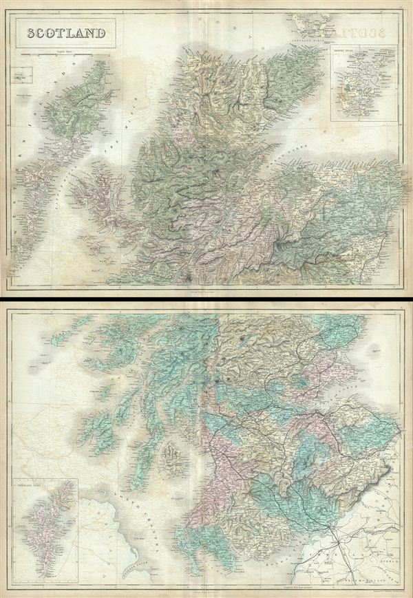
Scotland.
sold
- Digital Map Information
- Suitable for large format printing
- DPI: 300
- File Size: 35.18 MB
- File Type: ZIP / TIFF
- ICC color profile embedded
- Delivered instantly via download link
This is a fine example of Adam and Charles Black's map of Scotland. Divided into two separate maps, the upper map depicts northern Scotland from Blair Athol to the Island of Hoy (part of the Orkney Islands) in the north. An ... (more details)
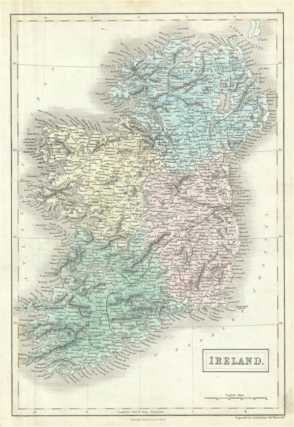
Ireland.
sold
- Digital Map Information
- Suitable for large format printing
- DPI: 300
- File Size: 6.39 MB
- File Type: ZIP / TIFF
- ICC color profile embedded
- Delivered instantly via download link
This is a fine example of Adam and Charles Black's map of Ireland. The map covers all of Ireland divided according to the four ancient provinces of Leister, Ulster, Munster and Connacht. After the Norman Invasion the old ... (more details)

Ireland.
sold
- Digital Map Information
- Suitable for large format printing
- DPI: 300
- File Size: 15.29 MB
- File Type: ZIP / TIFF
- ICC color profile embedded
- Delivered instantly via download link
This is a fine example of Adam and Charles Black's map of Ireland. The map shows all of Ireland divided by county. It covers from Donegal in the north to Cork in the south. After the Norman Invasion the old provincial ... (more details)
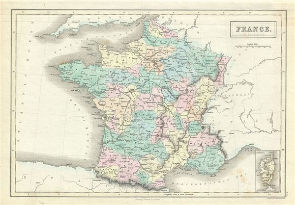
France in Provinces.
$100.00
Acquire
- Digital Map Information
- Suitable for large format printing
- DPI: 300
- File Size: 5.67 MB
- File Type: ZIP / TIFF
- ICC color profile embedded
- Delivered instantly via download link
This is a fine example of Adam and Charles Black's 1851 map of France. The map covers France just prior to the December 2 1851 coup d'etat that brought about the Second empire. In less than a year, the Second Republic ... (more details)
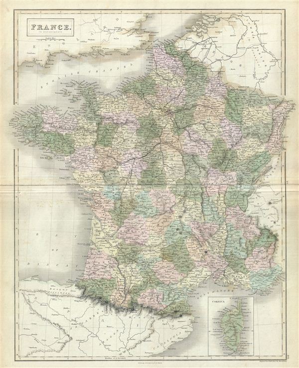
France in Departments.
sold
- Digital Map Information
- Suitable for large format printing
- DPI: 300
- File Size: 14.58 MB
- File Type: ZIP / TIFF
- ICC color profile embedded
- Delivered instantly via download link
This is a fine example of Adam and Charles Black's 1851 map of France. The map covers France just prior to the December 2 1851 coup d'etat that brought about the Second empire. In less than a year, the Second Republic ... (more details)
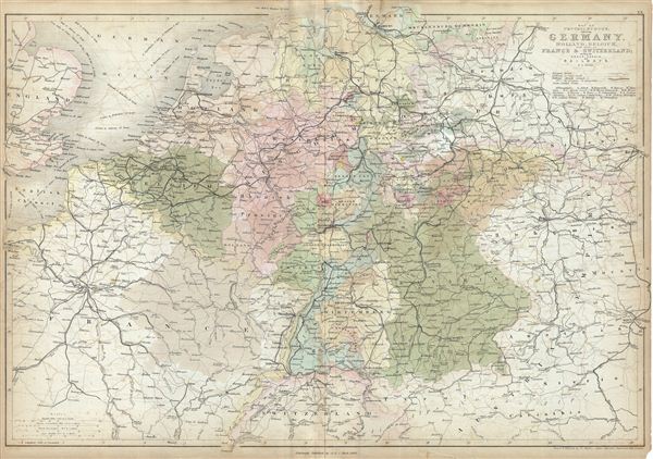
Map of Central Europe embracing Germany, Holland, Belgium, France, Switzerland; showing the Roads, Canals, and Railways.
sold
- Digital Map Information
- Suitable for large format printing
- DPI: 300
- File Size: 19.24 MB
- File Type: ZIP / TIFF
- ICC color profile embedded
- Delivered instantly via download link
This is a fine example of Adam and Charles Black's 1851 map of central europe. The map covers from Hamburg to Lake Geneva, including the modern day countries of Germany, Netherlands, Belgium, France, Poland, the Czech ... (more details)