
Exceedingly scarce first edition of Johnson's southwest map.
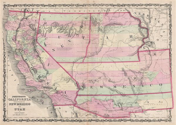
Johnson's California Territories of New Mexico and Utah.
sold
- Digital Map Information
- Suitable for large format printing
- File Size: 18.9 MB
- File Type: ZIP / TIFF
- ICC color profile embedded
- Delivered instantly via download link
The scarcest and most historically significant of A. J. Johnson's southwest series. This is the 1860 first edition of A. J. Johnson and Ross C. Browning's map of California, Utah, Nevada, New Mexico, and Arizona. The map covers from the 42nd parallel south to the ... (more details)

Planispheres Celestes.
sold
- Digital Map Information
- Suitable for large format printing
- DPI: 300
- File Size: 6.56 MB
- File Type: ZIP / TIFF
- ICC color profile embedded
- Delivered instantly via download link
A fine first edition example of M. Lapie's 1828 chart or map of the stars and constellations. This beautifully engraved map consists of two hemispheres detailing the starts of the Northern (left) and Southern (right) Hemispheres. Constellations are rendered by ... (more details)
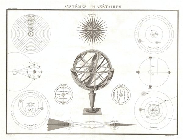
Systemes Planetaires.
sold
- Digital Map Information
- Suitable for large format printing
- Full resolution TIFF file
- ICC color profile embedded
- Delivered instantly via download link
A fine first edition example of M. Lapie's 1829 chart of the planetary systems. This beautifully engraved chart consists of eleven astronomically themed elements including a large central armillary sphere, a map of the Ptolemaic Universe, an illustration of ... (more details)
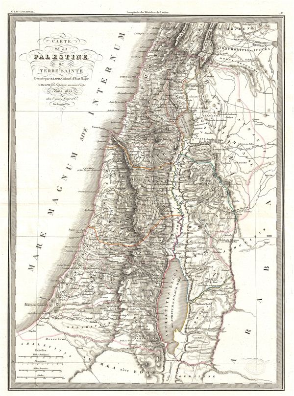
Carte de la Palestine ou Terre Sainte.
sold
- Digital Map Information
- Suitable for large format printing
- DPI: 300
- File Size: 11.25 MB
- File Type: ZIP / TIFF
- ICC color profile embedded
- Delivered instantly via download link
A fine first edition example of M. Lapie's 1829 map of the Israel, the Holy Land, or Palestine. This beautifully engraved map covers from the Mediterranean to Bostra and from Heldua (Lebanon) south to edom, inclusive of all of modern day Israel and ... (more details)

Carte des Antilles du Golfe due Mexique et d'une partie des Etates voisins.
sold
- Digital Map Information
- Suitable for large format printing
- DPI: 300
- File Size: 14.15 MB
- File Type: ZIP / TIFF
- ICC color profile embedded
- Delivered instantly via download link
A fine first edition example of M. Lapie's 1829 map of the West Indies. This map covers from the Gulf of Mexico to the Lesser Antilles and from Florida and the Bahamas to the Spanish Main, inclusive of the Greater Antilles, the Caribbean Sea, and ... (more details)

Mappe-Monde sur la Projection de Mercator.
sold
- Digital Map Information
- Suitable for large format printing
- DPI: 300
- File Size: 10.97 MB
- File Type: ZIP / TIFF
- ICC color profile embedded
- Delivered instantly via download link
A fine first edition example of M. Lapie's 1831 map of the world on a Mercator projection. Lapie's map offers fine detail throughout with elevation rendered by hachure and political boundaries demarcated with outline hand color. A stunning map, ... (more details)

Mappe-Monde en deux Hemispheres.
sold
- Digital Map Information
- Suitable for large format printing
- Full resolution TIFF file
- ICC color profile embedded
- Delivered instantly via download link
A fine first edition example of M. Lapie's 1831 map of the world in two hemispheres. Lapie's map offers fine detail throughout with elevation rendered by hachure and political boundaries demarcated with outline hand color. A stunning map, this ... (more details)
Important but little known map of the United States from the era of the Mountain Men.
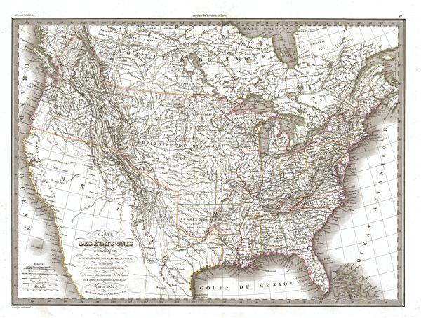
Carte des Etats-Unis d'Amerique du Canada, du Nouveau Brunswick de la Nouvelle Bretagne.
sold
- Digital Map Information
- Suitable for large format printing
- DPI: 300
- File Size: 14.33 MB
- File Type: ZIP / TIFF
- ICC color profile embedded
- Delivered instantly via download link
A significant though little known 1832 map of the United States, this is the first edition of M. Lapie's 1832 map of the United States. Lapie's map covers all of the territory claimed by the United States from Atlantic to Pacific and from ... (more details)

Carte de l'Italie comprenant Les Royaumes de Sardaigne, d'Illyrie et Lombard Venitien, les Duches de Parme, de Modene, de Toscane, les Etats de l'Eglise et le Royaume de Naples.
sold
- Digital Map Information
- Suitable for large format printing
- DPI: 300
- File Size: 12.33 MB
- File Type: ZIP / TIFF
- ICC color profile embedded
- Delivered instantly via download link
A fine first edition example of M. Lapie's 1831 map of Italy. This map covers all of Italy, inclusive of Sardinia, Corsica, Sicily, Malta, the Dalmatian Coast, and parts of adjacent France, Germany Austria, and north Africa. Lapie's map ... (more details)

Carte de la Suisse ou Helvetie.
sold
- Digital Map Information
- Suitable for large format printing
- DPI: 300
- File Size: 16.85 MB
- File Type: ZIP / TIFF
- ICC color profile embedded
- Delivered instantly via download link
A fine first edition example of M. Lapie's 1830 map of Switzerland. Centered on the country of Switzerland, this map also includes parts of adjacent France, Germany, and Italy. Lapie's map offers fine detail throughout with elevation ... (more details)
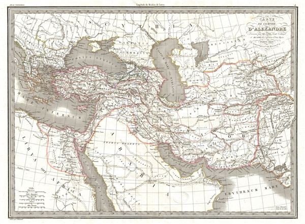
Carte de l'Empire d'Alexandre.
sold
- Digital Map Information
- Suitable for large format printing
- DPI: 300
- File Size: 11.46 MB
- File Type: ZIP / TIFF
- ICC color profile embedded
- Delivered instantly via download link
A fine first edition example of M. Lapie's 1832 map of the conquests of Alexander the Great. The map covers from Alexander's homeland in Macedonia eastwards past Asia Minor and Persia as far as India and south to include egypt and most ... (more details)
Monumental wall map of Itay.
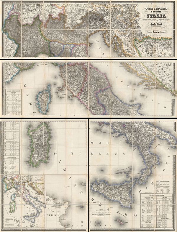
CARTA STRADALE E POSTALE DELL'ITALIA Disegnata secondo le Carte e le Opere più accreditate dei moderni geografi da CARLO CERRI nella proporzione di 1:804,000 del naturale l'anno 1852.
sold
- Digital Map Information
- Suitable for large format printing
- File Size: 1714.37 MB
- File Type: ZIP / TIFF
- ICC color profile embedded
- Delivered instantly via download link
This is the scarce 1859 edition of Carlo Cerri's monumental postal map of Italy. First published in 1849, this is one of the largest and most magnificent maps of Italy to emerge from the 19th century – the age of the Grand Tour. ... (more details)
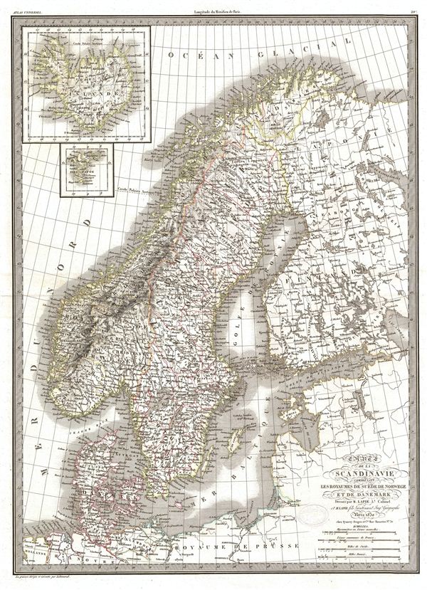
Carte de la Scandinavie comprenant Les Royaumes de Suede de Norwege et de Danemark.
sold
- Digital Map Information
- Suitable for large format printing
- Full resolution TIFF file
- ICC color profile embedded
- Delivered instantly via download link
A fine first edition example of M. Lapie's 1830 map of Scandinavia. Centered on the Kingdom of Sweden, this map covers all of Scandinavia, from the Arctic Ocean to Denmark and from Norway to Finland. Two inset maps in the upper ... (more details)
An extremely scarce nautical chart of the Long Island Sound.
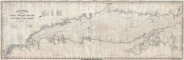
Geo. W. Eldridge's Chart C Long Island Sound from New York to New London.
sold
- Digital Map Information
- Suitable for large format printing
- File Size: 68.34 MB
- File Type: ZIP / TIFF
- ICC color profile embedded
- Delivered instantly via download link
A fine example of George W. eldridge's scarce nautical chart or map of the Long Island Sound. eldridge's monumentally proportioned chart covers the Long Island Sound from New York City to New London, Connecticut, Race Rock, and ... (more details)

New Zealand.
sold
- Digital Map Information
- Suitable for large format printing
- File Size: 21.91 MB
- File Type: ZIP / TIFF
- ICC color profile embedded
- Delivered instantly via download link
This is a stunning large format Japanese map of New Zealand dating to World War II, and one of the most beautiful cartographic depictions of New Zealand to appear in the 20th century. Covers the entirety of New Zealand, ... (more details)
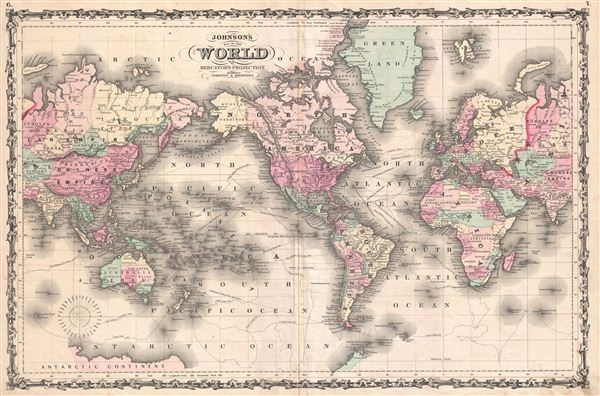
Johnson's Map of the World on Mercator's Projection.
sold
- Digital Map Information
- Suitable for large format printing
- File Size: 15.75 MB
- File Type: ZIP / TIFF
- ICC color profile embedded
- Delivered instantly via download link
This is A. J. Johnson's fine 1861 map of the world on Mercator's Projection. Depicts the entire world centered on the Americas. Offering a fascinating snapshot of the world during a period of rapid globalization and ... (more details)
First edition of Johnson's fascinating pre-Civil War Military Map of the United States.
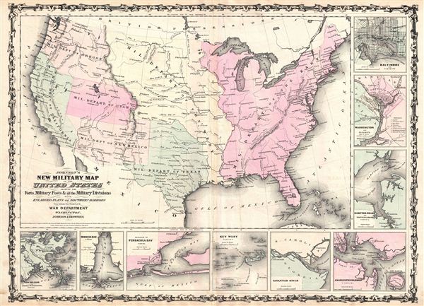
Johnson's New Military Map of the United States Showing the Forts, Military Posts & C. with Enlarged Plans of Southern Harbors from Authentic Data Obtained at the War Department Washington, Johnson and Browning.
sold
- Digital Map Information
- Suitable for large format printing
- File Size: 13.18 MB
- File Type: ZIP / TIFF
- ICC color profile embedded
- Delivered instantly via download link
This is the 1861 first edition of Johnson's Military Map of the United States. Johnson's map covers the entire United States and is divided into seven Military Departments: the Department of the east, the Department ... (more details)
A rare proof issue of the first map to depict Manhattan as an Island and to depict a beaver.

Nova Belgica et Anglia Nova.
sold
- Digital Map Information
- Suitable for large format printing
- DPI: 300
- File Size: 12.32 MB
- File Type: ZIP / TIFF
- ICC color profile embedded
- Delivered instantly via download link
A beautiful example of one of the most important maps in the history of America, Blaeu's 1635 Nova Belgica et Anglia Nova . Oriented to the west, this map covers the American coast from Virginia, past New York and ... (more details)
One of very few Civil War Maps to depict the ephemeral Confederate State of Arizona.

Johnson's New Military Map of the United States Showing the Forts, Military Posts & C. with Enlarged Plans of Southern Harbors from Authentic Data Obtained at the War Department Washington, Johnson and Ward.
sold
- Digital Map Information
- Suitable for large format printing
- File Size: 14.71 MB
- File Type: ZIP / TIFF
- ICC color profile embedded
- Delivered instantly via download link
Printed at the height of the American Civil War, this is a fine example of Johnson's 1863 Military Map of the United States . Johnson issued three editions of his Military Map, this being the scarcest and most ... (more details)

The Antilles or West-India Islands.
sold
- Digital Map Information
- Suitable for large format printing
- File Size: 4.5 MB
- File Type: ZIP / TIFF
- ICC color profile embedded
- Delivered instantly via download link
A beautifully colored 1873 map of the West Indies and Caribbean by the Society for the Diffusion of Useful Knowledge (S.D.U.K.). The map covers from Florida to the Spanish Main (U. States of Columbia) and from ... (more details)