
Great Lakes
The first map to illustrate and name all five of the Great Lakes.
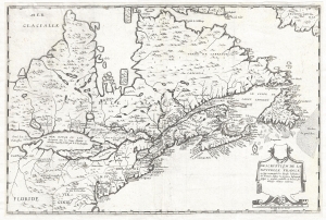
Description de la Nouvelle France, ou, sont remarquées les diverses habitations des françois, despuis la première descouverte jusques à present, receuillie et dressée sur diverses relations modernes.
$23,000.00
Acquire
- Digital Map Information
- Suitable for large format printing
- DPI: 300
- File Size: 8.1 MB
- File Type: ZIP / TIFF
- ICC color profile embedded
- Delivered instantly via download link
A rare separately published map considered the to be the first to illustrate all five of the Great Lakes. Drawn by Jean Boisseau, this map is cartographically derived from Samuel de Champlain's important map of 1632 with some important changes. The map covers from ... (more details)
Novel Mapping the Sea of the West.
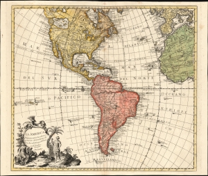
La America Dispuesta segun las ultimas y nuevas observationes de las Accademias, y de Paris, y de Londres.
$1,500.00
Acquire
- Digital Map Information
- Suitable for large format printing
- File Size: 25.48 MB
- File Type: ZIP / TIFF
- ICC color profile embedded
- Delivered instantly via download link
This is a scarce c. 1756 Spanish-language map of the Americas attributed to Pedro Gendron. This map is significant for its novel illustration of de L'Isle's Sea of the West. (more details)
Rare Edition Mapping the Spread of Christianity in America.
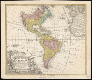
Americae Mappa Generalis.
$1,500.00
Acquire
- Digital Map Information
- Suitable for large format printing
- File Size: 24.72 MB
- File Type: ZIP / TIFF
- ICC color profile embedded
- Delivered instantly via download link
This is an elegant 1746 map of the Americas, prepared for Homann Heirs by the mathematicians and geographers Johann Matthias Hase and A. Gottlob Böhme. The present example includes a color key indicating the dominant religions on the map, a feature unique to an extremely rare 1754 edition of the work. (more details)
Bellin's seminal Great Lakes cartography.
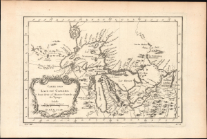
Carte des Lacs du Canada.
$950.00
Acquire
- Digital Map Information
- Suitable for large format printing
- File Size: 6.22 MB
- File Type: ZIP / TIFF
- ICC color profile embedded
- Delivered instantly via download link
This elegant map of the Great Lakes, printed in 1757 for Abbe Provost's L'Histoire Generale des Voyages, was drawn by French cartographer Jacques-Nicholas Bellin. It is also notable for being among the earliest maps to identify Detroit and the Port of Chicago (Checagou). Significantly, Bellin's cartography was one of the first to depict the four phantom islands in Lake Superior (Philippeux, Pontchartrain, Maurepas, and St. Anne) - islands that, despite their nonexistence, influenced the structuring of post-Revolutionary War borders between British Canada and the fledgling United States. (more details)
A rare cartoon map of the U.S. Naval Training Center Great Lakes - today the U.S. Navy's largest training center.
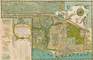
A Cartoon Map of the U.S. Naval Training Center Great Lakes, Illinois, Being as True and Faithful a Graphical Representation as the Cartographer's Art Will Allow, Taking Into Carful Account Prominent Natural Features and Including Certain Man-Made Structures as Bridges, Roads, and Divers Buildings.
$750.00
Acquire
- Digital Map Information
- Suitable for large format printing
- Full resolution TIFF file
- ICC color profile embedded
- Delivered instantly via download link
This is a 1949 Robert William Gadbois and Theodore J. Ritter cartoon pictorial map of the U.S. Naval Training Center Great Lakes, situated on the banks of Lake Michigan just north of Chicago in Illinois. Created in the post-war period, the map depicts the training center from the east and illustrates from Camp Porter to Foss Park and from the drill field to Lake Michigan. Highly detailed, myriad buildings throughout the U.S.N.T.C. are illustrated and labeled. Numerous camps, set up to house the tens of thousands of men present at the camp at any one time, are identified (most of which are named after Naval heroes), including Camp Downes, Camp Dewey, Camp Barry, Camp Moffett, and Camp Paul Jones. Ross Field, across from the main railway station, is named after Captain Albert R. Ross who supervised the base's construction. The Naval Hospital is also prominently labeled, complete with a patient drawn chasing a nurse. Other comic illustrations include a man in a striped suit, sailors playing ping pong, and another sailor drilling holes in the Drill Field. Others include a sea monster in Lake Michigan wearing a sailor's 'gob cap', a sailor riding a gigantic sea horse, and another sailor being romanced by a mermaid. There's even an octopus using a fishing pole fishing off a pier! A large decorative cartouche is situated in the lower left quadrant, just above an index of over one hundred buildings located throughout the base. (more details)
The Great Lakes.
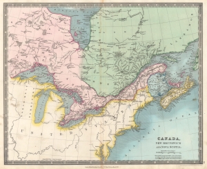
Canada, New Brunswick and Nova Scotia.
$200.00
Acquire
- Digital Map Information
- Suitable for large format printing
- DPI: 600
- File Size: 28.66 MB
- File Type: ZIP / TIFF
- ICC color profile embedded
- Delivered instantly via download link
This is an 1831 Henry Teesdale and John Dower map of Canada and the Great Lakes. (more details)