
Great Lakes (sold)
Champlain's great lost map of 1616 hidden within a Duval Map of 1664! The first printed map showing Lake Ontario and Lake Huron!
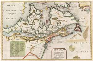
Le Canada faict par le Sr. de Champlain ou son La Nouelle France, La Nouvelle Angleterre, La Nouvelle Hollande, La Nouvelle Svede, La Virginie…
sold
- Digital Map Information
- Suitable for large format printing
- DPI: 300
- File Size: 9.35 MB
- File Type: ZIP / TIFF
- ICC color profile embedded
- Delivered instantly via download link
Truly one of the most intriguing maps we have had the privilege of working with. Ostensibly, this is the second edition of Pierre Du Val's map, Le Canada , but hidden within this map is one of the great historic maps – Samuel de Champlain's unpublished map of ... (more details)
The earliest obtainable specific map of the Great Lakes.
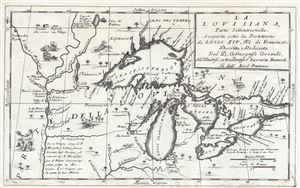
La Louisiana, Parte Settentrionalle, Scoperta sotto la Protettione di Luigi XIV, Re di Francia et Descritta, e Dedicata Dal P. Cosmografo Coronelli, All'Illustriss, et Eccellentiss, S. Zaccaria Bernardi su dell Ecc. S. Francesco.
sold
- Digital Map Information
- Suitable for large format printing
- DPI: 300
- File Size: 6.07 MB
- File Type: ZIP / TIFF
- ICC color profile embedded
- Delivered instantly via download link
This rare 1694 production by Venetian cartographer Vincenzo Coronelli is the earliest and most important obtainable map of the Great Lakes and the headwaters of the Mississippi. Coronelli's map centers on Lake Superior, but covers all five Great Lakes and ... (more details)
The earliest obtainable specific map of the Great Lakes.
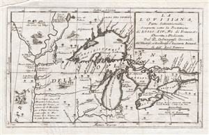
La Louisiana, Parte Settentrionalle, Scoperta sotto la Protettione di Luigi XIV, Re di Francia et Descritta, e Dedicata Dal P. Cosmografo Coronelli, All'Illustriss, et Eccellentiss, S. Zaccaria Bernardi su dell Ecc. S. Francesco.
sold
- Digital Map Information
- Suitable for large format printing
- DPI: 300
- File Size: 5.43 MB
- File Type: ZIP / TIFF
- ICC color profile embedded
- Delivered instantly via download link
This rare 1694 production by Venetian cartographer Vincenzo Coronelli is the earliest and most important obtainable map of the Great Lakes and the headwaters of the Mississippi. Coronelli's map centers on Lake Superior, but covers all five Great Lakes and ... (more details)
Essential Canadianum: 'The primary map of this period... influenced the cartography of Canada for the next fifty years.' - Kershaw
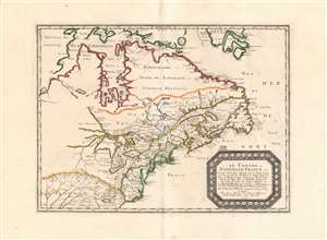
Le Canada, ou Nouvelle France...
sold
- Digital Map Information
- Suitable for large format printing
- DPI: 600
- File Size: 26.16 MB
- File Type: ZIP / TIFF
- ICC color profile embedded
- Delivered instantly via download link
This is Nicolas Sanson's 1656 map of Canada, the Northeast and the Great Lakes, in a superb, untrimmed example. It was among the most influential and important maps of the north part of the Americas to be printed in the 17th century - its depiction of Canada was not superseded until De l'Isle's 1703 Carte du Canada, and it featured the finest depiction of the Great Lakes until the 1687 Coronelli-Nolin. It is among the first printed maps to be informed by the reports of French Jesuit explorers, whose exploration of the Great Lakes region after Champlain's initial explorations was stalled by the 1648 escalation of the Beaver Wars (1603 - 1701) with the Iroquois Confederacy. Following the 1653 pause in the war, Jesuit and French fur traders resumed their push west, gradually revealing the form of the Great Lakes.
The map's treatment of the Arctic waters and Maritime Canada builds on Champlain's basic model, adding place names derived from Dutch and English exploration and preserving Button's explicit northwest passage leading from Button's Bay. (more details)
The map's treatment of the Arctic waters and Maritime Canada builds on Champlain's basic model, adding place names derived from Dutch and English exploration and preserving Button's explicit northwest passage leading from Button's Bay. (more details)
Best early map of the Great Lakes.
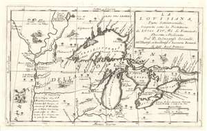
La Louisiana, Parte Settentrionalle, Scoperta sotto la Protettione di Luigi XIV, Re di Francia et Descritta, e Dedicata Dal P. Cosmografo Coronelli, All'Illustriss, et Eccellentiss, S. Zaccaria Bernardi su dell Ecc. S. Francesco.
sold
- Digital Map Information
- Suitable for large format printing
- Full resolution TIFF file
- ICC color profile embedded
- Delivered instantly via download link
This rare 1694 production by Venetian cartographer Vincenzo Coronelli is the earliest and most important obtainable map of the Great Lakes and the headwaters of the Mississippi. Coronelli's map centers on Lake Superior, but covers all five Great Lakes and extends westward as far as the Upper Mississippi River Valley. Cartographically this map is essentially an elaboration upon the 1688 Nolin/Coronelli map, Partie Occidentale du Canada ou de la Nouvelle France. Coronelli was particularly fascinated with the Great Lakes region and this map includes numerous updates and elaborations. (more details)
Rare first edition of Lahontan's highly influential map of the supposedly apocryphal Riviere Longue (Missouri River?)
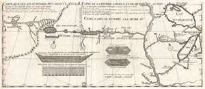
Carte que les Gnacsitares ont Dessine sur / Carte de la Riviere Longue et de quelques Autres qui se Dechargent dans le Grand Fleuve Missisipi.
sold
- Digital Map Information
- Suitable for large format printing
- DPI: 300
- File Size: 7.06 MB
- File Type: ZIP / TIFF
- ICC color profile embedded
- Delivered instantly via download link
A foundational map of extreme importance and influence, this is the rare 1703 first edition of Baron Louis-Armand de Lom d'Arce de Lahontan's, seminal map of the westernmost Great Lakes, the Mississippi River, and an enigmatic tributary river, the Riviere ... (more details)
Rare first edition of Lahontan's highly influential map of the supposedly apocryphal Riviere Longue (Missouri River?)
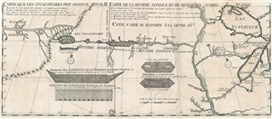
Carte que les Gnacsitares ont Dessine sur / Carte de la Riviere Longue et de quelques Autres qui se Dechargent dans le Grand Fleuve Missisipi.
sold
- Digital Map Information
- Suitable for large format printing
- DPI: 300
- File Size: 8.32 MB
- File Type: ZIP / TIFF
- ICC color profile embedded
- Delivered instantly via download link
A foundational map of extreme importance and influence, this is the rare 1703 first edition of Baron Louis-Armand de Lom d'Arce de Lahontan's, seminal map of the westernmost Great Lakes, the Mississippi River, and an enigmatic tributary river, the Riviere ... (more details)
The Heart of North America from the Finest Globemaker of the 17th Century.
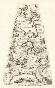
[Untitled Globe Gore of North America from the Tropic of Cancer to the Arctic Circle].
sold
- Digital Map Information
- Suitable for large format printing
- Full resolution TIFF file
- ICC color profile embedded
- Delivered instantly via download link
This is a beautiful 1688 Vincenzo Maria Coronelli globe gore focused on North America east of the Mississippi and west of the Chesapeake, engraved Coronelli's masterpiece 3 1/2 foot globe. The copperplate was adapted in 1697 for inclusion in Coronelli's bound atlases, masked off between the Tropic of Cancer and the Equator to fit book format. The gore covers most of North America east of the Mississippi, spanning from the Tropic of Cancer to the Arctic Circle. Thus, it shows the northern Gulf Coast, Florida, Chesapeake Bay, the Mississippi River (after La Salle), the Great Lakes, and Hudson's Bay. The geography is substantively the same as that on Coronelli's two-sheet America Settentrionale. Although that map bears the date 1688, it was not actually published any earlier than 1690 and it is very probable that the globes represent the earlier appearance of this geographical information. (more details)
'The primary map of this period... influenced the cartography of Canada for the next fifty years.' - Kershaw

Le Canada, ou Nouvelle France...
sold
- Digital Map Information
- Suitable for large format printing
- Full resolution TIFF file
- ICC color profile embedded
- Delivered instantly via download link
This is Nicolas Sanson's 1656 map of Canada, the Northeast, and the Great Lakes, in an attractive, untrimmed example. It ranks among the most influential and important maps of the north part of the Americas to be printed in the 17th century - its depiction of Canada was not superseded until De l'Isle's 1703 Carte du Canada, and it features the finest depiction of the Great Lakes until the 1687 Coronelli-Nolin. It is among the first printed maps to be informed by the reports of French Jesuit explorers, whose exploration of the Great Lakes region after Champlain's initial explorations was stalled by the 1648 escalation of the Beaver Wars (1603 - 1701) with the Iroquois Confederacy. Following the 1653 pause in the war, Jesuit and French fur traders resumed their push west, gradually revealing the form of the Great Lakes. (more details)
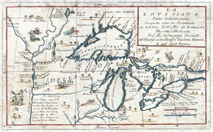
La Louisiana, Parte Settentrionalle, Scoperta sotto la Protettione di Luigi XIV, Re di Francia et Descritta, e Dedicata Dal P. Cosmografo Coronelli, All'Illustriss, et Eccellentiss, S. Zaccaria Bernardi su dell Ecc. S. Francesco.
sold
- Digital Map Information
- Suitable for large format printing
- DPI: 300
- File Size: 6.87 MB
- File Type: ZIP / TIFF
- ICC color profile embedded
- Delivered instantly via download link
This exceedingly rare 1694 map by Vincenzo Coronelli is the most important depiction of the Great Lakes and the headwaters of the Mississippi River to appear in the late 17th century. Covers all five Great Lakes and extends westward as far as the ... (more details)
One of the most influential maps of the Great Lakes to appear in the 18th century.
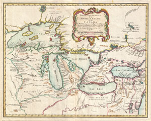
Partie Occidentale de la Nouvelle France ou du Canada.
sold
- Digital Map Information
- Suitable for large format printing
- DPI: 300
- File Size: 13.4 MB
- File Type: ZIP / TIFF
- ICC color profile embedded
- Delivered instantly via download link
A rare and extremely influential 1755 map of the Great Lakes drawn by Jacques Nicholas Bellin. This map, which appeared in the 1755 issue of the Homann Heirs Atlas Major , covers all five of the Great Lakes as well as the adjacent Indian lands ... (more details)
Imaginary (but important!) Islands of Lake Superior.
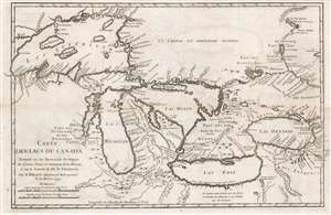
Carte des Lacs du Canada Dresse sur les Manuscrits du Depost des Carts, Plans et Journaux de la Marine et sur le Journal de RP. De Charlevoix.
sold
- Digital Map Information
- Suitable for large format printing
- Full resolution TIFF file
- ICC color profile embedded
- Delivered instantly via download link
This is the 1744 Bellin / Charlevoix map of the Great Lakes, the most accurate map of the Great Lakes to date and the best produced since the De l'Isle map of 1718. It is also the earliest obtainable map, preceded only by a 1742 proof noted by Kershaw, to depict the four fictive islands in Lake Superior (Philippeux, Pontchartrain, Maurepas, and St. Anne) - islands that nonetheless significantly influenced the structuring of post-Revolutionary War borders between British Canada and the fledgling United States. It is also notable for being among the earliest maps to identify Detroit and the Port of Chicago. Bellin's map covers all five Great Lakes and their adjacent drainage systems in considerable detail, noting known fortifications, American Indian villages, missions, and some speculative topography (particularly in Michigan). (more details)
The earliest obtainable example of the first map to introduce four fictional islands in Lake Superior. Islands later used to draw the post-Revolutionary War US-Canada border.
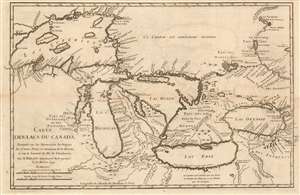
Carte des Lacs du Canada Dresse sur les Manuscrits du Depost des Carts, Plans et Journaux de la Marine et sur le Journal de RP. De Charlevoix.
sold
- Digital Map Information
- Suitable for large format printing
- Full resolution TIFF file
- ICC color profile embedded
- Delivered instantly via download link
This is the 1744 Bellin/ Charlevoix map of the Great Lakes, the most accurate map of the Great Lakes to date and the best to be produced since the De l'Isle map of 1718. It is also the earliest obtainable map, preceded only by a 1742 proof noted by Kershaw, to depict the four fictive islands in Lake Superior (Philippeux, Pontchartrain, Maurepas, and St. Anne) - islands that nonetheless significantly influenced the structuring of post-Revolutionary War borders between British Canada and the fledgling United States. It is also notable for being among the earliest maps to identify Detroit and the Port of Chicago. Bellin's map covers all five Great Lakes and their adjacent drainage systems in considerable detail, noting known fortifications, American Indian villages, missions, and some speculative topography (particularly in Michigan). (more details)
The earliest obtainable example of the first map to introduce four fictional islands in Lake Superior. Islands later used to draw the post-Revolutionary War US-Canada border.
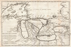
Carte des Lacs du Canada Dresse sur les Manuscrits du Depost des Carts, Plans et Journaux de la Marine et sur le Journal de RP. De Charlevoix.
sold
- Digital Map Information
- Suitable for large format printing
- DPI: 300
- File Size: 5.74 MB
- File Type: ZIP / TIFF
- ICC color profile embedded
- Delivered instantly via download link
An iconic and historically influential 1744 map of the Great Lakes by Jacques-Nicholas Bellin. Possibly Bellin's most important production, this is the earliest obtainable map, preceded only by a 1742 proof noted by Kershaw, to depict the four ... (more details)
The earliest obtainable example of the first map to introduce four fictional islands in Lake Superior. Islands later used to draw post-Revolutionary War US-Canada border.
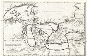
Carte des Lacs du Canada Dresse sur les Manuscrits du Depost des Carts, Plans et Journaux de la Marine et sur le Journal de RP. De Charlevoix.
sold
- Digital Map Information
- Suitable for large format printing
- Full resolution TIFF file
- ICC color profile embedded
- Delivered instantly via download link
An iconic and historically influential 1744 map of the Great Lakes by Jacques-Nicholas Bellin. Possibly Bellin's most important production, this is the earliest obtainable map, preceded only by a 1742 proof noted by Kershaw, to depict the four ... (more details)
The earliest obtainable example of the first map to introduce four fictional islands in Lake Superior. Islands later used to draw the post-Revolutionary War US-Canada border.
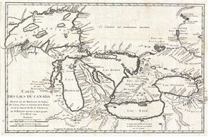
Carte des Lacs du Canada Dresse sur les Manuscrits du Depost des Carts, Plans et Journaux de la Marine et sur le Journal de RP. De Charlevoix.
sold
- Digital Map Information
- Suitable for large format printing
- DPI: 300
- File Size: 6.99 MB
- File Type: ZIP / TIFF
- ICC color profile embedded
- Delivered instantly via download link
An iconic and historically influential 1744 map of the Great Lakes by Jacques-Nicholas Bellin. Possibly Bellin's most important production, this is the earliest obtainable map, preceded only by a 1742 proof noted by Kershaw, to depict the four ... (more details)
Second-earliest example of one of the most important and enduring maps of Canada - with fine original color.
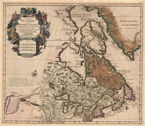
Carte du Canada ou de la Nouvelle France et des Decouverts qui y ont été faites...
sold
- Digital Map Information
- Suitable for large format printing
- Full resolution TIFF file
- ICC color profile embedded
- Delivered instantly via download link
This is the 1708 Pierre Mortier old-color issue of Guillaume de l'Isle's map of northern North America - one of the most important and influential maps of this region. (more details)
First Plate - most desirable Homann Map of America.
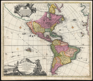
Totius Americae Septentrionalis et Meridionalis.
sold
- Digital Map Information
- Suitable for large format printing
- DPI: 600
- File Size: 54.51 MB
- File Type: ZIP / TIFF
- ICC color profile embedded
- Delivered instantly via download link
This is the scarce first plate of Johann Baptist Homann's 1707 map of America, in a beautiful original color example. It has been long misunderstood and miscataloged. The present example is the first plate, engraved by the elder Homann before 1707. Most examples of the map of this title appearing on the market are a different plate, engraved by Homann's son after 1724 (identified by the Imperial privilege). Thus, the present example is the most desirable Homann map of America. (more details)
The Definitive Great Lakes Map of the 18th Century.
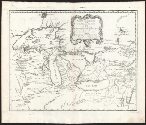
Partie Occidentale de la Nouvelle France ou du Canada.
sold
- Digital Map Information
- Suitable for large format printing
- DPI: 600
- File Size: 43.88 MB
- File Type: ZIP / TIFF
- ICC color profile embedded
- Delivered instantly via download link
An influential map of the Great Lakes, drawn in 1755 by Jacques Nicholas Bellin, and reengraved by Homann Heirs for inclusion in their 1755 Atlas Homannianus Mathematic-Historice Delineatus. It depicts all five of the Great Lakes as well as the adjacent Indian lands and the English colonies of Pennsylvania, New Jersey, and New York. (more details)
Important French and Indian War issue of Bellin's influential Map of the Great Lakes. Probably the most decorative of the series.
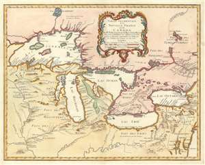
Partie Occidentale de la Nouvelle France ou du Canada.
sold
- Digital Map Information
- Suitable for large format printing
- DPI: 600
- File Size: 22.1 MB
- File Type: ZIP / TIFF
- ICC color profile embedded
- Delivered instantly via download link
A rare and extremely influential 1755 map of the Great Lakes drawn by Jacques Nicholas Bellin. This map, which appeared in the 1755 issue of the Homann Heirs Atlas Major , depicts all five of the Great Lakes as well as the adjacent Indian ... (more details)
Important French and Indian War issue of Bellin's influential Map of the Great Lakes. Probably the most decorative of the series.
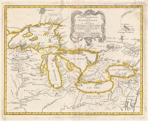
Partie Occidentale de la Nouvelle France ou du Canada.
sold
- Digital Map Information
- Suitable for large format printing
- DPI: 300
- File Size: 11.3 MB
- File Type: ZIP / TIFF
- ICC color profile embedded
- Delivered instantly via download link
A rare and extremely influential 1755 map of the Great Lakes drawn by Jacques Nicholas Bellin. This map, which appeared in the 1755 issue of the Homann Heirs Atlas Major , depicts all five of the Great Lakes as well as the adjacent Indian ... (more details)
This primary map of Canada emphasized the importance of the river trading routes.' -Kershaw
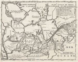
Carte Generale de Canada.
sold
- Digital Map Information
- Suitable for large format printing
- Full resolution TIFF file
- ICC color profile embedded
- Delivered instantly via download link
A fine example of Lahontan's scarce and important 1715 map of the Great Lakes, Canada, and the Upper Mississippi. Lahontan's map covers from the Mississippi River eastward to the mouth of the St. Lawrence and the Atlantic Ocean, and from ... (more details)
Premier Great Lakes Map of the Mid-18th Century.
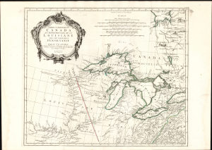
Partie Occidentale du Canada et Septentrionale de la Louisiane avec une partie de Pensilvanie.
sold
- Digital Map Information
- Suitable for large format printing
- Full resolution TIFF file
- ICC color profile embedded
- Delivered instantly via download link
This is Paolo Santini's 1775 map of the western part of Canada, the Upper Mississippi, and the Great Lakes Region. Produced to satisfy European interest in the American Revolutionary War (1775 - 1783), it drew on D'Anville's map, the best French mapping of the region produced during the French and Indian War (1754 - 1763). (more details)
The earliest map to use the term Great Lakes. Includes four fictional islands in Lake Superior later used to draw the post-Revolutionary War US-Canada border.
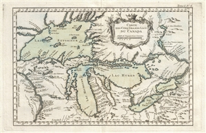
Carte des Cinq Grands Lacs du Canada.
sold
- Digital Map Information
- Suitable for large format printing
- Full resolution TIFF file
- ICC color profile embedded
- Delivered instantly via download link
An unusual 1764 variant edition Jacques-Nicholas Bellin influential map of the Great Lakes. This is the earliest known map to use the term 'Great Lakes'. Cartographically, this map follows Bellin's 1744 mapping of the Great Lakes. That ... (more details)
The earliest map to use the term Great Lakes. Includes four fictional islands in Lake Superior later used to draw the post-Revolutionary War US-Canada border.
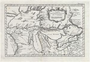
Carte des Cinq Grands Lacs du Canada.
sold
- Digital Map Information
- Suitable for large format printing
- DPI: 300
- File Size: 4.96 MB
- File Type: ZIP / TIFF
- ICC color profile embedded
- Delivered instantly via download link
An unusual 1764 variant edition Jacques-Nicholas Bellin influential map of the Great Lakes. This is the earliest known map to use the term 'Great Lakes'. Cartographically, this map follows Bellin's 1744 mapping of the Great Lakes. That ... (more details)
Highly decorative early map of the Great Lakes showing fictional islands in Lake Superior.
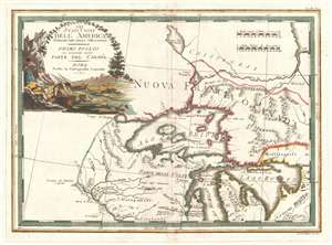
Gli Stati Uniti dell' America delineati sulle ultime Osservazioni. Primo Foglio che comprende inoltre Parte del Canada.
sold
- Digital Map Information
- Suitable for large format printing
- DPI: 300
- File Size: 7.79 MB
- File Type: ZIP / TIFF
- ICC color profile embedded
- Delivered instantly via download link
A spectacular 1797 Giovanni Maria Cassini map of the Western Great Lakes and the surrounding regions. Centered on Lake Superior, the map covers from the Mississippi River to the eastern limits of Lake Huron and from an apocryphal lake, ... (more details)
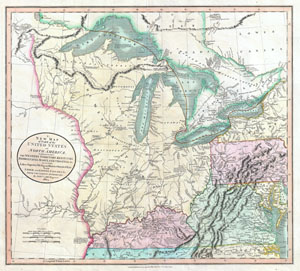
A New Map of Part of the United States of North America, exhibiting The Western Territory, Kentucky, Pennsylvania, Maryland, Virginia & C. Also, the Lakes Superior, Michigan, Huron, Ontario & Erie; with Upper and Lower Canada & C. From the Latest Authorities.
sold
- Digital Map Information
- Suitable for large format printing
- DPI: 300
- File Size: 16.69 MB
- File Type: ZIP / TIFF
- ICC color profile embedded
- Delivered instantly via download link
Published by John Cary in 1805, this is one of the most interesting and attractive maps of the American Frontier and the Great Lakes to emerge in the first years of the 19th century. Covers from Lakes Superior south along the ... (more details)
Fictional islands in Lake Superior.
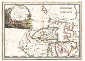
Gli Stati Uniti dell' America delineati sulle ultime Osservazioni. Primo Foglio che comprende inoltre Parte del Canada.
sold
- Digital Map Information
- Suitable for large format printing
- Full resolution TIFF file
- ICC color profile embedded
- Delivered instantly via download link
A spectacular 1797 Giovanni Maria Cassini map of the Western Great Lakes and the surrounding regions. Centered on Lake Superior, the map depicts from the Mississippi River to the eastern limits of Lake Huron and from an apocryphal lake, Cristinesi, to the central part of Lake Michigan, roughly in the vicinity of modern day Milwaukee. The Post-Revolutionary War borders of the United States and Canada are noted. Being a somewhat large scale production, the map offers excellent information, including the deportment of American Indian tribes and villages. A highly decorative title cartouche appears in the upper left quadrant and features fishermen. (more details)
Highly decorative early map of the Great Lakes showing fictional islands in Lake Superior.
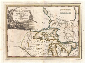
Gli Stati Uniti dell' America delineati sulle ultime Osservazioni. Primo Foglio che comprende inoltre Parte del Canada.
sold
- Digital Map Information
- Suitable for large format printing
- DPI: 300
- File Size: 7.67 MB
- File Type: ZIP / TIFF
- ICC color profile embedded
- Delivered instantly via download link
A spectacular 1797 Giovanni Maria Cassini old color map of the Western Great Lakes and the surrounding regions. Centered on Lake Superior, the map covers from the Mississippi River to the eastern limits of Lake Huron and from ... (more details)
Bellin's seminal Great Lakes cartography.
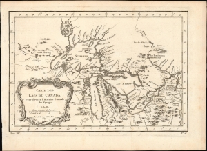
Carte des Lacs du Canada.
sold
- Digital Map Information
- Suitable for large format printing
- File Size: 6.17 MB
- File Type: ZIP / TIFF
- ICC color profile embedded
- Delivered instantly via download link
This elegant map of the Great Lakes, printed in 1757 for Abbe Provost's L'Histoire Generale des Voyages, was drawn by French cartographer Jacques-Nicholas Bellin. It is also notable for being among the earliest maps to identify Detroit and the Port of Chicago (Checagou). Significantly, Bellin's cartography was one of the first to depict the four phantom islands in Lake Superior (Philippeux, Pontchartrain, Maurepas, and St. Anne) - islands that, despite their nonexistence, influenced the structuring of post-Revolutionary War borders between British Canada and the fledgling United States. (more details)
Scarce map of Canada and the Great Lakes on the Eve of the French and Indian War.
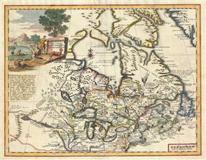
Carta Geografica Del Canada Nell' America Settentrionale.
sold
- Digital Map Information
- Suitable for large format printing
- DPI: 300
- File Size: 9.31 MB
- File Type: ZIP / TIFF
- ICC color profile embedded
- Delivered instantly via download link
An attractive 1740 map of Canada and the Great lakes by Giambattista Albrizzi. This map offers an exceptional overview of French America on the eve of the French and Indian War. Based upon a 1708 revision of a 1703 map by ... (more details)
An early map depicting the four fictional islands in Lake Superior which were later used to draw post-Revolutionary War US-Canada border.

Carte des Lacs du Canada.
sold
- Digital Map Information
- Suitable for large format printing
- Full resolution TIFF file
- ICC color profile embedded
- Delivered instantly via download link
This is an important 1757 map by French cartographer Jacques-Nicholas Bellin of the Great Lakes. It covers all five of the Great Lakes as well as the adjacent Indian lands and the English colonies of Pennsylvania, New ... (more details)