
Army Map Service (sold)
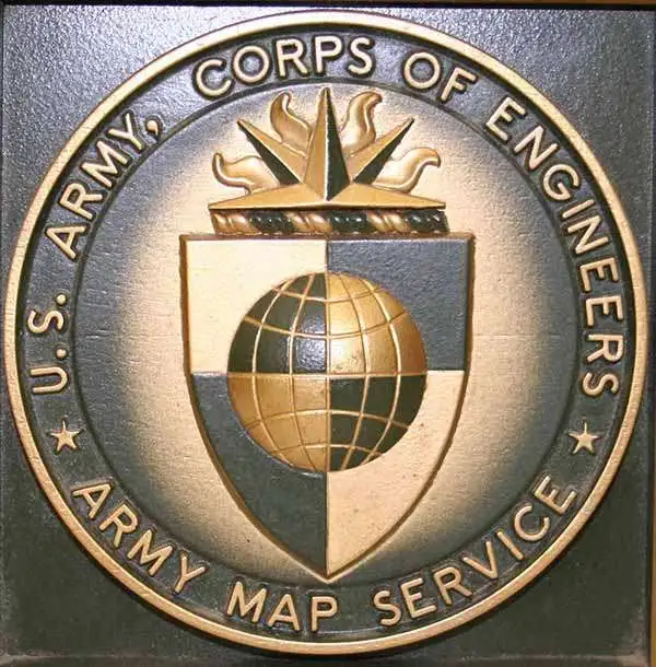
The Army Map Service (AMS) (1941 - 1968) was the military cartographic agency of the U.S. Department of Defense and part of the U.S. Army Corps of Engineers. The AMS compiled, published, and distributed military topographical maps and other related materials for use by the U.S. Armed Forces. They also prepared maps for space exploration, intelligence reports, and the establishment of world geodetic control networks. Formed during World War II, by the end of the war the Army Map Service had prepared 40,000 maps. 3,000 different maps were created for the Normandy invasion alone. The AMS was instrumental in the Korean War and the Vietnam War, and during all three of these conflicts distributed tens of millions of maps to U.S. servicemen. On September 1, 1968, the AMS was resdesignated the U.S. Army Topographic Command, and continued under this name as an independent organization until January 1, 1972 when it was merged with the new Defense Mapping Agency and renamed the DMA Topographic Center. The Defense Mapping Agency was added to the National Imagery and Mapping Agency on October 1, 1996, which was redesigned the National Geospatial-Intelligence Agency in 2003.
Japanese intelligence map from the decisive battle of the Pacific War.
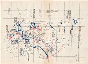
ガダルカナル要圖 / [Guadalcanal Plan].
sold
- Digital Map Information
- Suitable for large format printing
- File Size: 14.23 MB
- File Type: ZIP / TIFF
- ICC color profile embedded
- Delivered instantly via download link
A unique 1942 U.S. Army Map Service print of a Japanese military intelligence manuscript map of Guadalcanal, Solomon Islands. It details, from a Japanese perspective, the early stages of the Guadalcanal Campaign, a critical turning point in the Pacific Theater of World War II (1939 - 1945). Written entirely in Japanese, the map shows American positions around Henderson Field, the strategically important airstrip that was the main objective of both sides in the months-long battle for the island. (more details)
Produced for the Army Command and General Staff School during World War II.
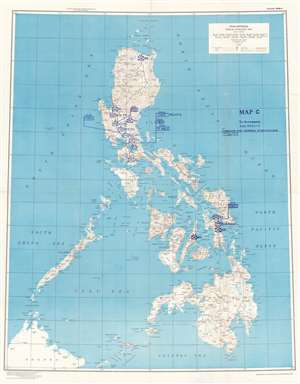
Philippines Special Strategic Map. Map C to Accompany Subj 5532 / 3 Command and General Staff College.
sold
- Digital Map Information
- Suitable for large format printing
- File Size: 97.29 MB
- File Type: ZIP / TIFF
- ICC color profile embedded
- Delivered instantly via download link
This is a 1944 Command and General Staff School map of the Philippines. Created during World War II by the Army Map Service, this map was repurposed by the Command and General Staff School likely for use in a class at the Command and General Staff College. Standard military map symbols identify units on Luzon, Leyte, and Cebu. While many of these units, such as the 70th Infantry Division, the 83rd Infantry Division, the 89th Infantry Division, and the 504th Fighter Squadron, saw combat in World War II, all were deployed in the European theater in 1944 and 1945. Task Force Able did serve in the Pacific and was the first unit to enter Tokyo Bay. However, it was not organized until August 1945. Other units, such as the 27th Corps, never existed. This leads us to speculate that this map was used as part of a hypothetical training exercise at the Command and General Staff College. Unfortunately, we have been unable to locate any information concerning the specific course or exercise. (more details)
Taiwan on the front lines of the Cold War.
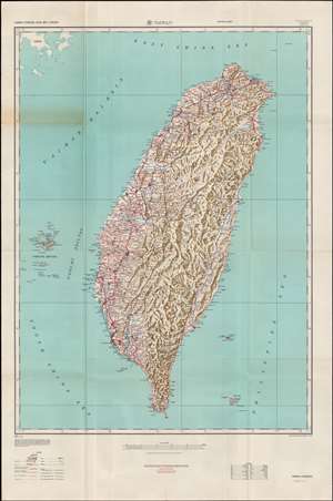
Taiwan.
sold
- Digital Map Information
- Suitable for large format printing
- File Size: 35.33 MB
- File Type: ZIP / TIFF
- ICC color profile embedded
- Delivered instantly via download link
This is an extremely detailed 1950 Army Map Service transportation and topographical map of Taiwan (Formosa). It was produced in the context of the Chinese Civil War (1927 - 1949), when the prospects of a conflict in the Taiwan Straits and on Taiwan itself seemed imminent. (more details)
Orienting U.S. personnel to Seoul.
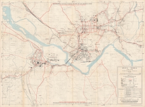
This is a 1959 U.S. Army Map Service Far East city map of Seoul, South Korea. Published 6 years after the Korean War (1950 - 1953), this map highlights the extensive and ongoing post-war U.S. military presence in Seoul. In so doing, it underscores the importance of the United States-South Korean Mutual Defense Treaty to the security of South Korea. (more details)
The American army taking over for the French in Vietnam.
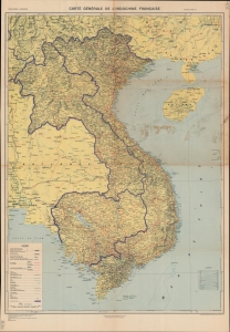
Encapsulating decades of warfare in Southeast Asia, this is a U.S. Army Map Service Far East map of French Indochina. Originally created by the French soon after the reoccupation of Vietnam following World War II, this map's evolution (see Publication History below) traces Western involvement in Vietnam, where the American army took over after the French defeat. (more details)
Hottest place on Earth.
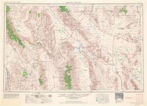
This is a 1961 U.S. Army Map Service map of Death Valley National Monument (now a National Park), with surrounding mountain ranges and valleys along the California-Nevada border in the Mojave Desert. This map reflects the history of the region, which has been inscribed onto the landscape in the form of Native American settlements, abandoned mines, federally protected land, and military testing sites, including nuclear testing sites. (more details)
First Earthside lunar stereographic map - prepping for Apollo.
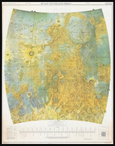
A seminal cartographic achievement, this is the first Earthside Stereographic map of the Moon produced by the Army Map Service in anticipation of the lunar landing missions of the late 1960s. The map was produced by the Army Map Service, Corps of Engineers, in March 1962 and incorporates the 6 landing sites of the forthcoming Apollo Missions. (more details)
A striking map of the Moon published in November 1963 - the same month as the John F. Kennedy assassination.
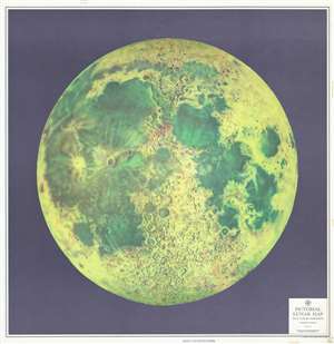
Pictorial Lunar Map.
sold
- Digital Map Information
- Suitable for large format printing
- File Size: 103.34 MB
- File Type: ZIP / TIFF
- ICC color profile embedded
- Delivered instantly via download link
This is a large-format 1963 Army Map Service pictorial map of the Moon. The map depicts the visible face of the Moon in striking detail, with the myriad craters and maria beautifully illustrated. Kepler and Copernicus, two craters in the Oceanus Pocellarum, are strikingly detailed. The lunar maria, or the lunar seas, as early astronomers believed them to be, are colored in such a way to make them appear to be bodies of water, when they are in fact large basaltic plains. (more details)
Critical Node of the Global Oil Supply.
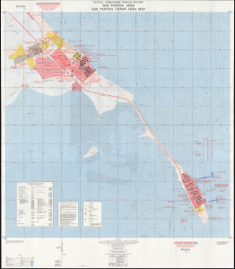
Tactical Commanders' Terrain Analysis Ras Tanura Area Ras Tanura Urban Area Map / Ras Tanura Area Orientation Map AP-1-380-46-65-INT. TacCTA Ras Tanura Saudi Arabia.
sold
This is a 1965 Tactical Commanders' Terrain Analysis (TacCTA) map of Ras Tanura, Saudi Arabia, prepared by the Army Map Service for the Defense Intelligence Agency. The area is home to a large Saudi Aramco oil refinery and port, the main avenue for Saudi Arabia's oil exports, and the map would have been vital for any military operation that might take place there. (more details)
A large and highly detailed topographic map of the Philippines.
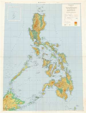
Philippines.
sold
- Digital Map Information
- Suitable for large format printing
- File Size: 142.44 MB
- File Type: ZIP / TIFF
- ICC color profile embedded
- Delivered instantly via download link
This is a large 1971 U.S. Army Topographic Command topographic map of the Philippines. Depicting from the Babuyen Islands south to Borneo and Sulawesi, an incredible level of detail is present. Myriad cities, towns, and villages throughout the archipelago are labeled, along with innumerable coastal bays, gulfs, and points. The number of islands identified here is astounding, with each of the major islands, such as Luzon, Mindoro, Leyte, Samar, Panay, Mindanao, Negros, and Cebu all labeled, as well as hundreds of smaller islands. Seas and channels within the archipelago are labeled as well. Roads are illustrated in red and are differentiated between primary, secondary, and tracks or trails, as well as those under construction. Topography is indicated by gradient lines and colors. (more details)