
Hassenstein, Bruno

Bruno Hassenstein (November 23, 1839 - August 27, 1902) was a German cartographer and was born in Ruhla, Thuringia. In 1854, Hassenstein began studying cartography and working under August Petermann in Gotha, founder of Petermanns Geographische Mitteilungen. Over the ensuing years, Hassenstein drew numerous maps for Petermanns Geographische Mitteilungen before relocating to Berlin in 1866 to work for another cartographer, including Karl Klaus von der Decken. He returned to Gotha two years later and works on maps for Henrich Theodor Menke's edition of Spurner's atlas of medieval history. He became editor of the cartography section of the Mittellungen in 1878 and worked on the Atlas von Japan, which was published in 1885. The University of Göttingen awarded him an honorary doctorate in 1878.
From the sea to the Sudan.
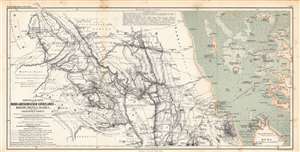
Originalkarte der Nord-Abessinischen Grenzlande Bogos, Mensa, Marea und der umliegenden Gebiete...
$350.00
Acquire
- Digital Map Information
- Suitable for large format printing
- File Size: 37.15 MB
- File Type: ZIP / TIFF
- ICC color profile embedded
- Delivered instantly via download link
This is an 1864 Augustus Petermann and Bruno Hassenstein map of what is today Eritrea, including a nautical chart of the Red Sea along the Eritrean coast. It illustrates the routes of mid-19th century European explorers from the Red Sea westwards to the Sudan. (more details)
Tracing the route of the Nile.
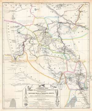
Originalkarte des westlichen Theiles des oberen Nil-Gebietes zur Übersicht der Reisen und Forschungen...
$275.00
Acquire
- Digital Map Information
- Suitable for large format printing
- File Size: 39.41 MB
- File Type: ZIP / TIFF
- ICC color profile embedded
- Delivered instantly via download link
This is a detailed 1865 Bruno Hassenstein map of the Upper White Nile, concurrent with the eastern part of today's South Sudan. It traces the routes of German and other European explorers of the mid-19th century, including those whose journeys had recently concluded in the months and years prior to publication. (more details)
Traces German exploration in East Africa between 1838 and 1862.
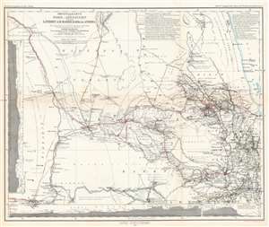
Originalkarte von Nord-Abessinien und den Ländern am Mareb, Barka und Anseba. Tafel 3a. (Ausgabe mit Colorit Übersicht der Reiserouten.)
$350.00
Acquire
- Digital Map Information
- Suitable for large format printing
- File Size: 19.56 MB
- File Type: ZIP / TIFF
- ICC color profile embedded
- Delivered instantly via download link
This is an 1864 Augustus map of East Africa. Depicting the region from the Red Sea and Mitsiwa (Massua), Eritrea west to Sudan, the routes of nine explorers though this region are traced. Spanning nearly twenty years, from 1838 to 1862, hand color highlights each route in a different color, allowing for easy differentiation and identification. Two of Werner Munzinger's expeditions through the region are illustrated, making his exploits the most thoroughly cataloged here. (more details)
Pundits on the 'roof of the world'.
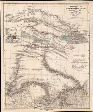
Reiserouten des Indischen Punditen A - K - in Gross Tibet und der Mongolei 1879 - 1882.
$400.00
Acquire
- Digital Map Information
- Suitable for large format printing
- File Size: 22.03 MB
- File Type: ZIP / TIFF
- ICC color profile embedded
- Delivered instantly via download link
This is an 1885 map of expeditions in western China compiled by G.W.E. Atkinson. The map depicts much of today's Qinghai Province and Tibetan Autonomous Region. The map is based not only upon European expeditions, but also those of the Pundits, or Pandits - Indian and / or Tibetan explorers working secretly for the British. (more details)
Highlights many of Guatemala's volcanoes, three of which are currently active.
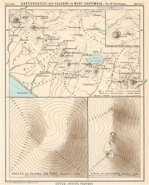
Kartenskizze der Vulkane in West-Guatemala.
$150.00
Acquire
- Digital Map Information
- Suitable for large format printing
- File Size: 4.53 MB
- File Type: ZIP / TIFF
- ICC color profile embedded
- Delivered instantly via download link
This is an 1895 Bruno Hassenstein map of volcanoes in western Guatemala. It depicts western Guatemala from the Tacaná Volcano on the Guatemala-Mexico border to Amatitlán and Lake Amatitlán, numerous volcanoes are illustrated and labeled, including the Volcán de Agua, the Volcán de Fuego, and the Volcán de Santa Maria. Cities and towns throughout the region are also labeled, along with rivers and the Lago de Atitlán. A dashed line marks the route followed by Dr. Sapper through the region. Topography lines are also illustrated, allowing the viewer some idea of the very mountainous nature of the terrain. An inset map situated in the upper right corner details the region around the Volcán de Tacaná, and labels both the town of Tacaná and Sabinal. Two other insets along the bottom focus on the Volcán San Pedro and the peak of the Volcán Acatenango. (more details)