
H.H. Lloyd and Company (sold)

H.H. Lloyd & Company (fl. 1860 - 1890) were 19th century American map and atlas publishers based in New York City. They should not be confused with the competing New York firm with of a similar name, J. T. Lloyd, with whom H. H. Lloyd had a ongoing conflict. The firm was founded by H. H. Lloyd and Benjamin S. Demarest in 1860. The H. H. Lloyd firm published numerous atlases, wall maps, and gazetteers before, during and after the American Civil War. These include some of the best maps of the period, many of which were used as battle plans by various Civil War generals on both sides of the conflict. From various offices around the city, the H.H. Lloyd firm worked with other prominent firms of the period including H. S. Stebbins, Warner and Beers to produce numerous state and county atlases. Around 1880 Demarest took full control of the firm, possibly suggesting that Lloyd either died or retired. Though H. H. Lloyd and Company continued to produce maps well in to the 1880s, the firm lost much of its momentum and eventually, by 1890, closed its doors. H. H. Lloyd is sometimes confused with J. T. Lloyd, another map publisher of the period who produced a small number of United States and regional maps sympathetic to the Confederacy. Both H. H. Lloyd and B. Demarest were Union supporters, Demarest having served as a Major in the Union Army.
Celebrates George Washington and details his estate at Mount Vernon.
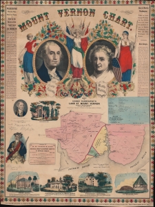
Mount Vernon Chart.
sold
- Digital Map Information
- Suitable for large format printing
- File Size: 124.39 MB
- File Type: ZIP / TIFF
- ICC color profile embedded
- Delivered instantly via download link
This is H. H. Lloyd's broadside map of Mount Vernon, Virginia, George Washington's home, published only months before the outbreak of the American Civil War (1861 - 1865). Created as a patriotic celebration of the 'Father of his Country', the broadside includes portraits of Martha and George Washington alongside maps of Washington's estate and the surrounding county. (more details)
Advertising currency promoting a mapmaker.
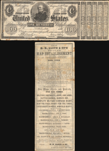
From H. H. Lloyd and Co's People's Map Establishment...
sold
- Digital Map Information
- Suitable for large format printing
- Full resolution TIFF file
- ICC color profile embedded
- Delivered instantly via download link
The only known surviving example of 1861 H. H. Lloyd advertising currency, produced in the early days of the American Civil War (1861 - 1865), to promote their printing and map publishing business. The recto is a facsimile of the $100 Interest Bearing Note then in circulation. It advertises Lloyd's printed products related to the war, including portraits of Union leaders and battle maps. (more details)
1862 Lloyd Map of New England (Vermont, New Hampshire, Maine, Massachusetts, Connecticut, Rhode Isla
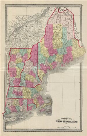
Township Map of New England.
sold
- Digital Map Information
- Suitable for large format printing
- File Size: 16.74 MB
- File Type: ZIP / TIFF
- ICC color profile embedded
- Delivered instantly via download link
This is a fascinating example of the 1862 H. H. Lloyd map of New england. Lloyds map covers from Maine to Long Island, including the states of Maine, New Hampshire, Vermont, Massachusetts, Rhode Island and Connecticut, as well as adjacent portions of New York and ... (more details)
Identifies the ephemeral province of 'Stickeen' in the modern day Yukon.
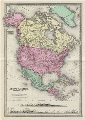
North America.
sold
- Digital Map Information
- Suitable for large format printing
- File Size: 14 MB
- File Type: ZIP / TIFF
- ICC color profile embedded
- Delivered instantly via download link
This is a fascinating example of the 1862 H. H. Lloyd map of North America. Centered on the United States, covers from the Arctic Ocean to Panama, including Greenland and parts of South American and the West Indies. A tiny inset map in the upper left quadrant ... (more details)
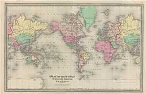
Chart of the World on Mercators Projection.
sold
- Digital Map Information
- Suitable for large format printing
- File Size: 13.88 MB
- File Type: ZIP / TIFF
- ICC color profile embedded
- Delivered instantly via download link
This is a fine example of the 1862 H. H. Lloyd map or chart of the world on Mercator's Projection. The map is centered on the American continent and a portion of Asia is duplicated to show its connection with the United States. The Antarctic continent is ... (more details)
The rarest iteration of this important map - the Lynchburg Edition.
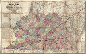
Lloyd's Official Map of the State of Virginia From actual surveys by order of the Executive 1828 and 1859.
sold
- Digital Map Information
- Suitable for large format printing
- File Size: 54.59 MB
- File Type: ZIP / TIFF
- ICC color profile embedded
- Delivered instantly via download link
An extremely scarce map, this is the Lynchburg edition of J. T. Lloyd's important map of Virginia – without a doubt the most influential map of Virginia to be issued during the American Civil War. Lloyd's enormous map covers Virginia just prior to the ... (more details)
Ephemeral configuration of the Dakota Territory.
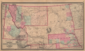
Nebraska and Northern Territories.
sold
- Digital Map Information
- Suitable for large format printing
- File Size: 57.39 MB
- File Type: ZIP / TIFF
- ICC color profile embedded
- Delivered instantly via download link
This is an 1868 Henry Stebbins and H. H. Lloyd map of Nebraska and the Northern Territories exhibiting an ephemeral configuration of the northern plains. Nebraska, Idaho, and Montana are recognizable, but 'Dakota' contains North and South Dakota and an unlabeled Wyoming is identified simply as 'Unexplored Territory'. (more details)
Wyoming just after it became a territory.
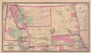
Nebraska and Northern Territories.
sold
- Digital Map Information
- Suitable for large format printing
- File Size: 52.02 MB
- File Type: ZIP / TIFF
- ICC color profile embedded
- Delivered instantly via download link
This is an 1869 Henry Stebbins and H. H. Lloyd map of Nebraska and the Northern Territories exhibiting an ephemeral configuration of the northern plains. Nebraska, Idaho, and Montana are recognizable, but 'Dakota' contains North and South Dakota. Wyoming is labeled for the first time and still includes the previous identifier 'Unexplored Territory.'
Collector William Resor points out that in addition to adding the placename Wyoming, this state of the map is also important for showing the Union Pacific Railroad complete beyond Bridger Pass: the first state of the map, which did not name Wyoming, had the Union Pacific complete only to the Laramie River. (more details)
Collector William Resor points out that in addition to adding the placename Wyoming, this state of the map is also important for showing the Union Pacific Railroad complete beyond Bridger Pass: the first state of the map, which did not name Wyoming, had the Union Pacific complete only to the Laramie River. (more details)
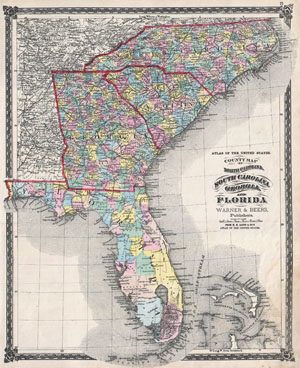
County Map of North Carolina, South Carolina, Georgia and Florida.
sold
- Digital Map Information
- Suitable for large format printing
- File Size: 14.15 MB
- File Type: ZIP / TIFF
- ICC color profile embedded
- Delivered instantly via download link
An attractive hand colored 1874 map of the southeastern part of the United States by Warner and Beers. Includes the states of North Carolina, South Carolina, Georgia and Florida. Also includes part of the Bahamas. Detailed to the county level with ... (more details)
The southeastern United States.
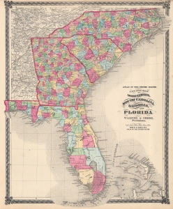
County Map of North Carolina, South Carolina, Georgia and Florida.
sold
- Digital Map Information
- Suitable for large format printing
- File Size: 38.16 MB
- File Type: ZIP / TIFF
- ICC color profile embedded
- Delivered instantly via download link
This is an attractive c. 1874 Warner and Beers map of the southeastern United States. Focusing on North Carolina, South Carolina, Georgia, and Florida, the map also includes parts of Tennessee, Alabama, Virginia, and Kentucky. The northern portion of the Bahamas occupies part of the lower left. Counties are shaded for differentiation, with roads, railroads, towns, forts, and geographical features identified. (more details)
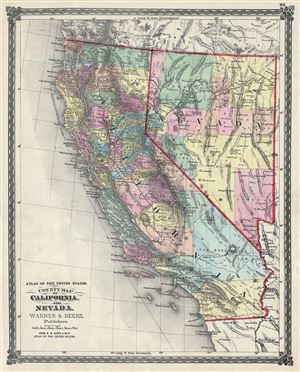
Atlas of the United States. County Map of California and Nevada.
sold
- Digital Map Information
- Suitable for large format printing
- File Size: 10.75 MB
- File Type: ZIP / TIFF
- ICC color profile embedded
- Delivered instantly via download link
This is a beautiful 1874 Warner and Beers' map of California and Nevada. It depicts the states of California and Nevada in extraordinary detail, noting major towns, counties, cities, lakes, rivers, railway lines, roads and other topographical ... (more details)
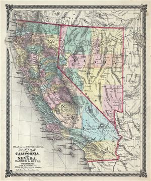
Atlas of the United States. County Map of California and Nevada.
sold
- Digital Map Information
- Suitable for large format printing
- File Size: 10.74 MB
- File Type: ZIP / TIFF
- ICC color profile embedded
- Delivered instantly via download link
This is a beautiful 1875 Warner and Beers' map of California and Nevada. It depicts the states of California and Nevada in extraordinary detail, along with parts of neighboring Utah, Oregon, Idaho and Arizona, noting major towns, counties, ... (more details)
One-of-a-kind puzzle map set in original metal box! Puzzles include Railroad Map of the United States, County of Westchester, Europe, and County Map of New England.
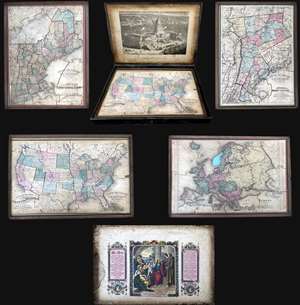
Improved Sectional Map: Railroad Map of the United States. / County of Westchester. / Europe. / County Map of New England.
sold
This is an 1877 set of four double-sided puzzle maps of the United States, Westchester, New England, and Europe contained in their original metal box. The verso of each puzzle also features an image, with a view of the United States ... (more details)