
Magnus, Charles (sold)

Charles Magnus (1826 - 1900) was a New York City based stationer, illustrator, bookseller, and map and print publisher active in the middle to late 19th century. Magnus was born in Elberfeld, Germany, as Julian Carl Magnus. Fleeing the March Revolution in Germany, the Magnus family immigrated to New York City in 1848. In New York, Charles' brother Carl Emil had already established himself as the editor of a German weekly newspaper, Deutsche Schnellpost. It was through his brother that Magnus learnt the printing and publishing trade. The earliest work to bear the Magnus inscription dated to the 1850s and includes various pictorial broadsides and maps intended to commemorate important events - the most notable for map enthusiasts being his 1855 map of New York commemorating the '79th Year of Independence of the United States'. During the 1860s and years of the American Civil War, Magnus, through various political connections, became one of the few illustrators with unrestricted access to Union military camps. He is consequently particularly well known for his authentic view of Civil War cities, personages, and events. Following the war, Magnus began to develop a prosperous business creating and selling panoramic city views, song sheets, and patriotic envelopes. In all Charles Magnus, with over 1000 known works, was one of the most prolific American printers of broadsides and other lithographs.
First Map of Iceland to Improve on Olaus Magnus
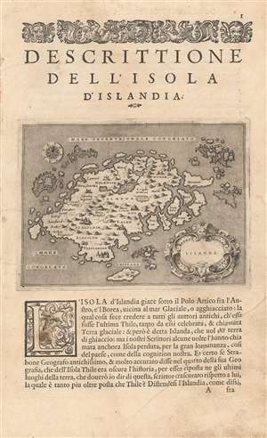
Islanda.
sold
- Digital Map Information
- Suitable for large format printing
- Full resolution TIFF file
- ICC color profile embedded
- Delivered instantly via download link
Tommaso Porcacchi's 1572 map of Iceland, in a beautiful early issue with a bold, sharp strike. It is the first separate map of Iceland to improve upon the cartography handed down from the venerable 1539 Olaus Magnus Carta Marina, whose Iceland data was reproduced by several mapmakers of the La Freri school without improvement. This map - elegantly engraved by Girolamo Porro for Porcacchi's isolario - starts with the Iceland of Magnus' Carta Marina but corrects the locations of many features. For example, the see of Hólar (Holensis) has been moved to its right place in the north, and Skálholt (Scalholdin) is correctly located in the south. Both of these locations were important in recent Icelandic history: Hólar had been the see of Jón Arason, the last Catholic bishop of Iceland. During the Reformation, it was to Skálholt that Arason and his two sons were taken and beheaded. Not all of Porcacchi's additions were well-advised; a few items have been taken from the wildly inventive Zeno map, including the seven islands appearing off the east coast. (more details)
Dual map showing Manhattan and Brooklyn.
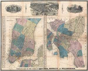
Complete Map of the Cities of New York, Brooklyn and Williamsburgh.
sold
- Digital Map Information
- Suitable for large format printing
- DPI: 300
- File Size: 14.62 MB
- File Type: ZIP / TIFF
- ICC color profile embedded
- Delivered instantly via download link
An exceptionally scarce 1852 map of New York City by Charles Magnus. Essentially two maps on one sheet. The left-hand map focuses on Manhattan and adjacent parts of Brooklyn. It extends northwards as far as 51st street. The right-hand map focuses on Brooklyn and Williamsburg when they were separate cities. It depicts Williamsburg as far as Morril Street and extends westward south of Division Avenue (current day Broadway) as far as Gowanus Bay and 59th Street. It extends eastward as far as Montgomery Street and Greenwood cemetery. The map is bounded by Bushwick on the north and Flatbush on the east. Throughout, both maps illustrate streets, important buildings, parks, city wards, piers, ferries, and rail lines. Surmounting the map there are three engraved views illustrating the University, Washington Square (future NYU), Manhattan as seen from the south, and New York's City Hall. (more details)
Extremely rare broadside map of New York City.
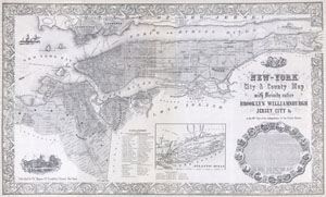
New-York City & County Map with Vicinity entire Brooklyn Williamsburgh Jersey City &c. in the 79th Year of Independence of the United States
sold
- Digital Map Information
- Suitable for large format printing
- File Size: 14.56 MB
- File Type: ZIP / TIFF
- ICC color profile embedded
- Delivered instantly via download link
An altogether extraordinary 1855 map of New York City issued by map publisher Charles Magnus in commemoration of the Declaration of Independence. Depicts the entirety of Manhattan as well as most of Brooklyn, Bedford, Williamsburgh, Greenpoint, Queens, Ravenswood, ... (more details)
Exceptional graphic large format map commemorative of New York City by master engraver Charles Magnus.
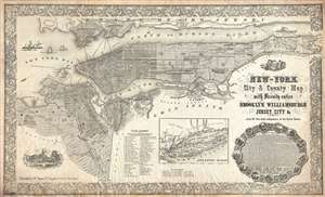
New-York City and County Map with Vicinity entire Brooklyn Williamsburgh Jersey City an c. in the 79th Year of Independence of the United States.
sold
- Digital Map Information
- Suitable for large format printing
- File Size: 30.88 MB
- File Type: ZIP / TIFF
- ICC color profile embedded
- Delivered instantly via download link
An altogether extraordinary 1855 broadside map of New York City issued by map publisher Charles Magnus in commemoration of the signing of the Declaration of Independence. Depicts the entirety of Manhattan as well as most of Brooklyn, Bedford-Stuyvsant, ... (more details)
Exceptionally graphic old color edition of Magnus's commemorative of New York City.
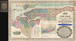
New-York City and County Map with Vicinity entire Brooklyn Williamsburgh Jersey City an c. in the 79th Year of Independence of the United States.
sold
- Digital Map Information
- Suitable for large format printing
- File Size: 23.37 MB
- File Type: ZIP / TIFF
- ICC color profile embedded
- Delivered instantly via download link
The extremely rare full color folding edition of Charles Magnus' s extraordinary 1855 broadside map of New York City issued to commemorate the signing of the Declaration of Independence. The is the only example of this map we have ever seen, and are ... (more details)
First year of the American Civil War.
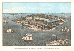
Fortress Monroe, Old Point Comfort and Hygeia Hotel, Va.
sold
- Digital Map Information
- Suitable for large format printing
- File Size: 52.72 MB
- File Type: ZIP / TIFF
- ICC color profile embedded
- Delivered instantly via download link
This is an 1861 Edward Sasche bird's-eye view map of Fort Monroe, Virginia. Published at the beginning of the American Civil War (1861 - 1865), the view overlooks Fort Monroe from the southeast, with the Hygeia Hotel in the foreground. A moat surrounds the fort, with buildings and soldiers drilling within the fort. Sailing and steamships fill the Hampton Roads and Chesapeake Bay. (more details)
Before Gettysburg.
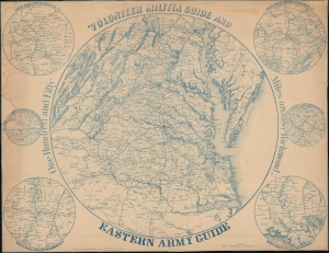
Volunteer Militia Guide and Eastern Army Guide: One Hundred and Fifty Miles around Richmond.
sold
- Digital Map Information
- Suitable for large format printing
- File Size: 38.63 MB
- File Type: ZIP / TIFF
- ICC color profile embedded
- Delivered instantly via download link
An extremely rare c. 1863 Charles Magnus broadside map of the Chesapeake, Virginia, Washington D.C. theater of the American Civil War (1861 - 1865). The map records the early days of the war when the Confederacy was rapidly advancing and before the high-water mark at Gettysburg. (more details)
Mostly likely the finest commercially published Civil War Era map of the Mississippi River.
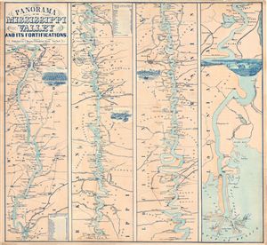
Panorama Of The Mississippi Valley And Its Fortifications.
sold
- Digital Map Information
- Suitable for large format printing
- File Size: 19.45 MB
- File Type: ZIP / TIFF
- ICC color profile embedded
- Delivered instantly via download link
An exceptionally scarce 1863 Charles Magnus Civil War era broadside map of the Mississippi River valley from St. Louis to the Delta of the Mississippi. This map, or as it is called 'panorama,' is presented in strip format divided into four distinct ... (more details)
Mostly likely the finest commercially published Civil War Era map of the Mississippi River.
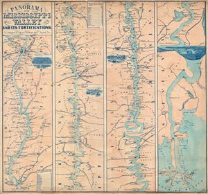
Panorama Of The Mississippi Valley And Its Fortifications.
sold
- Digital Map Information
- Suitable for large format printing
- File Size: 16.95 MB
- File Type: ZIP / TIFF
- ICC color profile embedded
- Delivered instantly via download link
An exceptionally scarce 1863 Charles Magnus Civil War era broadside map of the Mississippi River valley from St. Louis to the Delta of the Mississippi. This map, or as it is called 'panorama,' is presented in strip format divided into four distinct ... (more details)
Mostly likely the finest commercially published Civil War Era map of the Mississippi River.
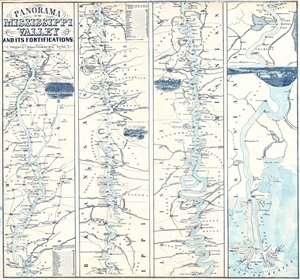
Panorama Of The Mississippi Valley And Its Fortifications.
sold
- Digital Map Information
- Suitable for large format printing
- File Size: 6.28 MB
- File Type: ZIP / TIFF
- ICC color profile embedded
- Delivered instantly via download link
An exceptionally scarce 1863 Charles Magnus Civil War era broadside map of the Mississippi River valley from St. Louis to the Delta of the Mississippi. This map, or as it is called 'panorama', is presented in strip format divided into four distinct ... (more details)
Union hospital during the Civil War.
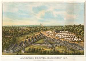
Harewood Hospital, Washington D.C.
sold
- Digital Map Information
- Suitable for large format printing
- File Size: 15.71 MB
- File Type: ZIP / TIFF
- ICC color profile embedded
- Delivered instantly via download link
This is an 1864 bird's eye view of Harewood General Hospital by Charles Magnus. Harewood General Hospital was a pavilion-style hospital operated by the United States during the American Civil War to render care for Union personnel, which was in operation from September 4, 1862, to May 5, 1866. The view shows the V-shaped layout of the Hospital's barracks-like wards, as well as an array of orderly tents extending across fields and into the neighboring woods. (The site of the hospital can be found east of Georgia Avenue NW north of the Glenwood Cemetery and south of the Armed Forces Retirement Home. Washington Hospital Center, the Washington DC VA Medical Center and the Children's National Medical Center can be found there now.) (more details)
Features a central view of the captured Confederate capital of Richmond and maps of thirty Civil War battles.
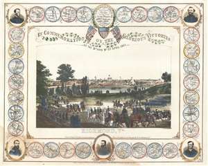
In Commemoration of the Glorious Victories of the 3rd and 9th of April 1865.
sold
- Digital Map Information
- Suitable for large format printing
- File Size: 19.22 MB
- File Type: ZIP / TIFF
- ICC color profile embedded
- Delivered instantly via download link
This is an 1865 Charles Magnus view of Richmond, Virginia at the end the American Civil War. The view commemorates the Union occupation of Richmond, the Confederate capital, on April 3, 1865 and the subsequent surrender of Confederate General Robert E. Lee to Union General Ulysses S. Grant on April 9. Richmond is illustrated as seen from the south bank of the James River with the Confederate capital building prominently illustrated. The Union Army appears in the foreground. Soldiers are shown marching in formation while officers and cavalrymen ride on horseback. A handful of cannons are included on the left.
The whole is framed by a series of medallions illustrating Civil War battles and five portraits of Union generals. Lieutenant General Ulysses S. Grant, commander of all Union forces at the end of the war, is prominently featured at bottom center. To his left is Major General Philip Sheridan and to his right, Major General Hugh Kilpatrick. A portrait of Major General William Tecumseh Sherman, known for capturing Atlanta and his March to the Sea, occupies the top left corner while a portrait of Major General George Henry Thomas is situated in the upper right. Between these illustrious commanders are thirty smaller circular medallions highlighting various engagements of the war, including the Capture of Atlanta, the Battle of Five Forks, the siege at Petersburg, Virginia, the Battle of Cold Harbor, the Battle of Spotsylvania Court House, and the surrender at Appomattox. (more details)
The whole is framed by a series of medallions illustrating Civil War battles and five portraits of Union generals. Lieutenant General Ulysses S. Grant, commander of all Union forces at the end of the war, is prominently featured at bottom center. To his left is Major General Philip Sheridan and to his right, Major General Hugh Kilpatrick. A portrait of Major General William Tecumseh Sherman, known for capturing Atlanta and his March to the Sea, occupies the top left corner while a portrait of Major General George Henry Thomas is situated in the upper right. Between these illustrious commanders are thirty smaller circular medallions highlighting various engagements of the war, including the Capture of Atlanta, the Battle of Five Forks, the siege at Petersburg, Virginia, the Battle of Cold Harbor, the Battle of Spotsylvania Court House, and the surrender at Appomattox. (more details)