
Neele, Samuel John

Samuel John Neele (July 29, 1758 - May 13, 1824) was a prolific British map engraver active in the late 18th and early 19th centuries. Neele apprenticed as a printer and engraver with Harry Ashby from about 1781 to 1782 before establishing himself independently in 1785 at 352 Strand, London. The combination of business acumen and technical skill made Neele extremely successful, with literally hundreds of maps to his credit. His vast corpus was composed of notable maps by most major English publishers of the period, including Haywood, Faden, Wallis, Stockdale, Arrowsmith, Thomson, Pinkerton, and Greenwood, among others. He operated from 352 Strand, London. Neele's sons, James and Josiah Neele, also engravers, took over their father's business around 1818, both becoming notable in their own right.
Largest 19th century map of Malta - issued by an ex-Knight when the Order of St. John was nearly destroyed.

A New Sea and Land Chart of the Sovereign Principality of Malta; laid down from the best Authorities and the different Manuscript Maps communicated to the Chevr. Louis de Boisgelin under whose particular inspection this Chart has been planned.
$2,800.00
Acquire
- Digital Map Information
- Suitable for large format printing
- Full resolution TIFF file
- ICC color profile embedded
- Delivered instantly via download link
This 1804 production is the largest and most detailed map of Malta and Gozo to appear in the 19th century. The map was produced by Pierre Marie Louis de Boisgelin de Kerdu and Samuel John Neele based upon Boisgelin's life in Malta as a member of the knightly Order of St. John. The map is matched in dimensions and sophistication only by the Carte Generale de la Principaute Souveraine des Isles de Malte et du Goze (53.1 x 22.8 inches), made by Gervais de Palmeus in 1752. (more details)
The icy northern waters.
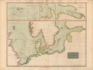
Chart of the North and Baltic Seas, etc.
$300.00
Acquire
- Digital Map Information
- Suitable for large format printing
- DPI: 600
- File Size: 19.01 MB
- File Type: ZIP / TIFF
- ICC color profile embedded
- Delivered instantly via download link
An impressive, hand-colored 1816 chart of the North and Baltic Seas, which appeared in John Thomson's New General Atlas. Remarkable detail is provided on depths, coasts, hazards, and other important navigational information. (more details)
Europe after the Congress of Vienna.
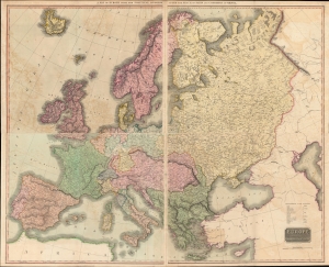
A Map of Europe with the Political Divisions after the Peace of Paris and Congress of Vienna / Europe after the Congress of Vienna.
$950.00
Acquire
- Digital Map Information
- Suitable for large format printing
- Full resolution TIFF file
- ICC color profile embedded
- Delivered instantly via download link
A stunning map in four sheets (conjoined in twos to form a top and bottom half), this 1816 work by John Thomson depicting Europe in the wake of the Congress of Vienna clocks in at more than three feet tall by four feet wide. It represents the summation and apogee of Thomson's diligent and aesthetically-pleasing cartographic work in his New General Atlas. (more details)
Enticing fur traders.
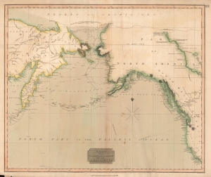
Chart of the Northern Passage Between Asia and America.
$300.00
Acquire
- Digital Map Information
- Suitable for large format printing
- DPI: 600
- File Size: 42.82 MB
- File Type: ZIP / TIFF
- ICC color profile embedded
- Delivered instantly via download link
This is John Thomson's 1816 map of the Bering Strait. It is one of the earliest atlas maps to give attention to the northern Alaskan coastline. (more details)
Waning days of the Transatlantic Slave Trade in British and Spanish West Indian Colonies.
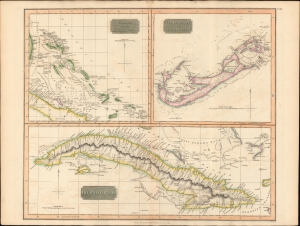
Island of Cuba. / The Bermudas. or Summer Islands. / Chart of the Bahama Islands.
$600.00
Acquire
- Digital Map Information
- Suitable for large format printing
- DPI: 600
- File Size: 63.75 MB
- File Type: ZIP / TIFF
- ICC color profile embedded
- Delivered instantly via download link
This is a striking 1816 map of Cuba, the Bahamas, and Bermuda issued by John Thomson. It captures the islands in the waning days of the Transatlantic slave trade in the British and Spanish West Indies. (more details)
Bargaining Chips of Colonial Competition.
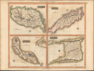
West India Islands.
$250.00
Acquire
- Digital Map Information
- Suitable for large format printing
- DPI: 600
- File Size: 650.17 MB
- File Type: ZIP / TIFF
- ICC color profile embedded
- Delivered instantly via download link
A map of the Caribbean islands of Grenada, Curacao, Trinidad, and Tobago in the Lesser Antilles, prepared by John Thomson and engraved by Samuel Neele for Thomson's New General Atlas. (more details)
Rounding out the Geography of the Pacific.
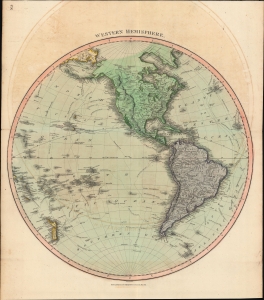
Western Hemisphere.
$350.00
Acquire
- Digital Map Information
- Suitable for large format printing
- DPI: 600
- File Size: 62.92 MB
- File Type: ZIP / TIFF
- ICC color profile embedded
- Delivered instantly via download link
A hand-colored 1815 map of the Western Hemisphere by John Thomson, which appeared in his New General Atlas. It is notable for tracing the routes of late 18th century explorers, including Cook, Vancouver, and La Perouse, that first gave shape, however inchoate, to the shores of northwestern America, Hawaii, New Zealand, and other Pacific coasts on European maps. (more details)
Vying for the Veneto.
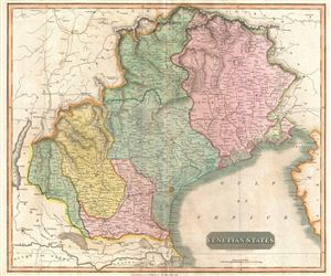
Venetian States.
$250.00
Acquire
- Digital Map Information
- Suitable for large format printing
- DPI: 300
- File Size: 15.79 MB
- File Type: ZIP / TIFF
- ICC color profile embedded
- Delivered instantly via download link
An 1816 map of Venice and environs (the Veneto and Friuli) in northern Italy, published in John Thomson's New General Atlas. It was produced in the immediate wake of the Congress of Vienna at the end of the Napoleonic Wars, which created the Austrian-ruled Kingdom of Lombardy-Venetia. (more details)
British expansion in India.
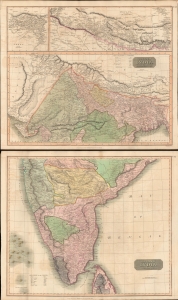
British India, Northern Part. British India, Southern Part.
$400.00
Acquire
- Digital Map Information
- Suitable for large format printing
- Full resolution TIFF file
- ICC color profile embedded
- Delivered instantly via download link
This is a stunning set of two 1817 maps of India and Nepal by Edinburgh cartographer John Thomson. As a whole, the maps illustrate India when the British East India Company had expanded their control - here in pink - from coast to coast. Color coding, with a key on the lower sheet, defines spheres of influence, including both British allies and enemies. (more details)
The romance of a 'savage paradise'.
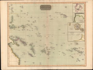
Map of the Islands in the Pacific Ocean.
$300.00
Acquire
- Digital Map Information
- Suitable for large format printing
- DPI: 600
- File Size: 56.99 MB
- File Type: ZIP / TIFF
- ICC color profile embedded
- Delivered instantly via download link
This is John Thomson's 1816 map of the Polynesia and the South Pacific. It is one of the few early 19th century maps to focus on Polynesia, despite, in the wake of Cook's travels (and gruesome death), the area being heavily romanticized as an savage paradise in the minds of the British public. (more details)
Humboldt on the Orinoco.
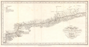
Map of the Course of the Oroonoko, from the Mouth of the Rio Sinaruco to Angostura. Compiled from Pobservations made on the Spot by Alexandre de Humboldt.
$500.00
Acquire
- Digital Map Information
- Suitable for large format printing
- File Size: 4.57 MB
- File Type: ZIP / TIFF
- ICC color profile embedded
- Delivered instantly via download link
This is an 1818 Alexander von Humboldt map of part of the Orinoco River in modern-day Venezuela. It was compiled to illustrate Humboldt's epic voyage through South America, resulting in his Cosmos, an era-defining scientific work. (more details)
Proving the connection between the Orinoco and Amazon.
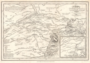
Map of the Eastern part of the Province of Verina, between the Oronooko ther Abura and the Rio Meta Compiled from Astronomical Observations and materials collected on the Spot by Alexander Humboldt.
$550.00
Acquire
- Digital Map Information
- Suitable for large format printing
- File Size: 4.59 MB
- File Type: ZIP / TIFF
- ICC color profile embedded
- Delivered instantly via download link
This is an 1818 Alexander von Humboldt map of parts of the modern-day states of Apure and Bolívar in Venezuela. The map provides greater context for Humboldt and Bonpland's epic voyage on the Rio Apure to the Orinoco. The copiously annotated map ('abounds with Crocodies') allowed Humboldt's Personal Narrative readers to better grasp the geography, challenges, and terrain. This voyage proved the connection between the Orinoco and the Rio Negro, and thus the Amazon, solving a long-pondered cartographic mystery. Humboldt's greater voyage through South America, resulted in his most famous work, Cosmos, an era-defining scientific achievement. (more details)
Promoting European investment in the dream of a unified independent Latin America.
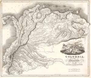
Colombia, from Humboldt and other Recent Authorities.
$2,200.00
Acquire
- Digital Map Information
- Suitable for large format printing
- Full resolution TIFF file
- ICC color profile embedded
- Delivered instantly via download link
This is the rare and important 1823' Zea Map of Colombia', one of the earliest specific maps of Gran Colombia at its height. This map was printed on behalf of the Colombian vice president under Simón Bolívar, Francisco Antonio Zea (1766 - 1822), to court European, and specifically British, investment in the new Republic, which was in dire need of financial support. The title references the naturalist Alexander von Humboldt, not for any cartographic contributions, as the map is based on the maps of John Arrowsmith, but rather for his unwavering support of an independent Gran Colombia and his promotion of its natural wealth. (more details)