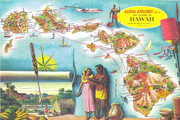
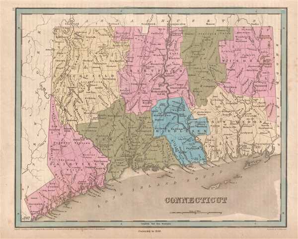
Most recently added antique and rare maps as of 7/4/2025.
Creates a visual comparison of the industrial strength of the North versus the weakness of the South in relation to the number of constructed and proposed railroad lines.
$200.00
Published soon after Brazil was declared a Republic.
$100.00
Depicts the Western Coast of England from the Lake District to Blackpool, a seaside resort town.
$250.00
A set of iconic American World War II propaganda broadside maps 'targeting' Berlin and Tokyo.
$750.00
A charming and beautifully colored pictorial map of Cape Cod.
$225.00
Highlights the extent of American manufacturing and includes a detailed index of products made in the United States.
$225.00
Provides a visual comparison of wool production in the United States by county and by state.
$225.00
Created during the political unrest rampant in 19th century South America.
$175.00
Includes Cape Cod, Martha's Vineyard, and Nantucket.
$125.00
A charming map of Beijing during the Interwar Years.
$275.00
Distributed free to attendees to give them a better idea of how to reach the Royal Route.
$200.00
An innovative battle for Prague fought during the War of the Austrian Succession.
$675.00
Highlights the European discovery, conquest, and exploration of the Americas.
$300.00
Features commentary on world affairs - including forms of government.
$325.00
Illustrates the network of railroads and canals connecting Philadelphia and Pittsburgh.
$250.00
Several small railroads are illustrated - constructed to convey cotton to market.
$400.00
Depicts the West Feliciana Railroad - the oldest standard-gauge line in the U.S. when it was abandoned in 1978.
$400.00
A beautiful airline route map featuring an illustration of the extremely successful Fairchild F-27 aircraft.
$400.00
Depicts the numerous railroad lines built in Connecticut in the 1830s and 1840s.
$250.00