
Pluth, Franz (sold)

Franz Pluth (1800 - 1871) was an engraver based in Prague, the capital of the Kingdom of Bohemia, then part of the Habsburg Austrian Empire. Pluth was born in Prague and most likely died in Zbraslav. He was active as a map engraver until at least 1848. His work is similar in style to that of Karl Ferdinand Weiland, a prolific German engraver, with whom he may have worked.
Turbulent Waters.
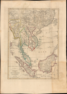
Charte von Ostindien Jenseits des Ganges.
sold
- Digital Map Information
- Suitable for large format printing
- File Size: 14.33 MB
- File Type: ZIP / TIFF
- ICC color profile embedded
- Delivered instantly via download link
This is a lovely 1812 Franz Pluth map of southern China and Southeast Asia. It is notable for illustrating islands, islets, and shoals in the South China Sea that have been the site of intense territorial disputes in recent decades. (more details)
Rare Czech map of North America with a fascinating Trans-Mississippi based upon the explorations of early fur trappers.
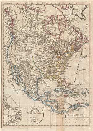
Charte von Nord-America Prag 1818.
sold
- Digital Map Information
- Suitable for large format printing
- DPI: 300
- File Size: 5.35 MB
- File Type: ZIP / TIFF
- ICC color profile embedded
- Delivered instantly via download link
A very unusual, rare, and information dense 1818 Franz Pluth map of North America featuring an inset of Alaska and an unusual speculative mapping of the Trans-Mississippi West. With German text, the map covers all of North America, from Baffin Bay to Colombia and ... (more details)
Labels Vancouver Island and Kodiak Island.
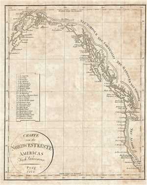
Charte von der Nordwestküste Americas Nach Vancouver.
sold
- Digital Map Information
- Suitable for large format printing
- DPI: 300
- File Size: 2.14 MB
- File Type: ZIP / TIFF
- ICC color profile embedded
- Delivered instantly via download link
This is an 1818 Franz Pluth Map of the Pacific coast of North America. The map depicts the region from Kodiak Island and Cook Inlet in Alaska along the Canadian coastline to Washington, Oregon, and California in the United States. Numerous locations along the ... (more details)
A reduced version of David William Smith's iconic map of Upper Canada / Ontario - created by Franz Pluth.
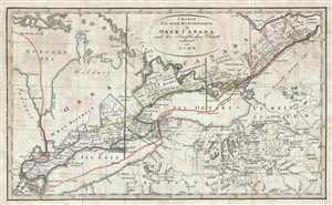
Charte Der neuen Niederlassungen in Ober Canada nach der Smythchen Charte reducirt von I.C.M.R.
sold
- Digital Map Information
- Suitable for large format printing
- DPI: 300
- File Size: 2.54 MB
- File Type: ZIP / TIFF
- ICC color profile embedded
- Delivered instantly via download link
This is an 1820 Franz Pluth and David William Smith map of the province of Upper Canada, or modern-day Ontario, Canada. The map depicts the region from Lake Huron and Detroit to the border between Ontario and Quebec and from Lake Huron and the Ottawa River to ... (more details)
Includes a highly detailed depiction of the western Amazon basin.
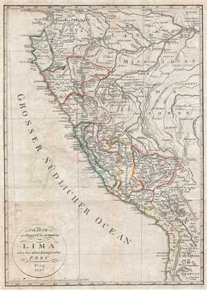
Charte der Provinz oder Audencia von Lima oder des alten Konigreichs Peru.
sold
- Digital Map Information
- Suitable for large format printing
- DPI: 300
- File Size: 5.4 MB
- File Type: ZIP / TIFF
- ICC color profile embedded
- Delivered instantly via download link
This is an 1820 Franz Pluth map of Peru. The map depicts the region from the Pacific Ocean to the western Amazon Rainforest and from southern Ecuador to Bolivia and northern Chile. Highly detailed, numerous cities, towns, and villages are labeled, including ... (more details)
Labels Savannah, Pensacola, Mobile, and New Orleans.
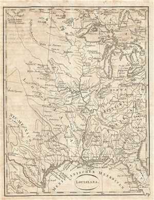
Louisiana.
sold
- Digital Map Information
- Suitable for large format printing
- DPI: 300
- File Size: 1.73 MB
- File Type: ZIP / TIFF
- ICC color profile embedded
- Delivered instantly via download link
This is a c. 1820 Franz Pluth map of the central United States. The map depicts the region from approximately the Rocky Mountains to the Appalachian Mountains and the Carolinas and from southern Canada to the Rio Grande and the Gulf of Mexico. Several ... (more details)
Beautiful and incredibly detailed map of Brazil.
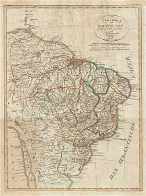
Charte von Brasilien entworfen und gezeichnet nach C. F. Weiland.
sold
- Digital Map Information
- Suitable for large format printing
- DPI: 300
- File Size: 6.24 MB
- File Type: ZIP / TIFF
- ICC color profile embedded
- Delivered instantly via download link
This is an 1822 Franz Pluth map of Brazil. The map depicts the region from the Caribbean islands of Martinique and St. Lucia to the Rio de la Plata and the Pampas and from Peru and the Pacific Ocean to the Atlantic Ocean. A highly detailed depiction ... (more details)
Labels Kingston.
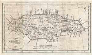
Charte von Jamaica.
sold
- Digital Map Information
- Suitable for large format printing
- DPI: 300
- File Size: 2.68 MB
- File Type: ZIP / TIFF
- ICC color profile embedded
- Delivered instantly via download link
This is an 1822 Franz Pluth map of Jamaica. The map depicts the entire island in wonderful detail, labeling towns and villages, including Kingston, along with parishes and counties. Numerous roads traverse the island. Points along the coastline are ... (more details)