
Tardieu, Pierre Francois

Pierre François Tardieu (1711 - 1771) was a French engraver and mapmaker active in Paris during the middle part of the 18th century and a member of the large and prolific Tardieu family. Several members of the family established themselves as engravers, and, for over 200 years, the family produced works. Pierre Francois Tardieu was born around 1711 in Paris, son of Jean Tardieu. His uncle, Nicolas-Henry Tardieu, taught him the art of engraving. Pierre was a general engraver whose work was not limited to maps but also included historical and genre works. Many of his maps are extremely significant and include some of the finest French productions of the period. Tardieu had his office at Rue de al Corderie, Paris. Tardieu was married to Marie-Anne Rousselet (1733-1826), whose family included the engraver Gilles Rousselet and the sculptor Jean Rousselet. It is highly likely that Pierre Francois Tardieu was succeeded by Pierre Antoine Francois Tardieu (1757 - 1822), who is also possibly his son, as the latter continued to engrave under the P. F. Tardieu imprint well after the former's death.
The Americas crafted into a unique puzzle!
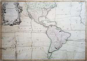
L'Amerique divisée en ses principaux états, assujetie aux observations astronomiques par le Sr. Janvier Geographe. A Paris.
$2,000.00
Acquire
This is Jean Janvier's 1760 rare, separately issued map of the western hemisphere, in its 1784 Paris edition. This map has, at an early date, been pasted down and hand-cut to form a simple jigsaw puzzle. Although the map does not name the new country, the colored national borders reflect the formation of the United States, which had been set according to the Treaty of Paris the year before this map was printed. The substance of the map is somewhat changed - dotted colonial borders have been burnished out and replaced with new ones, but the bulk of the engraving remains true to the 1760 edition. (more details)
Updating the Evans Map: First Map with Louisville
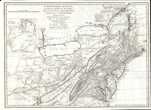
Carte Generale des Etats de Virginie, Maryland, Delaware, Pensilvanie, Nouveau-Jersey, New-York, Connecticut et Isle de Rhodes Ainsi que des Lacs Erie, Ontario, et Champlain. D'Apres la Carte Ameriquaine de Louis Evans et la Carte Anglaise de Thomas-Jefferys, pour les Lettres d'un Cultivateur Amériquain.
$1,950.00
Acquire
- Digital Map Information
- Suitable for large format printing
- DPI: 600
- File Size: 68.46 MB
- File Type: ZIP / TIFF
- ICC color profile embedded
- Delivered instantly via download link
An elegant 1787 French edition of Louis Evans' seminal and influential map of the Middle British Colonies, one of the most important maps of the British colonies and the best colonial mapping of the Ohio River Valley. It was issued for Michel Guillaume St. Jean de Crevecoeur's 1787 Lettres d'un Cultivateur Ameriquain, one of the most influential works on colonial America. (more details)
Detailed maps of America's New Frontier.
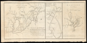
Esquisse des rivieres Muskinghum et Grand Castor que j'ai tiree du Journal du General Bouquet.
$350.00
Acquire
- Digital Map Information
- Suitable for large format printing
- DPI: 600
- File Size: 25.11 MB
- File Type: ZIP / TIFF
- ICC color profile embedded
- Delivered instantly via download link
This is a scarce 1787 Pierre Tardieu map of the Ohio River and its tributaries. (more details)
Russia's expanding empire.
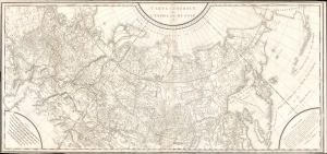
Carte Générale de L'Empire de Russie 1787.
$650.00
Acquire
- Digital Map Information
- Suitable for large format printing
- DPI: 600
- File Size: 1259.31 MB
- File Type: ZIP / TIFF
- ICC color profile embedded
- Delivered instantly via download link
An intricate large-scale c. 1787 French-language map of the Russian Empire engraved by Pierre-François Tardieu. It represents a significant improvement on earlier maps of the empire, especially its eastern portions and the northern Pacific, as both Russian and western European voyages of exploration proliferated in the late 18th century. (more details)
A beautifully engraved map of the West Indies printed on highly desirable French Revolution blue handkerchief paper.
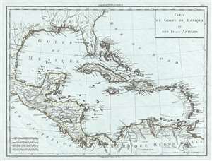
Carte du Golfe du Mexique et des Isles Antilles.
$650.00
Acquire
- Digital Map Information
- Suitable for large format printing
- DPI: 300
- File Size: 6.71 MB
- File Type: ZIP / TIFF
- ICC color profile embedded
- Delivered instantly via download link
This is a strikingly engraved c. 1795 Edme Mentelle and Pierre-Gilles Chanlaire map of the West Indies that is notably printed on high quality light French Revolution blue handkerchief paper, which briefly appeared during the French Revolution. The map depicts the region from Central America to the Atlantic Ocean and from the Gulf Coast of the United States to northern South America. Beautifully engraved, myriad locations throughout the region are labeled, including islands, archipelagos, and points and capes along the islands' coastlines. New Orleans and St. Augustine are labeled in the southern United States, along with Charleston (Charles Town) and numerous rivers. Regions in New Spain (Nouvelle Espagne) are labeled, as are towns, lakes, and mountains. (more details)
The Southeast of the young United States.
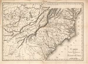
Carte De La Partie Méridionale Des Etats-Unis.
$650.00
Acquire
- Digital Map Information
- Suitable for large format printing
- Full resolution TIFF file
- ICC color profile embedded
- Delivered instantly via download link
An important and highly detailed 1801 map of the southeastern United States by Pierre Francis Tardieu. The map was issued to accompany Michel Guillaume de Crevecoeur's Le Voyage dans la Haute Pennsylvania et dans l'État de New-York, one of the most important post-Revolutionary War books about life and economy in the fledgling United States. Coverage extends from the Chesapeake Bay and the Ohio River south as far as central Georgia, including the modern-day states of Virginia, Kentucky, Tennessee, North Carolina, South Carolina, and parts of Georgia and Alabama. The map is notable for its exceptional detail, naming towns, mills, mines, and roads, as well as surveyed tracts intended to compensate Revolutionary War soldiers for their effort. (more details)
Illustrates land reserved for U.S. Soldiers after the American Revolutionary War.
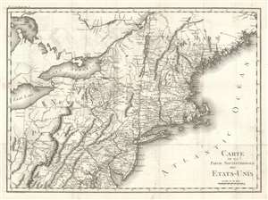
Carte De La Partie Septentrionale Des Etats-Unis.
$600.00
Acquire
- Digital Map Information
- Suitable for large format printing
- DPI: 600
- File Size: 21.41 MB
- File Type: ZIP / TIFF
- ICC color profile embedded
- Delivered instantly via download link
An important and highly detailed 1801 map of the northeastern United States by Pierre Francis Tardieu. The map was issued to a accompany Michel Guillaume de Crevecoeur's Le Voyage dans la Haute Pennsylvania et dans l'État de New-York, one of the most important post-Revolutionary War books about life and economy in the fledgling United States. Coverage extends from Maine to the District of Columbia and west as far as Ohio and the Connecticut Reserve, including modern-day New England, New York, New Jersey, Pennsylvania, and parts of Maryland, Delaware, and West Virginia. The map is notable for its exceptional detail, naming towns and roads, as well as surveyed military tracts intended to compensate Revolutionary War soldiers for their war effort. (more details)