
Vielé, Egbert Ludovicus (sold)
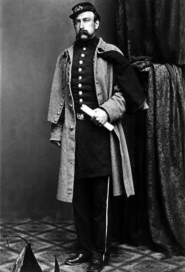
Egbert Ludovicus Vielé (June 17, 1825 - April 22, 1902) was an American civil engineer, cartographer, businessman, and politician active in New York City during the second half of the 19th century. Born in Saratoga County, Vielé attended the United States Military Academy at West Point. Graduating in 1847, he was commissioned as a brevet second lieutenant in the 2nd United States Infantry. He served in the Mexican-American War before resigning form military duty to pursue a career as a Civil Engineer in New York City. When the call came to plan New York City's Central Park in 1856, Vielé was established as Engineer-in-Chief of the project, and it was he who set down the guidelines by which Vaux and Olmstead ultimately planned the park. He held a similar position as engineer of Prospect Park, Brooklyn from 1860. It was most likely during his tenure with the park commissions that Vielé developed his theories connecting compromised natural drainage with sanitation and infectious disease. Vielé's great cartographic masterpiece, the Topographical Map of the City of New-York, euphemistically known as the 'Vielé Map' or 'Waterways Map' evolved out of the notion that epidemic level disease evolved from excess moisture in the soil. He contended that, as New York City expanded northwards, paving over stream beds and leveling out natural drainage channels, the underground waterways would stagnate and lead to plague or worse. Though intended for the purpose of urban planning, the Vielé Map's (as it came to be known) greatest legacy is as a construction tool. To this day, contractors, architects, and engineers consult the Vielé map to determine if unseen subterranean waterways need to be taken into account when preparing building foundations. He was elected as a Democratic representative to the Forty-ninth Congress (March 4, 1885 – March 3, 1887) and ran unsuccessfully for re-election in 1886. He was heavily involved in New York real-estate interests, but also owned shares of mining and railroad companies as far off as Colorado. Vielé died in April of 1902 and was buried in an elaborate Egyptian Revival tomb at West Point. Legend tells that Vielé, paranoid that he would be buried alive, an unfortunate but surprisingly common problem in the 19th century, installed a buzzer inside his coffin that would allow him to ring the school's commanding officer should the need arise. Apparently, it did not.
The important first plans of New York City's Central Park by Viele - predates Olmstead and Vaux.
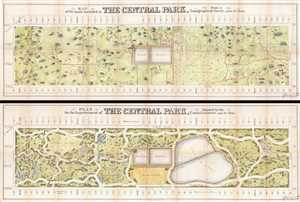
Map of the Lands Included in The Central Park, from a Topographical Survey, June 17th 1856. Plan for the Improvement of The Central Park, Adopted by the Commissioners, June 3rd 1856.
sold
- Digital Map Information
- Suitable for large format printing
- File Size: 30.04 MB
- File Type: ZIP / TIFF
- ICC color profile embedded
- Delivered instantly via download link
Two extremely rare 1856 pre-Design Competition plans of Central Park drawn by the park project's first engineer-in-Chief egbert Ludovicus Viele. Both plans extend from 59th street to 106th street, taking in the original grounds reserved for Central Park, as well ... (more details)
The important first plan of New York City's Central Park - predates Olmstead and Vaux.
Map of the Lands Included in The Central Park, from a Topographical Survey, June 17th 1856. Plan for the Improvement of The Central Park, Adopted by the Commissioners, June 3rd 1856.
sold
- Digital Map Information
- Suitable for large format printing
- File Size: 40.96 MB
- File Type: ZIP / TIFF
- ICC color profile embedded
- Delivered instantly via download link
Two extremely rare 1856 pre-Design Competition plans of Central Park drawn by the park project's first engineer-in-Chief egbert Ludovicus Viele. Both plans extend from 59th street to 106th street, taking in the original grounds reserved for Central Park, as well ... (more details)
The important first plan of New York City's Central Park - predates Olmsted and Vaux.
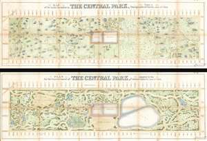
Map of the Lands Included in The Central Park, from a Topographical Survey, June 17th 1856. Plan for the Improvement of The Central Park, Adopted by the Commissioners, June 3rd 1856.
sold
- Digital Map Information
- Suitable for large format printing
- File Size: 60.03 MB
- File Type: ZIP / TIFF
- ICC color profile embedded
- Delivered instantly via download link
Two extremely rare 1856 pre-Design Competition plans of Central Park drawn by the park project's first engineer-in-Chief Egbert Ludovicus Viele. Both plans extend from 59th street to 106th street, taking in the original grounds reserved for Central Park, as well as some of the adjacent streets and avenues. Viele's printed signature appears in the lower right quadrant of both maps. (more details)
The early stages of Viele's historic Sanitary and Topographical Map of New York City.
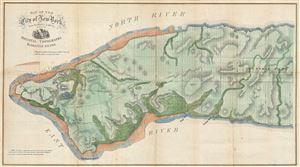
Map of the City of New York from the Battery to 80th St showing the Original Topography of Manhattan Island.
sold
- Digital Map Information
- Suitable for large format printing
- File Size: 15.8 MB
- File Type: ZIP / TIFF
- ICC color profile embedded
- Delivered instantly via download link
An uncommon 1859 map of lower Manhattan, New York City, by Egbert Viele, the famed city planner who spearheaded the construction of Central Park. The map covers lower Manhattan to about 80th street and includes the city's grid plan overlaying a topographical ... (more details)
One of the most beautiful, important, and enduring maps of Manhattan ever published.
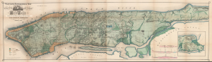
Topographical Map of the City of New York Showing Original Water Courses and Made Land.
sold
- Digital Map Information
- Suitable for large format printing
- Full resolution TIFF file
- ICC color profile embedded
- Delivered instantly via download link
This is a beautiful example of Egbert L. Viele's 1865 topography and waterways map of Manhattan, one of the scarcest, most important, and most enduring maps of New York City ever published. Viele's map details the canals, swamps, rivers, ditches, ponds, meadows, and drainage basins of Manhattan as they existed prior to the city's urban development. A version of the Viele map remains in use today by architects and contractors who need to be certain they are not building over underground rivers and swamps that may destabilize a new construction's foundation. (more details)
One of the most beautiful, important, and enduring maps of Manhattan ever published.
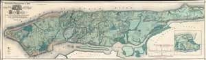
Sanitary and Topographical Map of the City and Island of New York Prepared for the Council of Hygiene and Public Health, of the Citizens Association.
sold
- Digital Map Information
- Suitable for large format printing
- File Size: 74.33 MB
- File Type: ZIP / TIFF
- ICC color profile embedded
- Delivered instantly via download link
This is a very beautiful and fine example of Egbert L. Viele's 1865 topography and waterways map of Manhattan, one of the scarcest, most important, and most enduring maps of New York City ever published. Covering the entirety of Manhattan Island, Viele's map details the canals, swamps, rivers, ditches, ponds, meadows, and drainage basins of Manhattan as they existed prior to the city's urban development. A version of the Viele map remains in use today by architects and contractors who need to be certain they are not building over underground rivers and swamps that may destabilize a new construction's foundation. (more details)
One of the most beautiful, important, and enduring maps of Manhattan ever published.
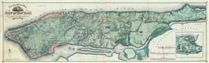
Topographical Map of the City of New York showing original water courses and made land.
sold
- Digital Map Information
- Suitable for large format printing
- File Size: 92.32 MB
- File Type: ZIP / TIFF
- ICC color profile embedded
- Delivered instantly via download link
This is Egbert L. Viele's 1865 topography and waterways map of Manhattan, one of the scarcest, most important, and most enduring maps of New York City ever published. Covering the entirety of Manhattan Island, Viele's map details the canals, swamps, rivers, ditches, ponds, meadows, and drainage basins of Manhattan as they existed prior to the city's urban development. A version of the Viele map remains in use today by architects and contractors who need to be certain they are not building over underground rivers and swamps that may destabilize a new construction's foundation. (more details)
One of the most beautiful, important, and enduring maps of Manhattan ever published.
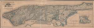
Sanitary and Topographical Map of the City and Island of New York. Prepared for the Council of Hygiene and Public Health of the Citizens Association.
sold
- Digital Map Information
- Suitable for large format printing
- File Size: 82.92 MB
- File Type: ZIP / TIFF
- ICC color profile embedded
- Delivered instantly via download link
This is Egbert L. Viele's 1865 topography and waterways map of Manhattan, one of the scarcest, most important, and most enduring maps of New York City ever published. Covering the entirety of Manhattan Island, Viele's map details the canals, swamps, rivers, ditches, ponds, meadows, and drainage basins of Manhattan as they existed prior to the city's urban development. A version of the Viele map remains in use today by architects and contractors who need to be certain they are not building over underground rivers and swamps that may destabilize a new construction's foundation. (more details)
One of the most beautiful, important, and enduring maps of Manhattan ever published.
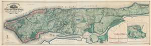
Topographical Map of the City of New York showing original water courses and made land.
sold
- Digital Map Information
- Suitable for large format printing
- Full resolution TIFF file
- ICC color profile embedded
- Delivered instantly via download link
This is a very beautiful and fine example of Egbert L. Viele's 1865 topography and waterways map of Manhattan, one of the scarcest, most important, and most enduring maps of New York City ever published. Covering the entirety of Manhattan Island, Viele's map details the canals, swamps, rivers, ditches, ponds, meadows, and drainage basins of Manhattan as they existed prior to the city's urban development. A version of the Viele map remains in use today by architects and contractors who need to be certain they are not building over underground rivers and swamps that may destabilize a new construction's foundation. (more details)
One of the most beautiful, important, and enduring maps of Manhattan ever published.
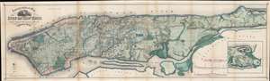
Topographical Map of the City of New York Showing Original Water Courses and Made Land.
sold
- Digital Map Information
- Suitable for large format printing
- File Size: 71.25 MB
- File Type: ZIP / TIFF
- ICC color profile embedded
- Delivered instantly via download link
This is a very beautiful and fine example of Egbert L. Viele's 1865 topography and waterways map of Manhattan, one of the scarcest, most important, and most enduring maps of New York City ever published. Covering the entirety of Manhattan Island, Viele's map details the canals, swamps, rivers, ditches, ponds, meadows, and drainage basins of Manhattan as they existed prior to the city's urban development. A version of the Viele map remains in use today by architects and contractors who need to be certain they are not building over underground rivers and swamps that may destabilize a new construction's foundation. (more details)
One of the most beautiful, important, and enduring maps of Manhattan ever published.
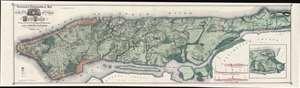
Topographical Map of the City of New York Showing Original Water Courses and Made Land.
sold
- Digital Map Information
- Suitable for large format printing
- File Size: 86.7 MB
- File Type: ZIP / TIFF
- ICC color profile embedded
- Delivered instantly via download link
This is a very beautiful and fine example of Egbert L. Viele's 1865 topography and waterways map of Manhattan, one of the scarcest, most important, and most enduring maps of New York City ever published. Covering the entirety of Manhattan Island, Viele's map details the canals, swamps, rivers, ditches, ponds, meadows, and drainage basins of Manhattan as they existed prior to the city's urban development. A version of the Viele map remains in use today by architects and contractors who need to be certain they are not building over underground rivers and swamps that may destabilize a new construction's foundation. (more details)
One of the most beautiful, important, and enduring maps of Manhattan ever published.
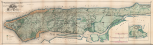
Sanitary and Topographical Map of the City and Island of New York Prepared for the Council of Hygiene and Public Health, of the Citizens Association.
sold
- Digital Map Information
- Suitable for large format printing
- Full resolution TIFF file
- ICC color profile embedded
- Delivered instantly via download link
This is Egbert L. Viele's large-format 1865 topography and waterways map of Manhattan, or the City of New York as it was then. It is one of the scarcest, most important, and most enduring maps of New York City ever published. This particular example is a rare variant appearing in the Report of the Council of Hygiene and Public Health of the Citizens' Association of New York upon the Sanitary Condition of the City and also has the esteemed provenance of being connected to the French Consulate in New York City. (more details)
One of the most beautiful, important, and enduring maps of Manhattan ever published.
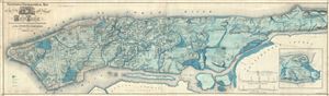
Sanitary and Topographical Map of the City and Island of New York Prepared for the Council of Hygene and Public Health, of the Citizens' Association under the direction of Egbert L. Viele, Topographical Engineer.
sold
- Digital Map Information
- Suitable for large format printing
- File Size: 51.42 MB
- File Type: ZIP / TIFF
- ICC color profile embedded
- Delivered instantly via download link
This is Egbert L. Viele's 1865 topography and waterways map of Manhattan, one of the scarcest, most important and most enduring maps of New York City ever published. Covering the entirety of Manhattan Island, Viele's map details the canals, swamps, rivers, ... (more details)
One of the most beautiful, important, and enduring maps of Manhattan ever published.
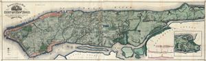
Topographical Map of the City of New York Showing Original Water Courses and Made Land.
sold
- Digital Map Information
- Suitable for large format printing
- File Size: 47.88 MB
- File Type: ZIP / TIFF
- ICC color profile embedded
- Delivered instantly via download link
This is Egbert L. Viele's 1865 topography and waterways map of Manhattan, one of the scarcest, most important and most enduring maps of New York City ever published. Covering the entirety of Manhattan Island, Viele's map details the canals, swamps, rivers, ... (more details)
One of the most beautiful, important, and enduring maps of Manhattan ever published.
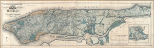
Sanitary & Topographical Map of the City and Island of New York Prepared for the Council of Hygene & Public Health, of the Citizens' Association under the direciton of Egbert L. Viele, Topographical Engineer.
sold
- Digital Map Information
- Suitable for large format printing
- File Size: 30.96 MB
- File Type: ZIP / TIFF
- ICC color profile embedded
- Delivered instantly via download link
This is Egbert L. Viele's 1865 topography and waterways map of Manhattan, one of the scarcest, most important, and most enduring maps of New York City ever published. Covering the entirety of Manhattan Island, Viele's map details the canals, swamps, ... (more details)
One of the most beautiful, important, and enduring maps of Manhattan ever published.
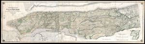
Topographical Atlas of the City of New York including the Annexed Territory, Showing original water courses and made land.
sold
- Digital Map Information
- Suitable for large format printing
- File Size: 9.68 MB
- File Type: ZIP / TIFF
- ICC color profile embedded
- Delivered instantly via download link
One of the scarcest, most important and most enduring maps of New York City ever published, this is the 1874 edition of Egbert L. Viele's topography and waterways map of Manhattan. Viele first issued this map in 1864. Nearly twice the size as the ... (more details)
The first map of the Upper West Side!
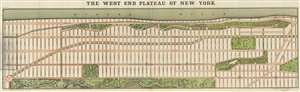
The West End Plateau of New York.
sold
- Digital Map Information
- Suitable for large format printing
- File Size: 61.55 MB
- File Type: ZIP / TIFF
- ICC color profile embedded
- Delivered instantly via download link
This is the first separately published map of the Upper West Side of Manhattan (New York City) and arguably the first printed map of the Upper West Side. Published in 1879 by Herman Knickerbocker Vielé, son of the prominent New York mapmaker and politician Egbert Ludovicus Vielé, this map was issued to promote real estate investment in the high ground of the Upper West Side. The map covers Manhattan from roughly Columbus Circle (58th Street) to 130th Street, between the Hudson River and Central Park. It includes all of Riverside Park, the Western side of Central Park, Morningside Park, the future site of Columbia University (Bloomingdale Lunatic Asylum), and Manhattan Square (American Museum of Natural History). Along 9th Avenue (Columbus Ave), the map illustrates the West Side and Yonkers Patent Railway Company, service along which opened in June of 1879 as far as 104th Street, and by December of the same year, to 155th Street. (more details)