
General Drafting Corporation (sold)

General Drafting Corporation (1909 - 1992) was one of the 'Big Three' publishers of road maps between 1930 and 1970, along with H. M. Gousha and Rand McNally. Founded in 1909, Otto G. Lindberg, an immigrant from Finland and the company's founder, began his business with a borrowed drafting board and a $500 loan from his father. At the time only twenty-three years old, Lindberg advertised his business as 'any and all general drafting' and was based out of 170 Broadway in New York City. Only two years later, in 1911, the firm secured its first contract from the American Automobile Association to make 'road maps'. Lindberg incorporated his business in 1914 and became its first Chairman of the Board, a position he held until his death in 1968. Lindberg persuaded Standard Oil of New Jersey to let him draw the 'best' road map of the state that they had ever seen, and Standard Oil would distribute it for free. Sufficiently impressed with the finished product, Standard contracted General Drafting to make all their road maps - a relationship that lasted another six decades. This relationship allowed General Drafting to work exclusively for Standard Oil, but when oil companies stopped providing free maps, General Drafting was in a bind. The company tried to expand into the retail map market, and it of course continued creating maps for Exxon (the new name for Standard Oil) to sell, but its returns continued to decline. The firm was purchased in 1992 by Langenscheidt and subsequently absorbed into the American Map Company. General Drafting's state maps became this company's 'Travelvision' lineup.
A charming pictorial map tracing the life of George Washington from the French and Indian War through his years as President of the United States.
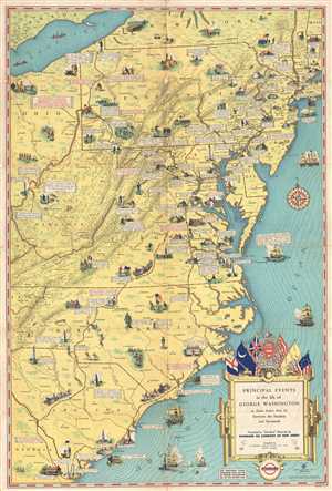
Principal Events in the life of George Washington in this States that lie between the Hudson and Savannah.
sold
- Digital Map Information
- Suitable for large format printing
- File Size: 11.57 MB
- File Type: ZIP / TIFF
- ICC color profile embedded
- Delivered instantly via download link
This is a c. 1932 General Drafting Company pictorial map of principal events and important sites in the life of George Washington, the First President of the United States and the Commander-in-Chief of the Continental Armies during the American Revolutionary War. ... (more details)
A charming pictorial map tracing the life of George Washington from the French and Indian War through his years as President of the United States.
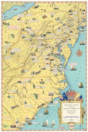
Principal Events in the life of George Washington in this States that lie between the Hudson and Savannah.
sold
- Digital Map Information
- Suitable for large format printing
- File Size: 24.92 MB
- File Type: ZIP / TIFF
- ICC color profile embedded
- Delivered instantly via download link
This is a c. 1932 General Drafting Company pictorial map of principal events and important sites in the life of George Washington, the First President of the United States and the Commander-in-Chief of the Continental Armies during the American Revolutionary War. ... (more details)
Ski New Hampshire!
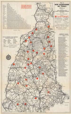
Map of New Hampshire Ski Trails 1935-6.
sold
- Digital Map Information
- Suitable for large format printing
- Full resolution TIFF file
- ICC color profile embedded
- Delivered instantly via download link
This is a 1935 New Hampshire State Planning and Development Commission and General Drafting map of New Hampshire ski trails. Numbered red dots mark twenty-nine ski trails across the state. Each corresponds with an index on the verso. New Hampshire's highway network is illustrated with a milage table in the upper left. New Hampshire's airports are also listed with their 'winter status' noted (open with plowed runways, open without plowed runways so skis are required, and closed during the winter). A list of amateur ski clubs in the eastern United States appears along the right border. (more details)
Rise of Sport Skiing in America.
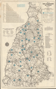
Map of New Hampshire Ski Trails 1936-7.
sold
- Digital Map Information
- Suitable for large format printing
- Full resolution TIFF file
- ICC color profile embedded
- Delivered instantly via download link
This is a 1937 New Hampshire State Planning and Development Commission and General Drafting map of New Hampshire ski trails for the 1936-37 ski season. (more details)
Visit sites across New England!
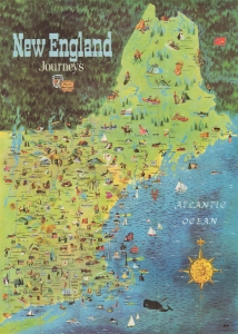
This is a 1954 pictorial map of New England published by the Ford Dealers of New England. The piece uses the scenic beauty and historical attractions of New England to capitalize on a new era of mobility that defined American Automobile Craze - and in fact, the rise of auto-tourism in the United States directly correlates with the Federal-Aid Highway Act of 1956, just two years after this piece was issued. (more details)
The first edition of Esso's extremely popular 'upside-down' road map - created for 'snowbirds' fleeing New York City in the winter.
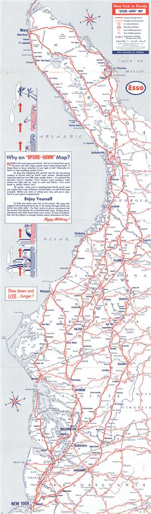
New York to Florida 'Upside-Down' Map.
sold
- Digital Map Information
- Suitable for large format printing
- File Size: 18.4 MB
- File Type: ZIP / TIFF
- ICC color profile embedded
- Delivered instantly via download link
A map with an unusual concept, this 1955 General Drafting Corporation road map of the east coast of the United States is printed upside-down! Created for 'snowbirds' fleeing New York City for the winter, this map is unlike nearly every other map one encounters. General Drafting discovered that travelers would turn their maps upside-down when traveling south, so it was decided that a map should be created that would accommodate this habit. Normally, maps are printed with the northernmost point depicted on the map at the top. Here, the cartographers have done the exact opposite: they created the map with Florida, more specifically the Florida Keys, at the top of the map and New York City at the bottom. As jarring as this may be at first glance, the more one looks at this piece the more charm it exudes. The entire piece was done purposefully. All text is printed correctly (not upside-down like the map's geography), making it fully functional. Major metropolises, such as New York, Washington, D.C., Baltimore, Richmond, Raleigh, Columbia, Jacksonville, and Miami are highlighted by large bold block letters, while smaller cities and towns throughout the depicted region are labeled by using progressively smaller, less bolded font. All the highways (both U.S. and state) are marked by red lines and labeled, making the map, as previously stated, easy to use. (more details)
How the world comes together to build a car.
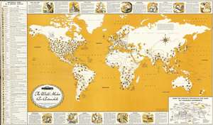
This is a 1956 General Drafting map of the world highlighting the worldwide effort necessary to build an automobile. Symbols spread throughout the world note where metals (iron, copper, antimony, manganese, nickel, platinum…), petroleum, rubber, and materials for textiles (wool, cotton, jute, and nylon) are mined, drilled, tapped, or harvested for use by the automobile industry. Meant for use in schools, short texts and two-tone vignettes along the top and bottom borders provide explanations about the use of these materials, including the smelting steel from iron and other metals, the use of other metals in cars, and how oil and rubber are gathered and used by the auto industry. A table along the left lists over sixty materials used in automobile manufacturing and acts as a map key. A diagram of a car in the lower right highlights some common car parts and names materials used in its manufacture. (more details)
Esso's extremely popular 'upside-down' map created for 'snowbirds'.
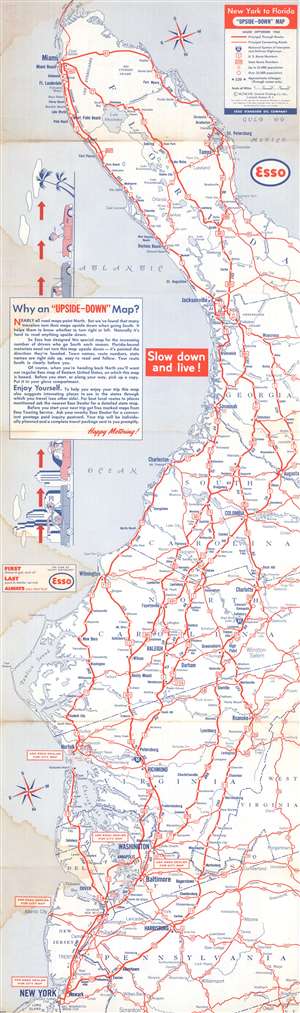
A map with an unusual concept, this 1958 General Drafting Corporation road map of the east coast of the United States is printed upside-down! Created for 'snowbirds' fleeing New York City for the winter, General Drafting discovered that travelers would turn maps upside-down when traveling south, so it was decided that a map should be created accordingly. Here, the southernmost point, the Florida Keys, appear at the top of the map and New York City at the bottom. As jarring as this may seem at first glance, the idea offers a great deal of practical utility. All text is printed correctly (not upside-down like the map's geography), making it fully functional. Major metropolises, such as New York, Washington, D.C., Baltimore, Richmond, Raleigh, Columbia, Jacksonville, and Miami, are highlighted by large bold block letters, while smaller cities and towns throughout the depicted region are labeled by using progressively smaller, less bolded font. All the highways (both federal and state) are marked by red lines and labeled, making the map, as previously stated, easy to use. (more details)
Keep on trucking...
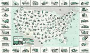
This is a 1958 General Drafting Company pictorial map of the United States, its industry, and the transportation network used to move its products . Pictorial vignettes highlight American production, from agricultural goods to aircraft parts and automobiles. Corn, potatoes, walnuts, citrus fruit, and flour appear among the nation's agricultural products. Coal, lead, uranium ore, copper, aluminum, and phosphates are only a few of the minerals excavated across the country. Farm machinery, shoes, synthetic rubber, textiles, and paper represent handful of the products manufactured. America's highway network, illustrated below the green vignettes in shades of gray, severs as arteries of trade and commercial production. The trucks that create the map's border carry it all. Many of which were designed with specific purposes in mind: Logging trucks, beverage panel trucks, telephone line trucks, bulk milk trucks, ice cream trucks, and vehicle carriers, etc. (more details)
Economic Arteries: Federal-Aid Highway Act of 1956.
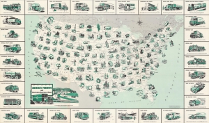
This is a 1958 General Drafting Company pictorial map of the United States, its industry, and the transportation network used to move its products. The map follows the 1956 Federal-Aid Highway Act, celebrating the success of the American Highway system and the hard work of truckers in moving goods along a growing arterial network of interstate trade. (more details)
The Westward Expansion Explained.
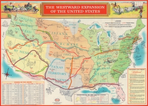
The Westward Expansion of the United States. / Life in Colonial America and the Westward Expansion of the United States.
sold
This is a 1958 General Drafting Company pictorial map of the United States illustrating the Westward Expansion. (more details)
Cowboys and Cold War propaganda.
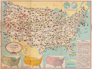
アメリカ合衆國 主要地方資源產物及び風景絵入り地図 / [Pictorial Map of the United States of America Showing Principal Regional Resources, Products and Natural Features].
sold
- Digital Map Information
- Suitable for large format printing
- File Size: 129.51 MB
- File Type: ZIP / TIFF
- ICC color profile embedded
- Delivered instantly via download link
This is a c. 1954 Japanese language pictorial map of the United States published by the U.S. Department of State and distributed by the U.S. Information Agency (U.S.I.A.). It was likely intended both for Japanese travelers to the United States and for consumption within Japan to increase knowledge about the U.S. Although outwardly rather innocuous, it was a product of a wider Cold War information war meant to improve the perception of the U.S. in foreign countries. (more details)
The Space Race.
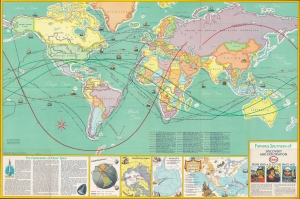
An inspirational 1963 map by General Drafting depicting voyages of discovery and exploration. It was made in the midst of the space race between the United States and Soviet Union, and more specifically, was prompted by the orbital space flights of Yuri Gagarin and John Glenn. (more details)