
Lewis, Samuel (sold)

Samuel Lewis (c. 1754 - 1822) was an American engraver, cartographer, draftsman, and geographer active in Philadelphia in the first of the 19th century. Though is place of birth is uncertain, most agree that Lewis emigrated from Dublin, Ireland, in the late 18th century. Lewis' earliest cartography work was produced in partnership with the well-known Philadelphia publishers Matthew Carey and Henry Schenk Tanner. In 1804, with the intention of republishing high quality English maps in the United States, Lewis partnered with the eminent British map publisher Arron Arrowsmith. Their first joint publication was A New and Elegant General Atlas, but many others followed including an American edition of Arrowsmith's important double hemisphere wall map of the world. Arrowsmith also worked with Jedidiah Morse, among other important American cartographers of the period. Ralph Brown considers Lewis to be "the most enterprising commercial map-maker of the period … " Lewis is best known for his map related to the expedition of Meriwether Lewis (no relation) and William Clark. In 1814 Lewis, copying directly from William Clark's manuscript, issued A Map of Lewis and Clark's Tracks across the Western Portion of North America. This important document was the first published map derived from the Lewis and Clark Expedition and profoundly transformed the cartography of the American northwest. Samuel Lewis of Philadelphia should not be confused with Samuel Lewis of London, another cartographer active during roughly the same period.
First map of Maine produced in the American Republic.
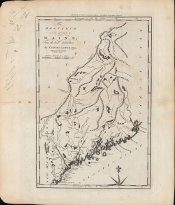
The province of Maine, from the best authorities.
sold
- Digital Map Information
- Suitable for large format printing
- Full resolution TIFF file
- ICC color profile embedded
- Delivered instantly via download link
A fascinating 1794 map of the 'Province of Maine' by Samuel Lewis and engraved by William Barker for Matthew Carey's American Edition of Guthrie's Geography improved, the first atlas published in the American Republic. It depicts the territory in the years just following independence, with borders that remained disputed and would later be shifted southwards as part of a compromise with Great Britain. (more details)
First map of the Granite State produced in the American Republic.
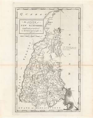
The state of New Hampshire, compared chiefly from actual surveys.
sold
- Digital Map Information
- Suitable for large format printing
- DPI: 600
- File Size: 32.14 MB
- File Type: ZIP / TIFF
- ICC color profile embedded
- Delivered instantly via download link
This is Samuel Lewis' 1794 map of New Hampshire, which appeared in Carey's General Atlas, the first atlas produced and published in the United States. It provides a wonderful snapshot of the state in the early days of the American Republic. (more details)
The earliest map of Pennsylvania published in the American Republic.
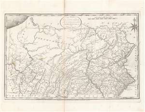
The State of Pennsylvania : reduced with permission from Reading Howell's map.
sold
- Digital Map Information
- Suitable for large format printing
- DPI: 600
- File Size: 35.23 MB
- File Type: ZIP / TIFF
- ICC color profile embedded
- Delivered instantly via download link
This is a fine first state example of Samuel Lewis’ 1795 map of Pennsylvania for Carey's General Atlas, the first atlas published in the young American Republic. It was an especially significant map as the producers of the atlas were based in Philadelphia, also the nation’s (temporary) capital at the time, which they used as the Prime Meridian throughout the atlas. (more details)
Earliest map of South Carolina published in the United States.
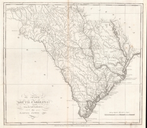
The state of South Carolina : from the best authorities.
sold
- Digital Map Information
- Suitable for large format printing
- DPI: 600
- File Size: 32.86 MB
- File Type: ZIP / TIFF
- ICC color profile embedded
- Delivered instantly via download link
This is a first state example of Samuel Lewis' 1795 map of South Carolina for Carey's General Atlas, the first atlas published in the American Republic. It illustrates the state's mountains, rivers, coastline, settlements, and infrastructure as they appeared soon after American Independence. (more details)
First American map of North Carolina. Shows the Moravian Settlement of Wachovia.
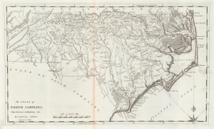
The State of North Carolina from the best Authorities etc.
sold
- Digital Map Information
- Suitable for large format printing
- Full resolution TIFF file
- ICC color profile embedded
- Delivered instantly via download link
This is a 1795 first state example of the Samuel Lewis map of North Carolina, the earliest specific map of that state printed in the United States. It is also one of the few maps to show the Moravian Settlement of Wachovia, near modern-day Winston-Salem. (more details)
A map of New Jersey from the first atlas produced in the American Republic.
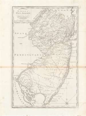
The state of New Jersey, compiled from the most authentic information.
sold
- Digital Map Information
- Suitable for large format printing
- DPI: 600
- File Size: 28 MB
- File Type: ZIP / TIFF
- ICC color profile embedded
- Delivered instantly via download link
Here is Mathew Carey and Samuel Lewis' c. 1796 map of New Jersey, made for Carey's General Atlas, the first atlas produced and published in the American Republic. It portrays the state in the years just after the American Revolution, in which it had played a central role. (more details)
From the first general atlas published in the United States.
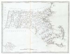
The State of Massachusetts.
sold
- Digital Map Information
- Suitable for large format printing
- Full resolution TIFF file
- ICC color profile embedded
- Delivered instantly via download link
This is a 1796 Mathew Carey and Samuel Lewis map of Massachusetts, published by Carey in the first general atlas of the United States. Cities, towns, and villages are labeled across the state, including Boston, Salem, Marblehead, and Plymouth. Major roads are depicted, along with rivers and lakes. Coastal bays and harbors, including Boston Harbor, Buzzards Bay, and Cape Cod Bay, are labeled. (more details)
Southern Theater of the American Revolution.
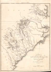
A Map of Those Parts of Virginia, North Carolina, South Carolina and Georgia which were the Scenes of the Most Important Operations of the Southern Armies.
sold
- Digital Map Information
- Suitable for large format printing
- File Size: 5.34 MB
- File Type: ZIP / TIFF
- ICC color profile embedded
- Delivered instantly via download link
A lovely example of Samuel Lewis' map of the Carolinas and Virginia that appeared in the 1806 first London edition of John Marshall's The Life of George Washington. The map depicts the Southern Theater of the American Revolutionary War. (more details)
One of the most important American maps of the 19th century.
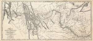
Map of Lewis and Clark's Track, Across the Western Portion of North America..
sold
- Digital Map Information
- Suitable for large format printing
- File Size: 47.16 MB
- File Type: ZIP / TIFF
- ICC color profile embedded
- Delivered instantly via download link
Among the most important maps in American history, this depiction of the Lewis and Clark Expedition completely changed Americans' understanding of the central and western part of the continent. Based on the sketches of William Clark, this is a c. 1870 reprint of the 1814 original map drafted by Samuel Lewis and engraved by Samuel Harrison, for inclusion in the History of the expedition under the command of Captains Lewis and Clark to the sources of the Missouri…. (more details)
Rare second state!
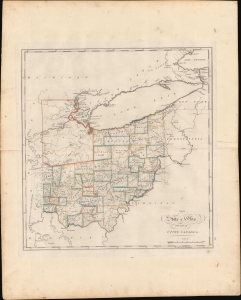
The State of Ohio with part of Upper Canada, etc.
sold
- Digital Map Information
- Suitable for large format printing
- DPI: 600
- File Size: 423.89 MB
- File Type: ZIP / TIFF
- ICC color profile embedded
- Delivered instantly via download link
This is the rare 1818 edition of Carey's map of Ohio. This second state is considerably rarer than the 1814 first state and notable for its significant updates, reflecting both corrections and Ohio's high-paced settlement. (more details)
The only known example of an unrecorded 1838 American issue of A. Arrowsmith's Globular Map of the World. Shows Republic of Texas.
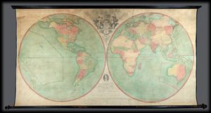
Arrowsmith's Map of the World on a Globular Projection, Exhibiting particularly the Nautical Researches of Captain James Cook, with all the recent Discoveries to the present Time, The Whole Engraved under the immediate Superintendence of, corrected and improved , by Samuel Lewis, Geographer.
sold
- Digital Map Information
- Suitable for large format printing
- File Size: 1.76 MB
- File Type: ZIP / TIFF
- ICC color profile embedded
- Delivered instantly via download link
A late unrecorded state of Arrowsmith's double hemisphere map of the world on a globular projection. Dating to 1838 and published well after the death of both Aaron Arrowsmith and Samuel Lewis, this is without a doubt the last iteration of this seminal map. The ... (more details)