
Senex, John (sold)

John Senex (1678 - 1740) was an English engraver and map maker active in London during the first half of the 18th century. Senex was born to upper middle class parents in Shropshire, England. As a young man, he was apprenticed to Robert Clavell, a London bookseller and member of the Stationers' Company, under whom he mastered the arts of engraving and printmaking. Around 1702 Senex completed his apprenticeship and established himself as a printer and bookseller in the Strand. A year later Senex partnered with Jeremiah Seller and Charles Price, the successors to the important mapmaker John Seller, and relocated to Cornhill. This was likely Senex's first introduction to mapmaking though he seems to have taken to it with abandon. In the subsequent years Senex established himself as one of the most prominent cartographers in London, publishing a number of beautiful and important maps that today rank among the finest examples from the Golden Age of British Cartography. In addition to a large corpus of flat maps, Senex also produced a number of important and highly desirable globes. Eventually Senex dissolved his partnership with Seller and Price and relocated to Fleet Street, where he maintained offices until his death in 1740. Senex was succeeded by his widow, Mary Senex, who continued to publish and update his works until about 1755, when the remaining globe and map plates were sold to James Ferguson.
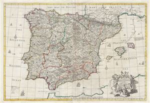
A correct map of Spain and Portugal : according to the newest observations and discoveries communicated to the Royal Society at London and the Royal Academy at Paris…
sold
- Digital Map Information
- Suitable for large format printing
- DPI: 300
- File Size: 40.04 MB
- File Type: ZIP / TIFF
- ICC color profile embedded
- Delivered instantly via download link
An exception c. 1708 elephant folio (large format) map of Spain and Portugal by the English cartographer John Senex. This enormously proportioned map covers the entirety Iberia from the Atlantic Coast to Minorca and from the Bay of Biscay to the Strait of ... (more details)
Earliest example of the largest early 18th century English map of Poland.
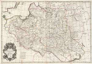
Poland: corrected from the observations communicated to the Royal Society at London and the Royal Academy at Paris.
sold
- Digital Map Information
- Suitable for large format printing
- Full resolution TIFF file
- ICC color profile embedded
- Delivered instantly via download link
This is a lovely, original old color example of John Senex' important map of Poland, one of the largest English maps of the Polish-Lithuanian Commonwealth. The map reaches from the Baltic, Silesia and Hungary in the west to Biela, Molenskow and Severia in the east. It is superbly engraved and richly detailed, with mountains and forests rendered pictorially. The cartouche, with its dedication to Sir James Hallett, has a particularly martial character. Surmounted with weapons, it is flanked by figures representing Mars and Winged Victory, perhaps alluding to the many wars suffered by the Commonwealth. It is unclear what connection Sir James Hallett (1690 - 1734, who may have been a Goldsmith, might have had with the subject matter. (more details)
An unrecorded variant of Senex's large map of North America.

North America corrected from the observations communicated to the Royal Society at London, and the Royal Academy at Paris.
sold
- Digital Map Information
- Suitable for large format printing
- DPI: 300
- File Size: 21.34 MB
- File Type: ZIP / TIFF
- ICC color profile embedded
- Delivered instantly via download link
An exceptional and influential 1710 British map of North America by John Senex. Hands down the most ambitions British mapping of North America produced thus far, Senex's large format map covers all of North America from the unexplored high arctic to ... (more details)
An early unrecorded variant of Senex's large map of North America.
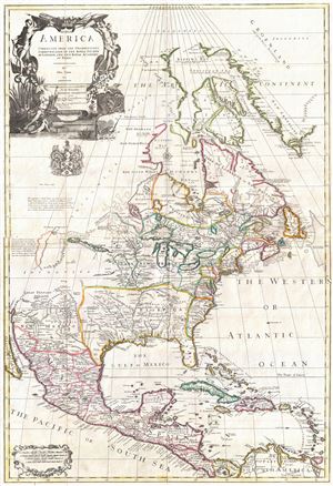
North America corrected from the observations communicated to the Royal Society at London, and the Royal Academy at Paris.
sold
- Digital Map Information
- Suitable for large format printing
- Full resolution TIFF file
- ICC color profile embedded
- Delivered instantly via download link
An exceptional and influential 1710 British map of North America by John Senex. Hands down the most ambitions British mapping of North America produced thus far, Senex's large format map covers all of North America from the unexplored high arctic to ... (more details)
Vitriolic Presentation of Greece Occupied by the Ottoman Empire.
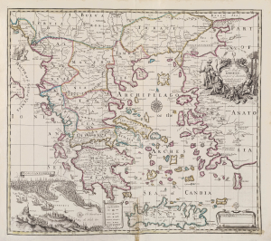
A Map of Greece with part of Anatolia most humbly Inscrib'd to Alexander Uruqhart of Newhall Esq. 1720 Revis'd by J. Senex.
sold
- Digital Map Information
- Suitable for large format printing
- File Size: 2455.27 MB
- File Type: ZIP / TIFF
- ICC color profile embedded
- Delivered instantly via download link
This elegant English map of Greece, produced by John Senex in 1721, presented a British audience with a view of Greece specifically as a possession of the Ottoman Empire. Its beautifully engraved cartouche and its bird's-eye view of Constantinople emphasized the idea that the land presented in the map was one forcibly occupied by the Muslim world in the person of the Ottoman Turks. (more details)
Extraordinary full color example of John Sennex's Rome.
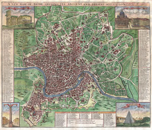
A New Mapp of Rome Shewing Its Antient And Present Scituation. Most Humbly Inscribed to His Grace The Duke of Queensbury and Dover.
sold
- Digital Map Information
- Suitable for large format printing
- Full resolution TIFF file
- ICC color profile embedded
- Delivered instantly via download link
A radiant full color example of John Sennex's 1721 map of Rome. Covers the entire and part of the surrouding countryside. Identifies both modern and ancient monuments in profile. Some of these include the Coliseum, the Vatican, the Pantheon, and ... (more details)
Exceptional decorative map of the world revealing older cartographic suppositions. Shows California as an Island.
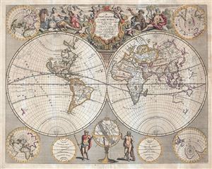
A New Map of the World from the Latest Observations.
sold
- Digital Map Information
- Suitable for large format printing
- Full resolution TIFF file
- ICC color profile embedded
- Delivered instantly via download link
An impressive 1721 double hemisphere map of the World by John Senex. This map covers the entire world in two hemispheres. It appeared during a period of rapid globalization and discovery. Senex here attempts to reveal both the most up-to-date ... (more details)
One of the largest, most decorative 18th century maps of Sicily.
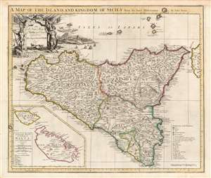
A Map of the Island and Kingdom of Sicily From the latest Observations By John Senex/ A Particular Map of the Island of Malta and the Neighboring Islands.
sold
- Digital Map Information
- Suitable for large format printing
- Full resolution TIFF file
- ICC color profile embedded
- Delivered instantly via download link
This is a beautiful example of John Senex's 1721 map of Sicily and Malta. It was the largest and most detailed English map of the island printed to date, pictorially showing the island's mountainous terrain with particular attention to its famous volcano, Etna, its vineyards, salt pans and post roads, and cities. The map is a faithful translation of Guillaume De l'Isle's 1717 Carte de l'Isle et Royaume de Sicile. (more details)
Presenting the East to an English Audience.
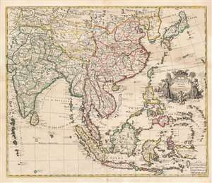
A New Map of India and China from the Latest Observations by I. Senex.
sold
- Digital Map Information
- Suitable for large format printing
- DPI: 600
- File Size: 65.27 MB
- File Type: ZIP / TIFF
- ICC color profile embedded
- Delivered instantly via download link
This is a scarce and elegant 1721 English map of Southeast Asia, the Far East, and the East Indies, drawn and engraved by John Senex. The map is dedicated to the British East Indian Company (EIC) and embraces its primary theaters of operation. At the time the EIC was the wealthiest company in the world and a dominant force in all British affairs, this making this map a subject of great interest to the British public. (more details)
An extraordinary and rare elephant folio map of Asia naming boh the Sea of Korea and the Eastern Sea.
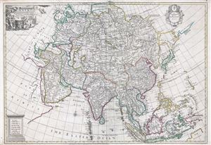
Asia Corrected from the Observations communicated to the Royal Society at London and the Royal Academy at Paris.
sold
- Digital Map Information
- Suitable for large format printing
- DPI: 300
- File Size: 35.55 MB
- File Type: ZIP / TIFF
- ICC color profile embedded
- Delivered instantly via download link
An exception c. 1725 elephant folio (large format) map of Asia by the English cartographer John Senex. This remarkable map covers the entirety of Asia from the Mediterranean to Japan and from Nova Zembla to Java and the Maldives. This map is ... (more details)
The first English Trade Atlas.
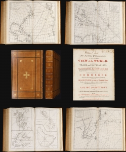
Atlas Maritimus et Commercialis or, A General View of the World, so far as relates to trade and navigation.
sold
This 1728 nautical atlas is the first openly published commercial geography produced for a general audience. 'No previous work in English had offered a survey of the world's trading sites on this scale' (Rogers, 2023). It was an ambitious project brought to completion by a consortium of mapmakers, printers, and writers. While it is conventionally credited to Nathaniel Cutler and the illustrious Edmond Halley, these supplied only portions of the monumental work. The maps can be assigned to John Senex, drawing extensively on a new projection provided by Henry Wilson; much of the descriptive content of the first part of the work has been attributed to the prolific Daniel Defoe, while the second portion - A General Coasting Pilot; Containing Directions for Sailing - is attributed to Cutler. (more details)
Charting North America's Atlantic Coast.
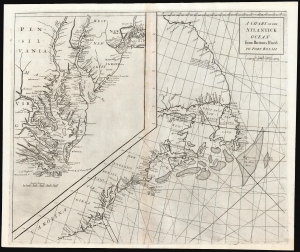
A Chart of the Atlantick Ocean from Buttons Island to Port Royall.
sold
- Digital Map Information
- Suitable for large format printing
- DPI: 600
- File Size: 54.71 MB
- File Type: ZIP / TIFF
- ICC color profile embedded
- Delivered instantly via download link
This is a scarce, elegant 1728 Senex chart of the east coast of North America, from Port Royal in South Carolina to Button Island in Arctic Canada. It includes an inset chart richly detailing Chesapeake and Delaware Bays, and New York Harbor. (more details)
Meet me at the Zuiderzee.
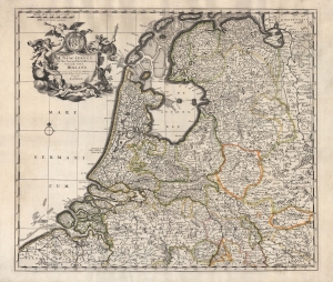
A New Survey of the Seaven United Provinces Commonly Called Holland.
sold
- Digital Map Information
- Suitable for large format printing
- Full resolution TIFF file
- ICC color profile embedded
- Delivered instantly via download link
An unrecorded c. 1740 John Overton map of the Netherlands, based on the 1721 map of the same by John Senex, published in the latter's A New General Atlas of the World. Adopting the convention of the time, 'Holland' is used synonymously with the entire United Provinces. (more details)