
Tittmann, Otto Hilgard (sold)

Otto Hilgard Tittmann (August 20, 1850 - August 21, 1938) was a German-American geodesist, geographer, and astronomer. Born in Belleville, Illinois, Tittmann attended school in St. Louis before joining the U.S. Coast and Geodetic Survey on November 10, 1867, and would remain with the U.S.C.G.S until his resignation 48 years later. Between 1889 and 1893, Dr. Tittmann was in charge of the Office of Standard Weights and Measures, which was, at this time in American history, part of the Coast and Geodetic Survey, and would remain so until the establishment of the National Bureau of Standards. During his time in charge of Weights and Measures, Tittman was sent to Paris to bring to the United States the national standard meter and to study weights and measures offices in Paris, London, and Berlin. Tittmann was named Assistant Superintendent of the Coast and Geodetic Survey on April 18, 1899 and was elevated to the post of Superintendent on December 1 1900, which he held until he resigned the post on April 15, 1915. Tittman, a co-founder of the National Geographic Society, served as the Society's President from 1915 until 1919. He was also a member of the Philosophical Society of Washington, the American Philosophical Society, the Washington Academy of Sciences, the American Association for the Advancement of Scient, the American Meteorological Society, the American Society of Civil Engineers, and the Cosmos Club. Dr. Tittman was a respected geodesist and renowned as one of the best in the country.
Depicts Parris Island, home of the Marine Corps Recruit Depot Parris Island.
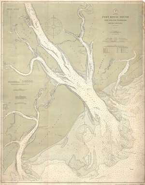
Port Royal Sound and Inland Passages South Carolina.
sold
- Digital Map Information
- Suitable for large format printing
- File Size: 29.22 MB
- File Type: ZIP / TIFF
- ICC color profile embedded
- Delivered instantly via download link
This is a 1901 U.S. Coast and Geodetic Survey nautical chart or maritime map of Port Royal Sound in South Carolina. An estuary of several rivers, the map depicts the region from Daufuskie Island to Pritchards Island and from Beaufort, South Carolina to the Atlantic ... (more details)
Illustrates both Cape May and Cape Henlopen.
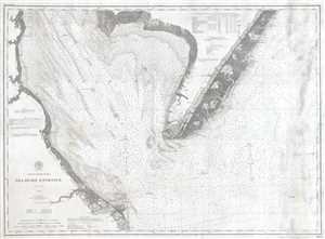
Delaware Entrance.
sold
- Digital Map Information
- Suitable for large format printing
- File Size: 23.39 MB
- File Type: ZIP / TIFF
- ICC color profile embedded
- Delivered instantly via download link
This is a 1902 United States Coast and Geodetic Survey nautical chart or maritime map of the entrance to Delaware Bay. The Map depicts the region from Delaware to the Atlantic Ocean and from Little Bombay Hook, Delaware, and Fortescue Bench, New Jersey to Rehoboth, ... (more details)
Navigating the Bay.
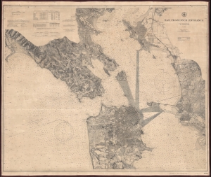
San Francisco Entrance California.
sold
- Digital Map Information
- Suitable for large format printing
- File Size: 91.18 MB
- File Type: ZIP / TIFF
- ICC color profile embedded
- Delivered instantly via download link
This is a 1903 U.S. Coast and Geodetic Survey nautical chart or map of San Francisco Bay, California. (more details)
Culmination of nearly 100 years of survey work in these waters.
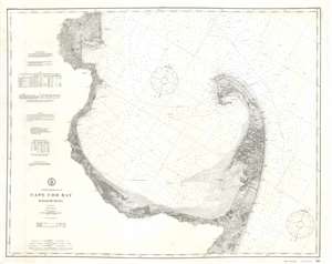
Coast Chart No. 110 Cape Cod Bay Massachusetts.
sold
- Digital Map Information
- Suitable for large format printing
- File Size: 41.42 MB
- File Type: ZIP / TIFF
- ICC color profile embedded
- Delivered instantly via download link
A stunning large format separate issue 1908 U.S. Coast Survey nautical chart or maritime map of Cape Cod Bay - representing the culmination of nearly 100 years of active survey work in these waters. The chart follows the Massachusetts coastline from Duxbury Bay to Provincetown at the tip of Cape Cod and south as far as Nickerson's Neck. As a whole it is extraordinarily engraved, with near 3-dimensional detail inland on the Cape. At the base of the map there are three land profile charts - intended to help navigators identify prominent features on distant shorelines. The left-hand quadrants of the map feature various tables, sailing instructions, notes on soundings and tides, and a wealth of other practical information for the mariner. (more details)
One of the most beautiful parts of Maine.
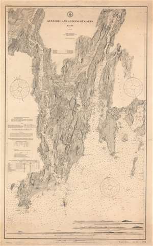
Kennebec and Sheepscot Rivers Maine.
sold
- Digital Map Information
- Suitable for large format printing
- File Size: 62.13 MB
- File Type: ZIP / TIFF
- ICC color profile embedded
- Delivered instantly via download link
A striking 1910 nautical chart or maritime map of the Kennebec and Sheepscot Rivers, Maine. Representing the culmination of the Coast and Geodetic Survey's work in the region, coverage extends from Cape Small and the mouths of both rivers, north as far as Wiscasset (considered one of Maine's most beautiful small towns). Named towns include Bath, a regional shipbuilding center, and the fishing port of Boothbay Harbor. Along the bottom there are three land profiles offering different views of Seguin Light. Countless depth sounding and practical information for the mariner fill the waters. This is a separate issue nautical chart, intended for maritime use, and is thus considerably more developed than earlier folding examples of the chart issued for the Survey's annual reports. (more details)
A nautical chart of the Hudson River.
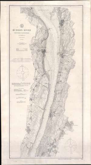
Hudson River New York to Haverstraw N.Y. and N.J.
sold
- Digital Map Information
- Suitable for large format printing
- File Size: 44.86 MB
- File Type: ZIP / TIFF
- ICC color profile embedded
- Delivered instantly via download link
This is a 1911 U.S. Coast and Geodetic Survey nautical chart of maritime map of the Hudson River. Detailed coverage extends from Haverstraw, New York, south to just below Fort Washington Point (where the George Washington Bridge stands today). Outside New York City, the towns of Ossining, Nyack, Tarrytown, Dobbs Ferry, Yonkers, Mount Vernon, Englewood, and Wakefield are all labeled. Within New York City, Fordham, Belmont, West Farms, Tremont, Claremont, Morrisania, and Inwood are identified. Depth soundings in feet appear throughout. Railroads along the river's banks, including the New York Central and Hudson River Railroad , are illustrated as well. The Croton Aqueduct is noted. (more details)
An attractive large chart of Pensacola Bay, Florida.
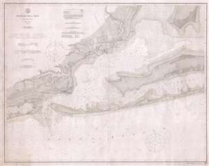
Pensacola Bay Florida.
sold
- Digital Map Information
- Suitable for large format printing
- File Size: 28.15 MB
- File Type: ZIP / TIFF
- ICC color profile embedded
- Delivered instantly via download link
This is a 1913 U.S. Coast and Geodetic Survey nautical chart or maritime map of Pensacola Bay, Florida. The map depicts the region from Big Lagoon and the Gulf of Mexico to the East Bay and from north of Pensacola to the Gulf of Mexico. Highly detailed, myriad ... (more details)
Maritime Massachusetts.
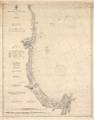
Coast Chart No. 108 From Wells to Cape Ann.
sold
- Digital Map Information
- Suitable for large format printing
- File Size: 53.91 MB
- File Type: ZIP / TIFF
- ICC color profile embedded
- Delivered instantly via download link
This is a 1910 / 1913 U.S. Coast and Geodetic Survey nautical chart or maritime map of the North Shore, Cape Ann, Massachusetts. Depicting the Massachusetts coast from Wells Beach to Popplestone Ledge south of Cape Ann, countless depth soundings provide navigational aid to mariners plying these waters. Bays, points, and other coastal features are identified. Aids to avoid hazards, such as whistles, bells, and lights, are all indicated as well. Newburyport and Gloucester are the two largest settlements illustrated. All other villages are small and marked by only a handful of buildings. Roads and railroads are also depicted. Two coastal views are situated in the lower left. One depicts Cape Ann from the north and the other the entrance to Gloucester Harbor. Information concerning tides, buoys, abbreviations, and other practical information for the mariner are included along the left. (more details)
A striking nautical chart of Portland.
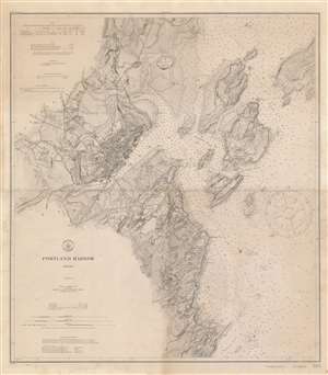
Portland Harbor, Maine.
sold
- Digital Map Information
- Suitable for large format printing
- File Size: 44.3 MB
- File Type: ZIP / TIFF
- ICC color profile embedded
- Delivered instantly via download link
This is a 1914 U.S. Coast and Geodetic Survey nautical chart or maritime map of Portland Harbor, Maine. The map depicts the region from Old Fort Casco to John's Hill and Broad Cove and from Brighton Corner to Long Island. Portland itself is illustrated with extreme attention to detail, with individual buildings appearing throughout the city. City Hall, the Fidelity Buildings, the cathedral, the observatory, and the Custom House are all labeled. Several railroad lines operated by the Boston and Maine Railroad are illustrated, along with the Grand Trunk Railroad and its bridge across a narrow part of the harbor. Port facilities also appear in detail. Individual docks are illustrated all along the waterfront. Numerous depth soundings are indicated throughout, with the highest concentration within Portland Harbor. Numerous islands, including Little Diamond Island, Peak's Island, Great Diamond Island, and Cushing Island, are all illustrated as well, with Fort Georges appearing on Diamond Island Ledge. Coastal bells and lights are noted. (more details)