
Van Keulen, Johannes (sold)
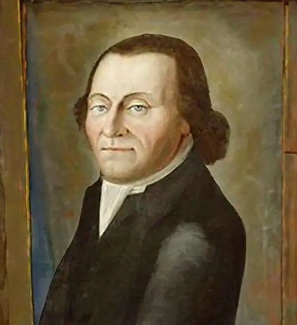
Johannes Van Keulen (1654 – 1715) was a Dutch cartographer active in Amsterdam during the late 17th century. Van Keulen was the son of Lucas van Keulen. Van Keulen's firm, ‘In de Gekroonde Lootsman' (In the Crowned Pilot), was founded in 1678 and registered with the Amsterdam bookseller's guild as 'Cross staff-maker and bookseller.' (The cross-staff is a nautical instrument used to determine latitude.) Two years later, in 1680, they obtained a patent from the States General of Holland and West Friesland to publish nautical charts and atlases. Together with his partner, the cartographer Claes Janz Vooght, Van Keulen published numerous atlases and nautical charts, including the Zee Atlas and Nieuwe Lichtende Zee-Fakkel. It was a massive five-volume atlas containing more than 130 nautical charts. The Zee-Fakkel established the Van Keulen firm as the pre-eminent maker of Dutch sea charts in the late 17th and early 18th century. In 1714, one year before Johannes Van Keulen's death, his son, Gerard van Keulen (1678 - 1726), took charge. Gerard continued to update and republish the Zee-Fakkel until his own death in 1726. The firm was later passed on to Gerard's son, Johannes II Van Keulen (1704 - 1755), who significantly updated the atlas, especially with regard to Asia, issuing the 1753 4th Volume, known as the 'Secret Atlas'. The final editions of the atlas were published by Gerard Hulst van Keulen (1733 - 1801), Joannes II's son. The final true Van Keulen edition of the Zee-Fakkel was published posthumously in 1803. It is noteworthy that though ostensibly controlled by the Van Keulen men, it was the Van Keulen widows who maintained and managed the firm in the periods following their husbands' deaths. After the death of Gerard Hulst Van Keulen's son, Johannes Hulst Van Keulen, ownership of the family plates and business fell into the hands of the Swart family, who continued to publish until the company closed its doors 1885, ending a cartographic legacy spanning nearly 207 years.
One of the most decorative early nautical charts of the American Southeast.
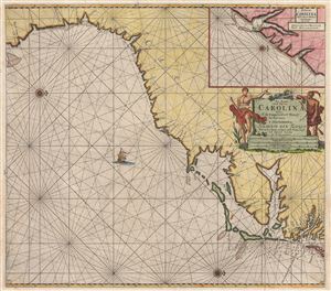
Pas Kaart van de Kust van Carolina tusschen C de Canaveral en C Henry.
sold
- Digital Map Information
- Suitable for large format printing
- DPI: 300
- File Size: 21.25 MB
- File Type: ZIP / TIFF
- ICC color profile embedded
- Delivered instantly via download link
Among the most scarce and decorative Dutch nautical charts of the American southeast, this is Johannis Van Keulen's and C. J. Vooght's 1687 maritime map of the Virginia, Carolina, Georgia and Florida coasts. Oriented to the west (with north to the right), this map ... (more details)
The earliest nautical chart to specifically detail the southeast Florida coast.
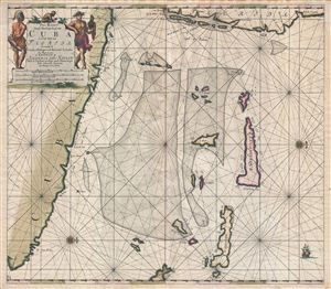
Pas Kaart Vande Noord Oost Kust van Cuba en d'Oost Kust van FLORIDA vervaatende de Canal van Bahama met de Bahaamse Eylende Door Vooght Goemetra…
sold
- Digital Map Information
- Suitable for large format printing
- DPI: 300
- File Size: 20.93 MB
- File Type: ZIP / TIFF
- ICC color profile embedded
- Delivered instantly via download link
A fine old color example of Claes Jansz Vooght and Johannes Van Keulen's 1687 nautical chart or maritime map of the approaches to the Straits of Florida. Oriented to the west, this map covers from the eastern tip of Cuba to the Bahamas and from Florida to exuma, ... (more details)
One of the first charts to name Philadelphia.
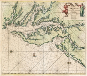
Pas kaart van de zee kusten van Virginia : tusschen C. Henry en t hooge land van Renselaars Hoek...
sold
- Digital Map Information
- Suitable for large format printing
- DPI: 600
- File Size: 27.92 MB
- File Type: ZIP / TIFF
- ICC color profile embedded
- Delivered instantly via download link
This is Van Keulen's 1695 nautical chart or maritime map of Chesapeake Bay, Delaware Bay, and the adjacent coastlines. It is one of the first charts to utilize the 1673 Hermann map as a source, making it one of the most up-to-date charts of the region - and a vast improvement on the 1675 Roggeveen, specifically because Van Keulen's chartmaker, Vooght, relied on the English Hermann map rather than Hessel Gerritz's c. 1630 chart. (more details)
The Raiding Ground of Buccaneers.
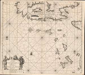
Pas kaart Van de Noord Kust van Espaniola met d Eylanden daar Benoorden.
sold
- Digital Map Information
- Suitable for large format printing
- DPI: 600
- File Size: 27.24 MB
- File Type: ZIP / TIFF
- ICC color profile embedded
- Delivered instantly via download link
A beautifully engraved 1684 nautical chart or maritime map of the north coast of Hispaniola, the east end of Cuba, the Turks and Caicos islands, and the southeastern reaches of the Bahamas. This southern-oriented chart depicts the heart of the raiding territory of the 'Brethren of the Coast', the buccaneers. (more details)
Dutch New York at the time of the British takeover.
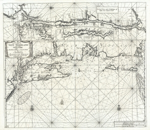
Pas-kaart vande zee kusten van Niew Nederland anders genaamt Niew York tusschen Renselaars Hock en de Staaten Hoek.
sold
- Digital Map Information
- Suitable for large format printing
- Full resolution TIFF file
- ICC color profile embedded
- Delivered instantly via download link
This is Johannes van Keulen and Claes Janszoon Vooght's 1702 map of New York, Long Island, the Hudson River, and the Connecticut River. First appearing in 1684, this is the second earliest published map to detail the coast between Long Island and Cape Cod. It also features the earliest published maps of any American River. Furthermore, many of the place names throughout make their first appearance here. As such, it may be considered the high point of Dutch knowledge about New Amsterdam before the British takeover. (more details)
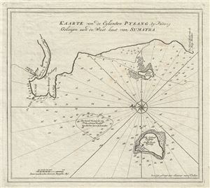
Kaarte van de Eylanden Pysang by Padang Geleegen aan de West kust van Sumatra.
sold
- Digital Map Information
- Suitable for large format printing
- DPI: 300
- File Size: 3.89 MB
- File Type: ZIP / TIFF
- ICC color profile embedded
- Delivered instantly via download link
This is a beautiful example of Joannes van Keulen's 1728 nautical chart or maritime map of Pisang Island, a small island near Padang, on the west coast of Sumatra, Indonesia. Oriented to the west, this map covers the coast of Padang, and the neighboring ... (more details)
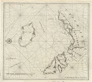
Untitled.
sold
- Digital Map Information
- Suitable for large format printing
- DPI: 300
- File Size: 4.05 MB
- File Type: ZIP / TIFF
- ICC color profile embedded
- Delivered instantly via download link
This is a beautiful example of Joannes van Keulen's 1728 nautical chart or maritime map of the northern coast of Sumatra, Indonesia. Oriented to the west, the map covers the northern part of modern day Aceh, including the islands of Nasi (Pulo Nancy), ... (more details)
VOC's Secret Map of the critical passage around Madagascar to the Indies.
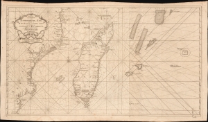
Paskaart van een Gedeelte van de Aethiopische-Zee, Strekkende van R. Sta. Lucia tot C. del Gado, Langs de Kusten van Suffalo en Mocambique, Bevattende Insgelyks 't Eiland Madagascar met Desselfs Onderhorige Eilanden.
sold
- Digital Map Information
- Suitable for large format printing
- File Size: 45.51 MB
- File Type: ZIP / TIFF
- ICC color profile embedded
- Delivered instantly via download link
This is an extremely rare 1753 Johannes II van Keulen / Jan de Marre nautical map of Madagascar, Mauritius, and the adjacent coast of Africa compiled for the sixth volume of the Zee-Fakkel - the Dutch East India Company's legendary 'Secret Atlas.' The map reveals tightly controlled navigational secrets when Madagascar was a haven not only for the world's most notorious pirates (including Captain Kidd) but also a source for the Atlantic Slave Trade. (more details)
The VOC's Secret Map of the South China Sea.
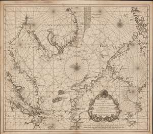
Nieuwe Caart strekkende van Banca, langs de kusten van Malacca, Siam, Cambodia, Cochinchina, als meede een gedeelte van de Eylanden Luçon, Borneo, et c. met alle dresslss Havens, Dieptens en Ankergronden.
sold
- Digital Map Information
- Suitable for large format printing
- DPI: 600
- File Size: 580.26 MB
- File Type: ZIP / TIFF
- ICC color profile embedded
- Delivered instantly via download link
The rare 1753 Johannes II van Keulen / Jan de Marre nautical map of the South China Sea compiled for the sixth volume of the Zee-Fakkel - the legendary Dutch East India Company (VOC - Vereenigde Oostindische Compagnie) 'Secret Atlas.' The map covers the South China Sea and Gulf of Thailand - thus embracing Singapore, Malaya, southern Thailand (Siam), Cambodia, southern Vietnam, most of Borneo, and parts of the Philippines. The map illustrates the most important waters and most dangerous sea passages in the East Indies. It was an essential navigational reference for VOC ships sailing from Malacca, through the Straits of Singapore, or north from Batavia for Siam (Bangkok), Laauwec (Cambodia), Nagasaki, Canton (Guangzhou), Macao, or Manila. (more details)
Scarce nautical chart of Table Bay, Cape Town, South Africa.
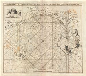
A Plan of Table Bay with the Road of th Cape of Good Hope, from the Dutch Survey Published by Joannes Van Keulen.
sold
- Digital Map Information
- Suitable for large format printing
- DPI: 300
- File Size: 16.3 MB
- File Type: ZIP / TIFF
- ICC color profile embedded
- Delivered instantly via download link
A scarce 1794 nautical chart or maritime map of the Table Bay, South Africa, by Robert Laurie and James Whittle. Oriented to the east, this stunning map of the Table Bay, South Africa, covers from Blue Hill to Table Mountain, including Cape Town, Lyons ... (more details)