
A bastion of Europe against Ottoman invasion.
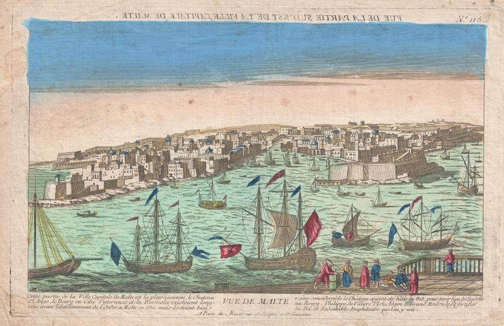
Vue de Malte. (Vue de la Partie Sed Est de la Ville Capitale de Malte.)
$500.00
Acquire
- Digital Map Information
- Suitable for large format printing
- DPI: 300
- File Size: 6.33 MB
- File Type: ZIP / TIFF
- ICC color profile embedded
- Delivered instantly via download link
An uncommon c. 1780 Chez Basset vue d'optique of Valletta, capital of Malta. The view reveals a busy and well-defended harbor. (more details)
Tampa area businesses and sites.

Tampa.
sold
This is a 1977 Barbara Spurll / Archar pictorial map of Tampa, Florida. Spurll highlights local businesses and cultural institutions offering amusing commentary. (more details)
Tampa Electric Company Dam.
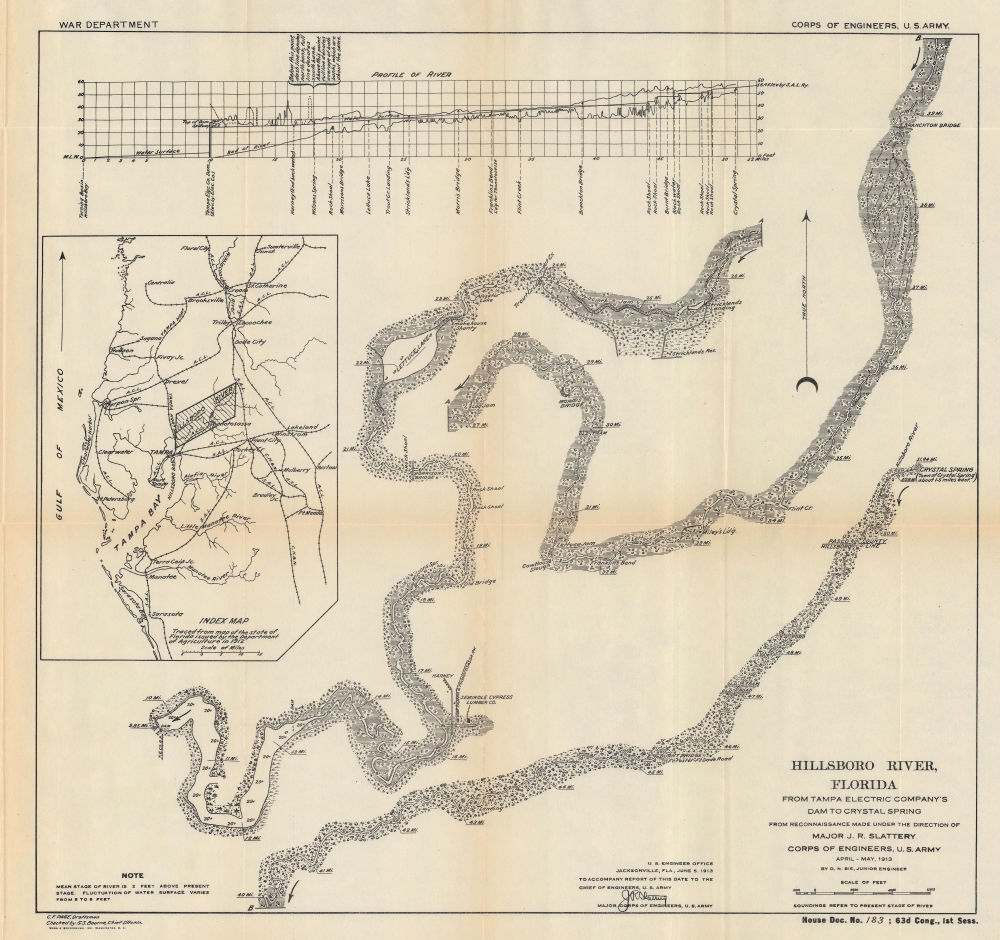
Hillsboro River, Florida From Tampa Electric Company's Dam to Crystal Spring.
sold
- Digital Map Information
- Suitable for large format printing
- File Size: 16.78 MB
- File Type: ZIP / TIFF
- ICC color profile embedded
- Delivered instantly via download link
This is a 1913 Otto N. Bie map of the Hillsborough River in Florida, just east of Tampa. (more details)
A Guide for the River Gambia.
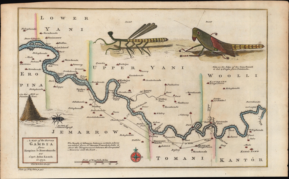
A Map of the River Gambia from Eropina to Barrakunda.
sold
- Digital Map Information
- Suitable for large format printing
- Full resolution TIFF file
- ICC color profile embedded
- Delivered instantly via download link
A fine example of Thomas Kitchin's 1752 map of the middle portion of the Gambia River, based on the description of John Leach, an agent of the Royal African Company. It highlights reconnaissance from Leach's travels, which were recounted in several works in the years afterwards, eliciting popular interest among the British public. (more details)
United States from 'Fawt Sumtah' to 'Tinasee Ernie Fode's Home'.

The United States of Dixie.
sold
This is a 1966 novelty Tip'n Twinkle placemat map of the United States, good-naturedly lampooning southern language, attitudes, and culture. (more details)
Get your Kicks on Route 66. Signed by Waldmire!

A Nostalgic, Bioregionally-Flavored, Bird's-Eye-View Map of Old Route 66. Main Street U.S.A. - Chicago to L.A.!
sold
This is Robert 'Bob' Waldmire's 1992 pictorial bird's-eye view map of Route 66. The product of 4 years of research, Waldmire considered this map his grand opus. From Chicago to Los Angeles, the view-map narrates the experience of Route 66, captivating readers with history and other anecdotes. (more details)
Extending L.A.'s sanitary sewer system.

Map of the City of Los Angeles Showing Location of Sanitary Sewers.
sold
- Digital Map Information
- Suitable for large format printing
- File Size: 29.26 MB
- File Type: ZIP / TIFF
- ICC color profile embedded
- Delivered instantly via download link
This is a 1916 Homer Hamlin city map of Los Angeles, California, illustrating its sewer system. (more details)
First mapping of pan-European wine production.

Weinkarte von Europa.
sold
- Digital Map Information
- Suitable for large format printing
- Full resolution TIFF file
- ICC color profile embedded
- Delivered instantly via download link
An exceptional 1871 Wilhelm Hamm infographic map of Europe illustrating wine production - considered a cartographic masterpiece in the illustration of viticulture. According to Petermann's, writing when this map was published, 'to our knowledge, the cultivation of viticulture throughout Europe has never been attempted to be presented in such completeness and with such detail'. (our translation, 'Prospectus') (more details)
Louisiana on the cusp of the Louisiana Purchase.

Carte Détaillée de la Basse-Louisiane et Floride Occidentale, pour étre adaptée à l'Ouvrage intitulé, Vue da la Colonie Espagnol due Mississipi, et c.
sold
- Digital Map Information
- Suitable for large format printing
- DPI: 600
- File Size: 21.22 MB
- File Type: ZIP / TIFF
- ICC color profile embedded
- Delivered instantly via download link
This is Alexandre's Blondeau's exceptional 1803 map of Spanish-administered Louisiana and West Florida, issued for Pierre-Louis Berquin Duvallon's travel narrative, Vue de la Colonie Espagnole due Mississipi. It is one of the best maps to capture the Gulf littoral during the Post-American Revolutionary War Spanish period on the cusp of the Louisiana Purchase. (more details)
WWII Guadalcanal Campaign.
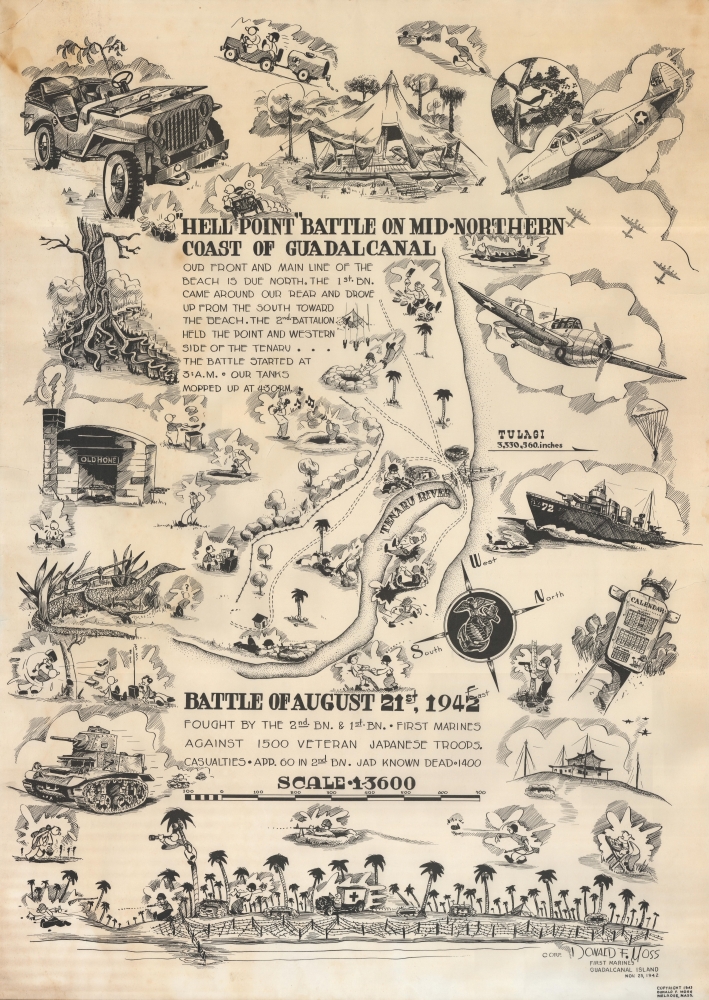
'Hell Point' Battle on Mid-Northern Coast of Guadalcanal. Battle of August 21, 1942.
sold
This is a 1943 Donald Moss pictorial map of the 1942 Battle of Hell's Point on Guadalcanal. Guadalcanal was the first American ground offensive in the Pacific and was a critical fight to stop the Japanese advance. (more details)
Ottoman Cartography.

مكمل آوروپا خريطه سى / [Complete Map of Europe].
sold
- Digital Map Information
- Suitable for large format printing
- File Size: 118.12 MB
- File Type: ZIP / TIFF
- ICC color profile embedded
- Delivered instantly via download link
A scarce and engrossing large format c. 1908 Ottoman Turkish wall map of Europe, produced by geographer Mehmet Nasrullah and published by Tefeyyüz Kitaphanesi in Istanbul. It reflects improvements in both Ottoman cartography and print technology in the last years of the long-ruling dynasty. (more details)
Only map recognized by the Assemblée Nationale.
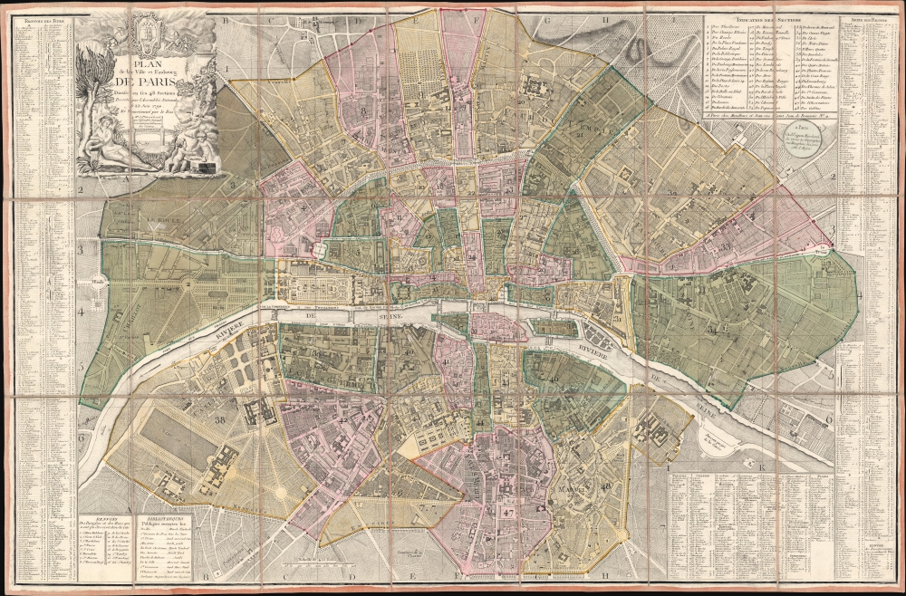
Plan de la Ville et Faubourg de Paris Divisé en ses 48 Sections Decreté par l'Assemblée Nationale le 22 Juin 1790 et Sanctionné par le Roi.
sold
- Digital Map Information
- Suitable for large format printing
- DPI: 600
- File Size: 80.24 MB
- File Type: ZIP / TIFF
- ICC color profile embedded
- Delivered instantly via download link
A stunning 1790 Louis-Joseph Mondhare and Pierre Jean Revolutionary-Era city map of Paris, France - this is the only map the Assemblée Nationale recognized to delineate its newly created sections within Paris. The map was printed by order of the Assemblée Nationale a year the Storming of the Bastille and the outset of the French Revolution (1789 - 1799). (more details)
Louisiana on the cusp of the Louisiana Purchase.
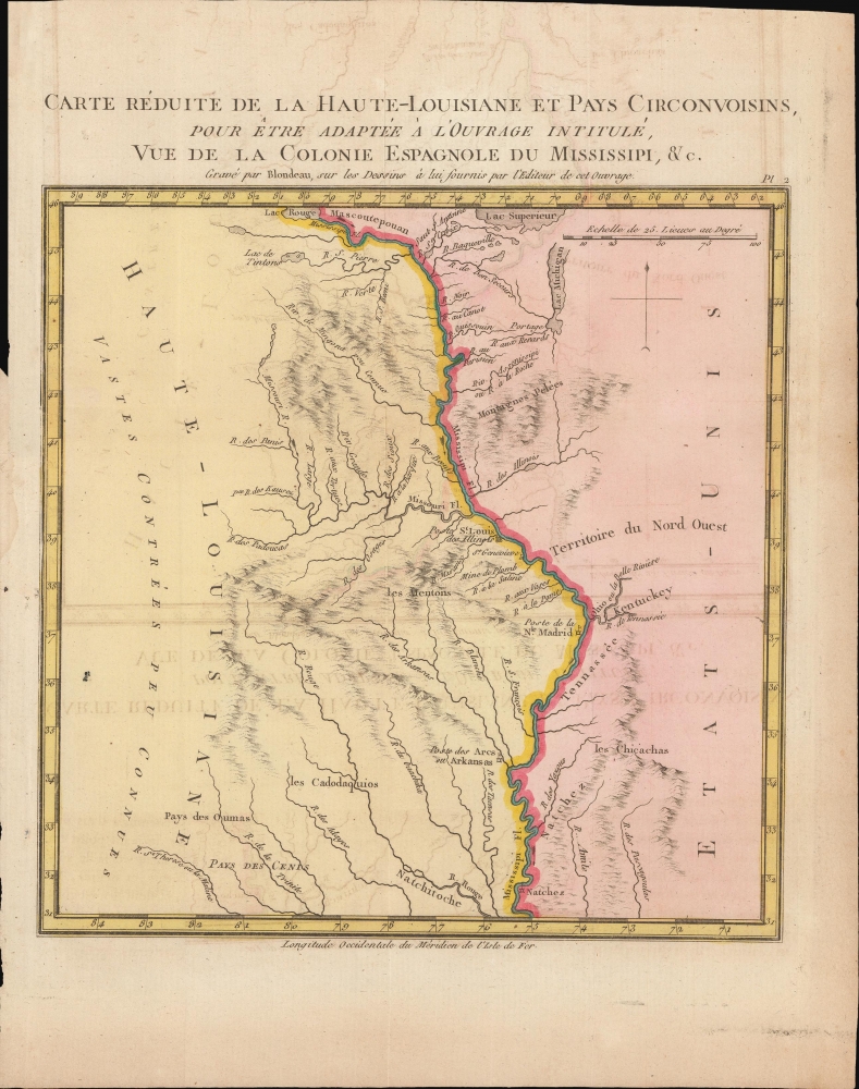
Carte Reduite de la Haute-Louisiane et Pays Circonvoisins, pour etre adaptee a l'ouvrage intitule Vue de la Colonie Espagnole du Mississipi, et c.
sold
- Digital Map Information
- Suitable for large format printing
- DPI: 300
- File Size: 3.12 MB
- File Type: ZIP / TIFF
- ICC color profile embedded
- Delivered instantly via download link
This is Alexandre's Blondeau's exceptional 1803 map of Spanish-administered upper Louisiana, issued for Pierre-Louis Berquin Duvallon's travel narrative, Vue de la Colonie Espagnole due Mississipi. It is one of the best maps to capture the Upper Mississippi Valley on the cusp of the Louisiana Purchase. The map moreover underscores the significance of the Mississippi River as a trade artery between the Great Lakes, and hence the Atlantic, and the Gulf of Mexico. (more details)
Dominant mapping of Poland of the 16th century.

Poloniae finitimarumque locorum descriptio.
sold
- Digital Map Information
- Suitable for large format printing
- Full resolution TIFF file
- ICC color profile embedded
- Delivered instantly via download link
This is Abraham Ortelius' 1581 map of Poland, based on the c. 1556-58 Grodziecki map. (more details)
Iconic Dutch Map of Persia.
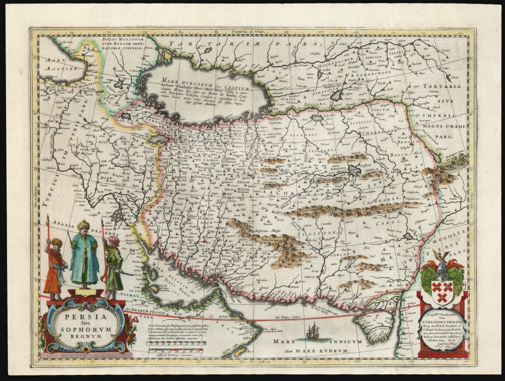
Persia Sive Sophorum Regnum.
sold
- Digital Map Information
- Suitable for large format printing
- Full resolution TIFF file
- ICC color profile embedded
- Delivered instantly via download link
This is a classic 17th-century Willem Blaeu map of the Kingdom of Persia - one of the most beautiful Dutch Golden Age maps of Persia. (more details)
Exodus of the Israelites.
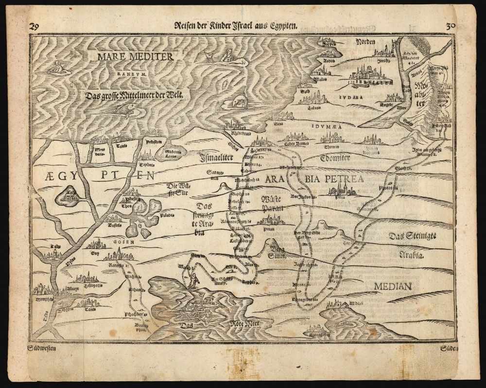
Reisen der Kinder Israel aus Egypten.
sold
- Digital Map Information
- Suitable for large format printing
- DPI: 600
- File Size: 29.86 MB
- File Type: ZIP / TIFF
- ICC color profile embedded
- Delivered instantly via download link
This is a Heinrich Bünting's 1581 map of the Holy Land, depicting the peregrination of the Israelites from Egypt to the Jordan River. The map illustrates the path of the Exodus, numbering the various stops. Biblical scenes are depicted in vignettes: Moses, having crossed the Red Sea, looks back at Egyptians drowning with their chariots; and the army of the Moabites can be seen fleeing their kingdom from the onslaught of the Israelites. The Mediterranean is decorated with a merman (although Laor maintained that this was a depiction of Jonah riding astride, rather than inside, the whale). There are also two giant fish, and a duck. (more details)
Rare, Separately Issued.
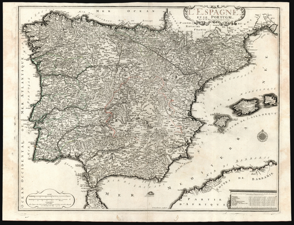
L'Espagne et le Portugal par N. De Fer Geographe de sa Majesté Catolique.
sold
- Digital Map Information
- Suitable for large format printing
- DPI: 600
- File Size: 73.85 MB
- File Type: ZIP / TIFF
- ICC color profile embedded
- Delivered instantly via download link
This is a beautiful example of Nicholas De Fer's 1705 map of Spain and Portugal, including the Balearic islands and part of the North African coast. Typical of De Fer's work, the map is superbly detailed, while remaining restrained and elegant in its decoration. (more details)
The 188th from England to victory in Germany.

Operations Against Germany World War II 188th Field Artillery Battalion 155mm Howitzer, Trac-Drawn First U.S. Army 1944 - 45.
sold
- Digital Map Information
- Suitable for large format printing
- File Size: 17.66 MB
- File Type: ZIP / TIFF
- ICC color profile embedded
- Delivered instantly via download link
This is a 1945 188th Field Artillery Battalion World War II Route Map of Europe. The map traces the battalion's movements during the war, marking important events, and providing comedic commentary on the experience. (more details)
Deciphering the Himalayas.
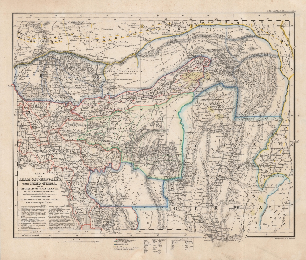
Karte von Asam, Ost-Bengalen und Nort-Birma Nebst Bhutan, Munipur, Catschar, etc.
sold
- Digital Map Information
- Suitable for large format printing
- DPI: 600
- File Size: 41.7 MB
- File Type: ZIP / TIFF
- ICC color profile embedded
- Delivered instantly via download link
This is Carl Ritter and Heinrich Mahlmann's 1840 map of Bhutan, northern Burma, northeastern India, and northern Bangladesh. This map was compiled at a time when Europeans knew little of this region. Thus, it represents a dense amalgam of explorers' accounts and speculation expounded through the lens of Ritter's German Romantic theories of the Earth as a 'cosmic individual'. (more details)
A Most Unique Early Map of Jerusalem.
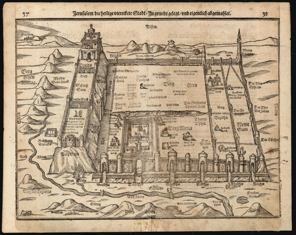
Jerusalem die heilige viereckete Stadt, in grund gelegt und eigentlich abgemahlet.
sold
- Digital Map Information
- Suitable for large format printing
- DPI: 600
- File Size: 31.55 MB
- File Type: ZIP / TIFF
- ICC color profile embedded
- Delivered instantly via download link
This is Heinrich Bünting's 1581 bird's-eye view of the Holy City of Jerusalem. Despite its schematic appearance, the plan was presented to Bünting's readers as depicting the city as being drawn as it was actually laid out - 'in Grundt gelegt und eigentlich abgemahlet'. This fascinating view appeared in Bünting's Itinerarium Sacrae, the first and for many years the only complete work of biblical geography. As such, this map's representation of Jerusalem would be for many years the armchair pilgrim's best view of the Holy City. (more details)