

Sweden, Denmark and Norway.
sold
- Digital Map Information
- Suitable for large format printing
- DPI: 300
- File Size: 8.76 MB
- File Type: ZIP / TIFF
- ICC color profile embedded
- Delivered instantly via download link
A fine 1799 map of Sweden, Denmark and Norway by the English map publisher Clement Cruttwell. Map includes the Kingdom of Norway, Denmark, Sweden, and Finland. Includes the 25 provinces of Sweden, which have no administrative function, but remain historical ... (more details)
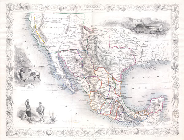
United States.
sold
- Digital Map Information
- Suitable for large format printing
- Full resolution TIFF file
- ICC color profile embedded
- Delivered instantly via download link
This is John Tallis's highly desirable 1851 Map of Mexico, Texas and Upper California. Herein Texas is depicted at its fullest extent including both Santa Fe and the Green Mountains. Upper California offers numerous interesting features, most specifically a ... (more details)
1852 Stansbury Map of the Great Salt Lake to Fort Leavenworth Route (Colorado, Utah, Wyoming, Kansas
A seminal mapping of the emigrant roads west.
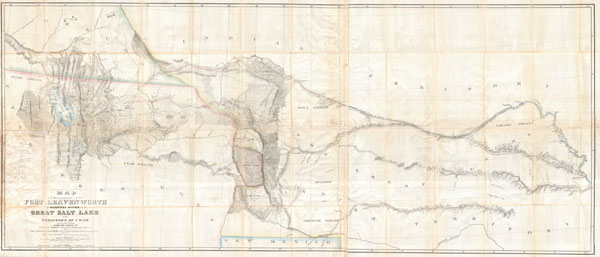
Map of a Reconnoissance between Fort Levenworth and the Missouri River, and the Great Salt Lake in the Territory of Utah, made in 1849 and 1850 …
sold
- Digital Map Information
- Suitable for large format printing
- DPI: 300
- File Size: 51.86 MB
- File Type: ZIP / TIFF
- ICC color profile embedded
- Delivered instantly via download link
It had been a daring feat of exploration, succeeding where the mountain men had all failed, and by means of his map ... Stansbury had painted at least one more bold stroke into the unfinished portrait of the national landscape. - William Goetzmann This ... (more details)

(A No. 5) Preliminary Chart of Muskeget Channel Massachusetts.
sold
- Digital Map Information
- Suitable for large format printing
- DPI: 300
- File Size: 10.78 MB
- File Type: ZIP / TIFF
- ICC color profile embedded
- Delivered instantly via download link
One of the better mid 19th century large format maps of Martha's Vineyard. This rare map depicts most of the island of Marthas Vineyard though does cut out its southwestern portion. Towns, villages, farms, and roads are all beautifully rendered. So too ... (more details)
An exemplar of mid-19th century French decorative map making.

Nouvelle Carte Universelle Du Monde.
sold
- Digital Map Information
- Suitable for large format printing
- File Size: 56.03 MB
- File Type: ZIP / TIFF
- ICC color profile embedded
- Delivered instantly via download link
A fine example of Felix Delamarche's 1859 case map of the World. Drawn on a monumental scale, this incredible map covers the known world, from the Arctic Icecap to the just discovered Terres Australes (Antarctica). The map purports to be based upon ... (more details)

Carte Générale de l'Ile de St. Domingue.
sold
- Digital Map Information
- Suitable for large format printing
- DPI: 300
- File Size: 3.86 MB
- File Type: ZIP / TIFF
- ICC color profile embedded
- Delivered instantly via download link
A rare and beautiful 1802 map of the West Indies island of Hispaniola or Santo Domingo ( St. Domingue ) by Ambroise Tardieu. This rare and stunning map depicts the island with all of Tardieu's glorious hallmark detail. Roads, topography, cities, ... (more details)
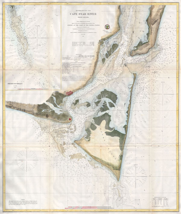
Entrances to Cape Fear River North Carolina.
sold
- Digital Map Information
- Suitable for large format printing
- File Size: 4.81 MB
- File Type: ZIP / TIFF
- ICC color profile embedded
- Delivered instantly via download link
One of the largest and most striking U.S.C.S. Map of North Carolina's Cape Fear. Extends from Federal Point south to the top of Cape Fear and then west past Smithville and Fort Caswell to Oak Island (roughly 78.04 Longitude). Upper right quadrant ... (more details)
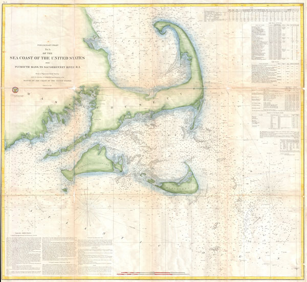
Preliminary Chart No. 4 of the Sea Coast of the United States from Plymouth Mass. To Saughkonnet River R. I.
sold
- Digital Map Information
- Suitable for large format printing
- File Size: 21.12 MB
- File Type: ZIP / TIFF
- ICC color profile embedded
- Delivered instantly via download link
A rare 1857 nautical chart of the Massachusetts coast from Plymouth, MA to Saughkonnet River, RI. Includes Barnstable county, Cape Cod, Nantucket, and Martha's Vineyard. Offers minimal inland detail but a wealth of nautical information including ... (more details)
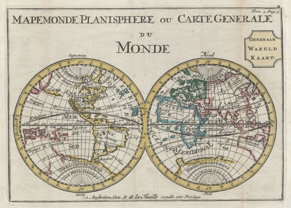
Mapemonde Planisphere ou Carte Generale du Monde / Generale Wareld Kaart.
sold
- Digital Map Information
- Suitable for large format printing
- Full resolution TIFF file
- ICC color profile embedded
- Delivered instantly via download link
A very scarce later, c. 1706, edition of a map of the world on a hemisphere projection first issued by Daniel de La Feuille in 1702. Much of the coastlines are plotted conjecturally at best. Features a massive California in Island form. ... (more details)
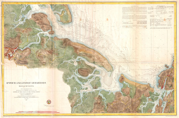
Ipswich and Annisquam Harbors Massachusetts.
sold
- Digital Map Information
- Suitable for large format printing
- File Size: 21.14 MB
- File Type: ZIP / TIFF
- ICC color profile embedded
- Delivered instantly via download link
A rare hand colored 1857 nautical chart of the Ipswich and Annisquam Harbors. These two important ports are located just north Boston near Cape Ann. Both were centers of for the cod fishing and whaling industries in the 18th and 19th ... (more details)
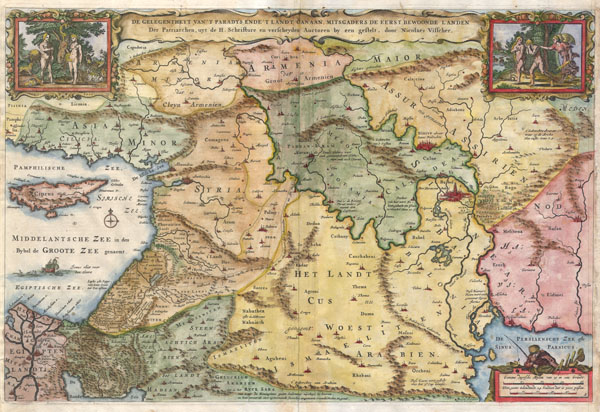
De Gelegentheyt van 't Paradys ende 't Land Canaan mitsgaders de eerste bewoonde landen Der Patriarchen, uyt de H. schrifture en verscheyden Auctoren bij een gestelt door Nicolaes Visscher
sold
- Digital Map Information
- Suitable for large format printing
- DPI: 300
- File Size: 4.62 MB
- File Type: ZIP / TIFF
- ICC color profile embedded
- Delivered instantly via download link
This is a splendid early example of Nicholas Visscher's important 1657 map of the Holy Land, or as it is titled (in rough translation) 'Paradise, or the Garden of Eden. With the Countries circumjacent Inhabited by the Patriarchs.' ... (more details)
Shows the California gold region and Texas at its largest.
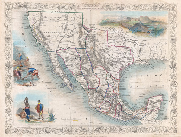
Mexico.
sold
- Digital Map Information
- Suitable for large format printing
- DPI: 300
- File Size: 5.69 MB
- File Type: ZIP / TIFF
- ICC color profile embedded
- Delivered instantly via download link
An exceptional example of John Tallis and John Rapkin's highly desirable 1851 Map of Mexico, Texas, and Upper California. Herein Texas is depicted at its fullest extent including both Santa Fe and a northern extension encompassing ... (more details)
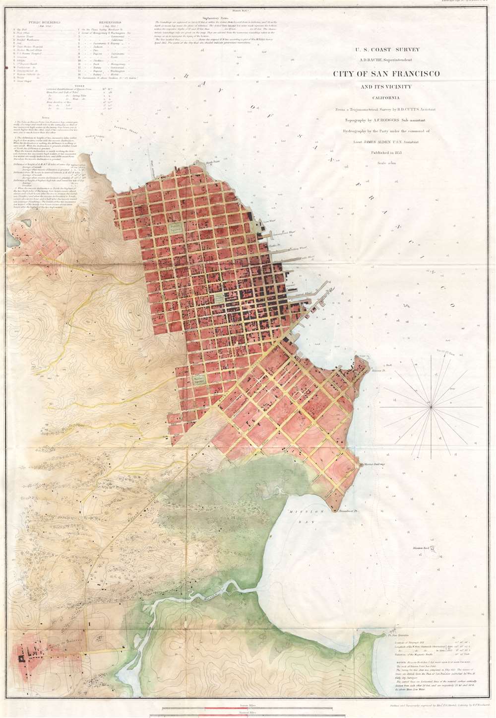
City of San Francisco and its Vicinity California.
sold
- Digital Map Information
- Suitable for large format printing
- DPI: 300
- File Size: 6.01 MB
- File Type: ZIP / TIFF
- ICC color profile embedded
- Delivered instantly via download link
A rare coastal chart of San Francisco by the U. S. Coast Survey, 1853. Depicts the immediate city of San Francisco and surrounding areas as far as the Mission de Dolores or the Mission de San Francisco. Issued shortly following ... (more details)
Extraordinary 21 ft panorama of history!
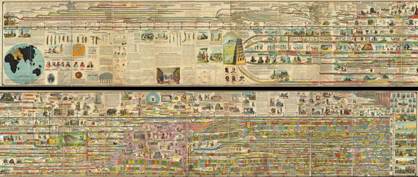
Adams' Illustrated Panorama of History.
sold
- Digital Map Information
- Suitable for large format printing
- Full resolution TIFF file
- ICC color profile embedded
- Delivered instantly via download link
A truly monumental achievement, this is Adams' Illustrated Panorama of History . Measuring some 27 inches high and 260 inches long, this gigantic panoramic diagram charts the history of the world from a Biblical perspective, ... (more details)

Map of that Part of the City of new York North of 155th Street Showing the progress made in laying out Streets, Roads, Public Squares, and Places, by the Commissioners of the Central Park, under Chap. 565 of Laws of 1865 and of new Pier and Bulkhead lines under Chap. 697 of Laws of 1867.
sold
- Digital Map Information
- Suitable for large format printing
- File Size: 19.6 MB
- File Type: ZIP / TIFF
- ICC color profile embedded
- Delivered instantly via download link
An rare and unusual map of upper Manhattan, New York City, prepared and printed for inclusion in the Thirteenth Annual Report of the Board of Commissioners of the Central Park. Depicts the Island of Manhattan north of 155th ... (more details)
The finest wall map of western Long Island ever made.

Map of Suffolk Co. L.I. New York
sold
Without a doubt, one of the finest wall maps of Suffolk County, eastern Long Island, ever made. This monumental 1858 wall map covers the eastern part of Long Island roughly from Huntington to Montauk. Divided into two main ... (more details)

Map of the Consolidated City of Brooklyn.
sold
- Digital Map Information
- Suitable for large format printing
- File Size: 7.48 MB
- File Type: ZIP / TIFF
- ICC color profile embedded
- Delivered instantly via download link
An extremely rare later edition of Henry McCloskey's 1866 pocket map of the city of Brooklyn, New York. In the mid 19th century, fueled by the advent of the steam ferry, which made crossing the East River practical, Kings ... (more details)
Spectacular late Renaissance Map and View of Rome.
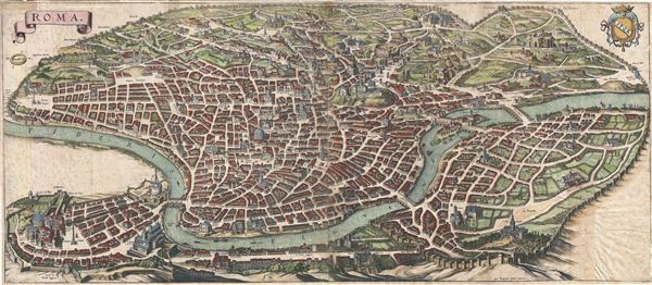
Roma.
sold
- Digital Map Information
- Suitable for large format printing
- DPI: 300
- File Size: 16.07 MB
- File Type: ZIP / TIFF
- ICC color profile embedded
- Delivered instantly via download link
An important and stunning c. 1642 bird's eye view and map of Rome by Matthus Merian. Merian's panoramic view of Rome, based on the eastward oriented model established in 1593 by Antonio Tempesta, reveals the city at the ... (more details)
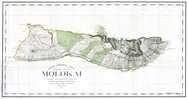
Hawaiian Government Survey. Molokai.
sold
- Digital Map Information
- Suitable for large format printing
- File Size: 14.73 MB
- File Type: ZIP / TIFF
- ICC color profile embedded
- Delivered instantly via download link
This rare and extraordinary 1897 map of the island of Molokai, in the Hawaiian group, was prepared for the 1906 Report of the Governor of the Territory of Hawaii to the Secretary of the Interior. Though the cartographic ... (more details)
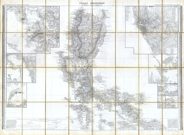
Islas Filipinas, Primera Hoja Central
sold
- Digital Map Information
- Suitable for large format printing
- Full resolution TIFF file
- ICC color profile embedded
- Delivered instantly via download link
This magnificent 1852 hand colored case map of the Philippines was issued by Dr. Morata and Francisco Coello of Madrid. In 32 folding sections mounted onto linen. Covers the central Philippines including the island of ... (more details)