
Important view illustrating the Colorado Gold Rush.
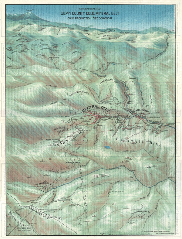
Topographical Map Gilpin County Colo. Mineral Belt Gold Production $125,000,000.00.
sold
- Digital Map Information
- Suitable for large format printing
- File Size: 20.3 MB
- File Type: ZIP / TIFF
- ICC color profile embedded
- Delivered instantly via download link
This is a stunning 1904 broadside bird's eye view or map of Gilpin County, Colorado. Centered on Central City, this view extends as far north as Rollinsville and Arapahoe Peak, as far south as Bellevue Mountain, as far east as Randolph Mill, and west as far as ... (more details)
A highly decorative map of New York City

Map Of The Country Thirty Three Miles Around The City Of New York.
sold
- Digital Map Information
- Suitable for large format printing
- File Size: 23.07 MB
- File Type: ZIP / TIFF
- ICC color profile embedded
- Delivered instantly via download link
This is the rare 1855 edition of one of the most beautiful pocket maps of New York made in the 19th century: Colton's Thirty Three Miles Around the City of New York . Covers New York City and vicinity as far south as Ocean County, New Jersey, as far east as ... (more details)
One of the largest and most impressive maps of Scotland to appear in the 18th century.
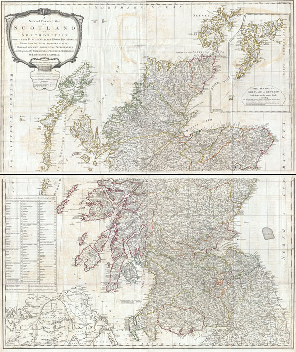
A New and Correct Map of Scotland or North Britain with all the Post and Military Roads, Divisions, and ca.
sold
- Digital Map Information
- Suitable for large format printing
- DPI: 300
- File Size: 70.98 MB
- File Type: ZIP / TIFF
- ICC color profile embedded
- Delivered instantly via download link
An absolutely stunning and monumental 1794 wall map of Scotland by Lieutenant Campbell. Covers Scotland in full with extraordinary detail throughout. Notes every town, hamlet, bishopric, country, forest, castle swam and road. Even offers some offshore ... (more details)
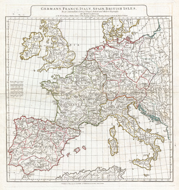
Germany, France, Italy, Spain, British Isles, In an intermediate Century between Ancient and Modern Geography…
sold
- Digital Map Information
- Suitable for large format printing
- DPI: 300
- File Size: 15.24 MB
- File Type: ZIP / TIFF
- ICC color profile embedded
- Delivered instantly via download link
A large and dramatic 1794 J. B. B. D'Anville map of Western Europe. Covers from the British Isles south to Spain and east as far as Hungary, Poland and Dalmatia. This map is intended to represent western Europe following the decline of the Roman ... (more details)

Britanniae Antiquae Tabula Geographica ex. Evi Romani Monumentis…
sold
- Digital Map Information
- Suitable for large format printing
- DPI: 300
- File Size: 14.24 MB
- File Type: ZIP / TIFF
- ICC color profile embedded
- Delivered instantly via download link
A large and dramatic 1794 map of England under Roman Rule. Covers all of England (Province of Britanniae) as well as adjacent parts of Scotland, Ireland (Hibernia), and France (Gallia). Features both ancient and contemporary place names, ie. ... (more details)

Orbis Vetribus Notus.
sold
- Digital Map Information
- Suitable for large format printing
- DPI: 300
- File Size: 20.96 MB
- File Type: ZIP / TIFF
- ICC color profile embedded
- Delivered instantly via download link
A large and dramatic composite 1794 map of the world as it was known to the ancients, by J. B. B. D'Anville. Covers all of Europe, Asia Minor, Arabia and India, much of Northern Africa, and parts of Southeast Asia. D'Anville compiled this ... (more details)

Palaestina.
sold
- Digital Map Information
- Suitable for large format printing
- DPI: 300
- File Size: 15.73 MB
- File Type: ZIP / TIFF
- ICC color profile embedded
- Delivered instantly via download link
A large and dramatic J. B. B. D'Anville map of Palestine, Israel, or the Holy Land. Covers from the ancient city of Sidon in modern day Lebanon south as far the city of Gaza and Egypt. Details mountains, rivers, cities, roadways, and lakes ... (more details)

Graeciae Antiquae Specimen Geographicum.
sold
- Digital Map Information
- Suitable for large format printing
- Full resolution TIFF file
- ICC color profile embedded
- Delivered instantly via download link
A large and dramatic J. B. B. D'Anville map of Ancient Greece. Covers from Macedonia to the Peloponnesus, inclusive of Euboea and the Ionian Isles. Details mountains, rivers, cities, roadways, and lakes with political divisions highlighted ... (more details)

Asiae, quae vulgo Minor dicitur, et Syriae tabula geographica quantum per subsidia licuit elaborata, opere, si quod aliud in antiqua geographia, arduo. Quam tabulam Clariss. Dom. Comes de Caylus in aere incidi curavit.
sold
- Digital Map Information
- Suitable for large format printing
- DPI: 300
- File Size: 17.59 MB
- File Type: ZIP / TIFF
- ICC color profile embedded
- Delivered instantly via download link
A large and dramatic J. B. B. D'Anville map of Asia Minor in antiquity. Covers from Greece (Graecia) and the Aegean Sea eastward to include all of Asia Minor as far as Armenia. Extends south as far as the ancient city of Sidon in modern ... (more details)

Graeciae Pars Meridionalis.
sold
- Digital Map Information
- Suitable for large format printing
- Full resolution TIFF file
- ICC color profile embedded
- Delivered instantly via download link
A large and dramatic Delisle map of the southern Greece, the Greek Isles, and Crete. Covers from the Ionian Islands to Asia Minor and south as far as Crete. Includes the Peloponnesus, the Cyclades, Rhodes, and numerous other Greek ... (more details)

Orbis Romani Pars Orientalis Auspiciis Serenissimi Principis Ludovici Philippi Aurelianorum Ducis Publici juris Facta…
sold
- Digital Map Information
- Suitable for large format printing
- DPI: 300
- File Size: 21.23 MB
- File Type: ZIP / TIFF
- ICC color profile embedded
- Delivered instantly via download link
A large and dramatic J. B. B. D'Anville map of the eastern part of the Roman Empire. Covers from Greece (Graecia) and Dacia east as far as Babylonia, Arabia and Armenia. Extends south as far as Thebes in Upper Egypt. Includes the ... (more details)

Orbis Romani Pars Occidentalis Auspiciis Serenissimi Principis Ludovici Philippi Aurelianorum Ducis Publici juris Facta…
sold
- Digital Map Information
- Suitable for large format printing
- DPI: 300
- File Size: 21.65 MB
- File Type: ZIP / TIFF
- ICC color profile embedded
- Delivered instantly via download link
A large and dramatic J. B. B. D'Anville map of the western part of the Roman Empire. Covers from England (Brittania) and Ireland (Hibernia), south to Spain (Hispania) and Morocco (Mauretania), and east as far as Italy (Italia) and ... (more details)

Tabula Italiae Antiquae Geographica Quam Excellentissimus Dominus Dux de la Rochefou Cauld in oere incidi curavit.
sold
- Digital Map Information
- Suitable for large format printing
- DPI: 300
- File Size: 17.94 MB
- File Type: ZIP / TIFF
- ICC color profile embedded
- Delivered instantly via download link
A large and dramatic 1764 J. B. B. D'Anville map of Italy in ancient Roman times. Covers from Lake Geneva (Lemanus Lac) to Sicily (Sicilia), inclusive of the entire Italian peninsula, Sardinia, Corsica, Sicily, and Dalmatia. ... (more details)

Cape Lookout Shoals.
sold
- Digital Map Information
- Suitable for large format printing
- File Size: 6.91 MB
- File Type: ZIP / TIFF
- ICC color profile embedded
- Delivered instantly via download link
An extremely attractive 1866 U.S. Coast Survey nautical chart or map detailing Cape Lookout, North Carolina, and nearby shoals. Map shows the land projection of Cape Lookout and much of the sea to the south and east. Follows ... (more details)
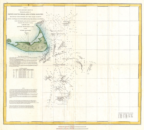
(A No. 3) Preliminary Sketch Showing the positions of Davis's South Shoal and Other Dangers Recently Discovered by the Coast Survey and the sounding on the Old South Shoal, Bass Rip, Old Man, Pochick Rip…
sold
- Digital Map Information
- Suitable for large format printing
- DPI: 300
- File Size: 6.93 MB
- File Type: ZIP / TIFF
- ICC color profile embedded
- Delivered instantly via download link
This beautiful and important sea chart or map depicts the waters immediately surrounding the island of Nantucket, Massachusetts, including Davis' Shoal, Old South Shoal, and others. Uncommon, highly significant, and often ... (more details)
A rarely seen U.S. Coast Survey chart of Nantucket Harbor.

Nantucket Harbor.
sold
- Digital Map Information
- Suitable for large format printing
- File Size: 8.93 MB
- File Type: ZIP / TIFF
- ICC color profile embedded
- Delivered instantly via download link
An extraordinary 1866 U.S. Coast Survey nautical chart or map of Nantucket Harbor, Massachusetts. Covers Nantucket Harbor on the northern part of Nantucket roughly from Whale's Rock to Pocomo Head. Includes the town of ... (more details)
The culmination of the U.S. Coast Survey's work around Cape Fear.
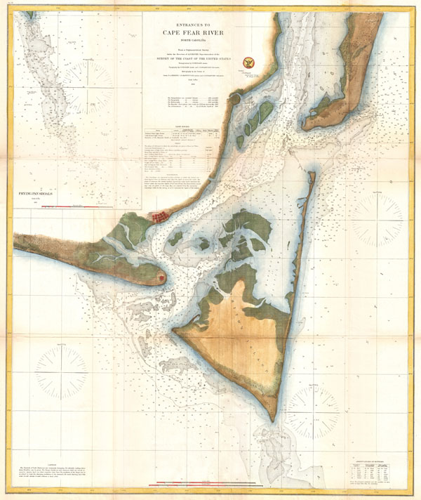
Entrances to Cape Fear River North Carolina.
sold
- Digital Map Information
- Suitable for large format printing
- File Size: 19.85 MB
- File Type: ZIP / TIFF
- ICC color profile embedded
- Delivered instantly via download link
One of the largest and most striking examples of the U.S Coast Survey's Map of North Carolina's Cape Fear. Extends from Federal Point south to the top of Cape Fear and then west past Smithville and Fort Caswell to Oak ... (more details)
First map to show the continental shelf break for a significant portion of the west coast.
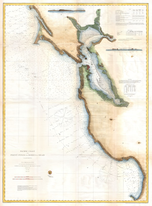
Pacific Coast from Point Pinos to Bodega Head California.
sold
- Digital Map Information
- Suitable for large format printing
- File Size: 21.29 MB
- File Type: ZIP / TIFF
- ICC color profile embedded
- Delivered instantly via download link
An extraordinary 1866 U.S. Coast Survey nautical chart or map of the San Francisco Bay. Covers from Point Pinot north was far as Bodega Head. Includes all of the San Francisco Bay with river systems documented as far ... (more details)
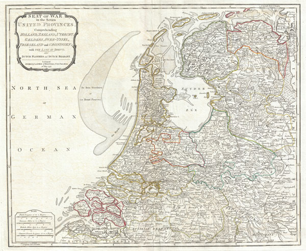
Seat of War in the Seven United Provinces, Comprehending Holland, Zeeland, Utrecht, Gelders, Over-Yssel, Frieseland and Groningen; with The Land of Drent, also Dutch Flanders and Dutch Brabant.
sold
- Digital Map Information
- Suitable for large format printing
- DPI: 300
- File Size: 16.37 MB
- File Type: ZIP / TIFF
- ICC color profile embedded
- Delivered instantly via download link
An extraordinary 1794 map of Holland or the Netherlands by Laurie and Whittle. Covers from Zeeland eastward as far as the Circle of Westphalia, north to the mouth of the Ems River, and south as far as the Bishopric of ... (more details)

A New Map of Switzerland Divided into the Thirteen Cantons with their Allies and their Subjects.
sold
- Digital Map Information
- Suitable for large format printing
- DPI: 300
- File Size: 23.49 MB
- File Type: ZIP / TIFF
- ICC color profile embedded
- Delivered instantly via download link
An extraordinary 1794 map of the Switzerland. Covers the entire country in extraordinary detail offering both topographical and political information. Color coded according to canton. With its unique blend of ... (more details)