
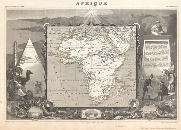
Afrique.
sold
- Digital Map Information
- Suitable for large format printing
- DPI: 300
- File Size: 10.16 MB
- File Type: ZIP / TIFF
- ICC color profile embedded
- Delivered instantly via download link
A stunning c. 1847 map of Africa by French cartographer Victor Levasseur. Depicts the entire continent with several interesting elements. A large lake appears in Mozambique which can only be Lake Malawi (Lake Nyasa). Lake Chad (Tchad) is also shown. Names ... (more details)
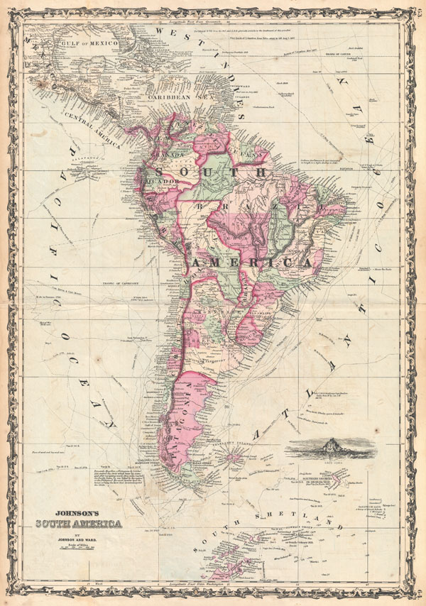
Rumsey 2905.035 (1860 edition). Phillips (Atlases) 6140, 52-53.
sold
- Digital Map Information
- Suitable for large format printing
- File Size: 12.99 MB
- File Type: ZIP / TIFF
- ICC color profile embedded
- Delivered instantly via download link
A beautiful example of A. J. Johnson's 1862 map of South America. This large and detailed map covers the continent from Mexico, Florida and the Caribbean south to include South Shetland and parts of Antarctica. Offers superb detail on the South American ... (more details)

Carte Physique et Politique de L'Italie dela Region des Alpes et des ProvincesAutrichiennes sur L'Adriatique.
sold
- Digital Map Information
- Suitable for large format printing
- File Size: 7.69 MB
- File Type: ZIP / TIFF
- ICC color profile embedded
- Delivered instantly via download link
This is A. Brue's c. 1870 map of Italy. Covers the entire peninsula of Italy including the Sicily, Corsica and Sardinia. Extends north to include Switzerland and parts of Austria and Bavaria. Shows shipping routes between Italy and North Africa, as ... (more details)
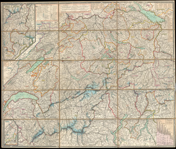
Schweizerische Karten und Plane, Panorama und Ansichten
sold
- Digital Map Information
- Suitable for large format printing
- DPI: 300
- File Size: 26.37 MB
- File Type: ZIP / TIFF
- ICC color profile embedded
- Delivered instantly via download link
This is an extremely detailed and attractive 1834 folding pocket map of Switzerland drawn by the Zurich cartographer and lithographer Heinrich Keller. Covers the mountainous country from Lake Geneva to Lake Constance. Details numerous river ways, ... (more details)
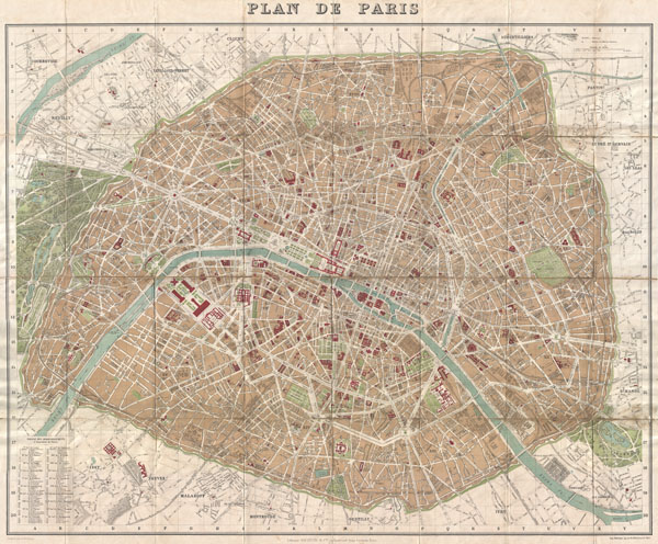
Plan de Paris
sold
- Digital Map Information
- Suitable for large format printing
- File Size: 33.74 MB
- File Type: ZIP / TIFF
- ICC color profile embedded
- Delivered instantly via download link
A rare and extremely attractive map of Paris, France drawn by A. Vuillemin and issued by the Librarie Hachette in 1894. Drawn shortly after the 1889 Exposition Universelle, this is one of the earlier maps of Paris to depict the Eiffel Tower. ... (more details)
The culmination of the Coast Survey's work in New York Harbor.
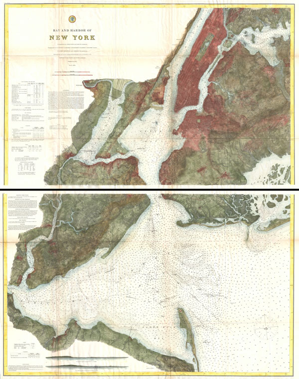
Bay and Harbor of New York.
sold
- Digital Map Information
- Suitable for large format printing
- File Size: 70.18 MB
- File Type: ZIP / TIFF
- ICC color profile embedded
- Delivered instantly via download link
The ultimate U.S Coast Survey chart of New York City, it's harbor, and environs. This nautical chart, dating to 1874, is divided into two parts and is the culmination of the U.S. Coast Survey's mapping of New York City. Assembled, this ... (more details)

Coast Chart No. 94. Mississippi River From the Passes to Grand Prairie, Louisiana.
sold
- Digital Map Information
- Suitable for large format printing
- File Size: 32.08 MB
- File Type: ZIP / TIFF
- ICC color profile embedded
- Delivered instantly via download link
The culmination of nearly 15 years of intense survey work, this is 1874 nautical chart is possibly the most attractive and dramatic map of the Mississippi River Delta to emerge from the U.S. Coast Survey. Due to the quick and dramatic ... (more details)

Plan de Paris.
sold
- Digital Map Information
- Suitable for large format printing
- File Size: 39.19 MB
- File Type: ZIP / TIFF
- ICC color profile embedded
- Delivered instantly via download link
This is the c. 1900 Taride edition of Louis Bretez and Michel-Etienne Turgot's monumental 1739 map of Paris. Turgot's map of Paris is possibly the most ambitious urban mapping ever undertaken. Shows the whole of 18th century Paris and ... (more details)

Map of The City of Boston and Vicinity.
sold
- Digital Map Information
- Suitable for large format printing
- File Size: 33.74 MB
- File Type: ZIP / TIFF
- ICC color profile embedded
- Delivered instantly via download link
An extremely attractive large format map of Boston published for the 1896 issued of Sampson and Murdock's Boston Directory . Covers the metropolitan Boston area and its immediate suburbs including Charlestown, Somerville, Brookline, ... (more details)
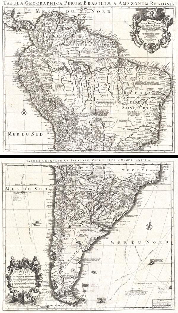
Tabula Geographica Peruae, Braziliae & Amazonum Regionis. / Carte de la Terre Ferme du Perou, du Bresil, et du Pays des Amazones. / Tabula Geographica Paragiae, Chilis, Freti a Magellanici & c. / Carte du Paraguay, Du Chili, du Detroit de Magellan & c.
sold
- Digital Map Information
- Suitable for large format printing
- DPI: 300
- File Size: 36.01 MB
- File Type: ZIP / TIFF
- ICC color profile embedded
- Delivered instantly via download link
An extraordinary example of a c. 1730 two map set depicting South America. This is Covens and Mortier's c. 1730 reissue of Guillaume de L'Isle's magnificent c. 1708 map of this region. The northern sheet covers from Costa Rica and ... (more details)
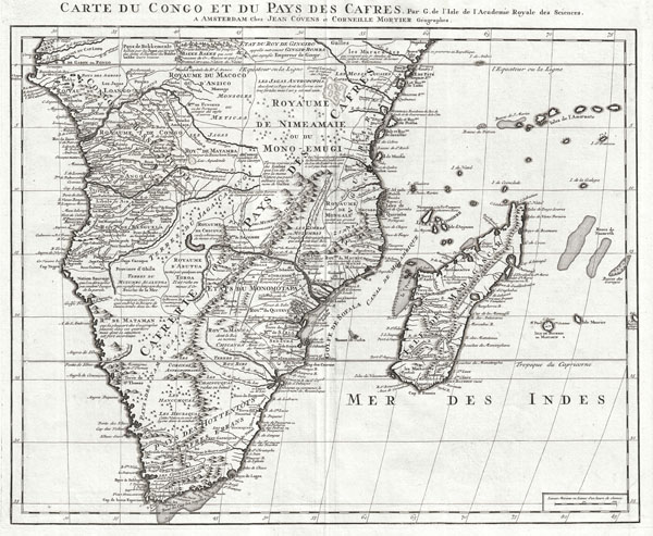
Carte du Congo et du Pays des Cafres. Par G. de l'Isle de l'Academie Royale des Sciences. A Amsterdam, Chez Jean Covens et Corneille Mortier, Geographes.
sold
- Digital Map Information
- Suitable for large format printing
- DPI: 300
- File Size: 18.12 MB
- File Type: ZIP / TIFF
- ICC color profile embedded
- Delivered instantly via download link
An extraordinary example of Covens and Mortier's c. 1730 issue of De L'Isle's important c. 1707 map of Africa south of the Equator. Depicts the southern Africa in stunning detail with numerous notations an comments regarding the ... (more details)
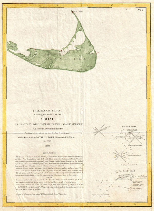
Preliminary Sketch Showing the Position of the Shoal Recently Discovered by the Coast Survey.
sold
- Digital Map Information
- Suitable for large format printing
- DPI: 300
- File Size: 2.63 MB
- File Type: ZIP / TIFF
- ICC color profile embedded
- Delivered instantly via download link
... The history of this most dangerous and fatal shoal is startling. Situated in mid-ocean; having, in low ebbs, scarcely a foot of water; in a region proverbial for its heavy swell; rising, at times, without a moment's warning; ... (more details)

Bacon's NewMap of the Environs of London.
sold
- Digital Map Information
- Suitable for large format printing
- File Size: 61.31 MB
- File Type: ZIP / TIFF
- ICC color profile embedded
- Delivered instantly via download link
A rare c. 1895 folding pocket map of London and its environs by G. W. Bacon. Covers the London area from Rickmansworth in the northwest to Keveldon Hatch in the northeast. Extends south to Whitewater Common and Ightham Common. ... (more details)

Reconnaissance of the Western Coast of the United States (Lower Sheet) San Francisco to San Diego.
sold
- Digital Map Information
- Suitable for large format printing
- DPI: 300
- File Size: 13.34 MB
- File Type: ZIP / TIFF
- ICC color profile embedded
- Delivered instantly via download link
One of the most attractive and desirable of the original U.S. Coast Survey charts of the California Coast. Covers from San Diego and the Mexican border north as far north as Pt. Reyes and the San Francisco Bay. Details San ... (more details)
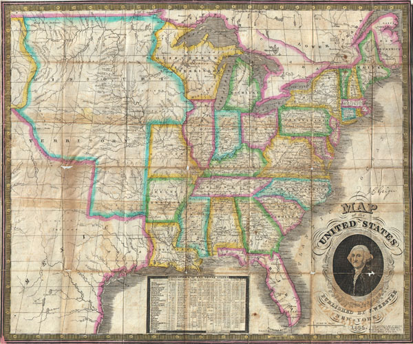
Map of the United States.
sold
- Digital Map Information
- Suitable for large format printing
- DPI: 300
- File Size: 13.02 MB
- File Type: ZIP / TIFF
- ICC color profile embedded
- Delivered instantly via download link
An exceptional and rare map of the United States published by James Webster in 1835. Extends from the east coast of the United States westward as far as the Rocky Mountains, including much of Texas. This map of the United ... (more details)

Johnson's Georgetown and the City of Washington the Capital of the United States of America.
sold
- Digital Map Information
- Suitable for large format printing
- File Size: 8.63 MB
- File Type: ZIP / TIFF
- ICC color profile embedded
- Delivered instantly via download link
A beautiful example of A. J. Johnson's 1862 map of Washington D.C. and Georgetown. Offers a fascinating snapshot of the nation's capitol shortly after the outbreak of the American Civil War. Shows the city in ... (more details)
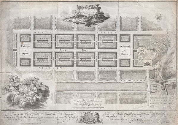
Plan of the New Streets and Squares intended for the city of Edinburgh.
sold
- Digital Map Information
- Suitable for large format printing
- Full resolution TIFF file
- ICC color profile embedded
- Delivered instantly via download link
Drafted for the city planning committee in 1768 by James Craig, this is the definitive plan of Edinburgh, Scotland's New Town. Oriented to the North, this plan details the streets of Edinburgh north of the Loch ... (more details)
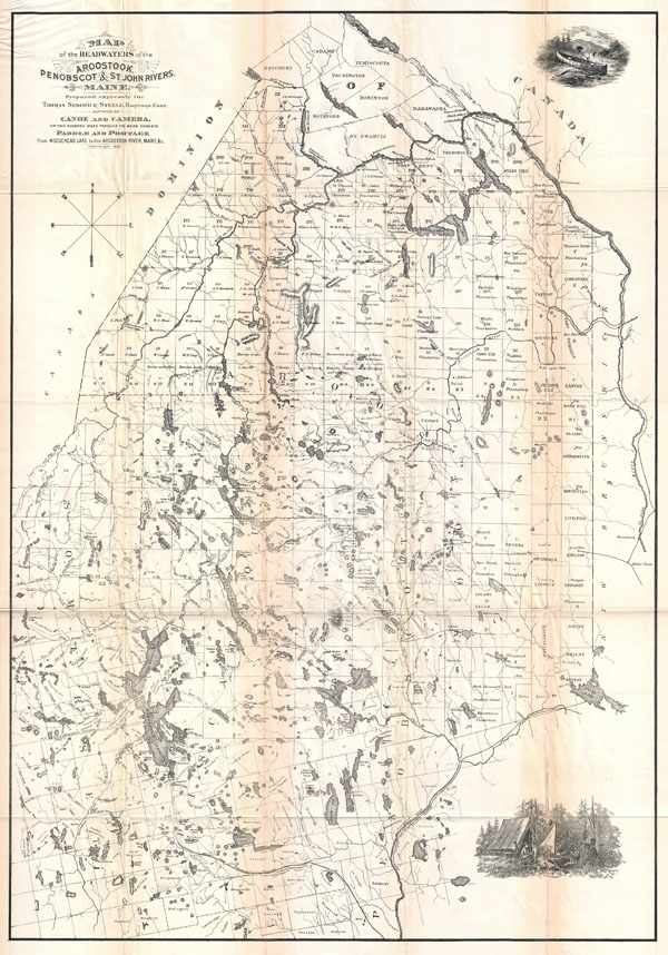
Map of the Headwaters of the Aroostook, Penobscot & St. John Rivers, Maine.
sold
- Digital Map Information
- Suitable for large format printing
- File Size: 16.15 MB
- File Type: ZIP / TIFF
- ICC color profile embedded
- Delivered instantly via download link
An attractive and important map of Maine published in 1881 for Thomas Sedgwick Steele's classic narrative of wilderness, Canoe and Camera . This is one of the first maps ever issued with the canoeist in mind. ... (more details)

Johnson's Florida.
sold
- Digital Map Information
- Suitable for large format printing
- File Size: 8.87 MB
- File Type: ZIP / TIFF
- ICC color profile embedded
- Delivered instantly via download link
A beautiful example of A. J. Johnson's 1862 map of Florida. This rare map offers a fascinating snapshot of this secessionist state shortly following the outbreak of the American Civil War. Map shows the ... (more details)

Johnson's Nebraska, Dakota, Colorado, & Kansas.
sold
- Digital Map Information
- Suitable for large format printing
- File Size: 9.27 MB
- File Type: ZIP / TIFF
- ICC color profile embedded
- Delivered instantly via download link
From the 1862 Johnson and Ward edition of the Atlas , this is one of the rarest and most desirable states of the Johnson's Dakota, Nebraska and Kansas map. In this example Nebraska is drawn with a long ... (more details)