

Nouvelle Carte du Royaume de Hongrie Avec ses Forteresses. / Nieuwe Kaart van Hongarien.
sold
- Digital Map Information
- Suitable for large format printing
- DPI: 300
- File Size: 3.8 MB
- File Type: ZIP / TIFF
- ICC color profile embedded
- Delivered instantly via download link
A stunning map of Hungary first drawn by Daniel de la Feuille in 1706. Covers from Moravia in the northwest south to Bosnia and east as far as Belgrade. Surrounded by twenty maps and views of important villages and fortresses in this region. From top right in a ... (more details)

Kaart Van't Hertogdom Brabant.
sold
- Digital Map Information
- Suitable for large format printing
- DPI: 300
- File Size: 4.29 MB
- File Type: ZIP / TIFF
- ICC color profile embedded
- Delivered instantly via download link
A stunning map of Brabant, Belgium first drawn by Daniel de la Feuille in 1706. Depicts from Brussels in the south west eastward as far as Limburg and Roermont. Surrounded by thirteen maps and views of important villages and fortresses in this region. From top ... (more details)

Duche de Baviere. / Het Hertogdom Byeren.
sold
- Digital Map Information
- Suitable for large format printing
- DPI: 300
- File Size: 4.15 MB
- File Type: ZIP / TIFF
- ICC color profile embedded
- Delivered instantly via download link
A stunning map of Bavaria, Germany first drawn by Daniel de la Feuille in 1706. Includes Munich and Augsburg. Surrounded by thirteen maps and views of important villages and fortresses in this region. From top right in a clockwise fashion these include ... (more details)
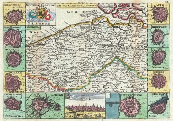
Nouvelle Carte Du Comte de Flandre. / Nieuwe Kaart van Vlaanderen.
sold
- Digital Map Information
- Suitable for large format printing
- DPI: 300
- File Size: 3.42 MB
- File Type: ZIP / TIFF
- ICC color profile embedded
- Delivered instantly via download link
A stunning map of Flanders, Italy first drawn by Daniel de la Feuille in 1706. This region includes portions of what is today Belgium and Holland. Surrounded by thirteen views and plans of important villages and fortresses in this region. From top ... (more details)

Nouvelle Carte du Piemont. / Nieuwe Kaart van Piemont.
sold
- Digital Map Information
- Suitable for large format printing
- DPI: 300
- File Size: 4.35 MB
- File Type: ZIP / TIFF
- ICC color profile embedded
- Delivered instantly via download link
A stunning map of Piedmont, Italy first drawn by Daniel de la Feuille in 1706. This province in northwestern Italy extends north from Milan to the border with Switzerland. Surrounded by thirteen views and plans of important villages and fortresses ... (more details)

Caart van Languedoc.
sold
- Digital Map Information
- Suitable for large format printing
- DPI: 300
- File Size: 3.82 MB
- File Type: ZIP / TIFF
- ICC color profile embedded
- Delivered instantly via download link
A stunning map of Languedoc, France first drawn by Daniel de la Feuille in 1706. This province in southeastern France roughly corresponds with the modern day departments of Gévaudan, Velay, and Vivarais. Surrounded by twelve views of important ... (more details)

Sketch Showing the Triangulation & Geographical Positions in Section No. II From New York City to Point Judith.
sold
- Digital Map Information
- Suitable for large format printing
- File Size: 14.47 MB
- File Type: ZIP / TIFF
- ICC color profile embedded
- Delivered instantly via download link
This is an attractive 1877 U.S. Coast Survey triangulation chart or nautical map of Long Island, New York. Covers from Staten Island and New York City eastward along Long Island and the coast of Connecticut to Block Island and Point Judith. ... (more details)
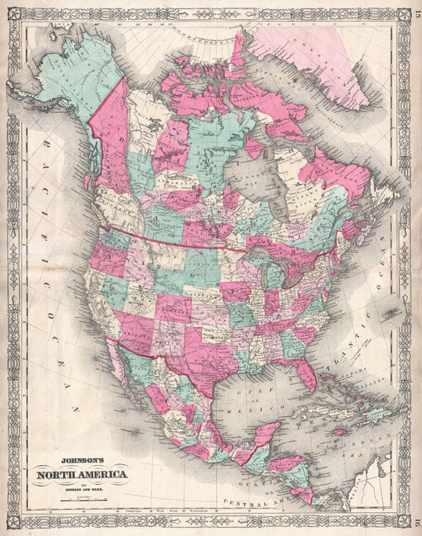
Johnson's North America.
sold
- Digital Map Information
- Suitable for large format printing
- File Size: 20.35 MB
- File Type: ZIP / TIFF
- ICC color profile embedded
- Delivered instantly via download link
This is Johnson and Ward's 1864 map of the North America and Central America. Details Extends from Panama northward as far the Arctic Circle, including Alaska and Greenland. Shows, the United State, Canada and Mexico divided into states and ... (more details)

Plan de Bombay et ses Environs.
sold
- Digital Map Information
- Suitable for large format printing
- Full resolution TIFF file
- ICC color profile embedded
- Delivered instantly via download link
An extremely attractive and rare 1764 map of Bombay or Mumbai, India by J. N. Bellin. Depicted the peninsula of Bombay as it was in the 1700s – divided into several small islands including Salcet, Bombay, and the Isle of the Jesuits. ... (more details)

New Foundland.
sold
- Digital Map Information
- Suitable for large format printing
- DPI: 300
- File Size: 1.03 MB
- File Type: ZIP / TIFF
- ICC color profile embedded
- Delivered instantly via download link
This is a lovely little c. 1810 schoolgirl map of Newfoundland ( New Foundland ), Canada. Hand drawn in a fine and delicate hand with a whimsical circular floral motif border. Title in decorative writing below map proper. Shows ... (more details)

Guayane, Terre Ferme, Isles Antilles, et Nlle. Espagne.
sold
- Digital Map Information
- Suitable for large format printing
- File Size: 13.3 MB
- File Type: ZIP / TIFF
- ICC color profile embedded
- Delivered instantly via download link
A stunning decorative 1766 map of Mexico, Central America and the West Indies by Louis Brion de la Tour. Covers from the Chesapeake Bay south to Peru and the Amazon but focuses on Mexico and the Caribbean region. Decorative ... (more details)

Johnson's New York and Brooklyn.
sold
- Digital Map Information
- Suitable for large format printing
- File Size: 22.71 MB
- File Type: ZIP / TIFF
- ICC color profile embedded
- Delivered instantly via download link
This is A. J. Johnson's attractive vertical plan of New York City, dated 1866. Depicts all of Manhattan, Brooklyn, and parts of Queens, Long Island City, Astoria, Jersey City and Hoboken. Covers Brooklyn from Greenwood ... (more details)

Principaute de Catalogne et Partie du Rous sillon Echelle de Lieux. / Kaart van Catalonien.
sold
- Digital Map Information
- Suitable for large format printing
- DPI: 300
- File Size: 3.62 MB
- File Type: ZIP / TIFF
- ICC color profile embedded
- Delivered instantly via download link
A stunning map of Catalonia, Spain first drawn by Daniel de la Feuille in 1706. Surrounded by thirteen city plans. From top right in an anti-clockwise fashion these include Perpignan, Vich, Roses, Irgel, Coullivre, ... (more details)

Zuyd America/ / L'Amerique Meridionale.
sold
- Digital Map Information
- Suitable for large format printing
- DPI: 300
- File Size: 2.01 MB
- File Type: ZIP / TIFF
- ICC color profile embedded
- Delivered instantly via download link
A stunning map of South America first drawn by Daniel de la Feuille in 1706. Continent is represented according to the 18th century political geography. Labels several important cities including Cusco, Quito, ... (more details)

Kaart van Andalusien en Granade. / Royaume D'Andalousie et de Grenade.
sold
- Digital Map Information
- Suitable for large format printing
- Full resolution TIFF file
- ICC color profile embedded
- Delivered instantly via download link
A stunning map of Andalusia and Grenada, Spain first drawn by Daniel de la Feuille in 1706. Surrounded by thirteen city plans and one city view. From top right in an anti-clockwise fashion these include ... (more details)
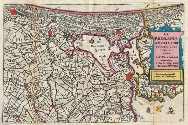
La Rhinlande Amstellande et Terres Circo uosines.
sold
- Digital Map Information
- Suitable for large format printing
- DPI: 300
- File Size: 2.83 MB
- File Type: ZIP / TIFF
- ICC color profile embedded
- Delivered instantly via download link
A stunning map of southern Holland (The Netherlands) and the vicinity of Amsterdam first drawn by Daniel de la Feuille in 1706. Based upon an earlier map by Balthazaro Florentio a Berkenrode who is ... (more details)

La France Moderne avec ses 12 anciens Gouvernement. / Generale Kaart van Vrankryk.
sold
- Digital Map Information
- Suitable for large format printing
- DPI: 300
- File Size: 3.82 MB
- File Type: ZIP / TIFF
- ICC color profile embedded
- Delivered instantly via download link
A stunning map of France first drawn by Daniel de la Feuille in 1706. Depicts all of France as well as parts of Italy, England, Spain, Switzerland, Belgium and Germany. Flanked on either side and ... (more details)
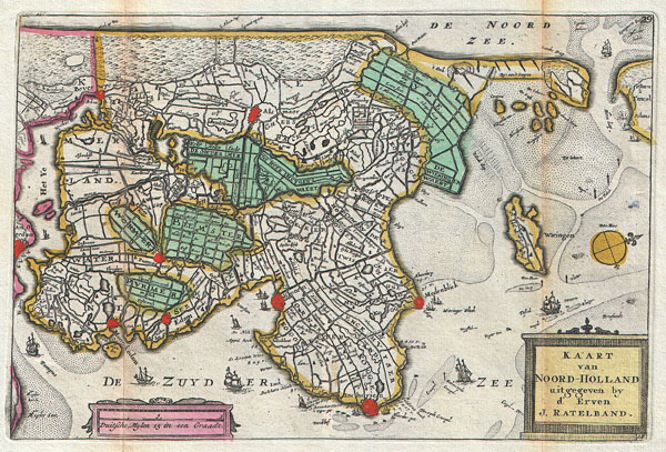
Kaart van Noord-Holland.
sold
- Digital Map Information
- Suitable for large format printing
- DPI: 300
- File Size: 2.99 MB
- File Type: ZIP / TIFF
- ICC color profile embedded
- Delivered instantly via download link
A stunning map of the northern part of Holland or the Netherlands first drawn by Daniel de la Feuille in 1706. Oriented to the west. Covers from Amsterdam at the far right northward as far as ... (more details)
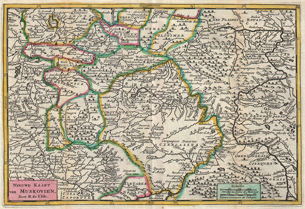
Nieuwe Kaart van Muskovien.
sold
- Digital Map Information
- Suitable for large format printing
- DPI: 300
- File Size: 10.94 MB
- File Type: ZIP / TIFF
- ICC color profile embedded
- Delivered instantly via download link
A stunning map of central Russia or Moscovie (Muskovien). Drawn by Daniel de la Feuille in 1706 based upon an earlier map by De L'Isle, who is credited in the title. Focuses on the ... (more details)

Le Royaume de Pologne avec ses Confins. / Generale Kaart van Polen.
sold
- Digital Map Information
- Suitable for large format printing
- Full resolution TIFF file
- ICC color profile embedded
- Delivered instantly via download link
A stunning map of Poland first drawn by Daniel de la Feuille in 1706. Covers the entire territory of Poland as well as parts of Latvia, Prussia, Hungary, Transylvania, Moldova and ... (more details)