

County Map of Texas.
sold
- Digital Map Information
- Suitable for large format printing
- File Size: 3.64 MB
- File Type: ZIP / TIFF
- ICC color profile embedded
- Delivered instantly via download link
A beautiful example of S. A. Mitchell Jr.'s 1864 map of Texas and part of New Mexico. Detailed to the county level with notations on railroads, topographical features, springs and cities. Lower left hand quadrant features an inset map of Galveston Bay and ... (more details)

Plan of New Orleans.
sold
- Digital Map Information
- Suitable for large format printing
- File Size: 2.82 MB
- File Type: ZIP / TIFF
- ICC color profile embedded
- Delivered instantly via download link
A beautiful example of S. A. Mitchell Jr.'s 1864 map of New Orleans, Louisiana. Depicts the city of New Orleans along with parts of Algiers, Macdonough and Belleville. Offers wonderful detail at the street level including references to the levees, trains, ... (more details)

Plan of the City of Washington The Capitol of the United States of America.
sold
- Digital Map Information
- Suitable for large format printing
- File Size: 3.51 MB
- File Type: ZIP / TIFF
- ICC color profile embedded
- Delivered instantly via download link
A beautiful example of S. A. Mitchell Jr.'s 1864 map of Washington D.C. Depicts the District of Columbia along with parts of Georgetown and Alexandria County. Offers wonderful detail at the street level including references to parks, individual streets, ... (more details)

The World in Hemispheres, with other Projections &c. &c.
sold
- Digital Map Information
- Suitable for large format printing
- File Size: 4.28 MB
- File Type: ZIP / TIFF
- ICC color profile embedded
- Delivered instantly via download link
A beautiful example of S. A. Mitchell Jr.'s 1864 decorative double hemisphere map of the world. Depicts the world on a hemisphere projection. Upper part of the map shows the rivers in relative proximity. Lower half of the map features three additional ... (more details)
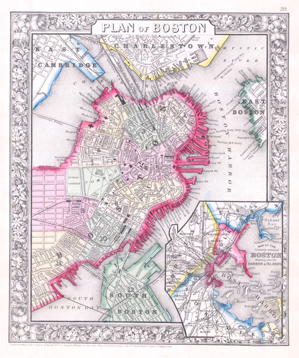
Plan of Boston.
sold
- Digital Map Information
- Suitable for large format printing
- File Size: 3.14 MB
- File Type: ZIP / TIFF
- ICC color profile embedded
- Delivered instantly via download link
A beautiful example of S. A. Mitchell Jr.'s 1864 map of Boston, Massachusetts. Depicts Boston along with parts of East Cambridge, Charlestown, East Boston, and South Boston. Offers wonderful detail at the street level including references to parks, ... (more details)

Plan of New York & c.
sold
- Digital Map Information
- Suitable for large format printing
- File Size: 4.52 MB
- File Type: ZIP / TIFF
- ICC color profile embedded
- Delivered instantly via download link
A beautiful example of S. A. Mitchell's 1864 map of New York City. Depicts New York City along with parts of Brooklyn, Williamsburg, Greenpoint, Hoboken and Jersey City. Offers wonderful detail at the street level including references to parks, ... (more details)
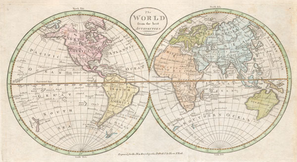
The World from the best authorities.
sold
- Digital Map Information
- Suitable for large format printing
- DPI: 300
- File Size: 2.21 MB
- File Type: ZIP / TIFF
- ICC color profile embedded
- Delivered instantly via download link
An extremely rare and unusual map of the world. Printed in 1798, this is one of the first maps of the world published for general audiences in the New World. While lacking in the refinement commonly seen in European maps of the same period, ... (more details)
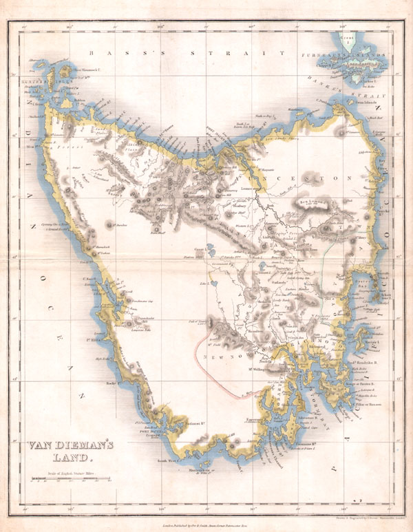
Van Dieman's Land.
sold
- Digital Map Information
- Suitable for large format printing
- Full resolution TIFF file
- ICC color profile embedded
- Delivered instantly via download link
A very rare and unusual example of John Dower's 1837 map of Tasmania or Van Dieman's Land. Depicts the island in considerable detail with good notes on geographical features, especially along the coast. Maps of Tasmania are exceptionally ... (more details)

A Circle of Winds consisting of 32 points commonly called the Mariners Compass. / The Artificial Sphere
sold
- Digital Map Information
- Suitable for large format printing
- Full resolution TIFF file
- ICC color profile embedded
- Delivered instantly via download link
A beautiful and rare chart consisting of two engraved drawings within a single border. Left hand drawing, entitled 'A Circle of Winds consisting of 32 points commonly called the Mariners Compass,' shows exactly that – a compass rose ... (more details)

Northern Hemisphere / Southern Hemisphere
sold
- Digital Map Information
- Suitable for large format printing
- DPI: 300
- File Size: 1.12 MB
- File Type: ZIP / TIFF
- ICC color profile embedded
- Delivered instantly via download link
An unusual and attractive map of the world on a hemisphere projection. Depicts the world as seen from the North Pole and south pole. Antarctica is mysteriously absent. Divided according to continents. In Africa the Mountains of ... (more details)
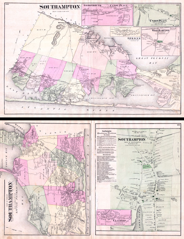
Southampton.
sold
- Digital Map Information
- Suitable for large format printing
- File Size: 12.23 MB
- File Type: ZIP / TIFF
- ICC color profile embedded
- Delivered instantly via download link
A scarce set of Fredrick W. Beers' Map three map set of Southampton, Long Island, New York. Published in 1873, this magnificent map covers from Eastport eastward to through West Hampton to Bridgehampton and Sag Harbor. Includes ... (more details)

Southold and Shelter Island Suffolk Co. L.I.
sold
- Digital Map Information
- Suitable for large format printing
- File Size: 5.87 MB
- File Type: ZIP / TIFF
- ICC color profile embedded
- Delivered instantly via download link
A rare example of Fredrick W. Beers' Map of Southold and Shelter Island, Long Island, New York. Published in 1873, this magnificent map covers from Franklinville and Mattituck Hills eastward past Cutchogue harbor, Peconic ... (more details)
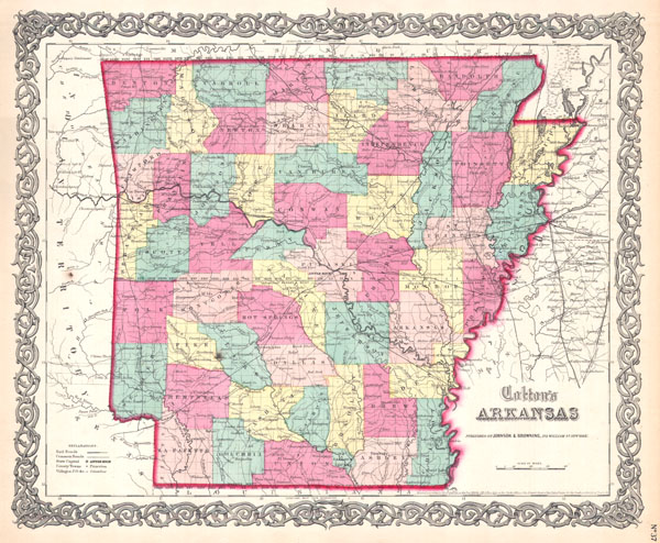
Colton's Arkansas
sold
- Digital Map Information
- Suitable for large format printing
- File Size: 4.46 MB
- File Type: ZIP / TIFF
- ICC color profile embedded
- Delivered instantly via download link
This rare hand colored map of Arkansas is a copper plate engraving dating to 1859. Produced by the important mid 19th century American map publisher J. H. Colton. Covers the region in considerable detail, documenting ... (more details)

Colton's New Jersey
sold
- Digital Map Information
- Suitable for large format printing
- File Size: 5.49 MB
- File Type: ZIP / TIFF
- ICC color profile embedded
- Delivered instantly via download link
This rare hand colored map of New Jersey is a copper plate engraving dating to 1855. Produced by the important mid 19th century American map publisher J. H. Colton. Covers the region in considerable detail, ... (more details)

New Hampshire.
sold
- Digital Map Information
- Suitable for large format printing
- File Size: 7.3 MB
- File Type: ZIP / TIFF
- ICC color profile embedded
- Delivered instantly via download link
One of the few maps specifically of New Hampshire published in the mid- 19th century. Depicts the state in full with superb detail regarding the cities, transportation system, geographical features and ... (more details)
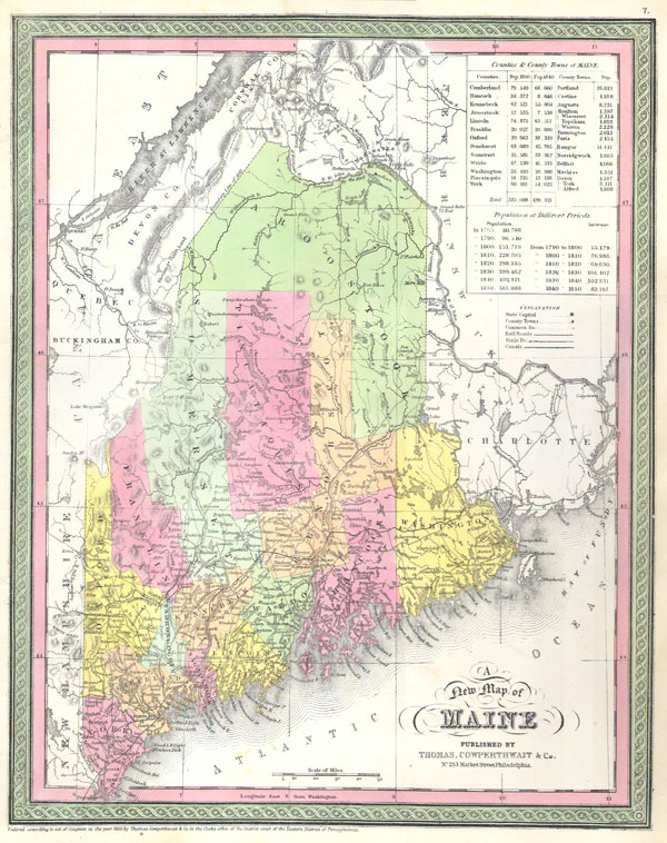
A New Map of Maine
sold
- Digital Map Information
- Suitable for large format printing
- DPI: 300
- File Size: 4.95 MB
- File Type: ZIP / TIFF
- ICC color profile embedded
- Delivered instantly via download link
A rare map of the state of Maine produced by S. A. Mitchell Sr. in 1850. Depicts the state in full with superb detail regarding the cities, transportation system, geographical features and counties. ... (more details)
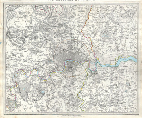
The Environs of London.
sold
- Digital Map Information
- Suitable for large format printing
- Full resolution TIFF file
- ICC color profile embedded
- Delivered instantly via download link
A difficult to find map of the vicinity of London, England. Depicts the London area from Kingston and Hamton Court Park in the southwest to Stanmore in the northwest, Hennault Forest in the northeast ... (more details)
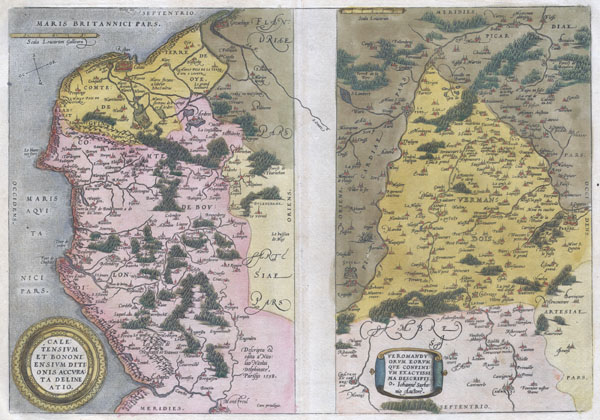
Caletensium et Bononiensium Ditionis Accurata Delinatio. / Veromanduorum Eorumque Confinium Exactissima Discriptio.
sold
- Digital Map Information
- Suitable for large format printing
- DPI: 300
- File Size: 5.07 MB
- File Type: ZIP / TIFF
- ICC color profile embedded
- Delivered instantly via download link
Two rare regional Abraham Ortelius maps on a single folio sheet. Left map, entitled Caletensium,depicts the French and Belgian coastline from Estables to Calais. Cartographically based upon a four ... (more details)

Nouveau Mexique, Louisiane, Canada, et les Etats Unis.
sold
- Digital Map Information
- Suitable for large format printing
- DPI: 300
- File Size: 4.11 MB
- File Type: ZIP / TIFF
- ICC color profile embedded
- Delivered instantly via download link
A rare and highly unusual late 18th century map of North America. Depicts North America according to the French conception with a northwest passage extending west from Hudson Bay towards Lake ... (more details)
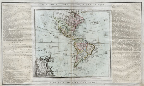
L'Amérique dressée pour l'étude de la géographie.
sold
- Digital Map Information
- Suitable for large format printing
- DPI: 300
- File Size: 3.78 MB
- File Type: ZIP / TIFF
- ICC color profile embedded
- Delivered instantly via download link
A hard to find 1786 map of the North America and South America by French cartographer Louis Brion de la Tour. Depicts the whole of North and South America with several interesting ... (more details)