
Attractive map on the dominant projection of the early 17th century.
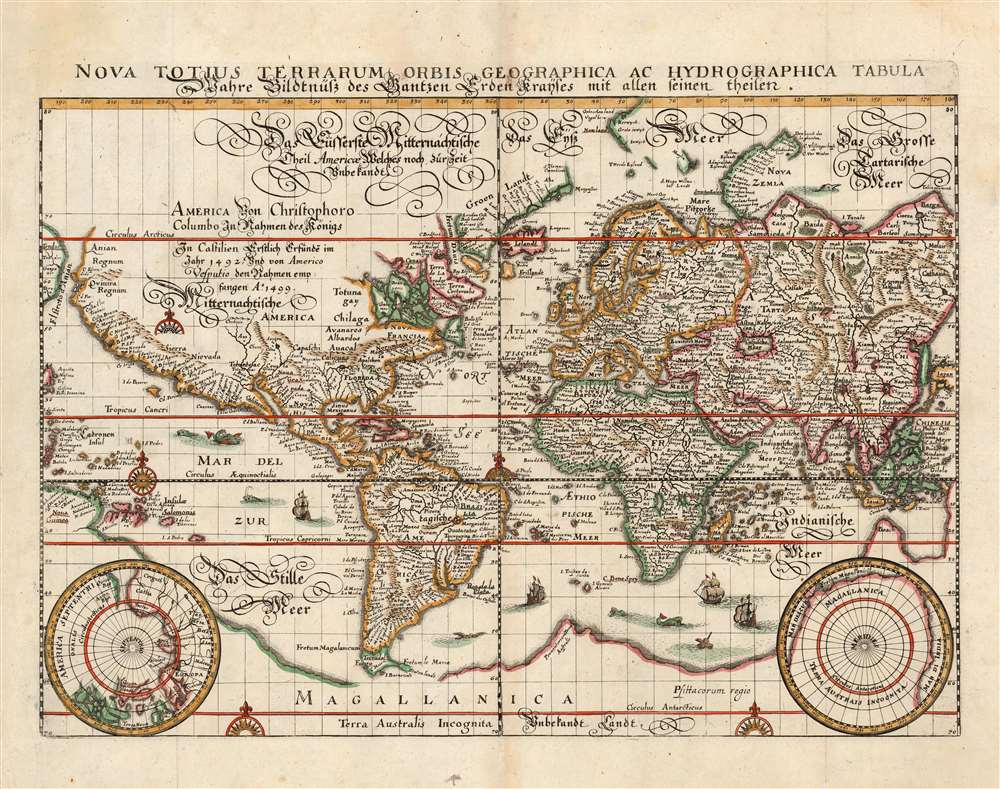
Nova Totius Terrarum Orbis Geographica Ac Hydrographica Tabula...
sold
- Digital Map Information
- Suitable for large format printing
- Full resolution TIFF file
- ICC color profile embedded
- Delivered instantly via download link
This is a scarce 1646 map of the world on the Mercator Projection, produced for inclusion in the 1646 edition of Matthias Merian's Neuwe Archontologia cosmica. It is a meticulous and beautiful reduced version of Blaeu's similarly-titled 1606 map, which remained the dominant depiction of the world using that projection - appearing in all of Blaeu's successful atlas editions up through the 1640s. While this map does not retain the decorative borders of its source, the cartographic detail is reproduced faithfully, including the polar projections in the lower corners. (more details)
Many-wondered city of Alexandria.

Alexandria, Vetustissimum Aegypti Emporium, Amplissima Civitas
sold
- Digital Map Information
- Suitable for large format printing
- Full resolution TIFF file
- ICC color profile embedded
- Delivered instantly via download link
This is a bold, sharp example of the 1575 view of Alexandria, produced by Braun and Hogenberg for inclusion in the second volume of the Civitates Orbis Terrarum. The view is oriented to the south, with the Mediterranean Sea in the foreground. City is presented both as a center of modern trade, and home of ancient wonders, many ruined or lost. (more details)
The discoveries of Le Maire and Schouten.

America noviter delineata.
sold
- Digital Map Information
- Suitable for large format printing
- Full resolution TIFF file
- ICC color profile embedded
- Delivered instantly via download link
This is a scarce 1638 Matthias Merian map of the Americas. Merian had already, in 1631 produced a larger-format map of America, based on Jansson’s 1623 America noviter delineata. Merian's source for the present map was not, as Burden suggests, Jodocus Hondius Jr.'s 1618 map of the same title, but Blaeu's Americae Nova Tabula whose detail here is presented with a high degree of faithfulness (although dispensing with Blaeu's decorative borders). It is an interesting choice, but appears to be consistent with Merian's decision to copy Blaeu's world map in this volume. (more details)
The most beloved fantasy series since Tolkien.

Wheel of Time Robert Jordan.
sold
An uncommon large-scale 1997 promotional map illustrating the 'Westlands', the primary setting of Robert Jordan's Wheel of Time series. It was issued to promote Book 7 of the series, A Crown of Swords based upon the original map art. Jordan fans will recognize the map from the endpapers of the hardcover editions of each volume designed by Elissa Mitchell. Coverage extends from the Spine of the World to the Aryth Ocean, and from the Blight (Shayol Ghul) to the Sea of Storms. The verso features glowing reviews for the Wheel of Time series. (more details)
Richly decorative map of the Africa.
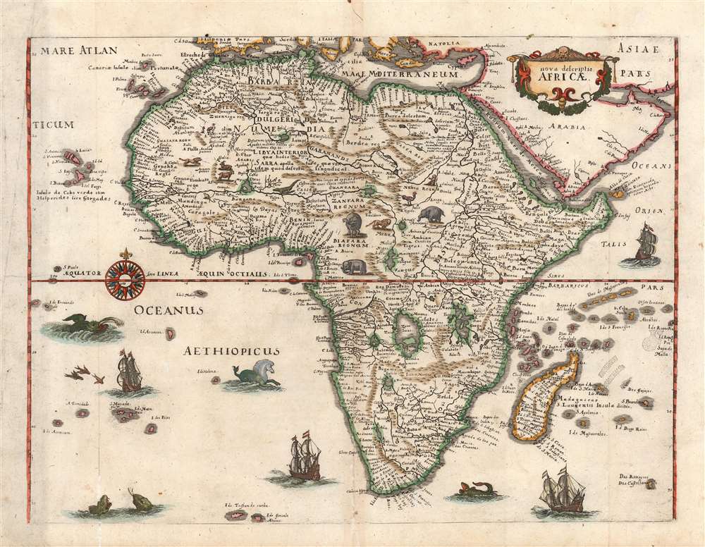
Nova descriptio Africae.
sold
- Digital Map Information
- Suitable for large format printing
- Full resolution TIFF file
- ICC color profile embedded
- Delivered instantly via download link
This is a scarce 1638 Matthias Merian map of Africa, built upon the geographic model of Willem Blaeu's 1617 'Africae nova descriptio'. Blaeu's details are presented here faithfully (though dispensing with Blaeu's decorative borders). This choice is consistent with Merian's decision to copy Blaeu's world and Americas maps for his 1638 Neuwe Archontologia cosmica. In addition to adopting Blaeu's cartography, Merian has filled the seas around Africa with ships and sea monsters; likewise the land teems with elephants, ostriches, lions, and other beasts. (more details)
Illustrates different types of terrain in Indochina, including dense forests and woodlands.
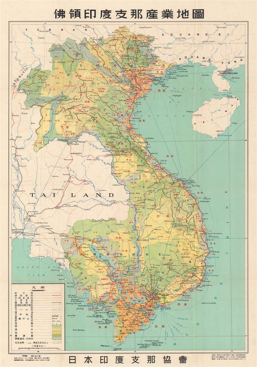
俳領印度支那産業地園. / Indochina Industrial Land.
sold
- Digital Map Information
- Suitable for large format printing
- File Size: 48.11 MB
- File Type: ZIP / TIFF
- ICC color profile embedded
- Delivered instantly via download link
This is a 1940 or Showa 15 Japan Indochina Association map of French Indochina / Vietnam detailing terrain. At the time, French Indochina consisted of modern-day Vietnam, Laos, and Cambodia. Indochinese cities and villages, such as Hanoi, Haiphong, Saigon, Vientiane, and Phnom Penh, are labeled with either their Vietnamese name or their French name. Geographic locations throughout are labeled in the same manner, either in Vietnamese or French. A table in the lower left corner details different notations used to illustrate roads, railroads, rivers, and international borders. Different kinds of terrain, including dense forests, woodlands, and land suitable for clearing and exploitation. The Latin alphabet content underscores that this was a French map that was repurposed by the Japanese - who added extensive overprinting in this new revised issue. (more details)
Japanese invasion of Vietnam.

俳領印度支那産業地園. / Indochina Industrial Land.
sold
- Digital Map Information
- Suitable for large format printing
- File Size: 38.57 MB
- File Type: ZIP / TIFF
- ICC color profile embedded
- Delivered instantly via download link
This is a 1940 or Showa 15 Japan Indochina Association map of French Indochina / Vietnam detailing agricultural production. At the time, French Indochina consisted of modern-day Vietnam, Laos, and Cambodia. Indochinese cities and villages, such as Hanoi, Haiphong, Saigon, Vientiane, and Phnom Penh, are labeled with either their Vietnamese name or their French name. A table in the lower left corner details different mineral resources, including silver, gold, and iron. Production figures for 1937, 1938, and 1939 are also provided. The Latin alphabet content underscores that this was a French map that was repurposed by the Japanese - who added extensive overprinting in this new revised issue. (more details)
An unsuccessful railroad through the White Mountains.

Portland and Ogdensburg Railroad. Through the White Mountains.
sold
- Digital Map Information
- Suitable for large format printing
- File Size: 15.56 MB
- File Type: ZIP / TIFF
- ICC color profile embedded
- Delivered instantly via download link
This is a c. 1880 Frederick Julian Ilsley map of the White Mountains in New Hampshire. Depicting from Lancaster on the Connecticut River south to Conway, the Saco River, and Black Sandwich Dome, thick black lines highlight the Portland and Ogdensburg Railroad's route through the mountains. Roads and rivers are illustrated and mountain peaks are identified. (more details)
Charming Oahu and Waikiki.

A Pic Tour Map Honolulu - Waikiki and 'Round the Isle of Oahu'.
sold
This is a 1956 Don Bloodgood pictorial map of the island of Oahu and Waikiki Beach, Hawaii. Created in two sections, the map of Oahu depicts the entire island and occupies nearly two thirds of the printed area. Sites all across the island, from Kaena Point to Makapuu Point and from Kahuku Point to Diamond Head are identified. These range from cities and towns, such as Honolulu, Lanikai, and Waialee, to coastal beaches, including Waikiki, and other important sites, such as Pearl Harbor, the Battleship Arizona Memorial, and the Mormon Temple. Palm groves and pineapple plantations dot the landscape, while surfers and fisherman ply the waters just off shore. Fish and whales surround the island. An inset of all eight Hawaiian Islands is located in the upper right. Mauna Loa, Mauna Kea, Kilauea, and Haulalai are illustrated and labeled on the island of Hawaii, as is Mt. Waialeale, the wettest spot in the world, on Kauai. Distances from Honolulu to the other islands is given, as are distances between Honolulu and Australia, New Zealand, Tokyo, Manila, Portland, San Francisco, and Los Angeles. (more details)
Charming tourist map of 'The Sunshine City'.

Pleasure Map of St. Petersburg Florida.
sold
- Digital Map Information
- Suitable for large format printing
- Full resolution TIFF file
- ICC color profile embedded
- Delivered instantly via download link
This is a 1953 Thomas Griffith and Robert McCarthy tourist map of St. Petersburg, Florida. Depicting the entirety of St. Petersburg, the map highlights the main thoroughfares and many points of interest around the city. According to the text along the bottom, studying this piece makes getting around St. Petersburg 'easy'. (more details)
Details both Key West and Marathon Key.

Your Treasure Map to 'Sea' Florida Keys and Key West for the Vacation Thrill of Your Life!
sold
This is a c. 1976 Monroe County Advertising Commission map of the Florida Keys. Printed on both sides, the map marks stops along the Overseas Highway from Homestead to Key West, naming major Keys en route. The Florida Keys Aquarium, Santini's Porpoise Training School, the Long Key Fishing Club, and the site of Zane Grey's former cottage rank amon highlighted sites. Boat ramps, underwater coral gardens, campgrounds, golf courses, and movie theaters, more traditional tourist sites, also appear. A scroll occupies most of Florida Bay and names the forty-two bridges on the Overseas Highway, with distances. An index for the Upper Keys is included. (more details)
First published plan of Singapore.
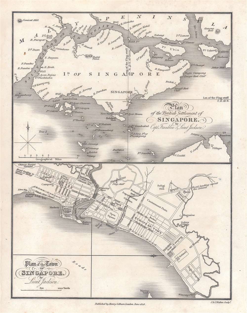
Plan of the Town of Singapore by Lieut. Jackson. / Plan of the British Settlement of Singapore by Capt. Franklin and Lieut. Jackson.
sold
- Digital Map Information
- Suitable for large format printing
- Full resolution TIFF file
- ICC color profile embedded
- Delivered instantly via download link
Known as the Jackson Plan or Raffles Plan, this is the first published map of Singapore. Published in 1828, the map was drawn by Lieutenant Philip Jackson at the request of Singapore founder Sir Stamford Raffles (1781 - 1826). It is divided into two sections, a map of the island of Singapore, and a close-up plan of the town of Singapore. The city plan presents an idealized version of Singapore following the Raffles vision and, while not fully implemented, was influential in the early development of the colony. (more details)
First obtainable map of the Upper West Side.

[Central Park and the Upper West Side.]
sold
- Digital Map Information
- Suitable for large format printing
- File Size: 24.32 MB
- File Type: ZIP / TIFF
- ICC color profile embedded
- Delivered instantly via download link
A scarce map of New York City's Upper West Side, including the southern half of Central Park, issued in 1867 by Matthew Dripps. This is likely the earliest obtainable specific map of the Upper West Side, predating the maps of Egbert Vielé (1868), John Bute Holmes (1874), and Herman Knickerbocker Vielé (1879). Moreover, as the map predates most major development on the Upper West Side, its ichnographic qualities - showing the layout of numerous individual buildings - are of the utmost historical significance. For example, no doubt one of these homes was where Edgar Allen Poe (84th and Broadway) composed The Raven. Coverage extends from West 91st Street to 59th Street and from 5th Avenue to the Hudson River. Cartographically, this map is based upon the 18th century farm surveys of John Randel Jr. (1787 - 1865) and Blackwell, with updates and revisions by the civil engineer John F. Harrison (1824 - 1891). (more details)
The height of Meiji cartographic artistry.

改正東京全圖 / [Corrected Map of Tokyo.] / Kaisei Tōkyō Zenzu.
sold
- Digital Map Information
- Suitable for large format printing
- File Size: 41.68 MB
- File Type: ZIP / TIFF
- ICC color profile embedded
- Delivered instantly via download link
A striking vividly colored 1890 (Meiji 23) map of Tokyo issued by Tsunajima Kamekichi. The map is oriented to the northwest and centered on the Imperial Palace. The map proper is surrounded by vignette views of important sites in Tokyo. Along the bottom of the map there is a detailed street index. (more details)
The first separate issue map of Middle Earth.
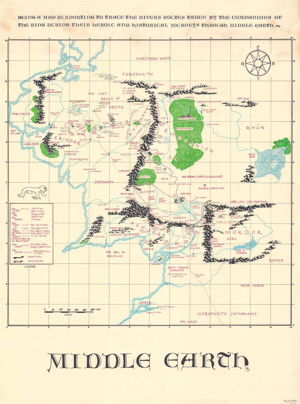
Middle Earth. Being a map purporting to trace the divers routes taken by the companions of the ring during their heroic and historical journeys through Middle Earth.
sold
A rare map of J. R. R. Tolkien's Middle Earth drawn in 1967 by M. Blackburn and issued in by Bruin Inc. This map is based upon the classic map of Middle Earth drawn by J. R. R.'s son, Christopher Tolkien, for the release of the Fellowship of the Ring. To this map has been appended annotation and overprinting, as well as a legend, detailing the routes taken by various figures from the Lord of the Rings. These are broken out and coded according to the subgroups established after the 'Breaking of the Fellowship' at the end of the Fellowship of the Ring. This map has the novel addition of a scale, uncommon in Middle Earth maps, where distances are frequently debated based upon interpretations of the text. (more details)
London from above.

The Pictorial Plan of London.
sold
- Digital Map Information
- Suitable for large format printing
- Full resolution TIFF file
- ICC color profile embedded
- Delivered instantly via download link
A striking chromolithograph Edwardian Era pictorial plan of London issued in 1901 by Charles Baker and Co. Ltd. Centered on Charing Cross, the map covers from Albert Bridge and Kensington Palace to the London Docks and Southwark Park. It extends south to the Grand Surrey Canal and north to include all of Regents Park and Kings Cross Station. The cartographer combines pictorial elements with axonometrical style mapping in which important buildings are represent from equidistant elevated perspective - similar to the great 1738 Bretez/Turgot Plan of Paris, if not on so grand a scale. (more details)
Rare map revealing the Russo-Persian Frontier.
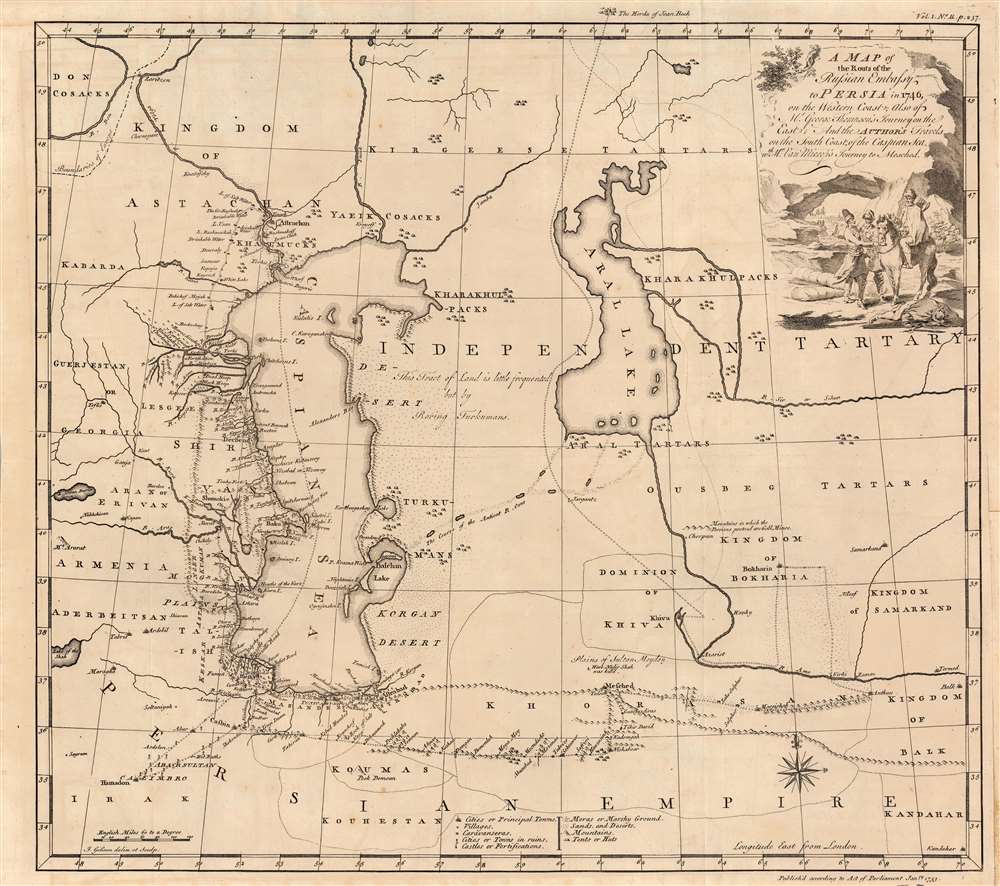
A Map of the Routs of the Russian Embassy to Persia in 1746, also of Mr. George Thompson's journey on the East and the author's travels on the South coast of the Caspian sea, with Mr. Van Mierop's Journey to Mesched.
sold
- Digital Map Information
- Suitable for large format printing
- Full resolution TIFF file
- ICC color profile embedded
- Delivered instantly via download link
This is an example of John Gibson's rare map of the Caspian region, engraved in 1753 to accompany Jonas Hanway's account of his journey from Russia to Persia. It represents one of the first and best detailed, maps of the region based on firsthand exploration. The map combines details of Hanway's own journey with reconnaissance from the 1740 journey of British merchant George Thompson, that of Martin Kyck van Mierop, a cloth merchant who traveled the region in 1746, and an abortive 1746 Russian embassy to Persia on behalf of the Tsarina Elizabeth Petrovna. The map shows the area around the Caspian Sea and northern Iran, as well as parts of modern-day Turkmenistan and Uzbekistan. (more details)
Steamships around the world.
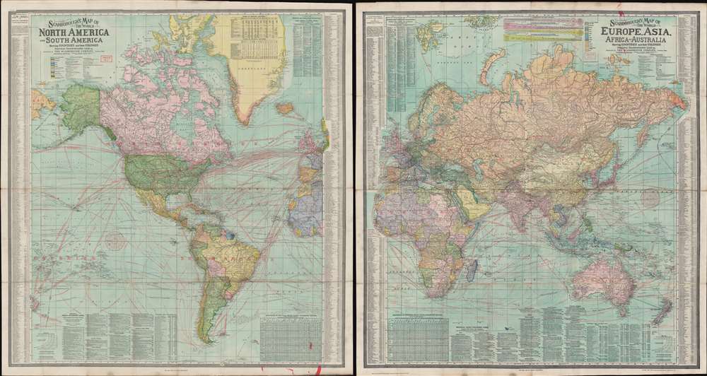
Scarborough's Map of the World North America and South America Shewing Countries and their Colonies Principal Transportation Lines etc. / Scarborough's Map of the World Eruope, Asia, Africa and Australia Shewing Countries and their Colonies Principal Transportation Lines etc.
sold
- Digital Map Information
- Suitable for large format printing
- Full resolution TIFF file
- ICC color profile embedded
- Delivered instantly via download link
This is an impressive double sided 1907 map of the world by the London branch of the Scarborough Company. The map is on a single waxed silk sheet which has been printed on both sides, with one side detailing the Western Hemisphere, including the Americas, and the other side detailing the Eastern Hemisphere, including Europe, Africa, Asia, and Australia. Particular attention has been paid to the global railroad and steamship network at its height. Rail and steam lines are here highlighted in red overprinting. Each side features a wealth of additional information, ranging from the locations of British and American Consulates, to detailed city indexes, and populations statistics. (more details)
Promoting the 1939 World's Fair, and the Petroleum Industry.
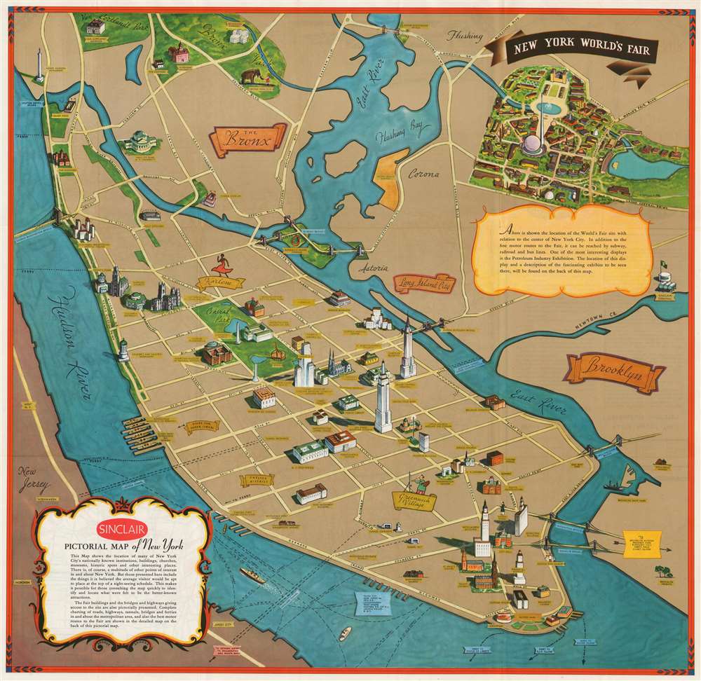
Sinclair Pictorial Map of New York. / New York World's Fair.
sold
- Digital Map Information
- Suitable for large format printing
- Full resolution TIFF file
- ICC color profile embedded
- Delivered instantly via download link
This is a scarce pictorial map of New York City drawn in 1939 by Georg Annand for Sinclair Oil to promote the 1939 New York World's Fair. The map is a simplified perspective view of the island of Manhattan, with Flushing and the Bronx retreating into the distance and Central Park taking center stage. Like most of Annand's work, this map combines pictorial and minimalist tendencies. The typography is clear and legible; by dispensing with all but the most important thoroughfares, Annand is able to pictorially present a selection of the city's landmarks, such as its skyscrapers, museums and cathedrals. Several sports venues are shown: Madison Square Garden, Yankee Stadium, and the lamented Polo Grounds. The Bronx Zoo is depicted with an improbable scene of a little girl in a red dress stroking an elephant's trunk. Two neighborhoods are highlighted: Greenwich Village (indicated with an artist at an easel) and Harlem (indicated with a dancer in a smashing red dress.) Also noted: the Fulton Fish Market. (more details)
Illustrates the legendary Mugrabi Cinema.
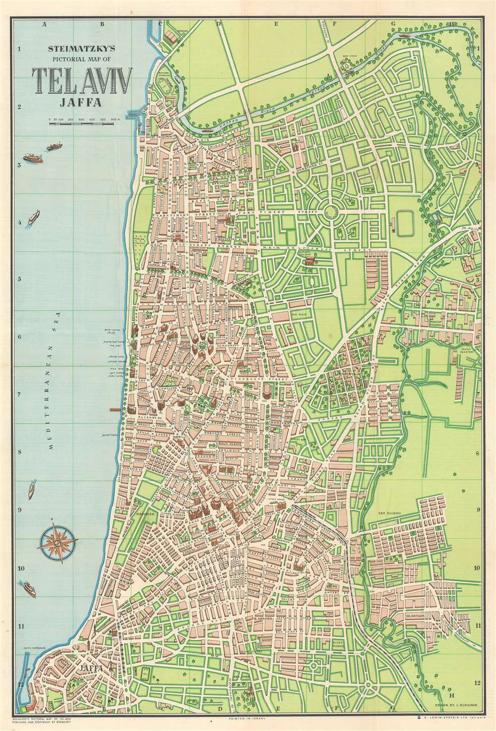
Steimatzky's Pictorial Map of Tel Aviv Jaffa.
sold
This is a c. 1954 Steimatzky pictorial city plan or map of Tel Aviv and Jaffa, Israel. The map depicts the city from the Yarkon River to Jaffa, with the Mediterranean dominating the left border. Hotels and the Knesset occupy prime beach-front real estate. The Habima (Israel's national theatre), the Mugrabi Cinema (which was demolished in 1989 after a fire), and the Barclays Bank Building are among the landmarks illustrated in profile. (more details)