
Capital of the Short-Lived Kingdom of Illyria.

Grundriss der Haupt-Stadt Laibach im Königreiche Illyrien.
sold
- Digital Map Information
- Suitable for large format printing
- File Size: 25.23 MB
- File Type: ZIP / TIFF
- ICC color profile embedded
- Delivered instantly via download link
A highly detailed 1827 city plan or map of Ljubljana (Laibach), Slovenia by Franz Deschmann. (more details)
Presenting the proto-Alaska Muller Peninsula, refuting the Sea of the West.
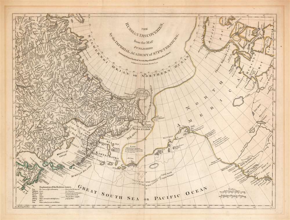
The Russian Discoveries from the Map Published by the Imperial Academy of St. Petersburg.
$1,100.00
Acquire
- Digital Map Information
- Suitable for large format printing
- Full resolution TIFF file
- ICC color profile embedded
- Delivered instantly via download link
An attractive example of Robert Sayer's 1775 translation of Gerhard Friedrich Müller's map presented to refute the spurious geography of the Pacific Northwest proposed by the French cartographers Philippe Buache and Joseph Nicolas De l'Isle. The map covers the same area as the 1752 Buache / De l'Isle map, and uses similarly state-of-the-art data from Russian explorers to show their successes in sailing via a Northeast Passage into the Pacific. This map however presents Müller's cartography of the American Northwest in explicit contradiction of the Buache/De l'Isle imaginary Sea of the West, and reliance on the fictional journeys of Admiral De Fonte. Thus, the map includes the North Pacific, including parts of Alaska, the Pacific Northwest, and Northeast Asia. Coverage extends from the Arctic Circle south to the latitudes of Vancouver and Japan. Most dramatically, the map includes a large, speculative peninsula extending westward from North America towards Asia. This, known as the Müller Peninsula, would become the dominant geographical model for the Pacific Northwest coast until the actual exploration of those coastal areas by Captain Cook in the 1770s. The map is also notable for its unusual Bulbous promontory in northern Siberia, an interpretation of the Witsen Peninsula, itself a mismapping of the Chukchi Peninsula. (more details)
Wettlauf um Afrika.
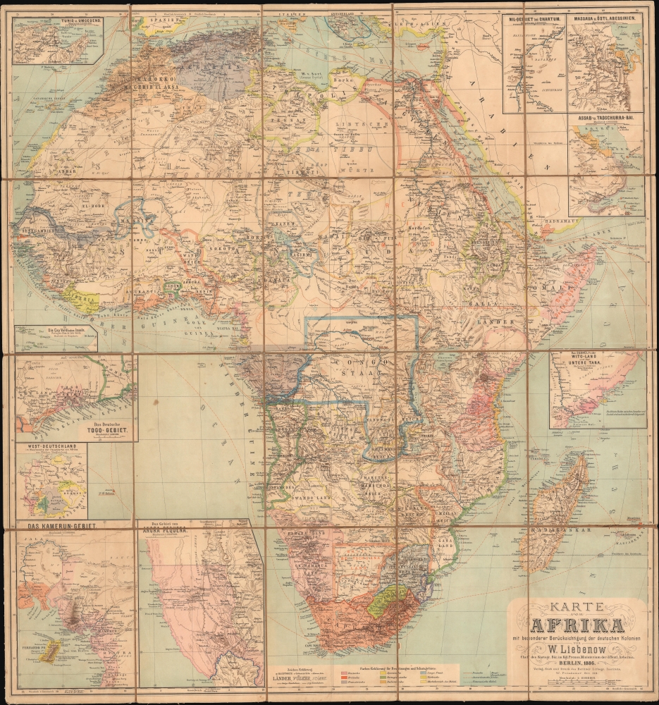
Karte von Afrika mit besonderer Berücksichtingung der deutschen kolonien von W. Liebenow.
sold
- Digital Map Information
- Suitable for large format printing
- File Size: 80.64 MB
- File Type: ZIP / TIFF
- ICC color profile embedded
- Delivered instantly via download link
A large-scale German-language folding map of Africa, produced at the height of the Scramble for Africa in 1886 by Wilhelm Liebenow. (more details)
Luxury dining on the Chicago and North-Western Railroad.

Dinner is Ready.
sold
- Digital Map Information
- Suitable for large format printing
- File Size: 11.48 MB
- File Type: ZIP / TIFF
- ICC color profile embedded
- Delivered instantly via download link
This is a very rare c. 1882 Chicago and North-Western Railway broadside promoting the elegance of the railroad's new dining cars. The broadside features caricatures of two waiters and announces the arrival of the 'famous North-Western Dining Cars,' put into service on March 1 on the Chicago, St. Paul, and Minneapolis line. All meals were only 75 cents. The broadside claims that the North-Western 'is bound to lead all competitors in furnishing all the best and latest improvements for the Pleasure, Comfort, and Safety of its patrons.' (more details)
Charitable Imperialism.

Around the World with 81 Billion.
sold
- Digital Map Information
- Suitable for large format printing
- File Size: 25.23 MB
- File Type: ZIP / TIFF
- ICC color profile embedded
- Delivered instantly via download link
This is a 1950 Edwin Sundberg map of the world highlighting U.S.-financed foreign aid in the wake of World War II. The map both lauds American generosity and suggests potential concerns that the funds might be misused or simply not paid back. (more details)
Florida's Highway Building Boom.
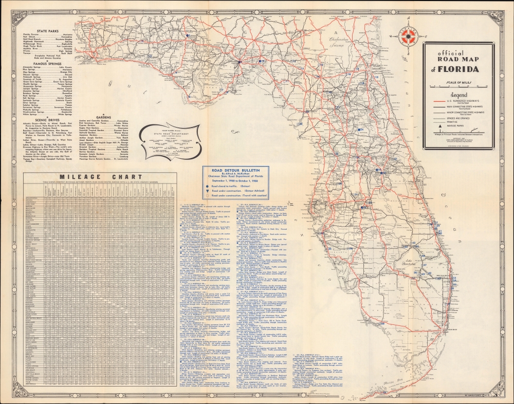
Official Road Map of Florida / Florida Highways Official Detour Bulletin for period shown in heading on map side.
sold
- Digital Map Information
- Suitable for large format printing
- Full resolution TIFF file
- ICC color profile embedded
- Delivered instantly via download link
An unusual 1950 road map of Florida produced by the State Road Department. In addition to highways, major roads, and cities, it provides information on detours and construction, reflecting the rapid pace of road construction in the state. (more details)
First issue of an early depiction of Quebec.

Plan de la Ville de Quebec.
$350.00
Acquire
- Digital Map Information
- Suitable for large format printing
- File Size: 5.39 MB
- File Type: ZIP / TIFF
- ICC color profile embedded
- Delivered instantly via download link
A scarce 1744 first state first issue of Bellin's important map of Quebec City, Canada. When this map was issued, Quebec dominated the French fur trade with its strategic position on a vital St. Lawrence artery. (more details)
Italians commemorating the end of World War I.
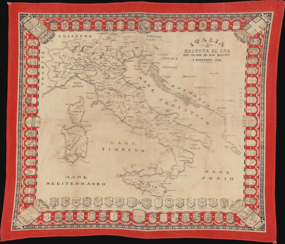
Italia Redenta ed una per valore dei suoi soldati, 3 Novembre 1918.
sold
- Digital Map Information
- Suitable for large format printing
- File Size: 31.62 MB
- File Type: ZIP / TIFF
- ICC color profile embedded
- Delivered instantly via download link
This is a 1918 Italian handkerchief map of Italy celebrating the end of World War I (1914 - 1918). Created soon after the signing of the Armistice of Villa Giusti, the map incorporates Italy's new northern border gained because of cessions from the treaty. (more details)
Ski Bromley Mountain!

Bromley Vermont.
sold
This is a c. 1987 Little Barn Graphics Company poster of Bromley Mountain ski resort, Vermont. A beautiful sunrise highlights Bromley Mountain with its many ski runs. Mainstays of the Bromley community appear in the foreground. Among these are the Bromley Sun Lodge and Restaurant, the Wild Wings Ski Touring Center, The Inn at Weston, and the J.J. Hapgood Store. The scene is covered in a thick blanket of snow. (more details)
One of the first lithograph views produced from a photograph.

City of Worcester Mass.
sold
- Digital Map Information
- Suitable for large format printing
- File Size: 42.24 MB
- File Type: ZIP / TIFF
- ICC color profile embedded
- Delivered instantly via download link
This is a rare, unusual, and significant 1864 chromolithograph bird's-eye view of Worcester, Massachusetts. The view is unique as being one of the first bird's-views produced from a photograph, as well as a pioneering example of balloon-based aerial photography - the image being taken by 'Black and Bachelder,' the photographers responsible for the first balloon photographs in the United States. It is worth noting that the 'Bachelder' attributed is not the more famous viewmaker John Badger Bachelder, but rather the important photographer Perez Mann Bachelder. (more details)
Ulimaroa - rare use of indigenous name for Australia.

Polynesien (Inselwelt) oder der Funfte Welttheil Versasst von Herrn Daniel Djurberg.
sold
- Digital Map Information
- Suitable for large format printing
- File Size: 29.62 MB
- File Type: ZIP / TIFF
- ICC color profile embedded
- Delivered instantly via download link
This important 1789 Djurberg map of Australia and Polynesia is one of the very few maps to use the Indigenous terms for Australia and New Zealand: Ulimaora (Australia), Tavai-Poenammoo (New Zealand South Island), and Ealiei-Nomauwe (North Island). All three of these terms are extracted from accounts of Capt. James Cook's epic voyages of discovery. (more details)
As the campus was being built.

Richmond College Richmond, V.A.
sold
- Digital Map Information
- Suitable for large format printing
- File Size: 24.01 MB
- File Type: ZIP / TIFF
- ICC color profile embedded
- Delivered instantly via download link
This is Richard Rummell's 1915 bird's-eye view of Richmond College, Virginia - now the University of Richmond. The view illustrates the campus shortly after its 1914 move to Westhampton, while the new campus was still under construction - making it unique among Rummell views in that much of it is presumptive. (more details)
One of the last editions of one of the most unusual and decorative pocket maps of New York City to appear in the 19th century.
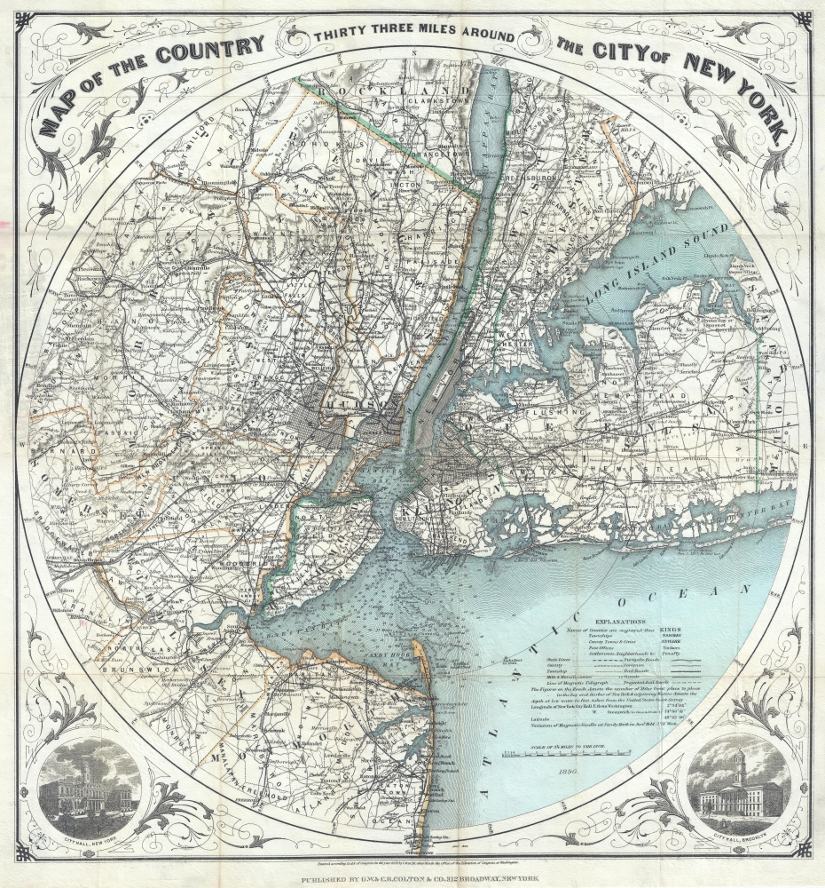
Map of The Country Thirty Three Miles Around The City of New York.
$1,200.00
Acquire
- Digital Map Information
- Suitable for large format printing
- File Size: 16.02 MB
- File Type: ZIP / TIFF
- ICC color profile embedded
- Delivered instantly via download link
This is the 1890 edition of one of the most beautiful pocket maps of New York made in the 19th century: Colton's Thirty Three Miles Around the City of New York. (more details)
Poland's Last Cholera Outbreak.

Polska / Pologne.
sold
- Digital Map Information
- Suitable for large format printing
- File Size: 13.14 MB
- File Type: ZIP / TIFF
- ICC color profile embedded
- Delivered instantly via download link
A curious and engaging c. 1923 map of Poland extensive manuscript annotations and highlights illustrating public health measures undertaken to contain a cholera outbreak in the wake of World War I (1914 - 1918), the country's last after battling the disease for decades. (more details)
Communist subversion of America.

The War Against America... we are losing!
sold
Spanning persuasive cartography, Cold War propaganda, and political broadsides, this work constituted the first (and seemingly only) issue of the Citizen's Intelligence Digest, a far-right anti-Communist publication prepared in 1962 by Robert E. Grigsby. It denounces Communist subversion within the United States and calls on citizens to fight for the defense of American values. (more details)
Perhaps the only map of Maryland in Liberia ever produced.

Maryland in Liberia.
sold
- Digital Map Information
- Suitable for large format printing
- DPI: 600
- File Size: 48.2 MB
- File Type: ZIP / TIFF
- ICC color profile embedded
- Delivered instantly via download link
This is an 1853 map and nautical chart of the ephemeral independent Maryland, in modern-day Liberia (or the Republic of Maryland), a colony for free people of color, which declared its independence as a republic soon after this map's production. This map was produced by William F. Lynch, an officer in the U.S. Navy who led a mission to West Africa to explore locations for further colonization sites for free people of color, along the lines of Liberia. It is the only map ever produced specifically focusing on the ephemera African state of Maryland. (more details)
Earliest Acquirable Map showing the True Source of the Blue Nile.

Jobi Ludolfi Habessinia Seu Abassia Presbyteri Johannis Regio perperam dicta...
$950.00
Acquire
- Digital Map Information
- Suitable for large format printing
- DPI: 600
- File Size: 66.6 MB
- File Type: ZIP / TIFF
- ICC color profile embedded
- Delivered instantly via download link
This is Job Ludolf's 1683 map of Ethiopia, the first generally acquirable map focusing on the headwaters of the Blue Nile, as well as the most influential - being copied by De Fer, Coronelli, and others well into the eighteenth century. The present example is the Valk and Schenk edition, in handsome original color. (more details)
Contest of Empires in the Horn of Africa.
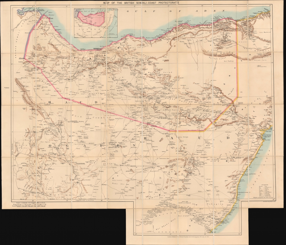
Map of the British Somali-Coast Protectorate.
$950.00
Acquire
- Digital Map Information
- Suitable for large format printing
- File Size: 33.19 MB
- File Type: ZIP / TIFF
- ICC color profile embedded
- Delivered instantly via download link
An impressive large-format folding map of British Somaliland, prepared and published in 1903 by Stanford's Geographical Establishment, London. It presents the region near the end of the 'Scramble for Africa,' when nearly the entire continent was carved up by European colonial powers, except Ethiopia, which also tried to expand into this region to secure its borders. (more details)
Early History of the Israeli War of Independence, Written by the IDF.

מלחמת העצמאות עזרי אימון מפות וטבלאות לשימושו של המפקד המסביר / [War of Independence Training Aids Maps and Tables for the Use of the Commander].
sold
A fascinating 1957 set of Hebrew-language folding maps prepared by the History Department of the Israeli Defense Forces (IDF). Together, they provide a military history of the 1948 First Arab-Israeli War (War of Independence). (more details)
Tensions between Greeks and Turks in Anatolia.
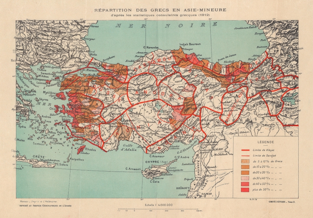
Repartition des Grecs en Asie-Mineure d'apres les statistiques consulaires grecques (1912).
sold
- Digital Map Information
- Suitable for large format printing
- File Size: 282.54 MB
- File Type: ZIP / TIFF
- ICC color profile embedded
- Delivered instantly via download link
This is a 1919 Service Géographique de l'Armée map of Turkey illustrating Greek populations throughout Anatolia. This piece visualizes Greek influence on the Turkish state in the wake of World War I (1914 - 1918). (more details)