
Schenk, Petrus

Petrus Schenk (Pieter Schenck) the Elder (December 26, 1660 - 1711) was a Dutch engraver, globe maker, and map publisher active in Amsterdam and Leipzig in the latter half of the 17th century. Schenk, was born in Elberfield, Germany. He moved in Amsterdam in 1675, becoming the apprentice to Gerard Valk (Valck). In 1687, Schenk married Agatha Valk, Gerard Valk's sister and went into partnership with his brother-in-law under the imprint of 'Valk and Schenk'. Initially they focused on maps and atlases, acquiring the map plates of Jan Jansson and Jodocus Hondius in 1694. Later, in 1701 they moved into the former Hondius offices where they began producing globes. Valk and Schenk quickly became known for producing the best globes in the Netherlands, a business on which they held a near monopoly for nearly 50 years. Schenk's three sons, Pieter Schenk the Younger, Jan Schenk, and Leonard Schenk, all became engravers in their own right. Pieter Schenk the Younger inherited the business and ran his father's shop in Leipzig. His daughter, Maria Schenk, married Leonard Valk, the son of Gerard Valk, and continued to run the Valk and Schenk map engraving workshop in Amsterdam.
The dominant 17th century depiction of the American Southeast.
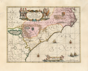
Virginiae Partis australis, et Floridae partis orientalis, interjacentiumque regionum Nova Descriptio.
$1,800.00
Acquire
- Digital Map Information
- Suitable for large format printing
- Full resolution TIFF file
- ICC color profile embedded
- Delivered instantly via download link
This is Jan Jansson's beautiful map of Virginia and Florida, engraved in 1639, appearing here in an attractive example of its c. 1694 restrike under the imprint of Gerard Valk and Peter Schenk. This classic Dutch map, encompassing the Carolinas and what would become Georgia and part of Florida, was derived from that of Willem Blaeu, which has been called 'the most correct map of this area yet to appear' (Cumming). Blaeu's map was sufficiently authoritative for Jansson to make an extremely faithful copy. Both cartographers' maps would have a long print life. (more details)
Earliest Acquirable Map showing the True Source of the Blue Nile.
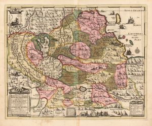
Jobi Ludolfi Habessinia Seu Abassia Presbyteri Johannis Regio perperam dicta...
$950.00
Acquire
- Digital Map Information
- Suitable for large format printing
- DPI: 600
- File Size: 66.6 MB
- File Type: ZIP / TIFF
- ICC color profile embedded
- Delivered instantly via download link
This is Job Ludolf's 1683 map of Ethiopia, the first generally acquirable map focusing on the headwaters of the Blue Nile, as well as the most influential - being copied by De Fer, Coronelli, and others well into the eighteenth century. The present example is the Valk and Schenk edition, in handsome original color. (more details)
An incredible map of Peru clearly showing the unknown of the Amazon region.
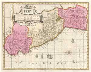
Peru.
$400.00
Acquire
- Digital Map Information
- Suitable for large format printing
- DPI: 300
- File Size: 8.73 MB
- File Type: ZIP / TIFF
- ICC color profile embedded
- Delivered instantly via download link
This is a c. 1700 Pieter Schenk and Gerard Valk map of Peru. The map, oriented towards the east, depicts the region from Los Pastos to Val Xuxuy and from an area east of Peru along the Omapalchas River and home to the Marquires and Cheriabonas Indians to the ... (more details)
Copernicus Centers the Sun.
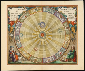
Planisphaerium Copernicanum Sive Systema Universi Totius Creati Ex Hypothesi Copernicana in Plano Exhibitum.
$4,500.00
Acquire
- Digital Map Information
- Suitable for large format printing
- File Size: 27.24 MB
- File Type: ZIP / TIFF
- ICC color profile embedded
- Delivered instantly via download link
This beautiful work is Andreas Cellarius' celestial chart, in its 1708 Valk and Schenk edition, illustrating the solar system theorized by Nicolaus Copernicus in the 16th century. It is among the most vivid and unambiguous depictions of the heliocentric solar system produced in the 17th century. (more details)
Visualizing the Celestial Sphere.

Situs Terrae Circulis Coelestibus Circundatae.
$1,800.00
Acquire
- Digital Map Information
- Suitable for large format printing
- DPI: 600
- File Size: 62.91 MB
- File Type: ZIP / TIFF
- ICC color profile embedded
- Delivered instantly via download link
This beautiful work is Andreas Cellarius' celestial chart, in its 1708 Valk and Schenk edition, illustrating the position of the Earth within the celestial sphere divided into its circles. Its lush, baroque presentation - filled with clouds, putti, and muses - frames a useful visual glossary illustrating terminology important both to the astronomer and to the geographer. (more details)
De l'Isle's State-of-the-art cartography in a Dutch edition.
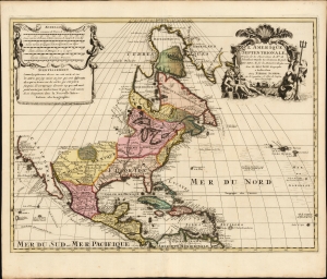
L' Amerique Septentrionale, Dressée sur les Observations de Mrs. de l'Academie Royale des Sciences, et quelques autres, et sur les Memoires les plus recens Par G. De l'Isle Geographe. a Amsterdam chez Pierre Schenk sur le vygendam, a l' Atlas de Sanson. Avec Privilege 1708.
$1,500.00
Acquire
- Digital Map Information
- Suitable for large format printing
- File Size: 22.52 MB
- File Type: ZIP / TIFF
- ICC color profile embedded
- Delivered instantly via download link
A truly beautiful original color example of Peter Schenk's 1708 edition of De L'Isle's foundational 1700 map of North America. Although derivative of De L'Isle, the map is richly decorative with a wealth of intriguing cartographic anomalies and tidbits. (more details)
A beautiful early 18th century map of Asia Minor.
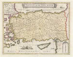
Natolia, quae olim Asia Minor.
$550.00
Acquire
- Digital Map Information
- Suitable for large format printing
- DPI: 300
- File Size: 10.72 MB
- File Type: ZIP / TIFF
- ICC color profile embedded
- Delivered instantly via download link
This is an attractive c. 1708 map of Turkey or Asia Minor. Issued by Petrus Schenk and Gerard Valk, it was engraved in 1636 by Henry Hondius, based on the 1634 map by Johannes Blaeu. The map depicts the region from the Aegean Sea and some of the Aegean ... (more details)
Trading centers on Borneo.
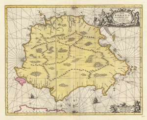
Insula BORNEO et occidentalis pars CELEBIS cum adjacentibus Infulis.
$1,300.00
Acquire
- Digital Map Information
- Suitable for large format printing
- DPI: 300
- File Size: 9.53 MB
- File Type: ZIP / TIFF
- ICC color profile embedded
- Delivered instantly via download link
A stunning full-color c. 1710 map of Borneo by Gerard Valk and Petrus Schenk under the imprint of Valk and Schenk. The map reflects tenuous knowledge of the island in the early days of VOC activity in the region. (more details)
Dutch interest in Sumatra and Malaya.
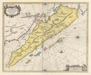
Sumatrae et Insularum Locorum que Nonnull Orum Circumiacentium Tabula Noua.
$1,300.00
Acquire
- Digital Map Information
- Suitable for large format printing
- DPI: 300
- File Size: 9.55 MB
- File Type: ZIP / TIFF
- ICC color profile embedded
- Delivered instantly via download link
A stunning full-color c. 1710 map of Sumatra, Malay, the straits of Malacca, and Singapore by Gerard Valk and Petrus Schenk under the imprint of Valk and Schenk. (more details)
First truly American flag - in RED!
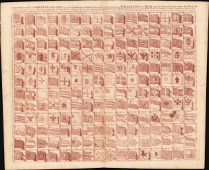
Schouw-park aller Scheeps-Vlaggen des geheelen Water-Waerelds... / Tableau des Pavillons de Mer, qui se trouvent dans tous les lieux du Monde Aquatique Augmente de 50 aui n ont jamais ete mis en lumiere... 1711.
$2,000.00
Acquire
- Digital Map Information
- Suitable for large format printing
- DPI: 600
- File Size: 72.75 MB
- File Type: ZIP / TIFF
- ICC color profile embedded
- Delivered instantly via download link
A vexillological wonder, this is the 1711 Pieter Schenk flag chart, here printed in unusual burgundy ink. In addition to its unusual color, this chart is significant for its inclusion of the ephemeral Globe Flag of New England (upper right corner). It also includes the flags of various trading companies, including the Dutch East India Company (VOC, Verenigde Oostindische Compagnie) and the Dutch West India Company (WIC, Geoctroyeerde Westindische Compagnie). (more details)