
Maps of the Hyderabad and Golconda Districts of Telangana, India, home to the famous historical Golconda diamond market.
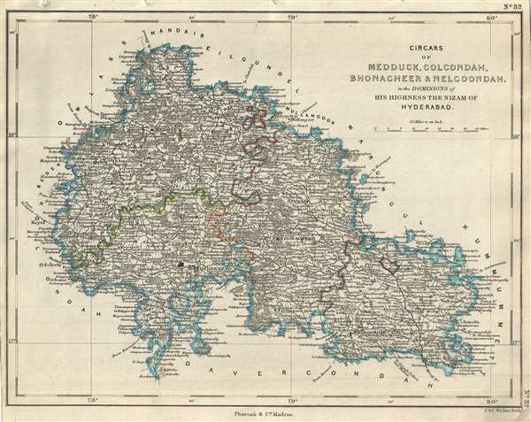
Circars of Medduck, Golcondah, Bhonagheer and Nelgoondah in the Dominions of His Highness the Nizam of Hyderabad.
sold
- Digital Map Information
- Suitable for large format printing
- DPI: 300
- File Size: 3.62 MB
- File Type: ZIP / TIFF
- ICC color profile embedded
- Delivered instantly via download link
This is a nice 1854 map issued by Pharoah and Company depicting the Circars or Sarkars of Medak, Golconda, Bhuvanagiri or Bhongir and Nalgonda. The map covers the modern day districts of Hyderabad, Sangareddy, Nalgonda and part of the Warangal and Ranga Reddy ... (more details)
Map of part of the Indian state of Karnataka under the dominion of the Nizam of Hyderabad.
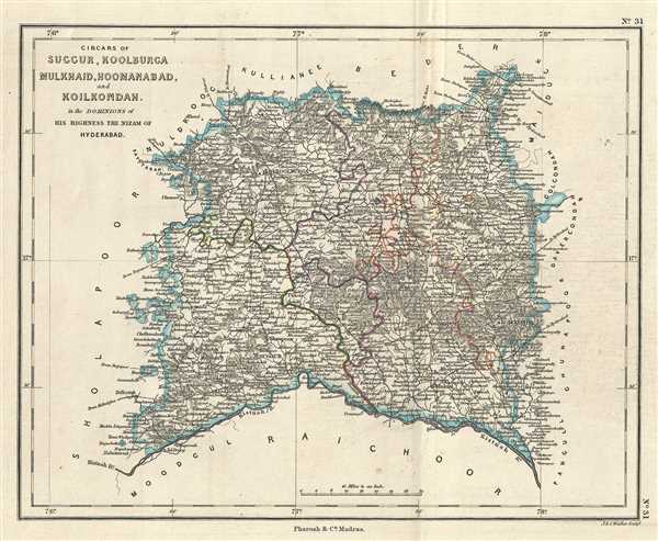
Circars of Suggur, Koolburga Mulkhaid, Hoomanabad, and Koilkondah in the Dominions of His Highness the Nizam of Hyderabad.
sold
- Digital Map Information
- Suitable for large format printing
- DPI: 300
- File Size: 3.39 MB
- File Type: ZIP / TIFF
- ICC color profile embedded
- Delivered instantly via download link
This is a lovely example of the 1854 Pharoah and Company map of the Circars of Suggur, Koolburga, Mulkhaid, Hoomanabad and Koilkondah under the Nizam of Hyderabad. The map covers the modern day districts of Gulbarga and Yadgir in the Indian state of Karnataka ... (more details)
19th century map of the princely state of Hyderabad during British rule.
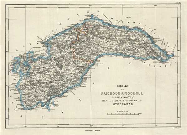
Circars of Raichoor and Moodgul in the Dominions of His Highness The Nizam of Hyderabad.
$250.00
Acquire
- Digital Map Information
- Suitable for large format printing
- DPI: 300
- File Size: 3.22 MB
- File Type: ZIP / TIFF
- ICC color profile embedded
- Delivered instantly via download link
This is a nice 1854 map of the Circars or Sarkars of Raichur and Mudgul under the Nizam of Hyderabad issued by Pharoah and Company. It covers what are today the Raichur and Koppal districts in the Indian state of Karnataka and part of the Mahbubnagar district ... (more details)
19th century map of the princely state of Hyderabad during British rule.
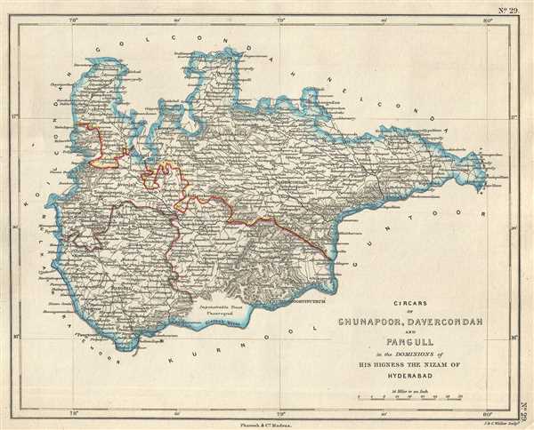
Circars of Ghunapoor, Davercondah and Pangull in the Dominion of His Highness the Nizam of Hyderabad.
$250.00
Acquire
- Digital Map Information
- Suitable for large format printing
- DPI: 300
- File Size: 2.67 MB
- File Type: ZIP / TIFF
- ICC color profile embedded
- Delivered instantly via download link
This is an uncommon 1854 Pharoah and Company map of the Circars or Sarkars of Ghunapoor, Davercondah and Pangull under the Nizam of Hyderabad. The map covers what is today part of the Districts of Nalgonda and Mahbubnagar in the Indian state of Telangana. The ... (more details)
Map of the Khammam province of the princely state of Hyderabad, India.
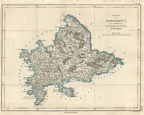
Circar of Kummummett in the Dominions of His Highness The Nizam of Hyderabad.
$250.00
Acquire
- Digital Map Information
- Suitable for large format printing
- DPI: 300
- File Size: 2.57 MB
- File Type: ZIP / TIFF
- ICC color profile embedded
- Delivered instantly via download link
This is an uncommon 1854 map of the Kummummet or Khammam Circar of the Nizam of Hyderabad. The map covers what is today the modern district of Khammam in the Indian state of Telangana from Kondapalli, Andhra Pradesh to Educberlapalle, Telangana. Notes ... (more details)
Map of the Ganjam District, part of British India's Madras Presidency.
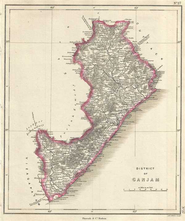
District of Ganjam.
$250.00
Acquire
- Digital Map Information
- Suitable for large format printing
- DPI: 300
- File Size: 2.95 MB
- File Type: ZIP / TIFF
- ICC color profile embedded
- Delivered instantly via download link
This is an unusual 1854 map of the Ganjam District (modern day Ganjam District and Srikakulam District in Odisha and Andhra Pradesh), India. It extends from the Chilika Lake south to Srikakulam or Chicacole. The map notes important towns, rivers, ... (more details)
Early map of the Visakhapatnam District under British Rule.
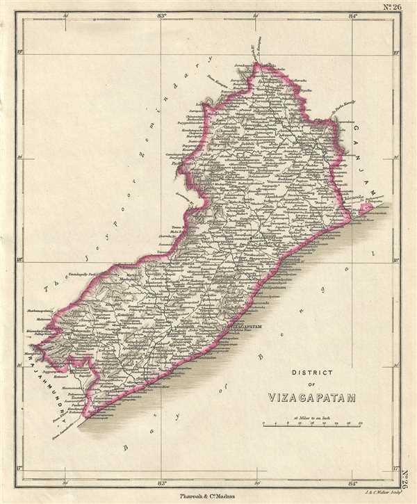
District of Vizagapatam.
sold
- Digital Map Information
- Suitable for large format printing
- DPI: 300
- File Size: 2.32 MB
- File Type: ZIP / TIFF
- ICC color profile embedded
- Delivered instantly via download link
This is a beautiful 1854 map of the Vizagapatam or Visakhapatnam District in Andhra Pradesh, India. The map extends from Parvathipuram to Tuni and the Rajahmundry District. Notes important towns, rivers, roads, and topography. At the time this map ... (more details)
Map of the East Godavari and West Godavari Districts on India.
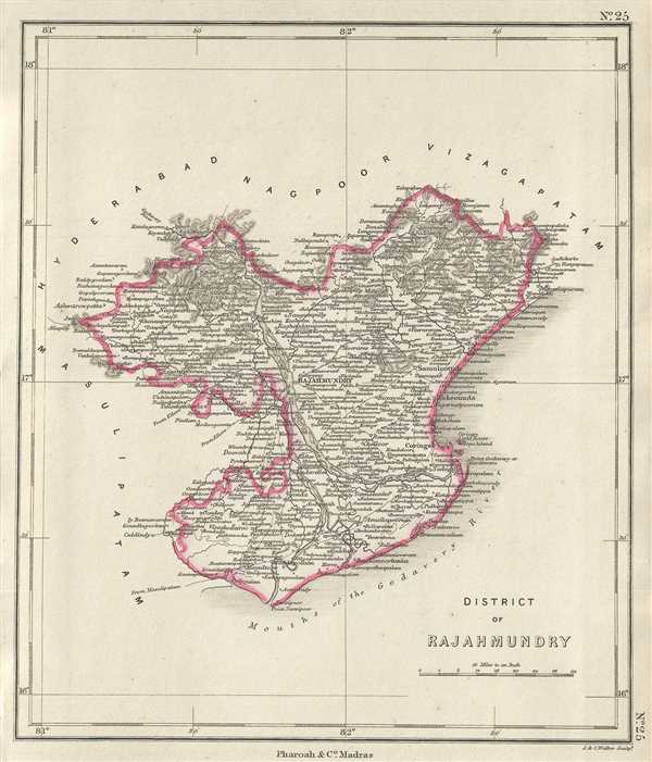
District of Rajahmundry.
sold
- Digital Map Information
- Suitable for large format printing
- DPI: 300
- File Size: 2.52 MB
- File Type: ZIP / TIFF
- ICC color profile embedded
- Delivered instantly via download link
This is an example of the 1854 Pharoah and Company map of the Rajahmundry District or modern day East Godavari District in the southern Indian state of Andhra Pradesh. The map extends from Antervedi north to Kolluru and notes important towns, ... (more details)
Early map of the Krishna District in Andhra Pradesh, India - The first headquarters of the British in India.
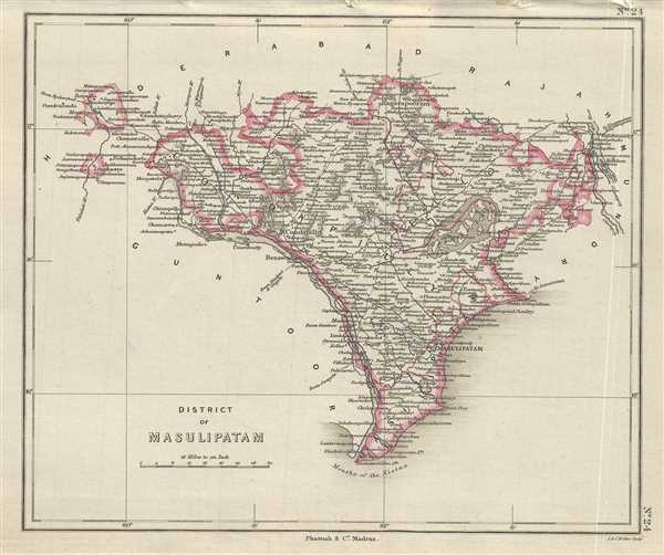
District of Masulipatam.
sold
- Digital Map Information
- Suitable for large format printing
- DPI: 300
- File Size: 2.4 MB
- File Type: ZIP / TIFF
- ICC color profile embedded
- Delivered instantly via download link
This is a nice example of Pharoah and Company’s 1854 map of the Masulipatam or Krishna District on Andhra Pradesh, India. It covers from the mouth of the Krishna River north to the Godavari River and Raghavapuram and notes important towns, ... (more details)
Early map of Guntur, India where Helium was first detected and where The Buddha first performed the Kalachakra ceremony.
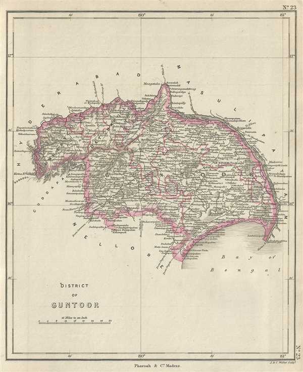
District of Guntoor.
sold
- Digital Map Information
- Suitable for large format printing
- Full resolution TIFF file
- ICC color profile embedded
- Delivered instantly via download link
This is a lovely example of the 1854 Pharoah and Company map of the Guntur District in the Indian state of Andhra Pradesh. The map covers the district from Chinnaganjam north along the Krishna River and west as far as Kurnool. At the time ... (more details)
19th century map of the city of Nagpur, India.

Plan of the City of Nagpoor and part of the British Cantonment of Seetabuldee.
sold
- Digital Map Information
- Suitable for large format printing
- DPI: 300
- File Size: 10.93 MB
- File Type: ZIP / TIFF
- ICC color profile embedded
- Delivered instantly via download link
This is a beautiful 1854 Pharoah and Company map of the city of Nagpur in the Indian state of Maharashtra. It covers the entire city in detail noting streets, gardens, lakes, fields, rivers, palaces, temples, tombs, police stations, ... (more details)
Map featuring important manuscript annotations regarding the parceling of Colonial land concessions in the French Congo.
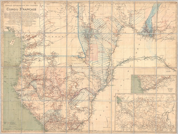
Service Géographique des Colonies Congo Français.
sold
- Digital Map Information
- Suitable for large format printing
- File Size: 51.15 MB
- File Type: ZIP / TIFF
- ICC color profile embedded
- Delivered instantly via download link
An extremely rare large format map of the French Congo (Congo Français) issued by Jules-André-Arthur Hansen in 1895 with important manuscript annotations relating to the 1899 divvying of the colony into land grants and ... (more details)
Rare first edition of Lahontan's highly influential map of the supposedly apocryphal Riviere Longue (Missouri River?)

Carte que les Gnacsitares ont Dessine sur / Carte de la Riviere Longue et de quelques Autres qui se Dechargent dans le Grand Fleuve Missisipi.
sold
- Digital Map Information
- Suitable for large format printing
- DPI: 300
- File Size: 8.32 MB
- File Type: ZIP / TIFF
- ICC color profile embedded
- Delivered instantly via download link
A foundational map of extreme importance and influence, this is the rare 1703 first edition of Baron Louis-Armand de Lom d'Arce de Lahontan's, seminal map of the westernmost Great Lakes, the Mississippi River, and an ... (more details)
One of the iconic maps of the golden age of Pictorial Maps.

A Map and History of Peiping; formerly known as Peking; capital of provinces, princedoms, and kingdoms since 1121 B.C.; in 1264 A.D. the capital of the Mongol Empire of Kublai Khan; made the capital of the Ming Empire and built as it is today by Yung Lo in 1421; continued as the capital of the Chinese Empire through the Ming and Ching Dynasties; and now a city which will live long in the memory of man as one of the greatest the world has ever known. Completed on this fifth day of February in the year of our Lord Nineteen Hundred and Thirty-six.
sold
- Digital Map Information
- Suitable for large format printing
- File Size: 35.52 MB
- File Type: ZIP / TIFF
- ICC color profile embedded
- Delivered instantly via download link
An example of Frank Dorn's iconic 1936 chromolithograph pictorial map of Beijing or Peking, China. It is considered one of the great maps from the Golden Age of Pictorial Cartography. The map captures Beijing in the days leading up to World War II (1939 - 1945) - though by this time, China was already at odds with Japan, and the Second Sino-Japanese War (1937 - 1945), a precursor to WWII in Asia, was brewing. (more details)
Scarce nautical chart illustrating the Thames Entrance and Estuary.
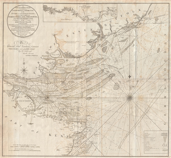
A new and correct chart extending from London Bridge to Orford Ness on the Essex and Suffolk coast & from the Nore to the North Foreland, the Downs, and South Foreland on the Kentish coast : comprehending the Swin and King's Channel, with the Wallet, Harwich Harbour, and Horsley Bay, to Aldborough Knapes, also the Five Fathom and South Channels, with the Oaze Deeps, Nubs & Queen's Channel, Kentish Knock &c., &c. By George Burn and several other masters & pilots in the Royal Navy.
sold
- Digital Map Information
- Suitable for large format printing
- DPI: 300
- File Size: 44.03 MB
- File Type: ZIP / TIFF
- ICC color profile embedded
- Delivered instantly via download link
An impressive 1800 George Burn large format nautical chart or maritime map of the entrance to the Thames River, England. The map covers parts of Kent, Essex, and Suffolk. It details the Entrance to the Thames River ... (more details)
Stunning Art Deco Map of Paris.

Nouveau Paris Monumental Inineraire Pratique de L'Etranger Dans Paris.
sold
- Digital Map Information
- Suitable for large format printing
- File Size: 21.28 MB
- File Type: ZIP / TIFF
- ICC color profile embedded
- Delivered instantly via download link
An iconic c. 1916 tourist pocket map of Paris, France. Presented as a same field birds-eye view, this map centers on the Seine River, and covers the embastilled heart of modern Paris. Although ostensibly designed ... (more details)
Attractive 19th century map of southern Manhattan showing city wards.

Plan of New York & c.
sold
- Digital Map Information
- Suitable for large format printing
- Full resolution TIFF file
- ICC color profile embedded
- Delivered instantly via download link
This is a beautiful example of S. A. Mitchell Junior's 1864 map of New York City. The map depicts southern Manhattan, below 45th street, along with parts of Brooklyn, Williamsburg, Greenpoint, Hoboken, and Jersey ... (more details)
19th century map of the Kadapa district in the Indian state of Andhra Pradesh.
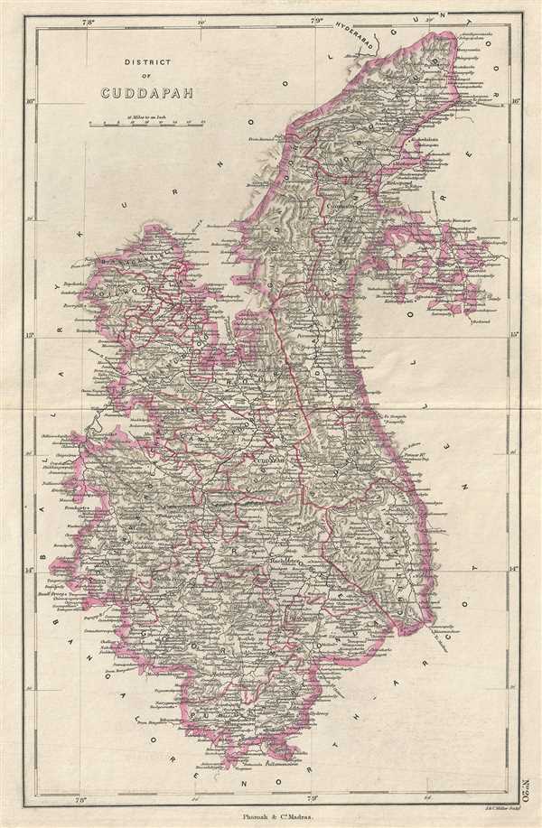
District of Cuddapah.
sold
- Digital Map Information
- Suitable for large format printing
- DPI: 300
- File Size: 4.52 MB
- File Type: ZIP / TIFF
- ICC color profile embedded
- Delivered instantly via download link
This is a nice example of the 1854 Pharoah and Company map of the Kadapa district of Andhra Pradesh, India. The map extends from Punganur northward past Markapur. Notes important towns, roads, lakes, rivers, and ... (more details)
Pharoah and company map of the Kurnool district in the Indian state of Andhra Pradesh.
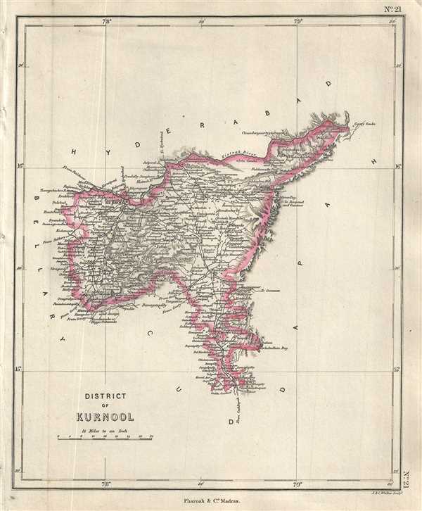
District of Kurnool.
$250.00
Acquire
- Digital Map Information
- Suitable for large format printing
- DPI: 300
- File Size: 2.24 MB
- File Type: ZIP / TIFF
- ICC color profile embedded
- Delivered instantly via download link
This is a lovely 1854 Pharoah and Company map of the Kurnool District of Andhra Pradesh, India. It extends from the Krishna River south to the Lankamalla reserved forest. Kurnool city is identified. The map ... (more details)
19th century map of South Canara or Dakshina Kannada in Karnataka, India.

District of South Canara.
sold
- Digital Map Information
- Suitable for large format printing
- DPI: 300
- File Size: 2.44 MB
- File Type: ZIP / TIFF
- ICC color profile embedded
- Delivered instantly via download link
This is an uncommon 1854 map of the District of South Canara or Dakshina Kannada in Karnataka, India issued by the Pharoah and Company. It extends from Kundapur south Payyanur. Mangalore city is identified. ... (more details)