

Environs of Foo-Chow.
sold
- Digital Map Information
- Suitable for large format printing
- Full resolution TIFF file
- ICC color profile embedded
- Delivered instantly via download link
A beautiful 1924 map of Foo-Chow or Fuzhou and its environs by the Imperial Japanese Government Railways. The map covers Fuzhou, the capital and largest city in the Fujian province, and its vicinity in great detail, noting streets, rivers, islands, towns, and ... (more details)

Swatow.
sold
- Digital Map Information
- Suitable for large format printing
- Full resolution TIFF file
- ICC color profile embedded
- Delivered instantly via download link
This is a beautiful 1924 railway map of Shantou or Swatow or Suatao, in the Guangdong Province of China, issued by the Imperial Japanese Government Railways. The map depicts in great detail, streets, individual buildings, rivers, railways, and other ... (more details)

Environs of Amoy.
sold
- Digital Map Information
- Suitable for large format printing
- Full resolution TIFF file
- ICC color profile embedded
- Delivered instantly via download link
A beautiful 1924 map of the environs of Amoy or Xiamen, located on the southeast coast of China, by the Imperial Japanese Government Railways. The map covers Amoy and its vicinity in great detail. Notes several towns, islands, rivers, railway lines ... (more details)
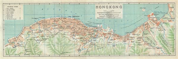
Hong Kong.
sold
- Digital Map Information
- Suitable for large format printing
- Full resolution TIFF file
- ICC color profile embedded
- Delivered instantly via download link
This is a beautiful 1924 map of Hong Kong by the Imperial Japanese Government Railways. The map covers the northern part of Hong Kong Island, including Central, Wan Chai and Victoria. This highly detailed map notes streets, individual buildings, ... (more details)
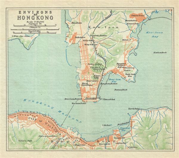
Environs of Hong Kong.
sold
- Digital Map Information
- Suitable for large format printing
- Full resolution TIFF file
- ICC color profile embedded
- Delivered instantly via download link
This is a scarce 1924 map of Hong Kong and environs issued by the Imperial Japanese Government Railway. It covers the northern portion of Hong Kong Island including Wan Chai, Central and Victoria as well as Kowloon, noting individual streets, ... (more details)
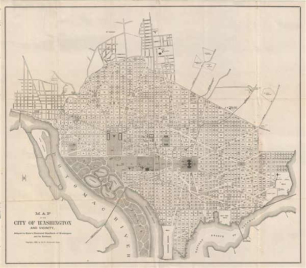
Map of the City of Washington and Vicinity.
sold
- Digital Map Information
- Suitable for large format printing
- Full resolution TIFF file
- ICC color profile embedded
- Delivered instantly via download link
This is a fine 1888 map or plan of Washington D.C. by De B. Randolph Keim. Centered on the National Mall, it covers from the Washington Barracks to Mt. Pleasant and from Arlington Cemetery to Congress Cemetery. The map offers a fascinating ... (more details)

Design for the Arrangement of Pedestrian Concourse.
sold
- Digital Map Information
- Suitable for large format printing
- Full resolution TIFF file
- ICC color profile embedded
- Delivered instantly via download link
This is a rare 1871 example Vaux & Olmsted's map of part of Prospect Park, Brooklyn. His map focuses on the section of Prospect Park now occupied by Wollman Rink and the adjacent Concert Grove. Pathways, individual trees, pavilions, boat ... (more details)

Tabula Magellanica, qua Tierrae del Fuego, cum celeberrimis fretis.
sold
- Digital Map Information
- Suitable for large format printing
- DPI: 300
- File Size: 15.09 MB
- File Type: ZIP / TIFF
- ICC color profile embedded
- Delivered instantly via download link
This is a beautiful c.1635 map of the Strait of Magellan and Tierra del Fuego by Willem Blaeu. Centered on the Straits of Magellan, it covers the southern portions of Chile and Tierra del Fuego. The map beautifully renders the ... (more details)

Esquisse du Muskinghum Esquisse des rivieres Muskinghum et Grand Castor.
sold
- Digital Map Information
- Suitable for large format printing
- Full resolution TIFF file
- ICC color profile embedded
- Delivered instantly via download link
This is a scarce 1787 map of the Ohio River region by Pierre Tardieu. Divided into three maps, this is one of the earliest maps of the region. The large map in the left depicts the course of the Ohio River, from the Hockhoking ... (more details)
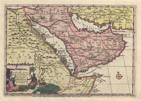
De Roode Zee met de Kusten van Arabien; en het Naauw tussen Aden en Zeila tot aan Bassora.
sold
- Digital Map Information
- Suitable for large format printing
- Full resolution TIFF file
- ICC color profile embedded
- Delivered instantly via download link
This is a very attractive 1707 map of Arabia and Egypt by the Dutch cartographer Pieter Van der Aa. Pieter's (or Pierre) map covers from the Nile delta east as far as the Gulf of Oman and south to include much of modern day ... (more details)
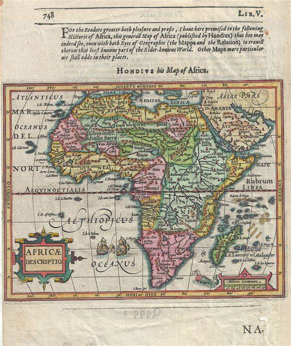
Africae Descriptio.
sold
- Digital Map Information
- Suitable for large format printing
- Full resolution TIFF file
- ICC color profile embedded
- Delivered instantly via download link
This is a beautiful 1625 map of Africa by the Dutch cartographer Jodocus Hondius. It depicts the continent of Africa from the early 17th century perspective. Largely based on earlier Mercator model, this map shows revised ... (more details)
Speculative geography of the Pacific northwest includes the mythical Sea of the West and De Fontes apocryphal discoveries.
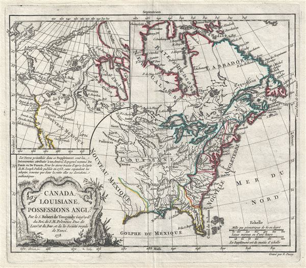
Camada, Louisiane, Possessions Angl?
sold
- Digital Map Information
- Suitable for large format printing
- Full resolution TIFF file
- ICC color profile embedded
- Delivered instantly via download link
A fine example of Robert de Vaugondy's wonderful 1778 map of North America incorporating his speculative or positivist geography of the American northwest. The map covers from the Hudson bay to the Gulf of Mexico and from ... (more details)
Scarce and beautiful map of Washington D.C. drawn for the inauguration of Benjamin Harrison.

Map of the City of Washington with compliments of The Evening Star. Souvenir of March 4th, 1889.
sold
- Digital Map Information
- Suitable for large format printing
- File Size: 10.62 MB
- File Type: ZIP / TIFF
- ICC color profile embedded
- Delivered instantly via download link
A spectacular and scarce 1889 map of Washington D.C. issued for The Evening Star newspaper. The The Evening Star hired the photo-lithography firm of Bell Brothers to produce this appealing map to commentate the ... (more details)
Rare maps showing the legendary Mines of St. Barbe.
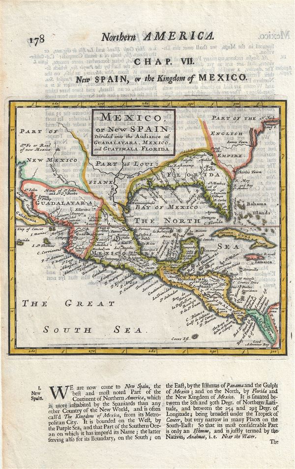
Mexico, or New Spain Divided into the Auddiance of Guadalayara, Mexico, and Guatimala, Florida.
sold
- Digital Map Information
- Suitable for large format printing
- Full resolution TIFF file
- ICC color profile embedded
- Delivered instantly via download link
An uncommon 1701 map by Herman Moll of Mexico, the Gulf Coast, and Florida. Centered on the Gulf Of Mexico (the Bay of Mexico here), this map covers from Baja California to Florida and Cuba, covering in the ... (more details)
Important early map of the English colonies in America.
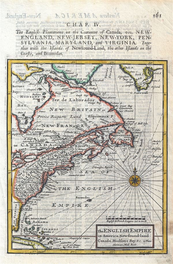
The English Empire in America, Newfound-land, Canada, Hudson Bay etc.
sold
- Digital Map Information
- Suitable for large format printing
- DPI: 300
- File Size: 2.93 MB
- File Type: ZIP / TIFF
- ICC color profile embedded
- Delivered instantly via download link
This is a fascinatine 1701 map of the English possessions in North America by Herman Moll. The map extends from Cuba north to Davies Strait and southern Greenland and covers the eastern portion of the ... (more details)
Shows Insular California.
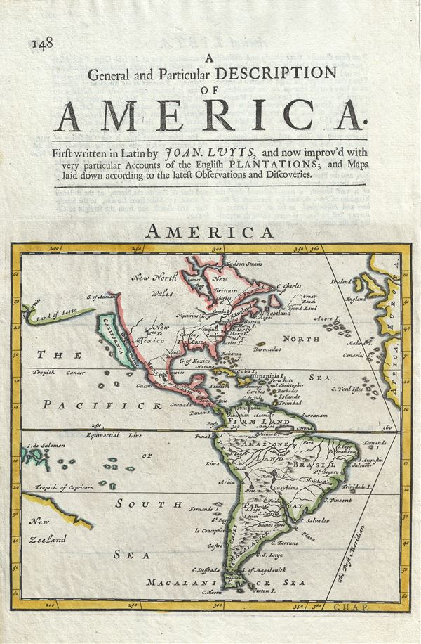
America.
sold
- Digital Map Information
- Suitable for large format printing
- Full resolution TIFF file
- ICC color profile embedded
- Delivered instantly via download link
This is a scarse 1701 map of North America and South America by Herman Moll. Centered on the American continent, this map covers from the Arctic Circle to Tierra del Fuego. The map features much of ... (more details)
Shows Insular California.
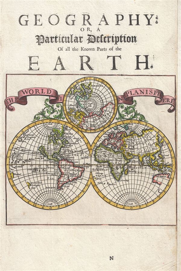
The World in Planisphere.
sold
- Digital Map Information
- Suitable for large format printing
- DPI: 300
- File Size: 3.26 MB
- File Type: ZIP / TIFF
- ICC color profile embedded
- Delivered instantly via download link
This is a scarce 1701 map of the world in hemispheres by Herman Moll. It depicts the world on a hemispheric projection and the map of the northern hemisphere with polar projection centered on the ... (more details)
The most important and influential 18th century Colonial Era map of New England.
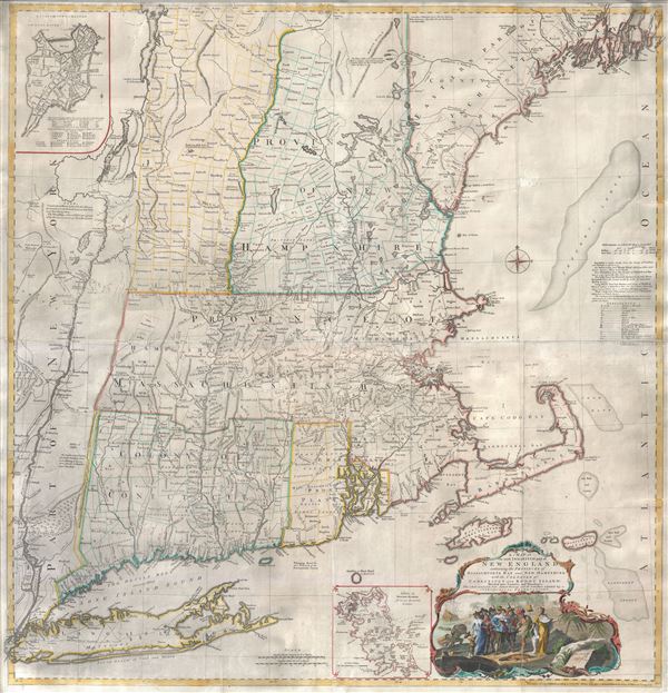
A Map of the most Inhabited part of New England containing the Provinces of Massachusets Bay and New Hampshire, with the Colonies of Connecticut and Rhode Island, divided into Counties and Townships: The whole composed form Actual Surveys and its Situation adjusted by Astronomical Observations.
sold
- Digital Map Information
- Suitable for large format printing
- Full resolution TIFF file
- ICC color profile embedded
- Delivered instantly via download link
A highly significant map, this is the 1774 'Jefferys' Map' of the Most Inhabited Part of New england . Centered on the Massachusetts Bay Colony, this map covers from Long Island to Lake Champlain ... (more details)

Peru and the Amazones Country.
sold
- Digital Map Information
- Suitable for large format printing
- Full resolution TIFF file
- ICC color profile embedded
- Delivered instantly via download link
This is a fine 1701 map of Peru, Bolivia, Brazil and Ecuador by Herman Moll. It covers the western parts of South America from the mouth of the Amazon south to Chile. Includes the modern day ... (more details)
Notes the mythical city of Manoa, supposed location of El Dorado.
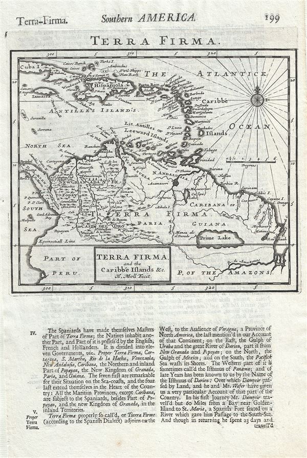
Terra Firma and the Caribbe Islands etc.
sold
- Digital Map Information
- Suitable for large format printing
- Full resolution TIFF file
- ICC color profile embedded
- Delivered instantly via download link
This is a scarce 1701 map of the West Indies and northern South America by Herman Moll. It covers from Cuba south as far as the Amazon River. Includes the modern day nations of Colombia, ... (more details)