
Hondius, Jodocus
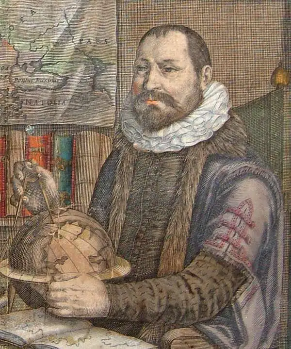
Jodocus Hondius (October, 14 1563 - February 12, 1612) was an important Dutch cartographer active in the late 16th and early 17th centuries. His common name, Jodocus Hondius, is actually a Latinized version of his Dutch name, Joost de Hondt. He is also sometimes referred to as Jodocus Hondius the Elder to distinguish him from his sons. Hondius was a Flemish artist, engraver, and cartographer. He is best known for his early maps of the New World and Europe, for re-establishing the reputation of Gerard Mercator, and for his portraits of Francis Drake. Hondius was born and raised in Ghent. In his early years, he established himself as an engraver, instrument maker, and globe maker. In 1584, he moved to London to escape religious difficulties in Flanders. During his stay in England, Hondius was instrumental in publicizing the work of Francis Drake, who had circumnavigated the world in the late 1570s. In particular, in 1589, Hondius produced a now-famous map of the cove of New Albion, where Drake briefly established a settlement on the west coast of North America. Hondius' map was based on journals and eyewitness accounts of the trip and has long fueled speculation about the precise location of Drake's landing, which historians have not yet firmly established. Hondius is also thought to be the artist of several well-known portraits of Drake, now in the National Portrait Gallery in London. In 1593, Hondius returned to Amsterdam, where he remained until his death. In 1604, he purchased the plates of Gerard Mercator's Atlas from Mercator's grandson. Mercator's work had languished in comparison to Ortelius' rival atlas, Theatrum Orbis Terrarum. Hondius republished Mercator's work, adding 36 additional maps, including several he himself produced. Despite adding his own contributions, Hondius, recognizing the prestige of Mercator's name, gave Mercator full credit as the author, listing himself as the publisher. Hondius's new edition of Mercator revived the great cartographer's reputation and was a great success, selling out after a year. Hondius later published a second edition, as well as a pocket version called the Atlas Minor. The maps have since become known as the 'Mercator/Hondius series'. Between 1605 and 1610, Hondius was employed by John Speed to engrave the plates for Speed's The Theatre of the Empire of Great Britaine. Following Hondius' death in 1612, his publishing work in Amsterdam was continued by his widow and two sons, Jodocus II and Henricus. Later, his family formed a partnership with Jan Jansson, whose name appears on the Atlasas co-publisher after 1633. Starting with the 1606 Latin edition, about 50 editions of the Atlas were published in the main European languages. In the Islamic world, the atlas was partially translated by the Turkish scholar Katip Çelebi. The series is sometimes called the 'Mercator/Hondius/Jansson' series because of Jansson's later contributions. Hondius is credited with several important cartographic innovations, including the introduction of decorative map borders and contributions to the evolution of 17th-century Dutch wall maps. Hondius's work was essential to Amsterdam's establishment as the center of cartography in Europe in the 17th century.
Earliest Detailed Mapping of the Bernese Alps.
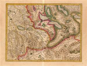
[Bernese Alps and the Swiss Lake District]
$450.00
Acquire
- Digital Map Information
- Suitable for large format printing
- DPI: 600
- File Size: 22.15 MB
- File Type: ZIP / TIFF
- ICC color profile embedded
- Delivered instantly via download link
This is Gerard Mercator's 1585 map of the Bernese Oberland and the Lake District of central Switzerland, in a warmly-colored Hondius edition. It is the earliest acquirable map to detail this specific region and is the earliest derivative of Thomas Schöpf's groundbreaking 1578 map of the Canton of Bern. It is the only acquirable early map of the Bernese Alps to name multiple peaks. (more details)
Modeling the Mapping of Switzerland for Two Centuries
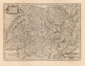
Helvetia cum finitimis regionibus confederatis.
$700.00
Acquire
- Digital Map Information
- Suitable for large format printing
- DPI: 600
- File Size: 45.8 MB
- File Type: ZIP / TIFF
- ICC color profile embedded
- Delivered instantly via download link
This is Gerard Mercator's 1585 map of Switzerland, the second map of the Confederation to appear in a modern atlas. It sharply improves upon its precursor, by Ortelius, both in overall delineation and detail. (more details)
Early edition of the most accurate map of Scandinavia of its day.
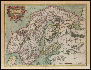
Suecia Et Norvegia cum confinijs.
$1,750.00
Acquire
- Digital Map Information
- Suitable for large format printing
- File Size: 21.56 MB
- File Type: ZIP / TIFF
- ICC color profile embedded
- Delivered instantly via download link
An attractive example of Gerard Mercator's 1595 map of Scandinavia, in its first French atlas edition of 1609. Among the maps of the northern parts of Europe produced in the sixteenth century, this is the first to focus narrowly on Scandinavia. Ginsberg, typically laconic in praise, notes that the map 'gave the Scandinavian peninsula its correct form' and 'became the model for nearly all subsequent maps of Scandinavia.' This basic model would stand until supplanted in the mid-17th century by the work of Anders Bure. (more details)
Holy Grail Map - 1st Map of the North Pole.
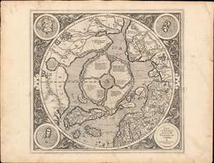
Septentrionalium Terrarum descriptio.
$30,000.00
Acquire
- Digital Map Information
- Suitable for large format printing
- Full resolution TIFF file
- ICC color profile embedded
- Delivered instantly via download link
This is the first edition, first state of Gerard Mercator's seminal 1595 map of the Arctic, the great cartographer's most interesting and important atlas map. In this first edition, it is the scarcest of Mercator's atlas maps and a holy grail for any Arctic collector. For all its flaws and inaccuracies, it is a schematized interpretation of factual voyages between Norway, England, Iceland, Greenland, and Labrador (Markland). (more details)
One of the earliest maps of Lake Geneva based on local knowledge.
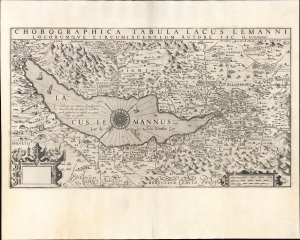
Chorographica Tabula Lacus Lemanni Locorumque Circumiacentium Auctore Iac. G. Genevensi.
$850.00
Acquire
- Digital Map Information
- Suitable for large format printing
- Full resolution TIFF file
- ICC color profile embedded
- Delivered instantly via download link
An uncommon and beautiful map of Lake Geneva engraved by Jodocus Hondius for his 1606 edition of the Mercator Atlas. It is one of the best-detailed maps of the region based on firsthand description, derived from the manuscript map of native Jacques Goulart. (more details)
Imaginary Cartography Meets Actual Exploration.
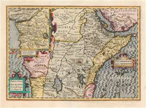
Abissinorum Sive Pretiosi Ioannis Imperiū.
$750.00
Acquire
- Digital Map Information
- Suitable for large format printing
- Full resolution TIFF file
- ICC color profile embedded
- Delivered instantly via download link
This is the 1606 Jodocus Hondius map of Abyssinia or East Africa, showing the headwaters of the Nile, as assumed in antiquity. The region thus depicted encompasses the apocryphal Christian Empire of Prester John. This example is from the first French text edition of the Mercator / Hondius atlas, dating to 1609. Hondius has drawn heavily on what was still the most authoritative take on the mythical kingdom: Abraham Ortelius' 1573 Presbiteri Iohannis, Sive, Abissionrum Imperii Descriptio. (more details)
Key Caribbean islands.
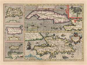
Cuba Insula. / Hispaniola Insula. / Insula Jamaica. / Ins. J. Ioannis. / I.S. Margareta Cum Confiniis.
$1,100.00
Acquire
- Digital Map Information
- Suitable for large format printing
- DPI: 600
- File Size: 67.48 MB
- File Type: ZIP / TIFF
- ICC color profile embedded
- Delivered instantly via download link
This is a superb, original color example of Jodocus Hondius's 1609 map of Cuba and Hispaniola, with inset maps of Jamaica, Puerto Rico, and Margarita Island. It is a beautifully engraving, whose rich detail, ships and sea monsters make it a most desirable work. (more details)
Richly-Engraved Guinea Coast.
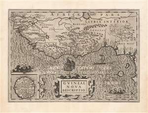
Guineae Nova Descriptio.
$550.00
Acquire
- Digital Map Information
- Suitable for large format printing
- DPI: 600
- File Size: 69.97 MB
- File Type: ZIP / TIFF
- ICC color profile embedded
- Delivered instantly via download link
This is Jodocus Hondius' 1606 map of the Guinea coast of Africa, stretching from the mouth of the Senegal River to Cape Lopez, from modern Senegal to Benin. It shows this coast at a time when its trade was largely controlled by the Portuguese, with whom the Dutch were at war; this map thus presented to a Dutch audience what would have been considered a rich prize to be taken. (more details)
First Hondius Edition.
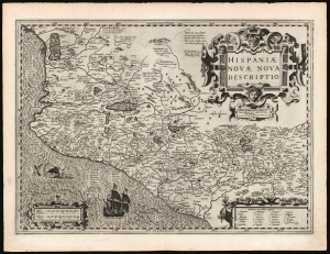
Hispaniae Novae Nova Descriptio.
$750.00
Acquire
- Digital Map Information
- Suitable for large format printing
- DPI: 600
- File Size: 54.48 MB
- File Type: ZIP / TIFF
- ICC color profile embedded
- Delivered instantly via download link
This is a superb, 1606 first edition example of Jodocus Hondius' map of New Spain. It was among the first maps Hondius produced to add to Gerard Mercator's Atlas, which Hondius acquired and contined to publish. Hondius' map is a faithful copy of the 1579 Ortelius map, which was authoritative enough to dominate the mapping of Mexico for more than a century. Hondius' strapwork cartouches reflect the Ortelius as well, but his engraving overall is superior, particularly his characteristic and evocative execution of water areas. Hondius' lettering, too, is more orderly and legible than was Ortelius'. (more details)
A Beautifully Engraved map of Lazio and part of Abruzzo, Italy.
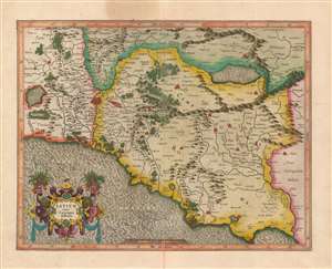
Latium nunc Campagna di Roma.
$850.00
Acquire
- Digital Map Information
- Suitable for large format printing
- Full resolution TIFF file
- ICC color profile embedded
- Delivered instantly via download link
A beautiful, original color example of Gerard Mercator's map of central Italy, focusing on Rome and the Roman Campagna. The superb engraving is the work of Mercator himself, most notable in the water areas, the elegant strapwork cartouche, and the precise Italic lettering. Forests and mountains are shown pictorially. Towns are illustrated with simple marks, although larger cities are shown as clusters of houses heightened in red color. These of course include Rome, but also Ostia, Alba, Palestrina, Formia, Terracina, and others. Also marked in red, to the east of Rome, is one of the ruined Roman aqueducts. Rivers are pictured in detail. (more details)
One of the most decorative early maps of Scotland.
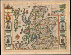
The Kingdome of Scotland.
$1,850.00
Acquire
- Digital Map Information
- Suitable for large format printing
- Full resolution TIFF file
- ICC color profile embedded
- Delivered instantly via download link
This is John Speed's 1676 map of Scotland, the first map of the kingdom published in an English atlas. It was included in Speed's The Theatre of the Empire of Great Britaine, which was the first collection of maps of the counties of the British Isles. The map's engraving is the work of Jodocus Hondius, who engraved many of the plates of Speed's atlases. (The border figures are the work of an unknown engraver.) (more details)
Among the First Maps of Sri Lanka from Contemporary Report.
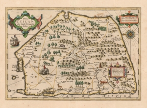
Ins. Ceilan quae incolis Tenarisin dicitur.
$800.00
Acquire
- Digital Map Information
- Suitable for large format printing
- DPI: 600
- File Size: 43.05 MB
- File Type: ZIP / TIFF
- ICC color profile embedded
- Delivered instantly via download link
This is an attractive edition of the 1606 Jodocus Hondius map of Ceylon of Sri Lanka. As one of the maps introduced to Mercator's Atlas after Hondoius acquired the work, it is among the first maps to address the island from first-hand contemporary reports. (more details)
Key Border County Between England and Wales.
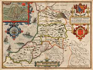
Cardigan Shyre Described with the due forme of the Shiretown as it was surveyed by I.S. Anno 1610.
$750.00
Acquire
- Digital Map Information
- Suitable for large format printing
- Full resolution TIFF file
- ICC color profile embedded
- Delivered instantly via download link
This is John Speed's map of the county of Cardiganshire, Wales. Engraved in 1608, this map was included in a 1627 edition of Speed's The Theatre of the Empire of Great Britaine. While many of Speed's maps were derived from the work of Christopher Saxton, this one was founded on Speed's own surveys. The map is beautifully engraved - this, the work of Jodocus Hondius - and identifies the county's towns, major villages, and its five hundreds of Genau'r-Glyn (Llanbadarn on the map), Ilar (Llanylar), Moyddyn, Penarth and Troedyraur. Rivers are marked and named. The region's mountainous terrain is indicated pictorially, with special emphasis placed on 'Plinillimon Hill' - that is to say, Plynlimon or Pen Pumlumon Fawr, the highest point of the Cambrian Mountains in Wales, and the source of the rivers Severn, Wye and Rheidol. (The headwaters of these rivers are all shown.) (more details)
El Dorado.
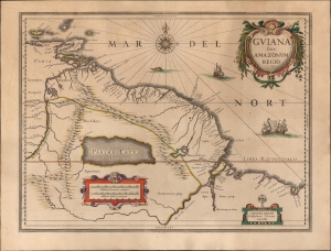
Guiana sive Amazonum Regio.
$750.00
Acquire
- Digital Map Information
- Suitable for large format printing
- Full resolution TIFF file
- ICC color profile embedded
- Delivered instantly via download link
This is an original color example of Willem Blaeu's 1629 map of Guiana in its German Atlas Major edition. The map is noteworthy for its bold depiction of El Dorado and the apocryphal Lake Parima. (more details)
Foundational Map of American Colonization.
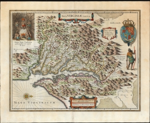
Nova Virginiae Tabula.
$3,000.00
Acquire
- Digital Map Information
- Suitable for large format printing
- Full resolution TIFF file
- ICC color profile embedded
- Delivered instantly via download link
A beautiful example of Henricus Hondius' 1630 map of the Virginia colony and the Chesapeake Bay. Hondius' map is based upon the foundational 1612 John Smith map of the Virginia colony. Smith's fine survey work, combined with reports from indigenous American Indian tribes and wishful thinking, resulted in one of the most essential maps of America to emerge in the 17th century. Philip D. Burden, the author of The Mapping of North America, considers this map to be 'one of the most important maps of America ever produced and certainly one of the greatest influence.' (more details)
Classic Dutch Map of Prussia.
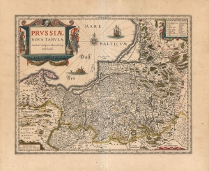
Prussiae Nova Tabula Auctore Gasparo Henneberg Erlichensi.
$650.00
Acquire
- Digital Map Information
- Suitable for large format printing
- DPI: 600
- File Size: 63.08 MB
- File Type: ZIP / TIFF
- ICC color profile embedded
- Delivered instantly via download link
A beautiful, original-color example of Willem Blaeu's map of Prussia, among the maps first added to the Appendix in 1630. It depicts the region now comprised of northern Poland (as far south as Toruń on the Vistula River), the Russian province of Kaliningrad, and western Lithuania. Detail spans from just west of Gdansk to Augustów in the east. The northeast limits of the map are marked with the region of Samogitia, and the Lithuanian coastal town of Palanga. (more details)
'One of the most important maps of America ever produced.' -Burden
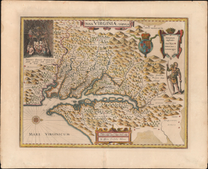
Nova Virginiae Tabula.
$3,000.00
Acquire
- Digital Map Information
- Suitable for large format printing
- Full resolution TIFF file
- ICC color profile embedded
- Delivered instantly via download link
A beautiful, original-color example of Guillaume Blaeu's 1635 map of the Virginia colony and the Chesapeake Bay. The map represents a combination of exceptional cartographic achievement and meaningful wishful thinking - suggesting possible connections to the Pacific from Virginia. (more details)
Insular Korea.
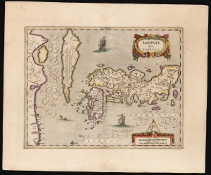
Japoniae nova Descriptio.
$2,500.00
Acquire
- Digital Map Information
- Suitable for large format printing
- Full resolution TIFF file
- ICC color profile embedded
- Delivered instantly via download link
This is a scarce. original-color example of Jan Jansson's map of Japan and Korea, featuring an insular Korea. The map follows the model of Luís Teixeira, the 16th-century court cartographer to the King of Spain. (more details)
Key Border County Between England and Wales.
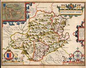
Montgomery shire.
$750.00
Acquire
- Digital Map Information
- Suitable for large format printing
- Full resolution TIFF file
- ICC color profile embedded
- Delivered instantly via download link
This is John Speed's map of the county of Montgomeryshire, Wales. Engraved in 1610, it was included in a 1646 edition of Speed's The Theatre of the Empire of Great Britaine. Speed derived this work from Christopher Saxton's extremely rare 1579 map of the county and added updated detail including the attractive town plan. The map is richly detailed, showing towns, abbeys, castles, forests, and parklands. The countryside's mountainous terrain is shown pictorially. An inset plan in the upper left details the castle and town of Montgomery. In it, a key labels the important streets, locations of the castle itself, and the city's wall (ruined since 1402.) The map includes a beautifully rendered compass rose, and the arms of Phillip Herbert (1584 - 1650). Herbert was the fourth Earl of Pembroke, and a favorite of King James I (1566 - 1625), who made Pembroke the Earl of Montgomery in 1605. (more details)
Scare Rea edition.
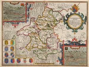
Penbrokshyre described and the situations both of Penbroke and St. Davids shewed in due form as they were taken by John Speed.
$750.00
Acquire
- Digital Map Information
- Suitable for large format printing
- Full resolution TIFF file
- ICC color profile embedded
- Delivered instantly via download link
This is John Speed's map of the county of Pembrokeshire, Wales. Engraved in 1608, this map was printed by publisher Roger Rea between 1662 and 1665. While Rea and his son produced an edition of Speed's The Theatre of the Empire of Great Britaine, examples of their output were also sold to their competitor John Overton (1640 - 1708) for inclusion in his atlases. These lacked the verso text that generally characterizes Speed maps, and such examples are scarce. Moreover, much of the stock remaining to Roger Rea the Younger after his father's death of the plague was itself destroyed in the 1666 Great Fire of London. Thus, any example of a Speed map with the imprint of 'Roger Rea the Elder and younger' is a rarity. (more details)
Men of Harlech on to glory...
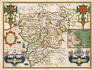
Merionethshire Described 1610.
$750.00
Acquire
- Digital Map Information
- Suitable for large format printing
- Full resolution TIFF file
- ICC color profile embedded
- Delivered instantly via download link
This is John Speed's map of the county of Merionethshire, Wales. It was included in Speed's The Theatre of the Empire of Great Britaine. Despite its depicting one of the most sparsely-populated counties of the United Kingdom, the map is richly detailed, showing towns, castles, forests, and lakes. The countryside's mountainous terrain is illustrated pictorially. An inset plan in the center right shows the town of Harlech, whose castle dominates the image much as it does the legend of the town, its famous siege being immortalized in song. Just offshore, the sea facing the castle sports a mermaid. (more details)
Celebrating Henry V, 'The Great Triumpher Over France'
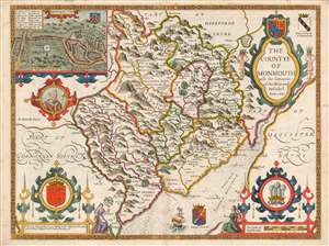
The Countye of Monmouth wih the sittuation of the Shiretowē Described Ann 1610.
$750.00
Acquire
- Digital Map Information
- Suitable for large format printing
- Full resolution TIFF file
- ICC color profile embedded
- Delivered instantly via download link
This is John Speed's map of the county of Monmouthshire, Wales. It was included in Speed's The Theatre of the Empire of Great Britaine. The map is richly detailed, showing towns, abbeys, castles, forests, and parklands. The countryside's rugged terrain is shown pictorially. An inset plan in the upper left details the castle and town of Monmouth. In it, a key labels the important streets, locations of the castle itself, St. Mary's Church, the town market, and the city's old wall and gates. Below the inset is a medallion depicting England's King Henry V (1386 - 1422), who was also known as Henry of Monmouth. King Henry's famed victories in the Hundred Years' War are celebrated in the medallion's text, 'Kinge Henry 5, The Great Triumpher Over France.' Henry's famous victory at Agincourt was nearly two centuries distant at the time this map was engraved: but those remote events had been made current by Shakespeare's 'Henriad' plays, which fixed Henry as the exemplar of the noble English war leader. (more details)
An incredible map of Peru clearly showing the unknown of the Amazon region.
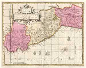
Peru.
$400.00
Acquire
- Digital Map Information
- Suitable for large format printing
- DPI: 300
- File Size: 8.73 MB
- File Type: ZIP / TIFF
- ICC color profile embedded
- Delivered instantly via download link
This is a c. 1700 Pieter Schenk and Gerard Valk map of Peru. The map, oriented towards the east, depicts the region from Los Pastos to Val Xuxuy and from an area east of Peru along the Omapalchas River and home to the Marquires and Cheriabonas Indians to the ... (more details)
Marking the Momentous Battle of Bosworth.
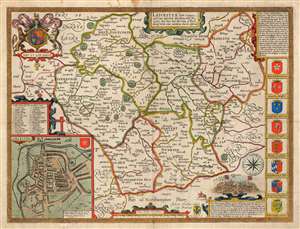
Leicester, both Countye and Citie described, the Honorabe Famylies that have had titles of Earls thereof. With other accidents therein observed.
$750.00
Acquire
- Digital Map Information
- Suitable for large format printing
- Full resolution TIFF file
- ICC color profile embedded
- Delivered instantly via download link
This is John Speed's 1770 map of the East Midlands county of Leicestershire, England. It was first included in Speed's county atlas and remained in publication long after Speed's death, and in this case this specific map was printed in Cluer Dicey's scarce, final edition of 1770. The map is richly detailed, showing towns, abbeys, castles, forests, and parklands. An inset plan in the lower left details the walled town of Leicester with a key naming thirty-four streets, gates and buildings. Along the right side of the map are displayed the armorial crests of eight of the historical Earls of Leicester. At the bottom are the arms of Robert Sidney, the second Earl of Leicester (probably added by Bassett and Chiswell in 1676). At the upper left are the Royal Arms, with the motto 'Dieu et Mon Droit.' (more details)