

January February March. April May June. July August September. October November December.
sold
- Digital Map Information
- Suitable for large format printing
- Full resolution TIFF file
- ICC color profile embedded
- Delivered instantly via download link
This is a beautifully hand colored set of four maps depicting the night sky in the twelve months of the year, by Elijah Burritt. Each sheet features the stars and constellation in the night sky over a quarter. On each of the charts, the constellations are drawn ... (more details)
Scarce and beautiful map of Washington D.C. drawn for the inauguration of Benjamin Harrison.
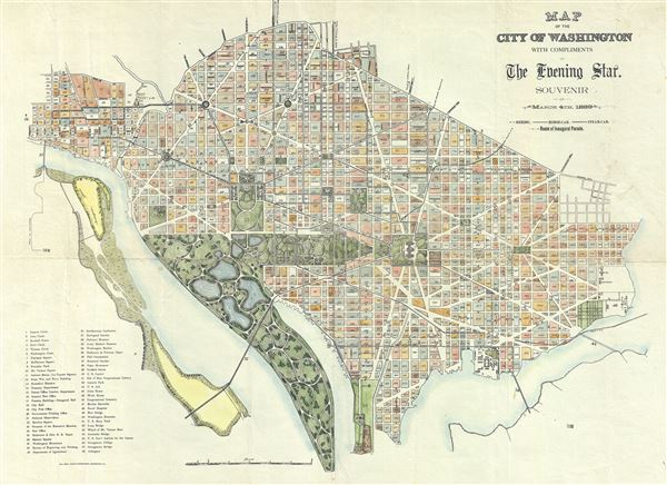
Map of the City of Washington with compliments of The Evening Star. Souvenir of March 4th, 1889.
sold
- Digital Map Information
- Suitable for large format printing
- File Size: 11.49 MB
- File Type: ZIP / TIFF
- ICC color profile embedded
- Delivered instantly via download link
A spectacular and scarce 1889 map of Washington D.C. issued for The Evening Star newspaper. The The Evening Star hired the photo-lithography firm of Bell Brothers to produce this appealing map to commentate the inauguration of Benjamin Harrison as the 23rd ... (more details)
A fine early map of Ceylon depicting an Elephant.
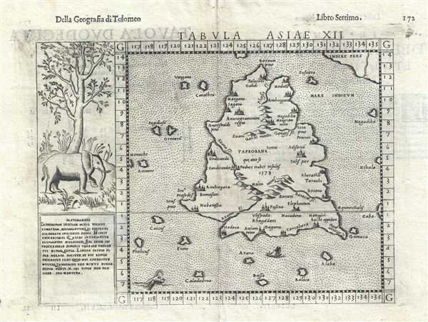
Tabula Asiae XII.
sold
- Digital Map Information
- Suitable for large format printing
- DPI: 300
- File Size: 3.34 MB
- File Type: ZIP / TIFF
- ICC color profile embedded
- Delivered instantly via download link
A highly appealing 1574 map of Ceylon, Sri Lanka, or as it was then known, Tapobrana. The first mention of Tapobrana is in the Geographia of Claudius Ptolemy. Today, Ptolemy's Taprobana is considered by some scholars to be entirely mythological and by ... (more details)
Reflects the curious Ptolemaic convention of a landlocked Indian Ocean
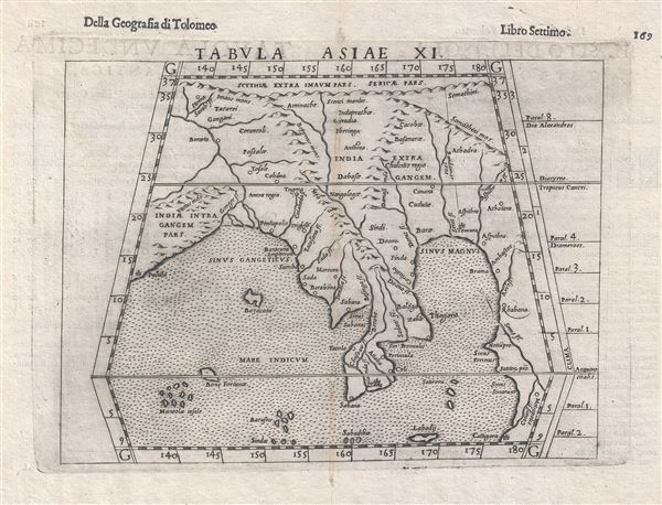
Tabula Asiae XI.
sold
- Digital Map Information
- Suitable for large format printing
- DPI: 300
- File Size: 3.2 MB
- File Type: ZIP / TIFF
- ICC color profile embedded
- Delivered instantly via download link
This is an uncommon 1588 Ptolemaic map of Southeast Asia and the Malay Peninsula issued for Girolamo Ruscelli's Italian edition of the Geografia di Tolomeo . Cartographically Ruscelli based this map on interpretations of Claudius Ptolemy's Geographica ... (more details)
One of the earliest obtainable maps of Brazil and among the first to depict an image of Cannibalism.
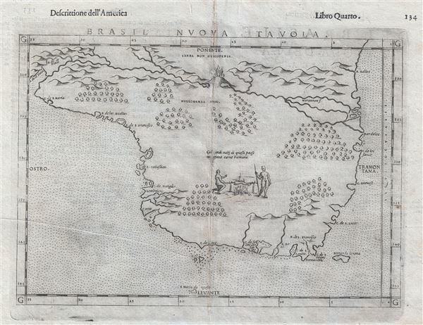
Brasil Nuova Tavola.
sold
- Digital Map Information
- Suitable for large format printing
- Full resolution TIFF file
- ICC color profile embedded
- Delivered instantly via download link
Printed in 1574 by Girolamo Ruscelli, this is one of the earliest obtainable maps of Brazil. The map is oriented to the west and covers from the Rio de la Plata to the mouth of the Amazon (Maranon) River. Little other detail of the interior is given ... (more details)
One of the more attractive 19th century atlas maps of New York City.
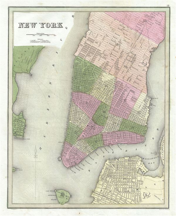
New York.
sold
- Digital Map Information
- Suitable for large format printing
- DPI: 300
- File Size: 8.02 MB
- File Type: ZIP / TIFF
- ICC color profile embedded
- Delivered instantly via download link
This is Thomas Bradford's important 1839 map of New York City. Bradford's plan covers Manhattan from 53rd Street to the Battery, with parts of adjacent Brooklyn, Hoboken, and Jersey City. The whole is beautifully engraved in Boynton's delicate ... (more details)
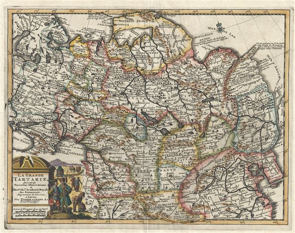
La Grande Tartarie Suivant les Nouvelles Observations de Messrs. De l'Academie Royale des Sciences, etc.
sold
- Digital Map Information
- Suitable for large format printing
- Full resolution TIFF file
- ICC color profile embedded
- Delivered instantly via download link
A very attractive 1729 map of Asia and Tartary by the Dutch cartographer Pieter van der Aa. Pieter's (or Pierre) map covers from the Black Sea to Korea and from Nova Zembla south as far as Lhasa and Lahor. Although Van der Aa's maps are not ... (more details)
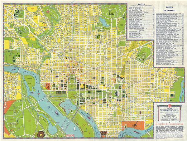
Visitors Map of Washington, D.C.
sold
- Digital Map Information
- Suitable for large format printing
- Full resolution TIFF file
- ICC color profile embedded
- Delivered instantly via download link
This is a charming 1951 map or plan of Washington D.C. by the American Automobile Association. Published by the Greater National Capital Committee, Convention and Tourist Bureau and the Washington Board of Trade, the map covers Washington ... (more details)

Geographia Pictorial Map of London.
sold
- Digital Map Information
- Suitable for large format printing
- Full resolution TIFF file
- ICC color profile embedded
- Delivered instantly via download link
This is a wonderful plan or pocket map of London published c.1923 by Geographia Ltd. It covers downtown London from the Hammersmith Bridge and Wormwood scrubs eastward past Hyde Park and Buckingham Place to Whitechapel Road and the London ... (more details)

[World Globe]
sold
- Digital Map Information
- Suitable for large format printing
- Full resolution TIFF file
- ICC color profile embedded
- Delivered instantly via download link
This is a beautiful 1940s vintage Japanese world globe made by Okumura of Osaka, Japan. Made before World War II, this globe represents the entire world on a three-dimensional scale mode of the Earth. Notes cities, rivers, lakes, ... (more details)

Cercle de Franconie qui comprend les Eveches de Wurtzbourg, de Bamberg et d'Aichstet; les Marquisats de Culmbach et d'Anspach; et les Comtes d'Henneberg, d'Hohenlohe, de Vertheim, de Reineck, d'Erpach etc.
sold
- Digital Map Information
- Suitable for large format printing
- Full resolution TIFF file
- ICC color profile embedded
- Delivered instantly via download link
This is a fine 1752 map of the Circle of Franconia, Germany, by Robert de Vaugondy. Centered on Bamberg, Wurtzburg, and Nuremberg, it covers from Arnstadt south to Regensburg and from Frankfurt east to Plauen. Includes the ... (more details)

Carte des Cercles du Haut et du Bas Rhin ou se trouvent dans le premier, le Duche de Deux-Ponts, les Echeves de Worms, et de Spire, les Etats de Nassau et de Hesse, les Comtes de Hanaw, de Solms, d'Isenburg, les Abbeyes de Fulde et d'Hirchfeld &c., et dans le second, les Electorats de Mayence, de Treves, de Cologne, et le Palatinat du Rhin, avec leurs enclaves.
sold
- Digital Map Information
- Suitable for large format printing
- Full resolution TIFF file
- ICC color profile embedded
- Delivered instantly via download link
This is a scarce 1753 map of the Upper Rhine and Lower Rhine regions in western Germany by Robert de Vaugondy. It covers from Saarbrucken north to Paderborn and east as far as Muhlhausen. The cities of Frankfurt, Cologne, ... (more details)

Carte de l'Empire d'Allemagne ou sont marquees exactement les Routes des Postes.
sold
- Digital Map Information
- Suitable for large format printing
- Full resolution TIFF file
- ICC color profile embedded
- Delivered instantly via download link
This is a scarce 1757 map of the German Empire by Robert de Vaugondy. It covers from Dunkirk in France east to Elblag in Poland and south as far as the Gulf of Venice and Geneva, to include the modern day countries of ... (more details)

La Principaute de Liege et le Duche de Limbourg.
sold
- Digital Map Information
- Suitable for large format printing
- Full resolution TIFF file
- ICC color profile embedded
- Delivered instantly via download link
This is a scarce 1754 map of Liege and Limbourg, Belgium by Robert de Vaugondy. It covers parts of northeastern Belgium and southern Netherlands along with neighboring Germany and map extends from Weert, Netherlands ... (more details)

Partie Meridion. du Duche de Brabant ou se trouvent le Quartier de Bruxelles et de Louvain, la Seigneurie de Malines; et une partie de l'Eveche de Lyege, le Comte de Namur, avec les confins du Haynaut et du Luxembourg.
sold
- Digital Map Information
- Suitable for large format printing
- Full resolution TIFF file
- ICC color profile embedded
- Delivered instantly via download link
This is an attractive 1752 map of the southern part of the Duchy of Brabant by Robert de Vaugondy. The map depicts part of modern day Belgium and Luxembourg, which was at the time this map was made, part of the ... (more details)
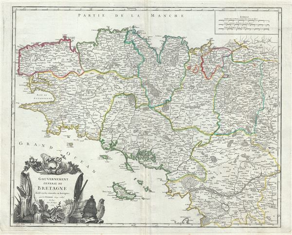
Gouvernement General de Bretagne divise en ses Dioceses ou Receptes.
sold
- Digital Map Information
- Suitable for large format printing
- Full resolution TIFF file
- ICC color profile embedded
- Delivered instantly via download link
This is a beautiful 1751 map of Brittany, France by Robert de Vaugondy. It covers the former province of Brittany from Avranches south to Isle de Noirmoutier and from the Celtic Sea inland as far as Ingrande. ... (more details)

Gouvernement Generale de Normandie divise en ses sept Bailliages de Coutances, Caen, Caux, Rouen, Evreux, Gisors, et Alencon.
sold
- Digital Map Information
- Suitable for large format printing
- Full resolution TIFF file
- ICC color profile embedded
- Delivered instantly via download link
This is a beautiful 1751 Robert de Vaugondy map of Normandy, France. It depicts the former French Duchy of Normandy and includes all or part of the departments of Calvados, Manche, Orne, Seine-Maritime, Somme, ... (more details)

Imperium Caroli Magni occidentis Imperatoris complectens Galliam, Marcam Hispanicam, Baleares insulas, Corsicam, Italiam Vulturnum usque et Ausidum fluv?, Istriam, Liburniam, Dalmatiam, Rhaetiam, Vindeliciam, Noricum, et quidquid Germaniae a Rheno ad Oderam usque et Mare Balticum, protenditur.
sold
- Digital Map Information
- Suitable for large format printing
- Full resolution TIFF file
- ICC color profile embedded
- Delivered instantly via download link
This is a beautiful 1752 map of Europe and the Empire of Charlemagne by Robert de Vaugondy. It covers Europe and the European Empire of Charles the Great from England south as far as northern Africa and from ... (more details)

Graecia Vetus ex schaedis Sansonianis desumpta, in qua Macedonia, Thessalia, Epirus, Achaia et Peloponesus, in minores partes seu populos distinguuntur; nec non inter adjacentes insulas speciatim Creta delineatur Insula.
sold
- Digital Map Information
- Suitable for large format printing
- Full resolution TIFF file
- ICC color profile embedded
- Delivered instantly via download link
This is an attractive 1752 map of the ancient Greece, the Balkans, and Macedonia by Robert de Vaugondy. It focuses on Greece under the Roman Empire, covering from the Ionian Sea to Aegean Sea and from ... (more details)

Italia Antiqua, cum Insulis Sicilia, Sardinia, et Corsica, in suas majores partes et populos divisa.
sold
- Digital Map Information
- Suitable for large format printing
- Full resolution TIFF file
- ICC color profile embedded
- Delivered instantly via download link
This is a beautiful 1751 map of Ancient Italy by Robert de Vaugondy. It covers from Gaul to Sicily, including the islands of Corsica and Sardinia. It identifies several important cities and towns ... (more details)