
Delahaye, Guillaume-Nicholas

Guillaume-Nicolas Delahaye (1725 - February 24, 1802) was the most prolific member of the Delahaye (De-La-Haye) family of engravers active in Paris throughout the 18th century. Given that the name, Delahaye literally translates to 'of the Hague' it can be assume they were French Huguenots who were forced to flee the Netherlands under threat of religious persecution. Born in Paris, he was the son of patriarch Jean-Baptiste Delahaye and brother to Jean-Baptistie-Henri Delahaye. It is said that his godfather, who held him at the baptismal font, was none other than the famous french cartographer Guillaume de L'Isle. The Delahaye family engraved for many of the great cartographers of 18th century Paris, including Jean-Baptiste Bourguignon d'Anville, Didier Robert de Vaugondy, Jean-Baptiste de Mannevillette, and Jean-Nicolas Buache, among others. He was awarded the public office Premier Graveur du Roi and worked on a series of maps illustrating the king's hunts around Versailles. Guillaume also worked with foreign cartographers such as Tomas Lopez of Madrid. Possibly Delahaye's most significant map is A Map of the Country between Albemarle Sound and Lake Erie prepared for the memories of Thomas Jefferson. He married in 1758. In total he engraved some 1200 maps. Delahaye died in Charenton. In 1792, his daughter, Antoinette Marie Delahaye (1773-1857), married the geographer Jean-Denis Barbie du Bocage.
Best French mapping of North America.

Amérique Septentrionale.
$1,800.00
Acquire
- Digital Map Information
- Suitable for large format printing
- Full resolution TIFF file
- ICC color profile embedded
- Delivered instantly via download link
This is the 1746 wall map of North America composed by Jean-Baptiste Bourguignon d'Anville, considered the finest French map of North America predating the French and Indian War (1754 - 1763). Nearly a century of French mapmaking and exploration in North America preceded this work, granting the map precedence, longevity, and a lasting influence. It was copied by Thomas Jefferys as the basis for his own 1755 map of North America. More than half a century later, it was among the maps consulted by Nicholas King for his seminal manuscript map of western North America compiled for the Lewis and Clark expedition. (more details)
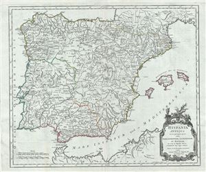
Hispania Antiqua in tres praecipuas partes, scilicet Tarraconensem, Lusitaniam, et Baeticam; nec non in Populos divisa.
$250.00
Acquire
- Digital Map Information
- Suitable for large format printing
- Full resolution TIFF file
- ICC color profile embedded
- Delivered instantly via download link
This is a beautiful 1750 map of Ancient Spain and Portugal by Robert de Vaugondy. It depicts the Iberian Peninsula under the Roman Empire and covers from the Atlantic Ocean to the Mediterranean Sea, including the Balearic Islands of Ibiza, Minorca and Majorca. ... (more details)
Early map of northeastern Poland and Lithuania.
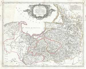
La Prusse divisee en Prusse Royale, et Prusse Ducale laquelle a ete erigee en Royaume par l'Empereur Leopold en favour de Frederic I. Elec? de Brandebourg couronee en Janvier 1701.
$350.00
Acquire
- Digital Map Information
- Suitable for large format printing
- Full resolution TIFF file
- ICC color profile embedded
- Delivered instantly via download link
This is a beautiful 1751 map of Prussia by Robert de Vaugondy. It covers the northeastern part of Poland and Lithuania and extends from Grodno and the Spirding-See in Poland north to Klaipeda in Lithuania and west as far as Leba and depicts the Holy Roman ... (more details)
Finest obtainable Colonial Era map of the Gulf Coast around the Mississippi Delta and Louisiana.
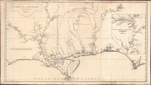
Carte de la Louisiane.
$1,400.00
Acquire
- Digital Map Information
- Suitable for large format printing
- DPI: 600
- File Size: 933.1 MB
- File Type: ZIP / TIFF
- ICC color profile embedded
- Delivered instantly via download link
A lovely example of the important 1732/52 map of the Gulf Coast and lower Mississippi River Valley by Jean Baptiste Bourguignon d'Anville. The map is significant as the largest and most comprehensive map of the Gulf littoral to appear during the French period of Louisiana. (more details)
Elegant Edition of the Pinnacle of the Colonial Mapping of Virginia.
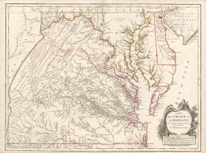
Carte de la Virginie et du Maryland Dressée sur la grande carte Angloise de Mrs. Josué Fry et Pierre Jefferson, Par le Sr. Robert de Vaugondy Géographe.
$2,200.00
Acquire
- Digital Map Information
- Suitable for large format printing
- Full resolution TIFF file
- ICC color profile embedded
- Delivered instantly via download link
This is Robert de Vaugondy's 1755 map of Virginia and Maryland, here in an attractive example of the 1793 5th state. (more details)