
The early stages of Viele's historic Sanitary and Topographical Map of New York City.
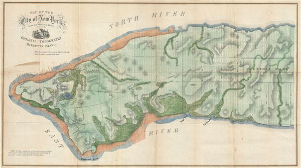
Map of the City of New York from the Battery to 80th St showing the Original Topography of Manhattan Island.
sold
- Digital Map Information
- Suitable for large format printing
- File Size: 15.8 MB
- File Type: ZIP / TIFF
- ICC color profile embedded
- Delivered instantly via download link
An uncommon 1859 map of lower Manhattan, New York City, by Egbert Viele, the famed city planner who spearheaded the construction of Central Park. The map covers lower Manhattan to about 80th street and includes the city's grid plan overlaying a topographical ... (more details)
Scarce map of New York City.
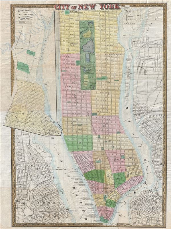
City of New York.
sold
- Digital Map Information
- Suitable for large format printing
- File Size: 23.03 MB
- File Type: ZIP / TIFF
- ICC color profile embedded
- Delivered instantly via download link
A very uncommon map, this is the c. 1866 Map of New York prepared and issued for Baldwin's Consolidated Business Directory . The map covers Manhattan from 119th street to Battery Park as well as parts of adjacent Hoboken, Jersey City, Brooklyn, and Queens. ... (more details)
Important Gold Rush map detailing the California Gold Region and showing Texas at its largest.

Map of North America by J. Calvin Smith.
sold
- Digital Map Information
- Suitable for large format printing
- DPI: 300
- File Size: 17.84 MB
- File Type: ZIP / TIFF
- ICC color profile embedded
- Delivered instantly via download link
An extremely scarce 1850 map of North America by J. Calvin Smith. Published to capitalize on the mass westward migrations associated with the 1849 California Gold Rush, this map covers all of North American and Central America from Panama to the Arctic ... (more details)
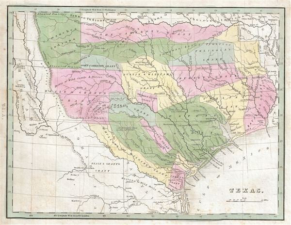
Texas.
sold
- Digital Map Information
- Suitable for large format printing
- Full resolution TIFF file
- ICC color profile embedded
- Delivered instantly via download link
A rare discovery, this is Thomas G. Bradford's 1835 map of the Republic of Texas. This important map is considered the first specific map of the Republic of Texas to appear in an atlas. The map covers the original claims of the Republic of Texas from ... (more details)
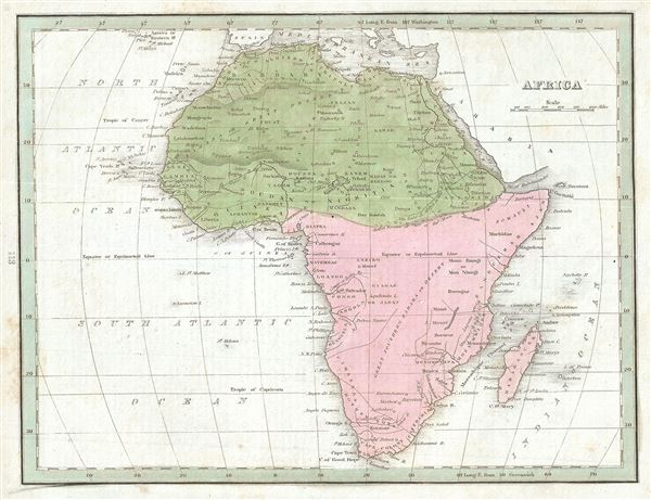
Africa.
sold
- Digital Map Information
- Suitable for large format printing
- Full resolution TIFF file
- ICC color profile embedded
- Delivered instantly via download link
An interesting example of the 1835 map of Africa by the important American mapmaker T. G. Bradford. This is an early 19th century and historically important representation of the continent of Africa. Nineteenth century mapmakers were particularly ... (more details)

Southern Africa.
sold
- Digital Map Information
- Suitable for large format printing
- Full resolution TIFF file
- ICC color profile embedded
- Delivered instantly via download link
This interesting map of southern Africa was printed by the important American mapmaker T. G. Bradford in 1835. It covers the southern portion of Africa from Liberia to Cape Colony, including Madagascar. An interesting map issued just as most of ... (more details)

[Map of cities of Europe].
sold
- Digital Map Information
- Suitable for large format printing
- Full resolution TIFF file
- ICC color profile embedded
- Delivered instantly via download link
This is a fine 1835 map or plan depicting the principal cities in Europe, by the important American mapmaker T. G. Bradford. Essentially six plans on a single sheet, it covers the cities of London, Edinburgh, Paris, Madrid, Brussels and Vienna. ... (more details)

Hungary and Turkey in Europe.
sold
- Digital Map Information
- Suitable for large format printing
- Full resolution TIFF file
- ICC color profile embedded
- Delivered instantly via download link
This is a beautiful 1835 map of Greece, the Balkans, Hungary and the European part of Turkey by the important American mapmaker T. G. Bradford. The map covers Turkey and Greece from the Gulf of Venice and the Ionian Sea to the Black Sea. It ... (more details)

Greece.
sold
- Digital Map Information
- Suitable for large format printing
- Full resolution TIFF file
- ICC color profile embedded
- Delivered instantly via download link
This fine map of Greece was printed in 1835 by the important American mapmaker T. G. Bradford. Depicts from Macedonia to Greece and Candia and includes many of the Greek Islands. It includes modern day Greece, Albania and Macedonia. Towns, ... (more details)

Italy.
sold
- Digital Map Information
- Suitable for large format printing
- DPI: 300
- File Size: 2.71 MB
- File Type: ZIP / TIFF
- ICC color profile embedded
- Delivered instantly via download link
This is an appealing 1835 map of Italy by the important American mapmaker T. G. Bradford. It covers the entire Italian peninsula from the Lake of Geneva to Malta. Towns, rivers, mountains and various other important topographical details ... (more details)

Sketch E Showing the progress of the Survey in Section No. V.
sold
- Digital Map Information
- Suitable for large format printing
- Full resolution TIFF file
- ICC color profile embedded
- Delivered instantly via download link
This is a beautiful hand colored U. S. Coast Survey triangulation chart or map of the South Carolina coastline from Bulls Bay to St. Helena Bay and includes the North Edisto River and South Edisto River. Focuses on the inlets and ... (more details)
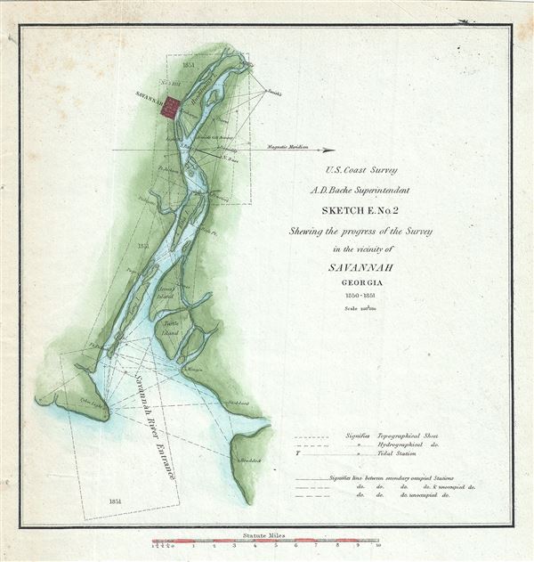
Sketch E. No. 2 Shewing the progress of the Survey in the vicinity of Savannah Georgia.
sold
- Digital Map Information
- Suitable for large format printing
- Full resolution TIFF file
- ICC color profile embedded
- Delivered instantly via download link
This is an attractive hand colored 1851 U.S. Coast Survey triangulation chart or map of Savannah, Georgia and the Savannah River. It shows the progress of the survey work in this area by date annotated sections. Shows navigation ... (more details)

Sketch of Frying-Pan Shoals and Cape Fear River.
sold
- Digital Map Information
- Suitable for large format printing
- Full resolution TIFF file
- ICC color profile embedded
- Delivered instantly via download link
This is a fine 1851 U. S. Coast Survey's nautical chart of the Frying Pan Shoals and Cape Fear River in North Carolina. It covers from Federal Lighthouse on the southern tip of Pleasure Island south past Smiths Island to the ... (more details)
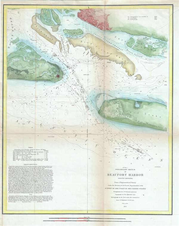
D No.5 Preliminary Sketch of Beaufort Harbor North Carolina.
sold
- Digital Map Information
- Suitable for large format printing
- Full resolution TIFF file
- ICC color profile embedded
- Delivered instantly via download link
This is a beautiful example of the 1851 U. S. Coast Survey's nautical chart of Beaufort Harbor in North Carolina. It covers from the town of Beaufort south to the Shackleford Banks and includes parts of Carrot Island and ... (more details)
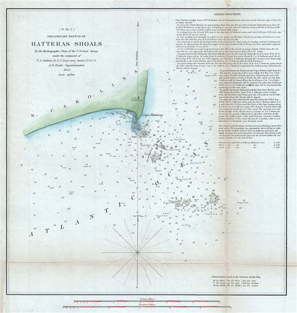
(D No. 2) Preliminary Sketch of Hatteras Shoals.
sold
- Digital Map Information
- Suitable for large format printing
- Full resolution TIFF file
- ICC color profile embedded
- Delivered instantly via download link
This is a fine example of the 1850 U. S. Coast Survey's nautical chart of Cape Hatteras on the Hatteras Island in North Carolina, and its surrounding shoals. It covers Cape Hatteras and Hatteras Cove and includes Diamond ... (more details)
The only significant map of the Chesapeake Bay to be issued between the early 19th century Admiralty Charts and the Coast Survey Charts of the 1860s.
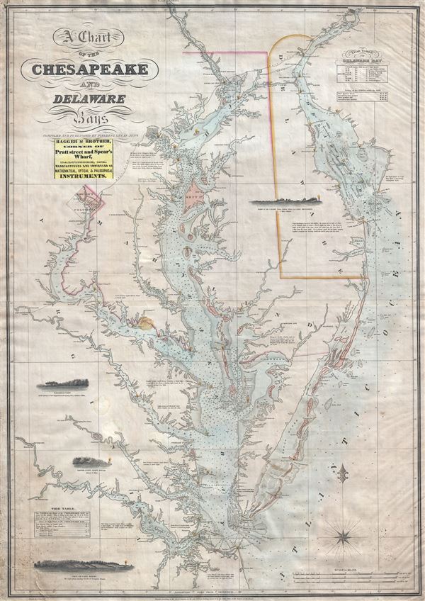
A Chart of the Chesapeake and Delaware Bays.
sold
- Digital Map Information
- Suitable for large format printing
- DPI: 300
- File Size: 40.07 MB
- File Type: ZIP / TIFF
- ICC color profile embedded
- Delivered instantly via download link
A scarce, important, and highly desirable 1852 nautical chart or maritime map of the Chesapeake and Delaware Bays by Fielding Lucas Jr. This chart covers the entirety of the Chesapeake Bay from Wrightsville (on the ... (more details)
Remarkable early French board game.
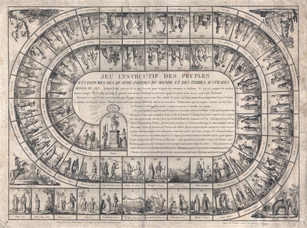
Jeu Instructif des Peuples et Costumes des Quatre Parties du Monde et des Terres Australes.
sold
- Digital Map Information
- Suitable for large format printing
- DPI: 300
- File Size: 17.65 MB
- File Type: ZIP / TIFF
- ICC color profile embedded
- Delivered instantly via download link
A scarce 1815 French geographically themed board game or jeux de l'oie (Game of Goose) produce by the French publishing house of Basset. In the spirit of snakes-and-ladders, the jeu de l'oie is a unicursal race game ... (more details)
The most attractive map of San Diego Bay to emerge from the work of the U.S. Coast Survey.
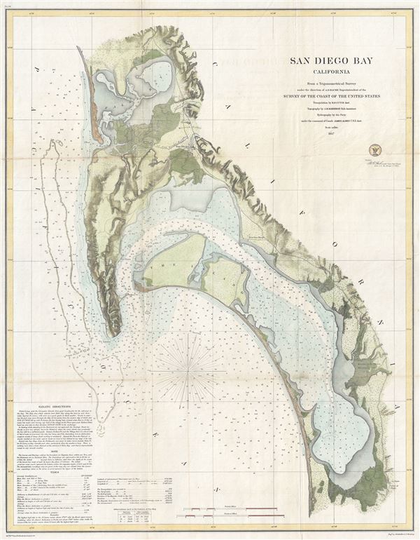
San Diego Bay California
sold
- Digital Map Information
- Suitable for large format printing
- File Size: 14.08 MB
- File Type: ZIP / TIFF
- ICC color profile embedded
- Delivered instantly via download link
This is the most attractive map of San Diego Bay, California, to emerge from the work of the U.S. Coast Survey. Covers the Sand Diego area from False Bay and the Valley of Las Yeguas southward past Mission Valley ... (more details)
An extrmely scarce pocket map of Staten Island, New York.
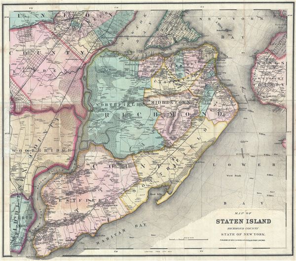
Map of Staten Island Richmond County State of New York.
sold
- Digital Map Information
- Suitable for large format printing
- File Size: 31.25 MB
- File Type: ZIP / TIFF
- ICC color profile embedded
- Delivered instantly via download link
A scarce large format pocket map of New York City's Staten Island. This is one of the few detailed maps of Staten Island from the middle part of the 19th century. The map covers the entirety of Staten Island ... (more details)

Spain and Portugal.
sold
- Digital Map Information
- Suitable for large format printing
- DPI: 300
- File Size: 2.78 MB
- File Type: ZIP / TIFF
- ICC color profile embedded
- Delivered instantly via download link
This is an appealing 1835 map of Spain and Portugal by the important American mapmaker T. G. Bradford. It covers the entirety of Iberia including the Balearic Islands of Minorca, Majorca, and Ibiza. Both ... (more details)