
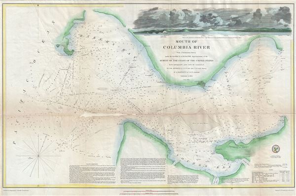
Mouth of Columbia River.
sold
- Digital Map Information
- Suitable for large format printing
- Full resolution TIFF file
- ICC color profile embedded
- Delivered instantly via download link
This is an attractive example of the U. S. Coast Survey's 1851 nautical chart or maritime map of the mouth of the Columbia River. The Columbia River, the largest river in the Pacific Northwest region of the United States forms the border between the states of ... (more details)

Harbor of Refuge No. The Harbor of Holmes' Hole.
sold
- Digital Map Information
- Suitable for large format printing
- Full resolution TIFF file
- ICC color profile embedded
- Delivered instantly via download link
This is a rare example of the 1847 U.S. Coast Survey nautical chart or map of Holmes' Hole (Vineyard Haven), Martha's Vineyard, Massachusetts. Focusing on the town of Holmes' Hole, today's Vineyard Haven, this map covers from West Chop to East Chop and as far ... (more details)
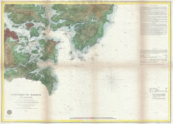
Portsmouth Harbor New Hampshire
sold
- Digital Map Information
- Suitable for large format printing
- File Size: 14.68 MB
- File Type: ZIP / TIFF
- ICC color profile embedded
- Delivered instantly via download link
This is a beautiful example of the U.S. Coast Survey's 1866 nautical chart or maritime map of Portsmouth Harbor, New Hampshire. It covers the city of Portsmouth, New Hampshire, and its vicinity from Odiornes Point and Sagamore Creek to Chauncy's Creek and ... (more details)
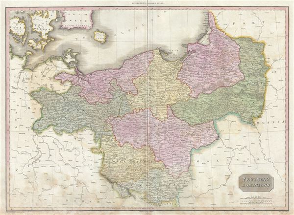
Prussian Dominions.
sold
- Digital Map Information
- Suitable for large format printing
- Full resolution TIFF file
- ICC color profile embedded
- Delivered instantly via download link
A scarce, beautiful, and exceptionally interesting example of John Pinkerton's stunning 1810 map of Prussia. The Map covers from the Baltic Sea to Upper Silesia and from Lower Saxony to Russia, including parts of modern day Poland. In 1815 Prussia emerged ... (more details)
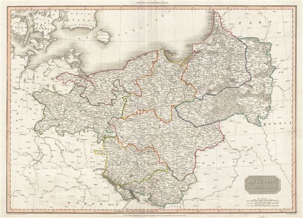
Prussian Dominions.
sold
- Digital Map Information
- Suitable for large format printing
- Full resolution TIFF file
- ICC color profile embedded
- Delivered instantly via download link
A scarce, beautiful, and exceptionally interesting example of John Pinkerton's stunning 1810 map of Prussia. The Map covers from the Baltic Sea to Upper Silesia and from Lower Saxony to Russia, including parts of modern day Poland. Prussia at this time ... (more details)
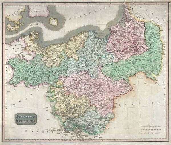
Prussian Dominions.
sold
- Digital Map Information
- Suitable for large format printing
- Full resolution TIFF file
- ICC color profile embedded
- Delivered instantly via download link
This fascinating hand colored 1815 map by Edinburgh cartographer John Thomson depicts Prussia (central and northern Europe). The Map covers from the Baltic Sea to Upper Silesia and from Lower Saxony to Russia, including parts of modern day Poland. In ... (more details)
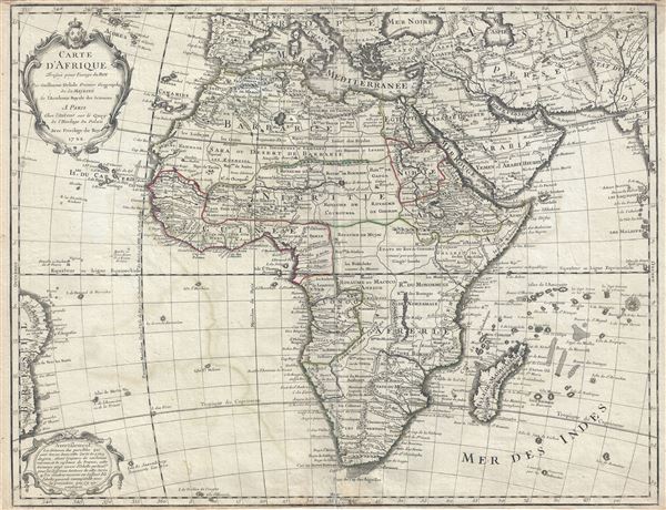
Carte D'Afrique.
sold
- Digital Map Information
- Suitable for large format printing
- DPI: 300
- File Size: 21.38 MB
- File Type: ZIP / TIFF
- ICC color profile embedded
- Delivered instantly via download link
This is an extraordinary example of Guillaume Delisle's 1722 important and influential map of Africa. It depicts the African continent in stunning detail with numerous notations and comments regarding the people, geography, and wildlife of the ... (more details)

Isle et Royme de Sardaigne.
sold
- Digital Map Information
- Suitable for large format printing
- Full resolution TIFF file
- ICC color profile embedded
- Delivered instantly via download link
This is an attractive map of the island of Sardinia, Italy by Nicholas Sanson dating to 1658. It covers the entire island in extraordinary detail offering both topographical and political information with mountains beautifully rendered in ... (more details)
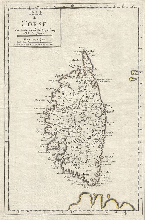
Isle de Corse.
sold
- Digital Map Information
- Suitable for large format printing
- Full resolution TIFF file
- ICC color profile embedded
- Delivered instantly via download link
A beautiful map of the Island of Corsica, France by Nicholas Sanson dating to 1658. Covers the entire island in extraordinary detail offering both topographical and political information with mountains beautifully rendered in profile. ... (more details)

Le Duche de Luxembourg, divise en Francois, et Espagnol.
sold
- Digital Map Information
- Suitable for large format printing
- DPI: 300
- File Size: 17.83 MB
- File Type: ZIP / TIFF
- ICC color profile embedded
- Delivered instantly via download link
This is a scarce 1674 map of the Duchy of Luxembourg by Alexis-Hubert Jaillot. It covers Luxembourg along with parts of neighboring Belgium, France and Germany from Revin in France east to Blankenheim in Germany and from Spa in ... (more details)
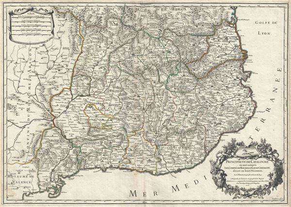
Principaute de Catalogne ou sont compris les Comtes de Roussillon, et de Cerdagne, divisees en leurs Vigueries.
sold
- Digital Map Information
- Suitable for large format printing
- DPI: 300
- File Size: 19.84 MB
- File Type: ZIP / TIFF
- ICC color profile embedded
- Delivered instantly via download link
This is a scarce 1706 map of Catalonia, Spain by Alexis-Hubert Jaillot. It covers the northeastern Iberian Peninsula from Sigean in France to Peniscola on the Mediterranean coast. The principality of Catalonia at the time ... (more details)
One of the earliest obtainable maps of Bombay or Mumbai, India.

Plan De Bombay et de Ses Environs, Tire de Thornton Hyd. Ang.
sold
- Digital Map Information
- Suitable for large format printing
- Full resolution TIFF file
- ICC color profile embedded
- Delivered instantly via download link
This beautifully hand colored c. 1750 Jacques Nicolas Bellin map of Bombay (Mumbai), India. Bellin's map illustrates Bombay as it was becoming the British East India Company's primary base of operations in India, ... (more details)
A seminal production - the first accurate map of the Caspian Sea.

Carte Marine de la Mer Caspiene.
sold
- Digital Map Information
- Suitable for large format printing
- DPI: 300
- File Size: 34.76 MB
- File Type: ZIP / TIFF
- ICC color profile embedded
- Delivered instantly via download link
A seminal production, this is Guillaume Delisle's 1721 map of the Caspian Sea according to the surveys of Van Verden and S. I Soimonov. It is the first printed map of the Caspian Sea based upon actual survey work. ... (more details)
The first edition of the first modern map of Arabia and the foundation of most subsequent maps of Arabia until the mid-18th century.
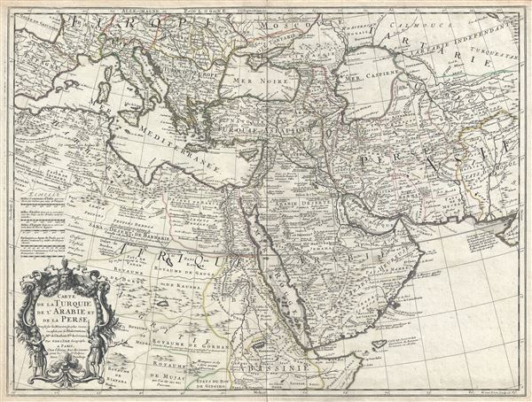
Carte de la Turquie de L'Arabie et de la Perse.
sold
- Digital Map Information
- Suitable for large format printing
- Full resolution TIFF file
- ICC color profile embedded
- Delivered instantly via download link
A scarce first edition first state example of Guillaume De L'Isle's 1701 map of Arabia, Turkey, and Persia. This is a foundational map and may be considered the first modern map of the Arabian Peninsula, in ... (more details)
Identifies the Sea of Korea
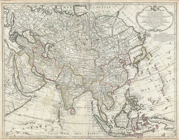
Carte D'Asie.
sold
- Digital Map Information
- Suitable for large format printing
- DPI: 300
- File Size: 19.04 MB
- File Type: ZIP / TIFF
- ICC color profile embedded
- Delivered instantly via download link
A rare and attractive 1723 map of Asia by Guillaume Delisle. Centered on Independent Tartary, this map covers the entire continent from Africa and the Mediterranean east to the Bering Sea and south as far as ... (more details)

Carte de la Terre Ferme, du Perou, du Bresil, et du Pays des Amazones.
sold
- Digital Map Information
- Suitable for large format printing
- DPI: 300
- File Size: 19.03 MB
- File Type: ZIP / TIFF
- ICC color profile embedded
- Delivered instantly via download link
This is an extraordinary example of Guillaume de L'isle's magnificent 1703 map of northern South America. It covers from Costa Rica and Barbados south roughly to the Tropic of Capricorn, or more precisely, ... (more details)

La Pologne.
sold
- Digital Map Information
- Suitable for large format printing
- DPI: 300
- File Size: 18.58 MB
- File Type: ZIP / TIFF
- ICC color profile embedded
- Delivered instantly via download link
This is a fine 1703 Guillaume De L'Isle map of Poland and Lithuania. It covers modern day Poland, Lithuania, Latvia, Belarus, Ukraine, Russia and the Czech Republic. The map renders the entire region in ... (more details)

Carte des Courones du Nord.
sold
- Digital Map Information
- Suitable for large format printing
- DPI: 300
- File Size: 39.89 MB
- File Type: ZIP / TIFF
- ICC color profile embedded
- Delivered instantly via download link
This is a beautiful 1706 two panel map of Scandinavia by Guillaume De L'Isle. It depicts Norway, Sweden, Denmark, Finland, Estonia and Latvia, along with parts of Lithuania, Poland and Germany. The map ... (more details)
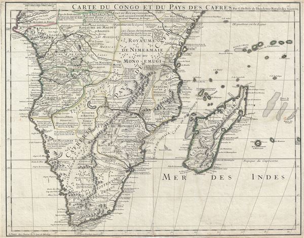
Carte du Congo et du Pays des Cafres.
sold
- Digital Map Information
- Suitable for large format printing
- DPI: 300
- File Size: 16.82 MB
- File Type: ZIP / TIFF
- ICC color profile embedded
- Delivered instantly via download link
This is an extraordinary example of Guillaume De L'isle's 1708 important map of Africa south of the Equator. It depicts southern Africa in stunning detail with numerous notations and comments regarding ... (more details)
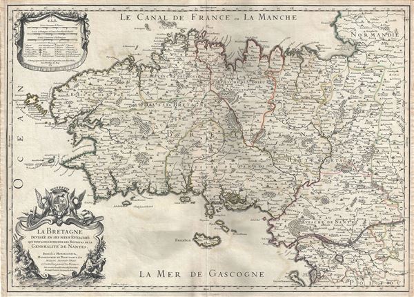
La Bretagne Divisee en ses neuf Evesches qui font aussi l'estendue des Receptes de la Generalite de Nantes.
sold
- Digital Map Information
- Suitable for large format printing
- DPI: 300
- File Size: 16.06 MB
- File Type: ZIP / TIFF
- ICC color profile embedded
- Delivered instantly via download link
This is a scarce 1706 map of Brittany, France by Alexis-Hubert Jaillot. It covers the former province of Brittany from Granville south to Noirmoutier-en-l'lle and from the Celtic Sea inland as far as ... (more details)