
The first edition of this important map to illustrate all three of Cook's seminal voyages.
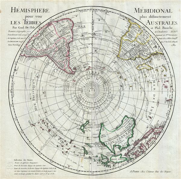
L'Hemisphere Meridional pour voir plus distinctement Les Terres Australes.
sold
- Digital Map Information
- Suitable for large format printing
- DPI: 300
- File Size: 14.89 MB
- File Type: ZIP / TIFF
- ICC color profile embedded
- Delivered instantly via download link
This is a stunning map of the Southern Hemisphere drawn by Guillaume de L'Isle and updated in 1782 by Jean-Claude Dezauche. Extends from the South Pole northwards in all directions as far as the Equator, encompassing in the process most of South America, southern ... (more details)
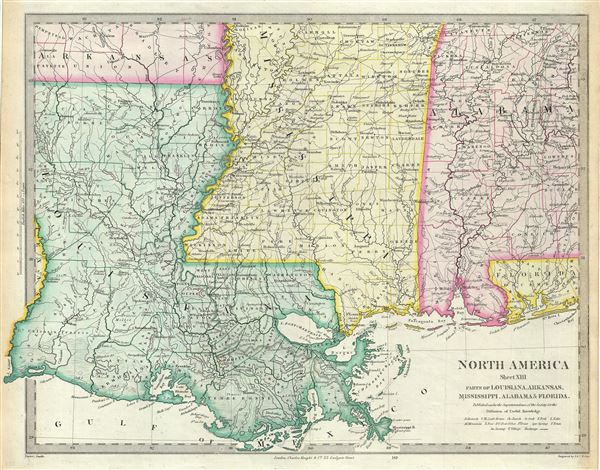
North America Sheet XIII Parts of Louisiana, Arkansas, Mississippi, Alabama and Florida.
sold
- Digital Map Information
- Suitable for large format printing
- DPI: 300
- File Size: 7.76 MB
- File Type: ZIP / TIFF
- ICC color profile embedded
- Delivered instantly via download link
This is an uncommon 1848 full color edition of the S.D.U.K. map of Mississippi, Louisiana and Alabama. It depicts a major portion of the states of Louisiana, Mississippi and Alabama, along with parts of Arkansas and Florida. The map coves from Hempstead County ... (more details)
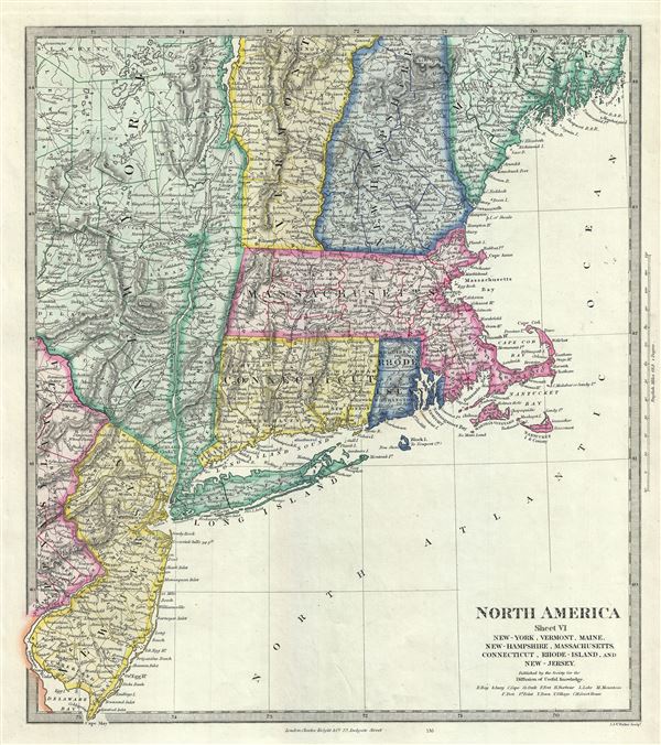
North America Sheet VI New-York, Vermont, Maine, New-Hampshire, Massachusetts, Connecticut, Rhode-Island, and New-Jersey.
sold
- Digital Map Information
- Suitable for large format printing
- DPI: 300
- File Size: 7.16 MB
- File Type: ZIP / TIFF
- ICC color profile embedded
- Delivered instantly via download link
This is a fine 1848 map of New England, New York and New Jersey issued by the S.D.U.K. The map covers from Waldo County in Maine south as far as the tip of New Jersey and west as far as St. Lawrence County in New York. The states of Massachusetts, Connecticut, ... (more details)
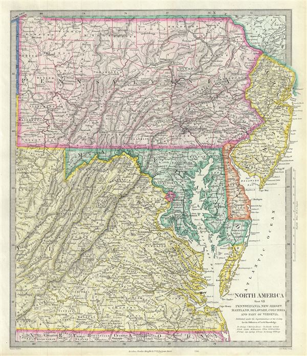
North America Sheet VII Pennsylvania, New Jersey, Maryland, Delaware, Columbia and Part of Virginia.
sold
- Digital Map Information
- Suitable for large format printing
- Full resolution TIFF file
- ICC color profile embedded
- Delivered instantly via download link
A beautiful 1848 map of Pennsylvania, New Jersey, Maryland, Delaware and Virginia issued by the S.D.U.K. The map covers the states of Pennsylvania, New Jersey, Maryland and Delaware in full with parts of modern day Virginia and West Virginia. Color coded ... (more details)
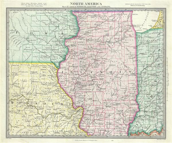
North America Sheet IX Parts of Missouri, Illinois and Indiana.
sold
- Digital Map Information
- Suitable for large format printing
- DPI: 300
- File Size: 7.04 MB
- File Type: ZIP / TIFF
- ICC color profile embedded
- Delivered instantly via download link
A lovely 1848 map of Illinois, Missouri, Iowa and Indiana by the S.D.U.K. The map covers parts of Illinois, Iowa, Missouri and Indiana from the Hahawa Lake in Iowa, south as far as Benton County in Missouri, east as far as Perry County and north as far as ... (more details)

North America Sheet XI Parts of North and South Carolina.
sold
- Digital Map Information
- Suitable for large format printing
- DPI: 300
- File Size: 6.59 MB
- File Type: ZIP / TIFF
- ICC color profile embedded
- Delivered instantly via download link
A beautiful 1848 full color map of North Carolina and South Carolina by the S.D.U.K. The map covers part of North and South Carolina from Ashe County in North Carolina to the Atlantic Ocean. It identifies several towns, lakes, mountains and a host of ... (more details)
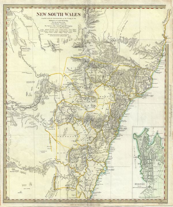
New South Wales.
sold
- Digital Map Information
- Suitable for large format printing
- DPI: 300
- File Size: 8.27 MB
- File Type: ZIP / TIFF
- ICC color profile embedded
- Delivered instantly via download link
This is a fascinating 1833 map of New South Wales, Australia, by the S.D.U.K. It covers the eastern Australia from Trial Bay to Bateman Bay. Although the coastlines are accurately mapped, much of the interior remains relatively unknown. Several ... (more details)
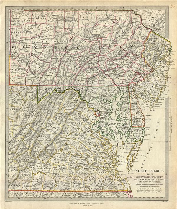
North America Sheet VII Pennsylvania, New Jersey, Maryland, Delaware, Columbia and Part of Virginia.
sold
- Digital Map Information
- Suitable for large format printing
- DPI: 300
- File Size: 9.28 MB
- File Type: ZIP / TIFF
- ICC color profile embedded
- Delivered instantly via download link
This is a lovely 1833 map of Pennsylvania, New Jersey, Maryland, Delaware and Virginia issued by the S.D.U.K. The map covers the states of Pennsylvania, New Jersey, Maryland and Delaware in full with parts of modern day Virginia and West ... (more details)
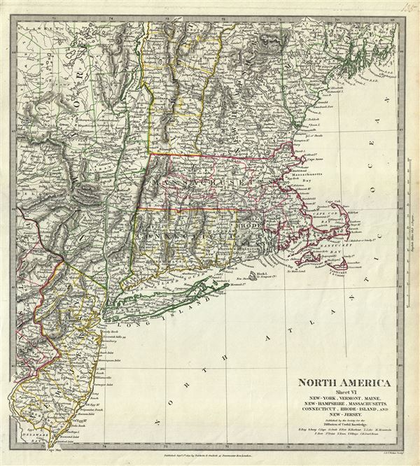
North America Sheet VI New-York, Vermont, Maine, New-Hampshire, Massachusetts, Connecticut, Rhode-Island, and New-Jersey.
sold
- Digital Map Information
- Suitable for large format printing
- DPI: 300
- File Size: 7.89 MB
- File Type: ZIP / TIFF
- ICC color profile embedded
- Delivered instantly via download link
This is a fine 1832 map of New England, New York and New Jersey issued by the S.D.U.K. The map covers from Waldo County in Maine south as far as the tip of New Jersey and west as far as St. Lawrence County in New York. The states of ... (more details)
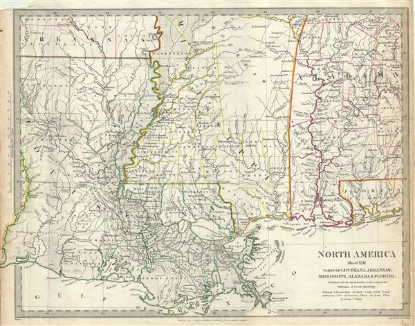
North America Sheet XIII Parts of Louisiana, Arkansas, Mississippi, Alabama and Florida.
sold
- Digital Map Information
- Suitable for large format printing
- DPI: 300
- File Size: 7.56 MB
- File Type: ZIP / TIFF
- ICC color profile embedded
- Delivered instantly via download link
This is an uncommon 1833 edition of the S.D.U.K. map of Mississippi, Louisiana and Alabama. It depicts a major portion of the states of Louisiana, Mississippi and Alabama, along with parts of Arkansas and Florida. The map coves from ... (more details)
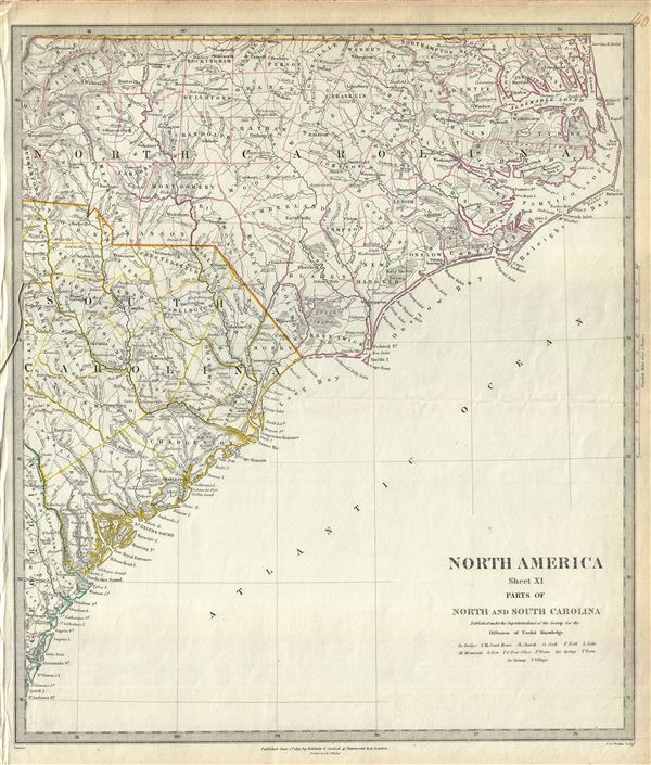
North America Sheet XI Parts of North and South Carolina.
sold
- Digital Map Information
- Suitable for large format printing
- DPI: 300
- File Size: 7.16 MB
- File Type: ZIP / TIFF
- ICC color profile embedded
- Delivered instantly via download link
This is a fine 1833 map of North Carolina and South Carolina by the S.D.U.K. The map covers part of North and South Carolina from Ashe County in North Carolina to the Atlantic Ocean. It identifies several towns, lakes, mountains and ... (more details)
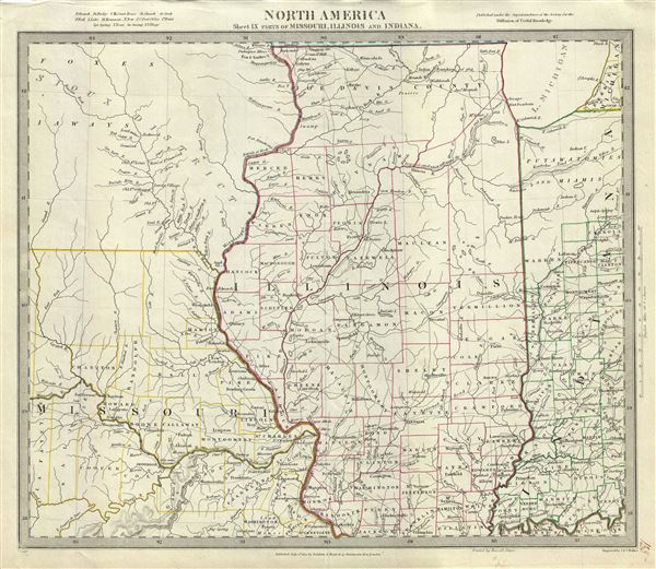
North America Sheet IX Parts of Missouri, Illinois and Indiana.
sold
- Digital Map Information
- Suitable for large format printing
- DPI: 300
- File Size: 7.24 MB
- File Type: ZIP / TIFF
- ICC color profile embedded
- Delivered instantly via download link
This is a beautiful 1833 map of Illinois, Missouri, Iowa and Indiana issued by the S.D.U.K. The map covers parts of modern day Iowa, Illinois, Missouri and Indiana from the Sioux Territory south as far as the Kentucky border and east ... (more details)
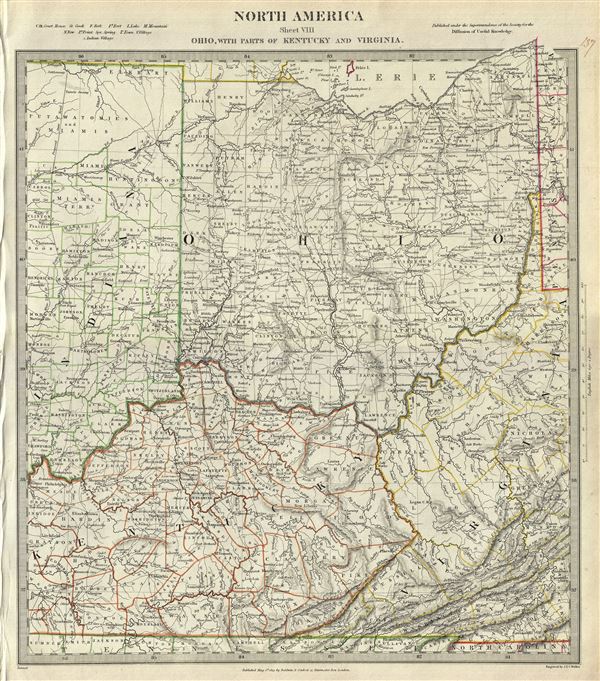
North America Sheet VIII Ohio, With parts of Kentucky and Virginia.
sold
- Digital Map Information
- Suitable for large format printing
- DPI: 300
- File Size: 9.58 MB
- File Type: ZIP / TIFF
- ICC color profile embedded
- Delivered instantly via download link
An attractive 1833 edition of the S.D.U.K. map of Ohio, Kentucky, Indiana and Virginia. The map covers the state of Ohio in its entirety along with parts of neighboring Indiana, Kentucky and Virginia. It offers extraordinary detail, ... (more details)
Stunning and uncommon Italian map of Corsica.
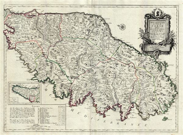
Carte Particuliere de L'Isle de Corse Divisee par ses Dix Provinces ou Juridictions et ses quatre Fiefs.
sold
- Digital Map Information
- Suitable for large format printing
- DPI: 300
- File Size: 22.45 MB
- File Type: ZIP / TIFF
- ICC color profile embedded
- Delivered instantly via download link
A fine Italian issue map of Corsica published in 1780 by the Venetian cartographer Francesco Santini. Oriented to the east, this map covers all of Corsica with the northern most extension, Capo Corso, appearing in an inset in the ... (more details)
Scarce highly detailed map of East Africa detailing the explorations of Jeronimo Lobo.

Carte de L'Ethiopie Orientale situee sur La Mer Des Indes Entre le Cap Guardasouin, le Cap de Bonne Esperance.
sold
- Digital Map Information
- Suitable for large format printing
- DPI: 300
- File Size: 19.81 MB
- File Type: ZIP / TIFF
- ICC color profile embedded
- Delivered instantly via download link
A scarce 1727 map of eastern and southern Africa by J. B. B. D'Anville. The map covers the Africa coastline from Bab al-Mandab and the Horn of Africa couth to the Cape of Good Hope, South Africa, and extends inland roughly to ... (more details)
One of the earliest nautical charts to show the coasts near Kuala Lumpur, Malaysia.
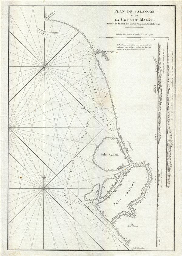
Plan de Salangor et de La Cote de Malaye depuis al Pointe de Caran jusqu au Mont Parcelar.
sold
- Digital Map Information
- Suitable for large format printing
- Full resolution TIFF file
- ICC color profile embedded
- Delivered instantly via download link
A scarce 1775 map of the coasts of Malay (modern day Malaysia) in the vicinity of Kuala Lumpur. This is a fine example Jean-Baptiste d'Apres de Mannevillette 1775 nautical chart or maritime map of Selangor and the Strait of ... (more details)

North America XIV Florida.
sold
- Digital Map Information
- Suitable for large format printing
- DPI: 300
- File Size: 6.21 MB
- File Type: ZIP / TIFF
- ICC color profile embedded
- Delivered instantly via download link
This is a beautiful 1848 full color edition of the S.D.U.K. map of Florida. It covers the state of Florida in its entirety with the westernmost portion depicted in an inset in the bottom left quadrant. The map identifies ... (more details)
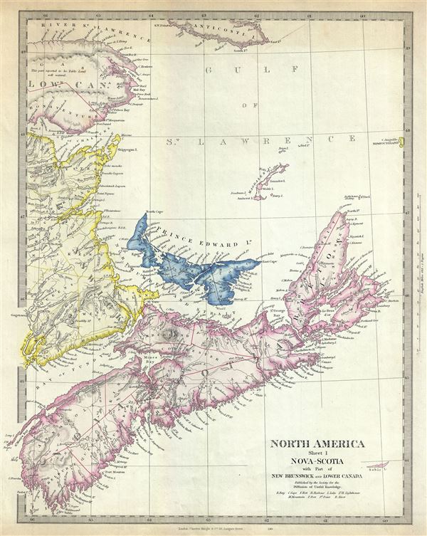
North America Sheet I Nova-Scotia with Part of New Brunswick and Lower Canada.
sold
- Digital Map Information
- Suitable for large format printing
- DPI: 300
- File Size: 6.82 MB
- File Type: ZIP / TIFF
- ICC color profile embedded
- Delivered instantly via download link
An uncommon 1848 full color edition of the S.D.U.K. map of Nova Scotia. The map covers the maritime provinces of Canada including the Prince Edward Island and part of New Brunswick and Quebec. Canadian provinces and ... (more details)
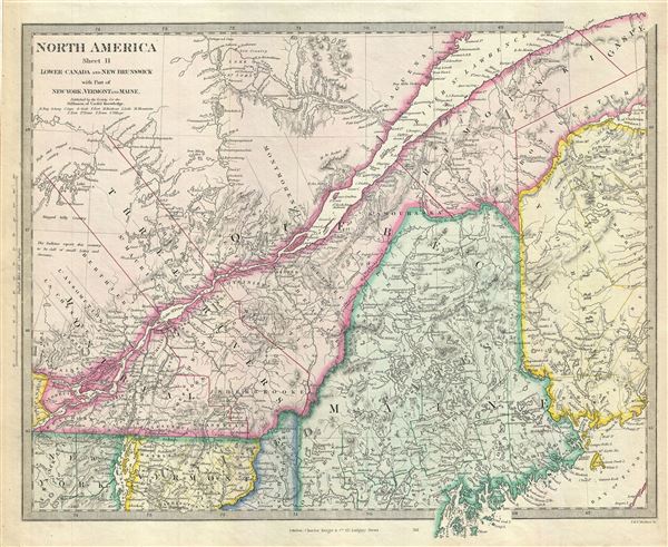
North America Sheet II Lower Canada and New Brunswick with Part of New-York, Vermont and Maine.
sold
- Digital Map Information
- Suitable for large format printing
- DPI: 300
- File Size: 9.05 MB
- File Type: ZIP / TIFF
- ICC color profile embedded
- Delivered instantly via download link
This is a lovely 1848 map depicting Quebec, Canada and Maine, United States, issued by the S.D.U.K. Parts of New Brunswick, Vermont and New York are also included. Centered on the St. Lawrence River, it covers part ... (more details)
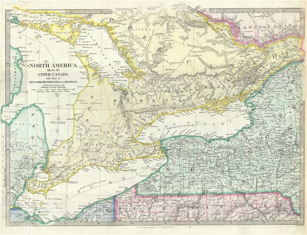
North America Sheet III Upper Canada with Parts of New-York, Pennsylvania and Michigan.
sold
- Digital Map Information
- Suitable for large format printing
- Full resolution TIFF file
- ICC color profile embedded
- Delivered instantly via download link
This is an attractive 1848 map of Upper Canada or Ontario issued by the S.D.U.K. Centered on Lake Ontario, the map covers from Drummond Island in the United States to Vaudreuil. Three of the Five Great Lakes, Lake ... (more details)