
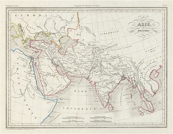
Asie Ancienne.
$100.00
Acquire
- Digital Map Information
- Suitable for large format printing
- DPI: 300
- File Size: 4.02 MB
- File Type: ZIP / TIFF
- ICC color profile embedded
- Delivered instantly via download link
This is a fine example of Conrad Malte-Brun's 1843 map of Asia in antiquity. It shows the continent only as far as modern day Vietnam and does not include China or Mongolia. The Caspian Sea is notably malformed and suggestive of a general lack of knowledge ... (more details)

Afrique Ancienne.
sold
- Digital Map Information
- Suitable for large format printing
- DPI: 300
- File Size: 4.46 MB
- File Type: ZIP / TIFF
- ICC color profile embedded
- Delivered instantly via download link
This is a fine example of Conrad Malte-Brun's 1843 map of northern Africa in ancient times. It depicts the various ancient kingdoms and offers a good detail in the deserts - some of which is entirely speculative. The ancient empires of Mauritania, ... (more details)
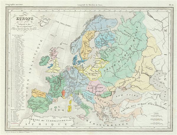
Europe en 1100 indiquant la date de la Fondation des Differens Etats.
sold
- Digital Map Information
- Suitable for large format printing
- DPI: 300
- File Size: 4.71 MB
- File Type: ZIP / TIFF
- ICC color profile embedded
- Delivered instantly via download link
This is a fine example of Conrad Malte-Brun's 1843 map of europe in 1100 AD, showing the date of the foundation of several states. It covers all of europe and parts of Asia during the High Middle Ages and the decline of the Byzantine empire. ... (more details)
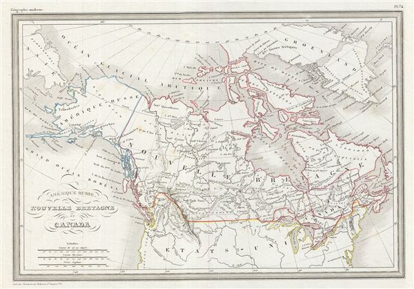
Amerique Russe, Nouvelle Bretagne et Canada.
sold
- Digital Map Information
- Suitable for large format printing
- DPI: 300
- File Size: 5 MB
- File Type: ZIP / TIFF
- ICC color profile embedded
- Delivered instantly via download link
This is a fine example of Conrad Malte-Brun's 1843 map of Canada and Alaska (Russian America). It covers from the Arctic Ocean to the United States and from the Bering Sea to Newfoundland. This map identifies American claims to parts of ... (more details)

Carte du Bresil.
sold
- Digital Map Information
- Suitable for large format printing
- Full resolution TIFF file
- ICC color profile embedded
- Delivered instantly via download link
This is a fine example of Conrad Malte-Brun's 1843 map of Brazil. It covers all of modern day Brazil from Guyana and Colombia in the north to Uruguay in the south and from Bolivia in the west to the Atlantic. Much of South America was, ... (more details)

Perou et Bolivia
sold
- Digital Map Information
- Suitable for large format printing
- DPI: 300
- File Size: 4.24 MB
- File Type: ZIP / TIFF
- ICC color profile embedded
- Delivered instantly via download link
This is a fine example of Conrad Malte-Brun's 1843 map of Peru and Bolivia. It covers from Colombia to the Argentine Republic and from the Pacific to Brazil. Bolivia's claims to the Atacama Desert and Peru's claims to the Tarapaca ... (more details)

Afrique.
sold
- Digital Map Information
- Suitable for large format printing
- DPI: 300
- File Size: 7.55 MB
- File Type: ZIP / TIFF
- ICC color profile embedded
- Delivered instantly via download link
This is a fascinating example of Conrad Malte-Brun's 1843 map of Africa. The map covers the entire continent from the Mediterranean Sea to Cape Colony and from the Atlantic Ocean to Madagascar and the Seychelles Islands in the ... (more details)
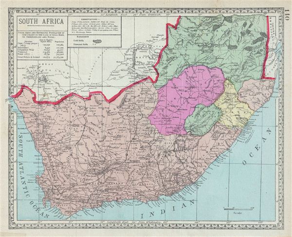
South Africa.
sold
- Digital Map Information
- Suitable for large format printing
- File Size: 5.56 MB
- File Type: ZIP / TIFF
- ICC color profile embedded
- Delivered instantly via download link
This is a beautiful example of the 1882 Tunison map of South Africa. It covers South Africa including Basutoland (Kingdom of Lesotho). Various Gold and Diamond Fields are identified. After the discovery of diamonds in 1867 ... (more details)
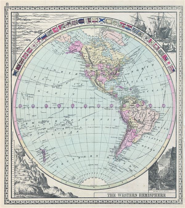
The Western Hemisphere.
sold
- Digital Map Information
- Suitable for large format printing
- File Size: 6.87 MB
- File Type: ZIP / TIFF
- ICC color profile embedded
- Delivered instantly via download link
This is a beautiful example of the 1887 Tunison map of the Western Hemisphere. It covers from the Arctic Ocean and Greenland south as far as the Antarctica. The map is surrounded by flags of various countries, including the ... (more details)

Tunison's Farther India and Sunda Isles.
sold
- Digital Map Information
- Suitable for large format printing
- File Size: 6.61 MB
- File Type: ZIP / TIFF
- ICC color profile embedded
- Delivered instantly via download link
This is a beautiful example of the 1887 Tunison map of the east Indies. It covers from Burma in the extreme northwest to the West Nusa Tenggara islands in Indonesia. It includes the modern day countries of Burma, Thailand, ... (more details)
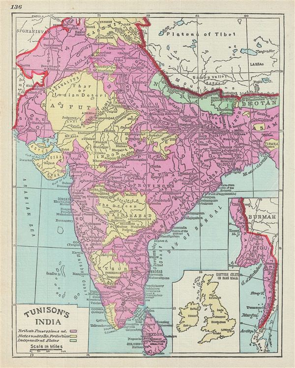
Tunison's India.
sold
- Digital Map Information
- Suitable for large format printing
- File Size: 4.99 MB
- File Type: ZIP / TIFF
- ICC color profile embedded
- Delivered instantly via download link
This is a beautiful example of the 1887 Tunison map of India. It covers the entire subcontinent from Kashmir south to Ceylon (Sri Lanka) and from Sindh east to Assam. An inset in the lower right quadrant details parts of ... (more details)
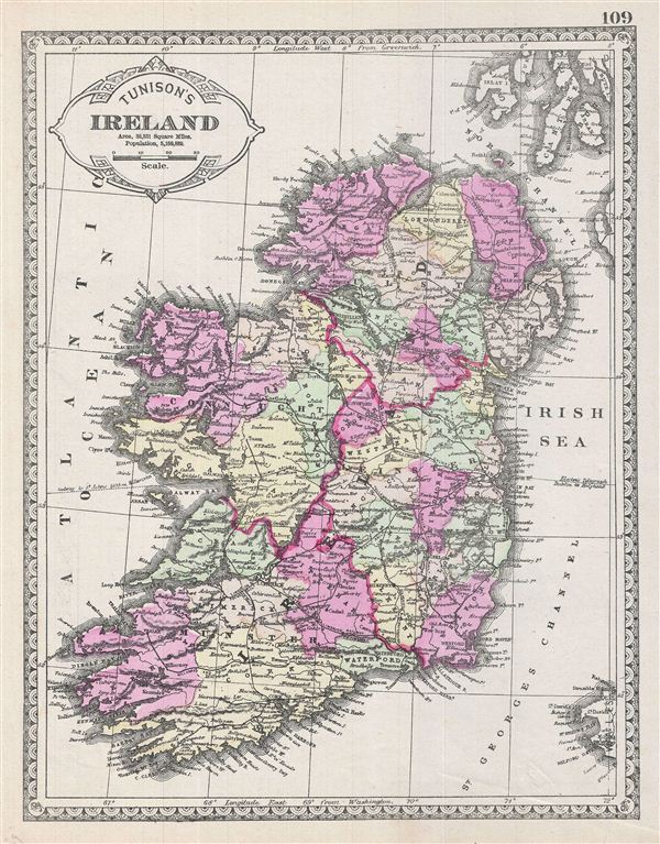
Tunison's Ireland.
sold
- Digital Map Information
- Suitable for large format printing
- File Size: 6.39 MB
- File Type: ZIP / TIFF
- ICC color profile embedded
- Delivered instantly via download link
This is a beautiful example of the 1887 Tunison map of Ireland. The map covers the emerald Isle in full from Donegal to Cork. Ireland is divided into its four primary provinces, Munster, Ulster, Connaught and Leinster. ... (more details)

Tunison's Michigan.
sold
- Digital Map Information
- Suitable for large format printing
- File Size: 6.84 MB
- File Type: ZIP / TIFF
- ICC color profile embedded
- Delivered instantly via download link
This is a beautiful example of the 1887 Tunison map of Michigan. It covers the state of Michigan from Marquette to Monroe excluding the northwest part of the state. The map also covers parts of neighboring Wisconsin. A ... (more details)
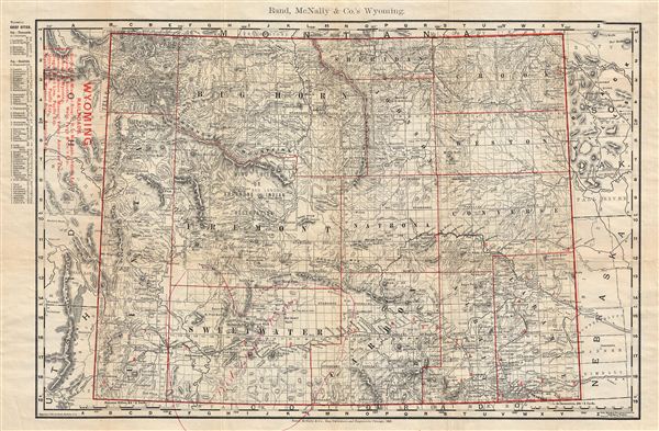
Pocket Map and Shippers' Guide of Wyoming.
sold
- Digital Map Information
- Suitable for large format printing
- File Size: 13.36 MB
- File Type: ZIP / TIFF
- ICC color profile embedded
- Delivered instantly via download link
An uncommon 1901 map of Wyoming by Rand, McNally, and Company. Rand McNally first issued this map in 1895. The map covers the entire state of Wyoming identifying counties, rivers, topography and railroads. An index of ... (more details)
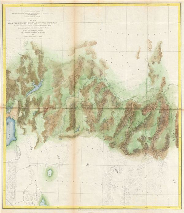
Map No. 3 From the Humboldt Mountains to the Mud Lakes, from Explorations and Surveys made under the direction of the Hon. Jefferson Davis Secretary of War by Capt. E. G. Beckwith 3rd Artillery F. W. Egloffstein Topographer for the Route 1855.
sold
- Digital Map Information
- Suitable for large format printing
- File Size: 11.56 MB
- File Type: ZIP / TIFF
- ICC color profile embedded
- Delivered instantly via download link
This is a rare and important 1855 map of parts of Nevada prepared for the Pacific Railroad Survey . This map covers from the Humboldt Mountains (West Humboldt Range), at the western end of the Great Basin, westward was ... (more details)
The culmination of the U.S. Coast Survey's work around San Francisco.
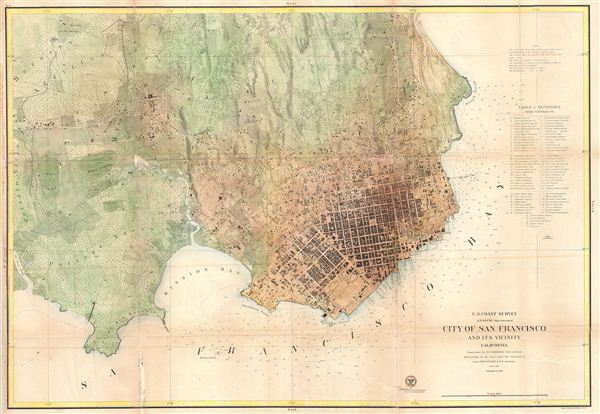
City of San Francisco and its Vicinity California.
sold
- Digital Map Information
- Suitable for large format printing
- File Size: 31.03 MB
- File Type: ZIP / TIFF
- ICC color profile embedded
- Delivered instantly via download link
A rare coastal chart of San Francisco by the U. S. Coast Survey, 1859. Oriented to the west, this map depicts the immediate city of San Francisco and surrounding areas as far as the Mission de Dolores and Rancho San ... (more details)

Preliminary Chart of Rappahannock River Virginia from Entrance to Deep Creek.
sold
- Digital Map Information
- Suitable for large format printing
- File Size: 13.73 MB
- File Type: ZIP / TIFF
- ICC color profile embedded
- Delivered instantly via download link
An uncommon example of the 1857 U.S. Coast Survey nautical chart or maritime map of the Rappahannock River, Virginia. The map focuses on the southern part of the Rappahannock River where it enters into the ... (more details)

Preliminary Chart of Rappahannock River Virginia from Occupacia Creek to Deep Creek.
sold
- Digital Map Information
- Suitable for large format printing
- File Size: 12.41 MB
- File Type: ZIP / TIFF
- ICC color profile embedded
- Delivered instantly via download link
An uncommon example of the 1857 U.S. Coast Survey nautical chart or maritime map of the Rappahannock River, Virginia. The map focuses on the middle part of the Rappahannock just north of the River's ... (more details)
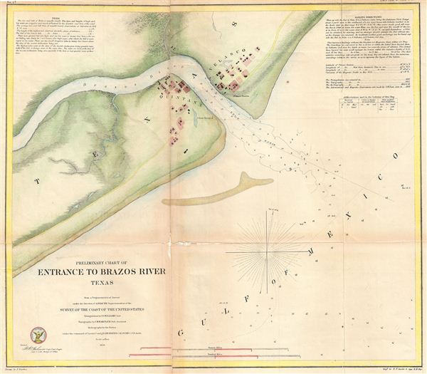
Preliminary Chart of Entrance to Brazon River, Texas
sold
- Digital Map Information
- Suitable for large format printing
- File Size: 7.83 MB
- File Type: ZIP / TIFF
- ICC color profile embedded
- Delivered instantly via download link
An uncommon example of the 1858 U.S. Coast Survey nautical chart or maritime map of the entrance to the Brazos River, Texas. The map focuses on the Brazos River's outlet into the Gulf of Mexico an ... (more details)
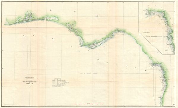
Sketch G Showing the Progress of the Survey in part of Section VII from 1849 to 1871.
sold
- Digital Map Information
- Suitable for large format printing
- File Size: 15.8 MB
- File Type: ZIP / TIFF
- ICC color profile embedded
- Delivered instantly via download link
An uncommon example of the 1871 U.S. Coast Survey progress and triangulation chart or map of the Gulf coast of northern Florida from Pensacola to the Cedar Keys, including St. Georges Sound. ... (more details)