
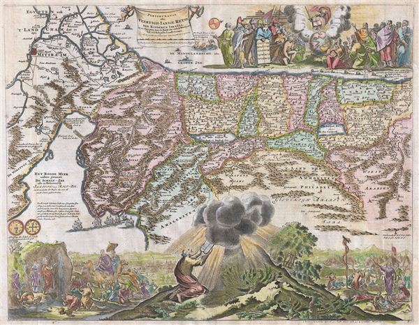
Perigrinatie oste Veertigh-Iarige Reyse der Kinderen Israels, Uyt Egypten door de Roode Zee endede Woestyne tot in't Beloof de Lande Canaan.
sold
- Digital Map Information
- Suitable for large format printing
- DPI: 300
- File Size: 12.61 MB
- File Type: ZIP / TIFF
- ICC color profile embedded
- Delivered instantly via download link
An absolutely stunning c. 1687 map of the Holy Land, Israel, or Palestine by N. Visscher and Jan van den Avelen. This map, from a Dutch Bible, is oriented to west and covers from the Nile Delta, Cairo and Memphis, egypt, across the Red Sea and along the ... (more details)

Ungarn und seine südlichen Nachbarländer seit 1526.
sold
- Digital Map Information
- Suitable for large format printing
- DPI: 300
- File Size: 8.07 MB
- File Type: ZIP / TIFF
- ICC color profile embedded
- Delivered instantly via download link
This is Karl von Spruner's 1854 map of Hungary and its neighbors since 1526. The map covers all of Hungary and includes an inset map detailing the northern boundary of Ottoman rule in the 16th and 17th century. The year 1526 marks the Battle of Mohacs ... (more details)

Die Ostsee-Laender, Polen und Litthauen im Anfange des XIIIten Jahrhunderts. Die Ordens-Gebiete in Preussen und Livland bis 1525 und 1562.
sold
- Digital Map Information
- Suitable for large format printing
- DPI: 300
- File Size: 7.1 MB
- File Type: ZIP / TIFF
- ICC color profile embedded
- Delivered instantly via download link
This is Karl von Spruner's 1854 map of Poland and Lithuania in the beginning of the 13th century and of Prussia and Livonia between 1525 and 1562. essentially two maps on a single sheet. The leftmost map covers from the Gulf of Finland and estonia to ... (more details)

Die Reiche der Karolinger.
sold
- Digital Map Information
- Suitable for large format printing
- DPI: 300
- File Size: 7.85 MB
- File Type: ZIP / TIFF
- ICC color profile embedded
- Delivered instantly via download link
This is Karl von Spruner's 1854 map of the Holy Roman or Carolingian empire. The map covers Charlemagne's empire from modern day Germany to Italy and shows the division at Verdun in August 845. Inset maps on the bottom left corner and near the bottom ... (more details)

Europa zur Zeit Carl's des Grossen.
sold
- Digital Map Information
- Suitable for large format printing
- DPI: 300
- File Size: 9.1 MB
- File Type: ZIP / TIFF
- ICC color profile embedded
- Delivered instantly via download link
This is Karl von Spruner's 1854 map of europe at the time of Charlemagne. The map covers all of europe from Sweden south as far as Africa and from Portugal to the Caspian Sea in the east. After ruling and reforming France in 768, Charlemagne ... (more details)

Das Roemische Reich und die noerdlichen Barbaren im IVten Jahrhundert.
sold
- Digital Map Information
- Suitable for large format printing
- DPI: 300
- File Size: 9.15 MB
- File Type: ZIP / TIFF
- ICC color profile embedded
- Delivered instantly via download link
This is Karl von Spruner's 1854 map illustrating the Roman empire and the northern Barbarians tribes during the 4th century. The map covers the span of the Roman empire from the British Isles south, as far as Africa, and from Portugal to the ... (more details)

Die iberische Halbinsel nach ihrer kirchlichen Eintheilung. Mit Angabe der romischen & gothischen Bischofsitze, so wie der aeltesten & wichtigern Kloster.
sold
- Digital Map Information
- Suitable for large format printing
- DPI: 300
- File Size: 8.45 MB
- File Type: ZIP / TIFF
- ICC color profile embedded
- Delivered instantly via download link
This is Karl von Spruner's 1854 map of the Iberian Peninsula (Spain and Portugal) illustratingits ecclesiastical divisions. The map covers all of Spain and Portugal from France to the Mediterranean Sea. It also includes the Balearic Islands ... (more details)
Identifies the Sea of Korea.

The Empire of China with its Principal Divisions.
sold
- Digital Map Information
- Suitable for large format printing
- Full resolution TIFF file
- ICC color profile embedded
- Delivered instantly via download link
A fine 1794 map of China and Korea by the London firm of Laurie and Whittle. Centered on China, this maps covers from Chinese Tartary to the Gulf of Tonkin and the Philippines and from the Gobi Desert to Korea and Japan. The map includes ... (more details)

Preliminary Chart of the Pacific Coast from Point Pinos to Bodega Head, California.
sold
- Digital Map Information
- Suitable for large format printing
- File Size: 23.76 MB
- File Type: ZIP / TIFF
- ICC color profile embedded
- Delivered instantly via download link
An uncommon and highly appealing 1862 U.S. Coast Survey nautical chart or maritime map of San Francisco Bay and vicinity. The map covers from Bodega Bay and Tomales Bay, in the north, southward as far as Monterrey Bay, inclusive of San ... (more details)
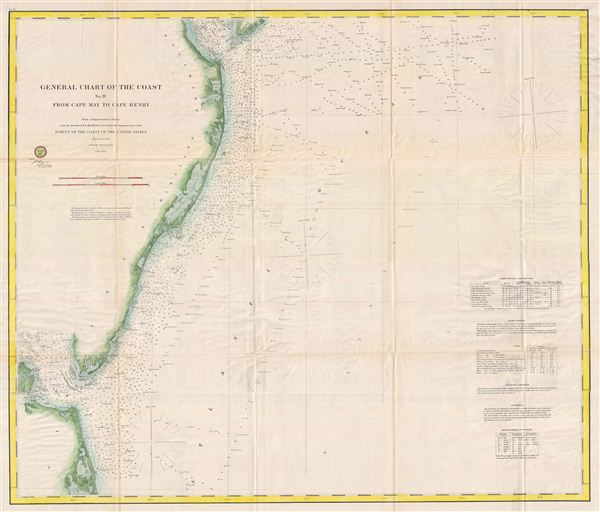
General Chart of the Cost No. IV From Cape May to Cape Henry.
sold
- Digital Map Information
- Suitable for large format printing
- File Size: 25.82 MB
- File Type: ZIP / TIFF
- ICC color profile embedded
- Delivered instantly via download link
An uncommon and highly appealing 1862 U.S. Coast Survey nautical chart or maritime map of Atlantic Coast of Delaware, Maryland, and Virginia. The map covers from the entrance to Delaware Bay (and Cape May) southwards to the entrance to ... (more details)

Atlantic Coast of the United States (in four sheets) Sheet No. II Nantucket to Cape Hatteras.
sold
- Digital Map Information
- Suitable for large format printing
- File Size: 16.96 MB
- File Type: ZIP / TIFF
- ICC color profile embedded
- Delivered instantly via download link
An uncommon and highly appealing U.S. Coast Survey nautical chart or maritime map of Atlantic Coast of the United States. The map covers from Nantucket to Cape Hatteras, inclusive of Long Island, New York City, Delaware Bay, the ... (more details)

Bristol Harbor Rhode Island.
sold
- Digital Map Information
- Suitable for large format printing
- File Size: 6.43 MB
- File Type: ZIP / TIFF
- ICC color profile embedded
- Delivered instantly via download link
An uncommon and highly appealing U.S. Coast Survey nautical chart or maritime map of Bristol Harbor, Narragansett Bay, Rhode Island. The map covers from Prudence Island to Rhode Island ad from Popasquash Neck to Bristol. The ... (more details)

Gezigt van den Iagang van Chequetan, of Seguataneo leggende N.O. op een asstand van 5 Eng. Mylen. / Gezigt van den Ingang van de Haven van Acapulco.
sold
- Digital Map Information
- Suitable for large format printing
- File Size: 5.74 MB
- File Type: ZIP / TIFF
- ICC color profile embedded
- Delivered instantly via download link
A pair of appealing 1765 nautical views of the Mexican harbors of Acapulco and Zihuatanejo by George Anson and Jan van Schley. These shore profiles include beautiful renderings of 18th century sailing ships as well as still ... (more details)

A Plan of the Harbour of Chequetan or Seguataneo Lying in the Lat.d of 17 d. 36 m. No.
sold
- Digital Map Information
- Suitable for large format printing
- DPI: 300
- File Size: 8.58 MB
- File Type: ZIP / TIFF
- ICC color profile embedded
- Delivered instantly via download link
An extremely attractive 1745 map of the Mexican harbor of Zihuatanejo by George Anson. Details the harbor beautifully showing mountains, waterways, and trees as well as offering detailed depth soundings and nautical ... (more details)

(J bis) Sktech J Showing the Progress of the Survey in Section No. X (Middle Sheet) From Pt. Sal to Tomales Bay from 1850 to 1862.
sold
- Digital Map Information
- Suitable for large format printing
- File Size: 12.36 MB
- File Type: ZIP / TIFF
- ICC color profile embedded
- Delivered instantly via download link
An exceptional example of the 1862 U.S. Coast Survey's progress nautical and triangulation chart for the San Francisco Bay region, California. Centered on the San Francisco Bay, this chart covers the Californaia ... (more details)

Barnstable Harbor Massachusetts.
sold
- Digital Map Information
- Suitable for large format printing
- File Size: 15.54 MB
- File Type: ZIP / TIFF
- ICC color profile embedded
- Delivered instantly via download link
An uncommon and highly appealing U.S. Coast Survey nautical chart or maritime map of Barnstable Harbor, Cape Cod, Massachusetts. The map covers from Great Creak and Sandy Neck south to the Cape Cod Railroad and ... (more details)
Rare example of this lovely map with an elaborate decorative border. Identifies the phantom island of Borodon or St. Brendan.
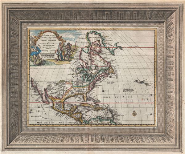
L'Amerique Septentrionale Suivant les Nouvelles Observations de Messrs. De L'Academie Royal des Sciences, etx.
sold
- Digital Map Information
- Suitable for large format printing
- Full resolution TIFF file
- ICC color profile embedded
- Delivered instantly via download link
A fine 1729 map of North America by Pieter Van der Aa with an elaborate frame style border. Centered on the Great Lakes, this map covers all of North America from the Baffin Bay to the Spanish Map and from ... (more details)
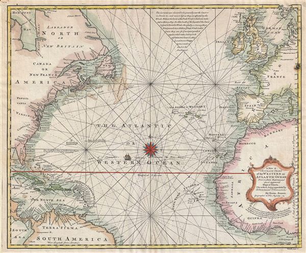
A New and Accurate Chart of the Western Ocean.
sold
- Digital Map Information
- Suitable for large format printing
- DPI: 300
- File Size: 15.21 MB
- File Type: ZIP / TIFF
- ICC color profile embedded
- Delivered instantly via download link
A fine map of the Atlantic Ocean drawn by emmanuel Bowen in 1744. The map covers from the Arctic Ocean to South America and Africa's Slave Coast and from Cuba and Florida eastwards as far as England and ... (more details)

Die Britischen Inseln bis auf Wilhelm den Eroberer 1066.
sold
- Digital Map Information
- Suitable for large format printing
- DPI: 300
- File Size: 12.01 MB
- File Type: ZIP / TIFF
- ICC color profile embedded
- Delivered instantly via download link
This is Karl von Spruner's 1854 historical map of the British Isles shortly following the 1066 invasion of William the Conqueror. The map covers from the Orkney Islands to Cornwall, including Ireland. ... (more details)

Scandinavien bis zum Frieden von Friedrichshamm 1809. Mit Angabe der, bis zur neuesten Zeit merkwuerdig gewordenen Orte.
sold
- Digital Map Information
- Suitable for large format printing
- DPI: 300
- File Size: 12.15 MB
- File Type: ZIP / TIFF
- ICC color profile embedded
- Delivered instantly via download link
This is Karl von Spruner's 1854 historical map of Scandinavia just prior to the Treaty of Fredrikshamn. The map covers Sweden, Norway, Denmark and Finland and includes parts of Russia. On September ... (more details)