
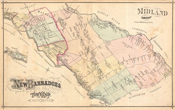
New Baradoes Township. Midland Township.
sold
- Digital Map Information
- Suitable for large format printing
- File Size: 10.86 MB
- File Type: ZIP / TIFF
- ICC color profile embedded
- Delivered instantly via download link
Very detailed map of New Barbadoes and Midland Townships, New Jersey, in 1876, showing roads and property boundaries and owners' names. Notable too is the early depiction of school district boundaries in a state that today publicizes the high quality of its ... (more details)
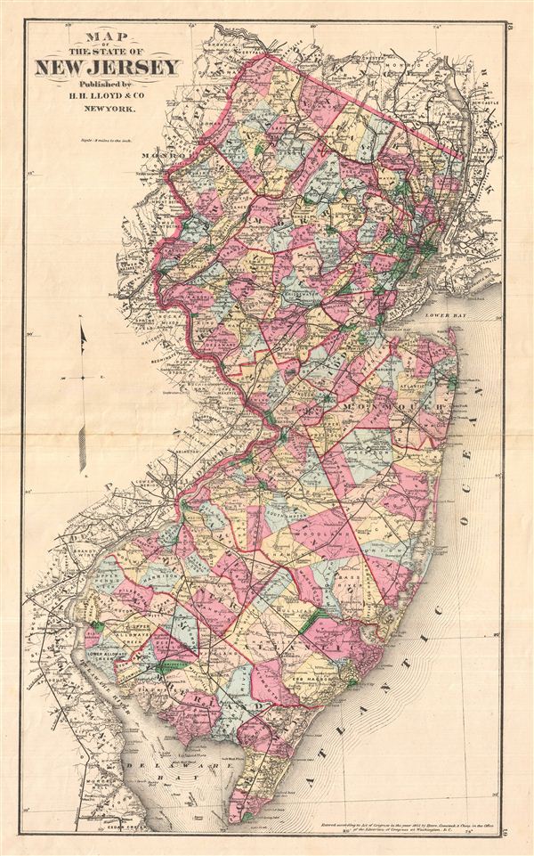
Map of the State of New Jersey
sold
- Digital Map Information
- Suitable for large format printing
- File Size: 11.28 MB
- File Type: ZIP / TIFF
- ICC color profile embedded
- Delivered instantly via download link
A fine double page 1876 map of New Jersey drawn by H. H. Lloyd and, copyrighted by Frederick Beers, and published by Walker & Pease. Covers the entire state with color coding according to county. Shows major roadways and railways as well as basic ... (more details)
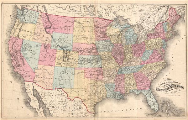
Railroad Map of the United States.
sold
- Digital Map Information
- Suitable for large format printing
- File Size: 15.88 MB
- File Type: ZIP / TIFF
- ICC color profile embedded
- Delivered instantly via download link
Beautifully detailed Railroad Map of the United States, with the Rocky Mountains depicted by fine hachure as a single thin line of mountains. Fascinating to see the country at the precise moment of its centennial. Drawn by H.H. Lloyd & Co. N.Y., ... (more details)

Chart of the World on Mercators Projection by H.H. Lloyd & Co. New York.
sold
- Digital Map Information
- Suitable for large format printing
- File Size: 13.79 MB
- File Type: ZIP / TIFF
- ICC color profile embedded
- Delivered instantly via download link
Unique and attractive 'Chart of the World on Mercator's Projection' with two insets of the world in hemispheres. A fascinating glimpse of what the world looked like at the moment of the U.S.'s centennial, to a presumably well-off, well-educated ... (more details)

Cresskill, Palisade Township.
sold
- Digital Map Information
- Suitable for large format printing
- File Size: 10.83 MB
- File Type: ZIP / TIFF
- ICC color profile embedded
- Delivered instantly via download link
Extremely detailed map of Cresskill in Palisade Township, New Jersey. Published in Walker & Pease' exquisite centennial 'topographical, illustrated, historical, descriptive' Atlas of Bergen County, New Jersey , ... (more details)

Lodi & Ridgewood.
sold
- Digital Map Information
- Suitable for large format printing
- File Size: 34.34 MB
- File Type: ZIP / TIFF
- ICC color profile embedded
- Delivered instantly via download link
A Map of Lodi Township, New Jersey, with Maps of Wood-Ridge, New Jersey and another map of another part of Lodi Township, New Jersey, all showing roads, property boundaries and owners' names. Notable too is ... (more details)

Coytesville.
sold
- Digital Map Information
- Suitable for large format printing
- File Size: 9.2 MB
- File Type: ZIP / TIFF
- ICC color profile embedded
- Delivered instantly via download link
A Map of Coytesville, New Jersey locating property boundaries and owners' names, with an enchanting view of George Dayton's residence and horses and buggy's passing. With a text ad on verso advertising ... (more details)
One of only four known examples.

Colton's Georgetown and the city of Washington the Capital of the United States of America. / Colton's Map Showing Part of Virginia, Maryland, Pennsylvania, New Jersey & New York.
sold
- Digital Map Information
- Suitable for large format printing
- File Size: 19.23 MB
- File Type: ZIP / TIFF
- ICC color profile embedded
- Delivered instantly via download link
A highly unusual discovery, this is an independently issued c. 1862 map of Washington D.C. and the Chesapeake Bay area by the American cartographer J. H. Colton. Our research has only been able to ... (more details)

Dickinson, Robert L., Palisades Interstate Park, 1921.
sold
- Digital Map Information
- Suitable for large format printing
- File Size: 11.88 MB
- File Type: ZIP / TIFF
- ICC color profile embedded
- Delivered instantly via download link
exquisitely illustrated guidebook to Palisades, New Jersey Interstate Park, drawn and illustrated in 1921 by Robert Dickinson. Contains charmingly drawn views, detailed descriptions of various ... (more details)

Pictorial Map of Florida.
sold
- Digital Map Information
- Suitable for large format printing
- File Size: 9.79 MB
- File Type: ZIP / TIFF
- ICC color profile embedded
- Delivered instantly via download link
A fine decorative pictorial map, this charming tri-color tourist map of Florida is covered in fascinating details that make Florida look like it was the only place for men to be in the 1940s. ... (more details)
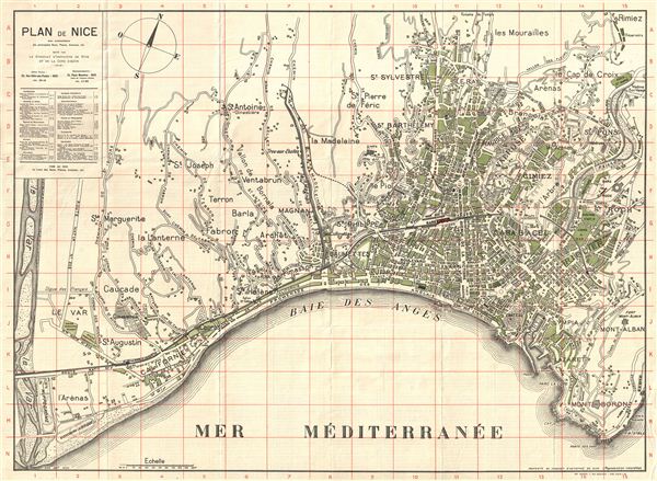
Plan de la Ville De Nice avec nomenclature des principales Rues, Places, Avenues, etc. Edite par le syndicat d'Initiative de Nice et de la Cote d'Azur
sold
- Digital Map Information
- Suitable for large format printing
- File Size: 3.68 MB
- File Type: ZIP / TIFF
- ICC color profile embedded
- Delivered instantly via download link
extremely attractive plan of Nice in 1920, showing individual building footprints and with a legend identifying various museums, newspaper offices, social clubs and sights. Wonderful French ... (more details)

A Comparative View of the Heights of the Principal Mountains in the World. Drawn and Eng'd by R. Scott.
sold
- Digital Map Information
- Suitable for large format printing
- File Size: 3.19 MB
- File Type: ZIP / TIFF
- ICC color profile embedded
- Delivered instantly via download link
This is an extremely interesting takes on the comparative heights of mountains cartographic sub-genre, as it adds human achievement and buildings to the scale. Comparative mountains charts ... (more details)
One of the crowning glories of modern cartography
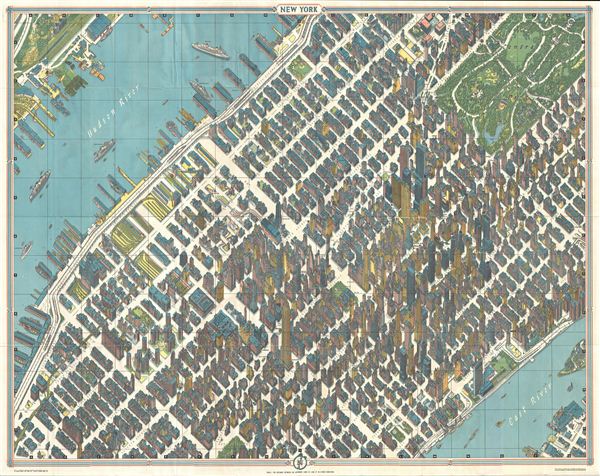
New York Map-Guide
sold
- Digital Map Information
- Suitable for large format printing
- File Size: 69.4 MB
- File Type: ZIP / TIFF
- ICC color profile embedded
- Delivered instantly via download link
One of the greatest cartographic feats of all time, this 1963 axonometric ('bird's eye view') map of New York City was the first such since 1866. The technique dates back to the 15th ... (more details)
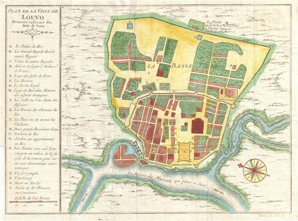
Plan de la Ville De Luovo Deineure ordinarie des Rois du Siam.
sold
- Digital Map Information
- Suitable for large format printing
- DPI: 300
- File Size: 3.46 MB
- File Type: ZIP / TIFF
- ICC color profile embedded
- Delivered instantly via download link
A beautifully detailed and engraved c. 1750 plan of the city of Louvo (Lopburi), the 'ordinary abode' of the kings of Siam (Thailand) on the Menam (Chao Phraya) River. An ancient ... (more details)
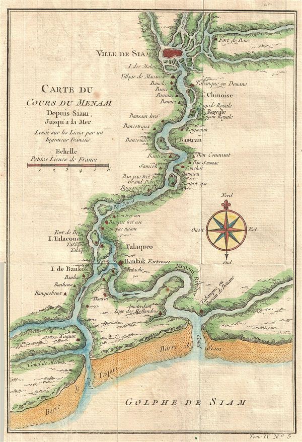
Carte du Cours Du Menam Depuis Siam Jusqu'a La Mer Levee sur los Lieux par un Ingenieur Francois
sold
- Digital Map Information
- Suitable for large format printing
- DPI: 300
- File Size: 1.84 MB
- File Type: ZIP / TIFF
- ICC color profile embedded
- Delivered instantly via download link
A beautifully hand-colored, copper engraving from the mid-1700s detailing the course of the Chao Phraya River from the former Thai royal capital Ayutthaya (known to europeans as ... (more details)
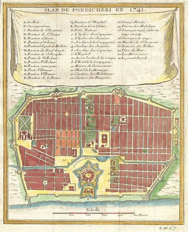
Plan de Pondicheri en 1741.
sold
- Digital Map Information
- Suitable for large format printing
- DPI: 300
- File Size: 2.18 MB
- File Type: ZIP / TIFF
- ICC color profile embedded
- Delivered instantly via download link
This beautifully hand colored map of Pondicherry (now 'Puducherry'), India was drawn by Nicholas Bellin and dates to the 1750s. The site of Pondicherry had been a trading post ... (more details)
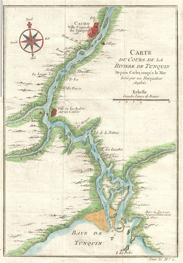
Carte Du Cours De La Riviere De Tonquin Depuis Cacho jusqu'a la Mer, Levee par un Navigateur Anglois.
sold
- Digital Map Information
- Suitable for large format printing
- DPI: 300
- File Size: 1.64 MB
- File Type: ZIP / TIFF
- ICC color profile embedded
- Delivered instantly via download link
Laden with reddish silt, the Red River, once known as the 'River of Tonkin,' begins in China and forms part of Vietnam's border with China before turning south to pass Hanoi ... (more details)
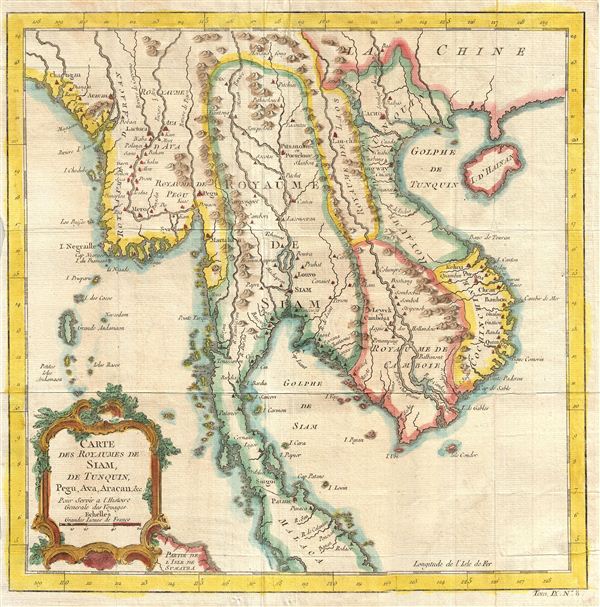
Carte des Royauames de Siam, de Tunquin, Pegu, Ava, Aracan, &c. Pour Servir a a L'Histoire Generale des Voyages.
sold
- Digital Map Information
- Suitable for large format printing
- DPI: 300
- File Size: 4.72 MB
- File Type: ZIP / TIFF
- ICC color profile embedded
- Delivered instantly via download link
A beautifully detailed and engraved c. 1750 map of Southeast Asia. Centered on the Chao Phraya River, this map covers from the Kingdom of Aracan to the Gulf of Tonkin and ... (more details)
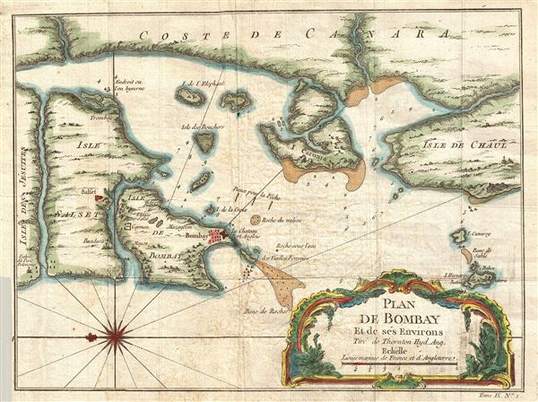
Plan De Bombay et de Ses Environs, Tire de Thornton Hyd. Ang.
sold
- Digital Map Information
- Suitable for large format printing
- DPI: 300
- File Size: 3.39 MB
- File Type: ZIP / TIFF
- ICC color profile embedded
- Delivered instantly via download link
This beautifully hand colored, copper-plate engraved, 1752 map of Bombay (Mumbai), captures the town that was becoming the east India Company's base of operations in ... (more details)
Rare mid-19th century Nautical Chart of Hong Kong.
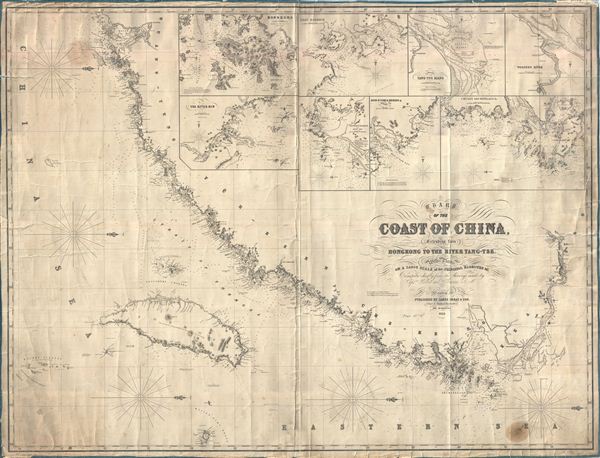
Chart of the Coast of China, Extending from Hong Kong to the River Yang-Tse, with Plans on a Large Scale of the Principal Harbours & C.
sold
- Digital Map Information
- Suitable for large format printing
- File Size: 65.86 MB
- File Type: ZIP / TIFF
- ICC color profile embedded
- Delivered instantly via download link
An impressive large 1855 format nautical chart or maritime map detailing the coast of China from the Yangtze River to Hong Kong and Macao. Map incudes Taiwan or Formosa in full. Drawn by the nautical chart maker James Imray, this is one of the rarest 19th century maps of Hong Kong and Taiwan. It includes insets of Hong Kong, the River Min, Amoy Harbor (Xiamen), Tongsang harbor, Hoo-e-Two and Chimmo Bays, the mouth of the Yangtze, and the Chusan Archipelago (Zhoushan). Dated 1855. (more details)