
One of the first accurate maps of the California Coast around San Francisco.
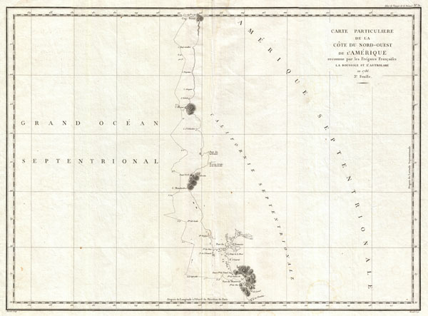
Carte Particuliere de la Cote du Nord-Ouest de l Amerique reconnue par les Fregates Francaises la Boussole et l Astrolabe en 1786. 3e. Feuille.
sold
- Digital Map Information
- Suitable for large format printing
- DPI: 300
- File Size: 14.05 MB
- File Type: ZIP / TIFF
- ICC color profile embedded
- Delivered instantly via download link
This is a fine example of La Perouse's important 1787 mapping of the California and Oregon coastlines from Port de Monterey (Monterey Bay) northwards past the Port de St. Francois (San Francsico Bay) and Cape Mendocino to Cap Rond (Tillamook Head, Oregon). Though ... (more details)
One of the first map of Vancouver's western shore and British Columbia.

Carte Particuliere de la Cote du Nord-Ouest de l Amerique reconnue par les Fregates Francaises la Boussole et l Astrolabe en 1786. 2e. Feuille.
sold
- Digital Map Information
- Suitable for large format printing
- DPI: 300
- File Size: 14.1 MB
- File Type: ZIP / TIFF
- ICC color profile embedded
- Delivered instantly via download link
This is a fine example of La Perouse's important 1787 mapping of Vancouver Island and the coastlines of Washington and British Columbia. When drawn in 1787 La Perouse's map was the only available map of this region not based on the survey work of Captain Cook. ... (more details)
Extremely rare early Mexican map of San Diego. Only four known examples!
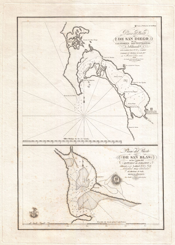
Plano del Puerto de San Diego de la California Septentrional. Plano del Puerto de San Blas en Las Costas del Estado de Xalisco.
sold
- Digital Map Information
- Suitable for large format printing
- Full resolution TIFF file
- ICC color profile embedded
- Delivered instantly via download link
This is an exceptionally rare and early map of San Diego Bay, California, and San Blas, Mexico, published in 1825 by order of Senor Don Guadalupe Victoria, the first president of the Republic of Mexico. Essentially two maps on a single sheet, this map ... (more details)

(A bis) Sketch A Shewing the progress of the Survey in Section No. 1 from 1844 to 1859.
sold
- Digital Map Information
- Suitable for large format printing
- File Size: 17.56 MB
- File Type: ZIP / TIFF
- ICC color profile embedded
- Delivered instantly via download link
An impressive and striking example of the U.S Coast Survey's 1859 map or triangulation chart of the New England coastline. Covers the coast line from Narraganset Bay (Rhode Island) eastwards past Martha's Vineyard and Nantucket then north to Cape Cod, ... (more details)
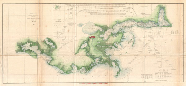
Sketch II Showing the progress of the Survey in Section No. 8 1846 - 1855.
sold
- Digital Map Information
- Suitable for large format printing
- File Size: 11.2 MB
- File Type: ZIP / TIFF
- ICC color profile embedded
- Delivered instantly via download link
A very attractive example of the 1855 U.S. Coast Survey nautical chart or map of the Mississippi River Delta and environs. Centered on the fanlike river delta itself, this map extends westward as far as Marsh Island and Vermillion Bay and eastward ... (more details)
The first U.S. Coast Survey chart of the Aleutian Islands.
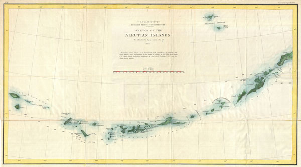
Sketch of the Aleutian Islands to Illustrate Appendix No. 11.
sold
- Digital Map Information
- Suitable for large format printing
- File Size: 6.37 MB
- File Type: ZIP / TIFF
- ICC color profile embedded
- Delivered instantly via download link
This unusual map is the U.S. Coast Survey's first significant mapping of the Aleutian Islands following the 1867 acquisition of the Alaska territory from Russia. The map covers the Aleutian Archipelago from Atta Island to Unimak Island and extends ... (more details)
Among the first Japanese maps to include the new 'Territory' of Taiwan.
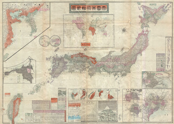
Imperial Japan.
sold
- Digital Map Information
- Suitable for large format printing
- File Size: 46.28 MB
- File Type: ZIP / TIFF
- ICC color profile embedded
- Delivered instantly via download link
An extremely impressive large scale map of the Japanese Empire dating to 1895 or Meiji 28. This map was issued shortly after the 1895 Japanese invasion of Taiwan and is consequently one of the first Japanese maps to include Taiwan and Korea as ... (more details)

(C No. 3) Preliminary Chart of Delaware and Chesapeake Bays and the Sea Coast from Cape Henlopen to Cape Charles.
sold
- Digital Map Information
- Suitable for large format printing
- File Size: 18.41 MB
- File Type: ZIP / TIFF
- ICC color profile embedded
- Delivered instantly via download link
An exceptional example of the 1855 U.S. Coast Survey's progress chart of the Chesapeake Bay. Covers the Bay from the mouth of the Susquehanna River southwards as far as Cape Henry and Norfolk. Includes both the Chesapeake Bay and Delaware Bay ... (more details)

Neuse River North Carolina.
sold
- Digital Map Information
- Suitable for large format printing
- File Size: 22.08 MB
- File Type: ZIP / TIFF
- ICC color profile embedded
- Delivered instantly via download link
A very attractive example of the 1874 U.S. Coast Survey nautical chart or map of the Neuse River, North Carolina. This map covers the Neuse River from New Berne, North Carolina, eastward as far as the river's mouth in the Pamlico Sound. The ... (more details)
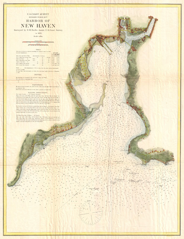
Harbor of New Haven.
sold
- Digital Map Information
- Suitable for large format printing
- File Size: 13.73 MB
- File Type: ZIP / TIFF
- ICC color profile embedded
- Delivered instantly via download link
A very attractive example of the 1872 U.S. Coast Survey nautical chart or map of New Haven Harbor, Connecticut. This map covers New Haven Harbor from the town of New Haven south as far as Oyster Point and Morgan's Point. Offers exceptional ... (more details)
Uncommon nautical chart of the second largest city on Lake Champlain.
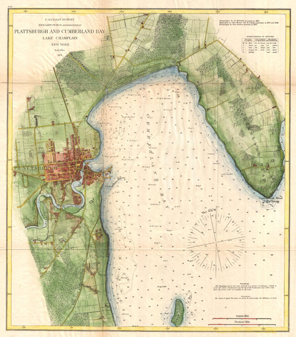
Plattsburgh and Cumberland Bay Lake Champlain New York.
sold
- Digital Map Information
- Suitable for large format printing
- File Size: 11.62 MB
- File Type: ZIP / TIFF
- ICC color profile embedded
- Delivered instantly via download link
A very attractive example of the 1872 U.S. Coast Survey nautical chart or map of Plattsburgh and Cumberland Bay, Lake Champlain, New York. This map covers the urban center of Plattsburgh as well as the surrounding areas as far south as Crab ... (more details)
Uncommon nautical chart of the largest city on Lake Champlain.

Burlington Vermont.
sold
- Digital Map Information
- Suitable for large format printing
- File Size: 8.43 MB
- File Type: ZIP / TIFF
- ICC color profile embedded
- Delivered instantly via download link
A very attractive example of the 1872 U.S. Coast Survey nautical chart or map of Burlington, Vermont. This map covers the urban center of Burlington as well as the surrounding areas as far south as Shelburn Point and as far north as far as ... (more details)
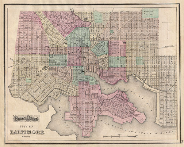
Gray's Alas City of Baltimore Maryland.
sold
- Digital Map Information
- Suitable for large format printing
- File Size: 8.07 MB
- File Type: ZIP / TIFF
- ICC color profile embedded
- Delivered instantly via download link
A fine map of Baltimore from Gray's 1874 Atlas of the United States. Covers the entire city from Gwinn's Falls to Seventh Street and from Green Mountain Cemetery to the Patapsco River. Shows proposed landfills along the water's edge. ... (more details)
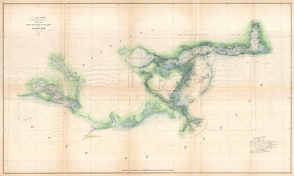
Sketch H Showing the Progress of the Survey in Section No. VIII from 1846-1873.
sold
- Digital Map Information
- Suitable for large format printing
- File Size: 12.17 MB
- File Type: ZIP / TIFF
- ICC color profile embedded
- Delivered instantly via download link
A very attractive example of the 1873 U.S. Coast Survey nautical chart or map of the Mississippi River Delta and environs. Centered on the fanlike river delta itself, this map extends westward as far as Marsh Island and Vermillion Bay ... (more details)

Johnson, A. J., Johnson's New Illustrated Family Atlas of The World with Physical Geography, and with Descriptions Geographical, Statistical, and Historic including The Latest Federal Census, A Geographical Index, and a Chronological History of the Civil War in America, (last Johnson and Ward), 1865.
sold
- Digital Map Information
- Suitable for large format printing
- File Size: 15.05 MB
- File Type: ZIP / TIFF
- ICC color profile embedded
- Delivered instantly via download link
This is A. J. Johnson's beautifully hand colored 1865 map of Georgia and Alabama. This map shows cities, topographical features, railways, ferries and roads with color coding at the county level. Published by A. J. Johnson and Ward ... (more details)
An uncommon nautical chart of Washington's Puget Sound.
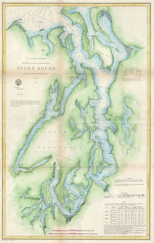
Puget Sound Washington Territory.
sold
- Digital Map Information
- Suitable for large format printing
- File Size: 12.87 MB
- File Type: ZIP / TIFF
- ICC color profile embedded
- Delivered instantly via download link
This is a very uncommon U.S. Coast Survey maritime map or nautical chart of the Puget Sound, Washington Territory, dating to 1867. It covers Puget Sound, named by George Vancouver after one of his officers Lieutenant Peter Puget, ... (more details)

Sketch C Showing the Progress of the Survey in Section No. III from 1843 to 1855.
sold
- Digital Map Information
- Suitable for large format printing
- File Size: 13.66 MB
- File Type: ZIP / TIFF
- ICC color profile embedded
- Delivered instantly via download link
An exceptional example of the 1855 U.S. Coast Survey's progress chart of the Chesapeake Bay. Covers the Bay from the mouth of the Susquehanna River southwards as far as Cape Henry and Norfolk. Includes both the Chesapeake Bay ... (more details)

Gallia.
sold
- Digital Map Information
- Suitable for large format printing
- File Size: 4.47 MB
- File Type: ZIP / TIFF
- ICC color profile embedded
- Delivered instantly via download link
A particularly interesting map, this is Karl von Spruner's 1865 rendering of France or Gaul under the Roman Empire. Like most of Spruner's work this example overlays ancient political geographies on relatively contemporary ... (more details)

Pontus et Bithynia, Asia, Lycia et Pamphylia, Galatia, Cappadocia, Syria, Creta, Cyprus.
sold
- Digital Map Information
- Suitable for large format printing
- File Size: 6.33 MB
- File Type: ZIP / TIFF
- ICC color profile embedded
- Delivered instantly via download link
A particularly interesting map, this is Karl von Spruner's 1865 rendering of Asia Minor in antiquity. This map covers Asia Minor from the Aegean Sea to Armenia and from Cyprus to the Black Sea, including all of modern day ... (more details)

Imperium Romanum Inde a bellow Actiaco usque ad Diocletiani Tempus.
sold
- Digital Map Information
- Suitable for large format printing
- File Size: 4.51 MB
- File Type: ZIP / TIFF
- ICC color profile embedded
- Delivered instantly via download link
A particularly interesting map, this is Karl von Spruner's 1865 rendering of the Roman Empire under Diocletian (224 – 311 AD). Centered on Italy, this map covers the whole of continental Europe extending as far north ... (more details)