
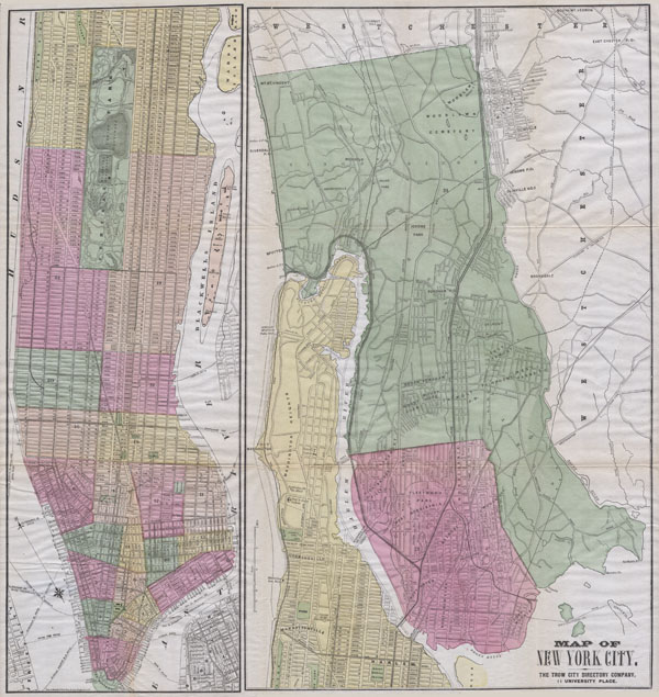
Map of New York City. The Trow City Directory Company, 11 University Place.
sold
- Digital Map Information
- Suitable for large format printing
- File Size: 8.54 MB
- File Type: ZIP / TIFF
- ICC color profile embedded
- Delivered instantly via download link
A large and rare hand colored map of New York City prepared by Fisk & Russell for the Trow City Directory Company. Covers all of Manhattan Island and in a very unusual variation on most maps of the period, the whole of the Bronx. Most streets are labeled as are ... (more details)
Extraordinary woodcut Tokugawa Period map of Tokyo or Edo.

Edo.
sold
- Digital Map Information
- Suitable for large format printing
- DPI: 300
- File Size: 68.24 MB
- File Type: ZIP / TIFF
- ICC color profile embedded
- Delivered instantly via download link
This extraordinary item is a hand colored Tokugawa Period woodcut map of Edo, or Tokyo, Japan. Impressive size and detail. Produced in the mid 19th century Japanese woodcut style, this map is a rare combination of practical and decorative. Ships and waves ... (more details)
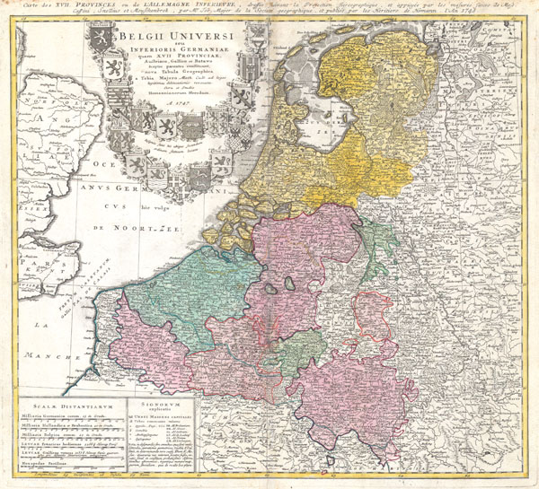
Belgii Universi seu Inferioris Germaniae quam XVII Provinciae Austriaco, Gallico et Batavo sceptro parentes constituunt nova Tabula Geographica a Tobia Majero Math. Cult. ad leges legitimae delineationis revocata Cura et studio Homanniorum Heredum A. 1747.
sold
- Digital Map Information
- Suitable for large format printing
- DPI: 300
- File Size: 13.27 MB
- File Type: ZIP / TIFF
- ICC color profile embedded
- Delivered instantly via download link
A beautifully detailed 1747 Homann Heirs map of Belgium and the Netherlands (Holland). Includes Belgilum proper as well as the seven states of the Belgian Federation – what is today Holland or the Netherlands. Also includes parts of England and extends ... (more details)
A masterpiece of late 18th century topographical engraving.

Nuova Pianta della Citta di Genova, e sue Fortificazioni con le Valli circonvicine.
sold
- Digital Map Information
- Suitable for large format printing
- Full resolution TIFF file
- ICC color profile embedded
- Delivered instantly via download link
An beautifully engraved and extremely obscure 1800 map of Genoa or Genova, Italy. Covers the walled center of Genoa and parts of the surrounding countryside as far as Voltri in the west and Calzo in the east. Detailed to the level of individual ... (more details)

Venetian States
sold
- Digital Map Information
- Suitable for large format printing
- Full resolution TIFF file
- ICC color profile embedded
- Delivered instantly via download link
This fascinating hand colored 1814 map by Edinburgh cartographer John Thomson depicts the Venetian States of Italy. This includes the area immediately surrounding the floating city of Venice: Trevigiano, Friuli, Padova, and Vicentino. Extends to ... (more details)

Sketch D Showing the Progress of the Survey in Section No. IV from 1845 to 1875.
sold
- Digital Map Information
- Suitable for large format printing
- File Size: 19.29 MB
- File Type: ZIP / TIFF
- ICC color profile embedded
- Delivered instantly via download link
An exceptional example of the 1875 U.S. Coast Survey's progress chart of the North Carolina and South Carolina. Covers from Cape Henry, Virginia, south past the Pamplico Sound and Cape Hatteras, to Cape Fear. It was here, looking over the ... (more details)

General Reconnaissance of the Western Coast of Florida.
sold
- Digital Map Information
- Suitable for large format printing
- DPI: 300
- File Size: 3.99 MB
- File Type: ZIP / TIFF
- ICC color profile embedded
- Delivered instantly via download link
A rare costal chart of Florida by the U. S. Coast Survery, 1853. Depicts the whole of the Florida peninsula, but specifically details the western coastline, showing all bays and harbors, as well as accurately mapping the Florida Keys. ... (more details)

A New Map of Turkey in Asia, Divided into its Provinces, from the Best Authorities.
sold
- Digital Map Information
- Suitable for large format printing
- DPI: 300
- File Size: 9.85 MB
- File Type: ZIP / TIFF
- ICC color profile embedded
- Delivered instantly via download link
This is a stunning 1801 map of Turkey in Asia by English Cartographer John Cary. Depicts the vast regions in Asia controlled by the Ottoman Empire at the close of the 18th century. Includes the modern day nations of Turkey, Iraq, ... (more details)

Canada West or Upper Canada.
sold
- Digital Map Information
- Suitable for large format printing
- File Size: 4.33 MB
- File Type: ZIP / TIFF
- ICC color profile embedded
- Delivered instantly via download link
This is the uncommon 1857 issue of J. H. Colton's map of Quebec, which at the time was called Canada West or Upper Canada. Covers from Essex in the south to Renfrew in the north, and from Lambton in the west to Glengabby in the ... (more details)
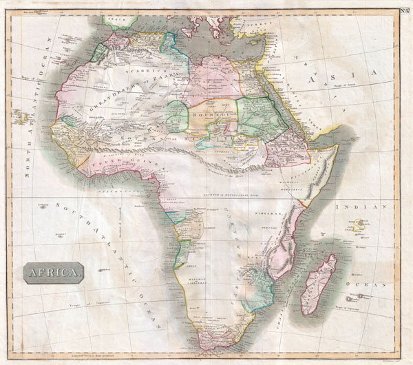
Africa
sold
- Digital Map Information
- Suitable for large format printing
- DPI: 300
- File Size: 15.09 MB
- File Type: ZIP / TIFF
- ICC color profile embedded
- Delivered instantly via download link
This hand colored map is a steel plate engraving, dating to 1813 by the important English mapmaker John Thomson. It is an early and historically important representation of the continent of Africa. Much of the continent is ... (more details)
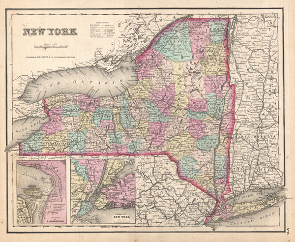
New York.
sold
- Digital Map Information
- Suitable for large format printing
- File Size: 7.82 MB
- File Type: ZIP / TIFF
- ICC color profile embedded
- Delivered instantly via download link
This is the uncommon 1857 issue of J. H. Colton's map of New York. Covers the entire state including Lake Ontario, Long Island, and detailed insets of the vicinity of both Niagara Falls and New York. Divided and color coded ... (more details)

Abyssinia, Nubia & c.
sold
- Digital Map Information
- Suitable for large format printing
- Full resolution TIFF file
- ICC color profile embedded
- Delivered instantly via download link
This fascinating hand colored 1818 map by Edinburgh cartographer John Pinkerton depicts Abyssinia, Sudan and Nubia. Covers from the Great Desert of Selima south to Donga and west through the 'Dominons of a Princes called ... (more details)

Maine.
sold
- Digital Map Information
- Suitable for large format printing
- File Size: 7.1 MB
- File Type: ZIP / TIFF
- ICC color profile embedded
- Delivered instantly via download link
This is the uncommon 1857 issue of J. H. Colton's map of Maine. Highly detailed and covering the state in its entirety. Divided and color coded according to county. Shows major roadways and railroads as well as ... (more details)

A New Map of Turkey in Asia.
sold
- Digital Map Information
- Suitable for large format printing
- DPI: 300
- File Size: 9.98 MB
- File Type: ZIP / TIFF
- ICC color profile embedded
- Delivered instantly via download link
This is a stunning large format map of Turkey in Asia by the French cartographer and geographer J. B. d'Anville. Depicts the whole of Turkey as well as the modern day Holy Land (Israel / Palestine), Syria, ... (more details)

Vermont.
sold
- Digital Map Information
- Suitable for large format printing
- File Size: 5.57 MB
- File Type: ZIP / TIFF
- ICC color profile embedded
- Delivered instantly via download link
This is the uncommon 1857 issue of J. H. Colton's map of Vermont. Covers the state in its entirety, including Lake Champlain to the west. Divided and color coded according to county. Shows major roadways ... (more details)

A New Map of Ohio with its Canals, Roads & Distances.
sold
- Digital Map Information
- Suitable for large format printing
- Full resolution TIFF file
- ICC color profile embedded
- Delivered instantly via download link
This scarce hand colored map is a lithographic engraving of Ohio dating to 1846 by the legendary American Mapmaker S.A. Mitchell, the elder. Includes a detailed inset map of Cincinnati Along the bottom ... (more details)

Massachusetts and Rhode Island.
sold
- Digital Map Information
- Suitable for large format printing
- File Size: 8.36 MB
- File Type: ZIP / TIFF
- ICC color profile embedded
- Delivered instantly via download link
This is the uncommon 1857 issue of J. H. Colton's map of Massachusetts and Rhode Island. Covers both states in their entirety along with a detailed inset of the vicinity of Boston. Divided and color ... (more details)
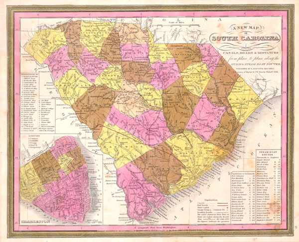
A New Map of South Carolina with its Canals, Roads & Distances from place to place along the Stage & Steam Boat Routes..
sold
- Digital Map Information
- Suitable for large format printing
- Full resolution TIFF file
- ICC color profile embedded
- Delivered instantly via download link
This scarce hand colored map is a lithographic engraving of South Carolina dating to 1846 by the legendary American Mapmaker S.A. Mitchell, the elder. Includes a detailed inset map of Charleston. ... (more details)

Canada East or Lower Canada and New Brunswick.
sold
- Digital Map Information
- Suitable for large format printing
- File Size: 7.7 MB
- File Type: ZIP / TIFF
- ICC color profile embedded
- Delivered instantly via download link
This is the uncommon 1857 issue of J. H. Colton's map of Quebec and New Brunswick. At the time this region was referred to as Canada East or Lower Canada. Covers lower Canada from Tadoussac in ... (more details)
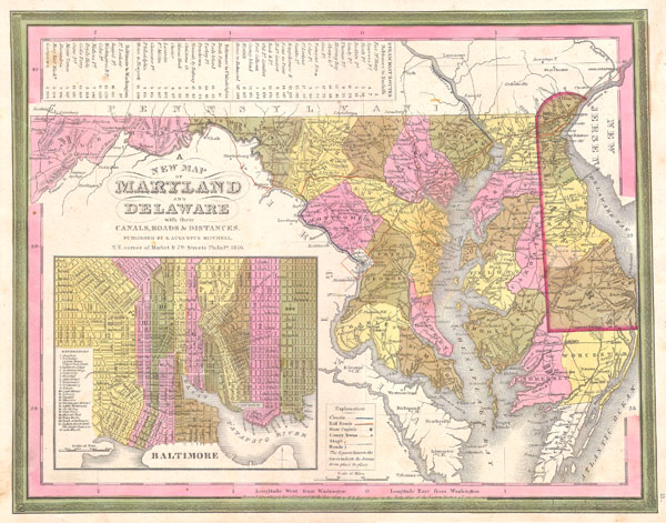
A New Map of Maryland and Delaware with their Canals, Roads & Distances.
sold
- Digital Map Information
- Suitable for large format printing
- Full resolution TIFF file
- ICC color profile embedded
- Delivered instantly via download link
This scarce hand colored map is a lithographic engraving of Maryland and Delaware, dating to 1846 by the legendary American Mapmaker S.A. Mitchell, the elder. Includes a detailed inset map of ... (more details)