
Burroughs, Horatio Nelson (sold)
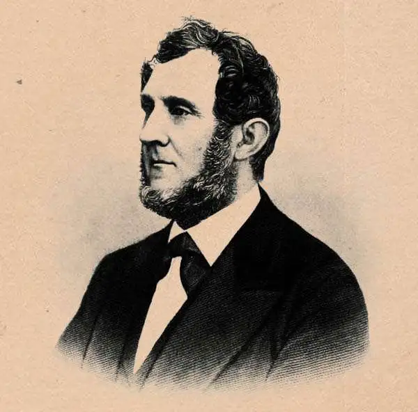
Horatio Nelson Burroughs (June 28, 1812 - August 23, 1896) was an engraver and later a banker based in Pennsylvania and active in the early 19th century. He was born in Washington Crossing, New Jersey. Burroughs' work first appears in conjunction with Henry Schenk Tanner and Samuel Augustus Mitchell (the elder). His name appears on the 1846 copyrights of many of Mitchell's earliest and most important atlas and pocket maps. Following 1846, Burroughs retired from engraving to become a banker, eventually becoming president of Commonwealth Bank. He married first Eleanor Douglas Mitchell (18?? - 1853), then, after her untimely death, her sister Caroline Mitchell (1818 - 1892), both daughters of map and atlas publisher Samuel Augustus Mitchell Sr. (1792 - 1868).
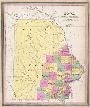
Iowa.
sold
- Digital Map Information
- Suitable for large format printing
- DPI: 300
- File Size: 5.96 MB
- File Type: ZIP / TIFF
- ICC color profile embedded
- Delivered instantly via download link
A scarce first edition example of S. A. Mitchell and H. N Burrough's 1846 map of Iowa. This map was prepared by H.N. Burroughs as plate no. 16 in the 1846 edition of Mitchell's New General Atlas . The map covers all of modern day Iowa though county platting has ... (more details)
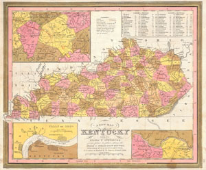
A New Map of Kentucky with its Roads & Distances from place to place along the Stage & Steam Boat Routes.
sold
- Digital Map Information
- Suitable for large format printing
- Full resolution TIFF file
- ICC color profile embedded
- Delivered instantly via download link
This scarce hand colored map is a lithographic engraving of Kentucky dating to 1846 by the legendary American Mapmaker S.A. Mitchell, the elder. There are inset maps of the vicinity of Lexington, the Falls of Ohio River, and the Ohio River near Clarksburg, KT. ... (more details)
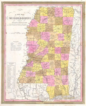
A New Map of Mississippi with its Roads & Distances.
sold
- Digital Map Information
- Suitable for large format printing
- Full resolution TIFF file
- ICC color profile embedded
- Delivered instantly via download link
This scarce hand colored map is a lithographic engraving of Mississippi dating to 1846 by the legendary American Mapmaker S.A. Mitchell, the elder. This is a rare transitional map produced by the mysterious engraver H. N. Burroughs, whose work for the Mitchell ... (more details)
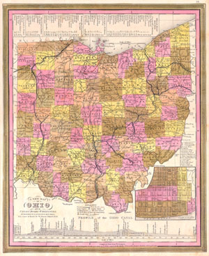
A New Map of Ohio with its Canals, Roads & Distances.
sold
- Digital Map Information
- Suitable for large format printing
- Full resolution TIFF file
- ICC color profile embedded
- Delivered instantly via download link
This scarce hand colored map is a lithographic engraving of Ohio dating to 1846 by the legendary American Mapmaker S.A. Mitchell, the elder. Includes a detailed inset map of Cincinnati Along the bottom there is a profile of the Ohio Canal with navigational ... (more details)
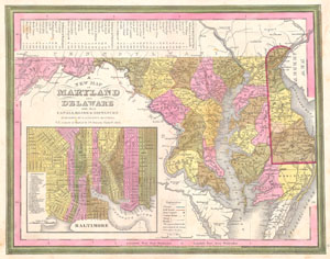
A New Map of Maryland and Delaware with their Canals, Roads & Distances.
sold
- Digital Map Information
- Suitable for large format printing
- Full resolution TIFF file
- ICC color profile embedded
- Delivered instantly via download link
This scarce hand colored map is a lithographic engraving of Maryland and Delaware, dating to 1846 by the legendary American Mapmaker S.A. Mitchell, the elder. Includes a detailed inset map of Baltimore. This is a rare transitional map produced by the ... (more details)
The Great Metropolis.
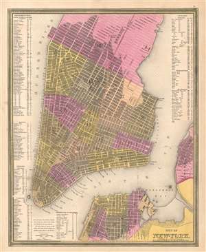
City of New York.
sold
- Digital Map Information
- Suitable for large format printing
- Full resolution TIFF file
- ICC color profile embedded
- Delivered instantly via download link
This is a beautiful example of S. A. Mitchell 1846 map of New York City. The map depicts southern Manhattan from 37th Street (Kips Bay) south to Battery Park and Brooklyn from Williamsburg to Columbia St. Mitchell offers wonderful detail at the ... (more details)
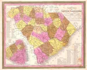
A New Map of South Carolina with its Canals, Roads & Distances from place to place along the Stage & Steam Boat Routes..
sold
- Digital Map Information
- Suitable for large format printing
- Full resolution TIFF file
- ICC color profile embedded
- Delivered instantly via download link
This scarce hand colored map is a lithographic engraving of South Carolina dating to 1846 by the legendary American Mapmaker S.A. Mitchell, the elder. Includes a detailed inset map of Charleston. This is a rare transitional map produced by the ... (more details)
Uncommon map presenting Texas at its largest.
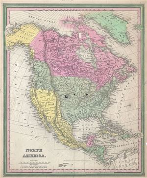
North America.
sold
- Digital Map Information
- Suitable for large format printing
- DPI: 300
- File Size: 8.24 MB
- File Type: ZIP / TIFF
- ICC color profile embedded
- Delivered instantly via download link
This is an important and scarce first edition example of S. A. Mitchell and H. N. Burroughs' 1846 map of North America. This hand colored lithographic map covers all of the United States, Canada, Russian America (Alaska), Mexico and Central ... (more details)
Rare first edition of Mitchell's map of Philadelphia.
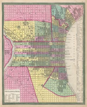
Philadelphia.
sold
- Digital Map Information
- Suitable for large format printing
- DPI: 300
- File Size: 8.33 MB
- File Type: ZIP / TIFF
- ICC color profile embedded
- Delivered instantly via download link
This is a scarce first edition example of S. A. Mitchell and H. N. Burrough's 1846 plan or map of Philadelphia, Pennsylvania. This hand colored lithographic engraving depicts the city of Philadelphia in superb detail at the street level ... (more details)
Rare first edition of Mitchell's map of Virginia.
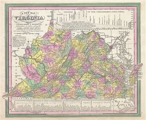
A New Map of Virginia with its Canals, Roads and Distances from place to place, along the Stage and Steam Boat Routes.
sold
- Digital Map Information
- Suitable for large format printing
- DPI: 300
- File Size: 7.38 MB
- File Type: ZIP / TIFF
- ICC color profile embedded
- Delivered instantly via download link
This is a scarce first edition example of S. A. Mitchell and H. N. Burrough's 1846 map of Virginia, including West Virginia. This hand colored lithographic map predates the 1862 separation of Virginia and West Virginia, and so contains ... (more details)

A New Map of Michigan with its Canals, Roads & Distances.
sold
- Digital Map Information
- Suitable for large format printing
- DPI: 300
- File Size: 9.11 MB
- File Type: ZIP / TIFF
- ICC color profile embedded
- Delivered instantly via download link
A fine example of the 1846 first edition of Mitchell's map of Michigan. The whole is engraved and colored in Mitchell's distinctive style with green border work and vivid pastels. Political and topographical features are noted and ... (more details)
Rare first edition of Mitchell's map of Washington D.C.
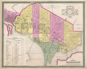
City of Washington.
sold
- Digital Map Information
- Suitable for large format printing
- DPI: 300
- File Size: 6.5 MB
- File Type: ZIP / TIFF
- ICC color profile embedded
- Delivered instantly via download link
A scarce first edition example of S. A. Mitchell and H. N Borrough's 1846 map or plan of Washington D.C. Given that most of Washington D.C. was under construction when this map was drawn, Mitchell's plan is a remarkable combination ... (more details)
Includes Carver's Claim - a debunked 18th century land claim that never truly existed.
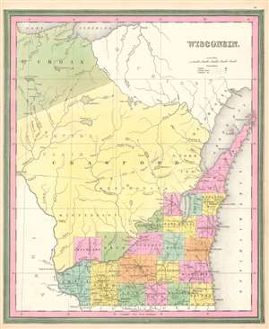
Wisconsin.
sold
- Digital Map Information
- Suitable for large format printing
- DPI: 600
- File Size: 11.9 MB
- File Type: ZIP / TIFF
- ICC color profile embedded
- Delivered instantly via download link
This is a first edition 1846 Samuel Augustus Mitchell map of Florida. The map depicts the region from Lake Pepin to Lake Michigan and from Lake Superior to Illinois and Iowa. At this point in American history, Wisconsin was still a territory and would not be granted statehood until May 29, 1848, over two years after this map was published. Here, only the southeastern portion of Wisconsin is illustrated as having been divided into counties and surveyed. The familiar grid of the Public Land Survey System divides this portion of the territory, while the rest of the territory remains unsurveyed. Counties are labeled and shaded different colors to allow for easy differentiation. Cities and towns are identified, including Madison, Milwaukee, and Sheboygan. Crawford and St. Croix Counties occupy the vast majority of the territory. Crawford County was one of Wisconsin's original counties and originally covered the western half of present-day Wisconsin. It was transferred from Michigan to the newly formed Wisconsin Territory as the former prepared for statehood and was slowly divided until it reached its current size. (more details)
The quintessential trail map of the American west.
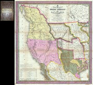
A New Map of Texas Oregon and California with the Regions Adjoining.
sold
- Digital Map Information
- Suitable for large format printing
- Full resolution TIFF file
- ICC color profile embedded
- Delivered instantly via download link
Considered 'the quintessential trail map of the American West' Samuel Augustus Mitchell's 'New Map of Texas Oregon and California' is one of the most important 19th century pocket maps ever issued. In Mitchell's own words This map ... (more details)
Records Florida's First Railroads.
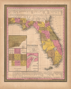
Map of Florida.
sold
- Digital Map Information
- Suitable for large format printing
- File Size: 12.66 MB
- File Type: ZIP / TIFF
- ICC color profile embedded
- Delivered instantly via download link
This is a 1848 Samuel Augustus Mitchell map of Florida. The map is significant for highlighting Florida's first two railroads, both in the Panhandle: the Tallahassee Railroad (see below) and the 'Lake Wimico and St. Joseph Canal and Railroad'. Dates in Marion, Benton, and St. Lucie counties mark battles of the Second Seminole War (1835 - 1842). This map falls within the Tanner/Mitchell tradition, in which Tanner's 1830s maps were regularly updated through 1858, generating in the process a comprehensive record of Florida's early development. (more details)
Just before the Gold Rush.
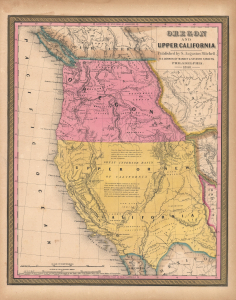
Oregon and Upper California.
sold
- Digital Map Information
- Suitable for large format printing
- File Size: 13.74 MB
- File Type: ZIP / TIFF
- ICC color profile embedded
- Delivered instantly via download link
This is Samuel Augustus Mitchell's 1848 map of Upper California and Oregon. It is considered one of the most important and desirable mid-19th-century American atlas maps, presenting the region immediately after annexation of Upper California (California Alta) to the United States following the Mexican-American War (1846 - 1848) but before the momentous California Gold Rush (1849 - 1850). (more details)
The first specific map of the west to appear in an American Atlas. Also, the only edition of this map to show the California Gold Region.
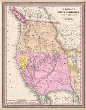
Oregon, Upper California, and New Mexico.
sold
- Digital Map Information
- Suitable for large format printing
- DPI: 300
- File Size: 6.24 MB
- File Type: ZIP / TIFF
- ICC color profile embedded
- Delivered instantly via download link
One of the most important mid-19th century American Atlas maps ever published, this is Samuel Augustus Mitchell's 1849 map of Upper California and Oregon, with a highlighted gold region. The map covers from Vancouver to the Mexico ... (more details)
The first specific map of the west to appear in an American Atlas. Also, the only edition of this map to show the California Gold Region.
Oregon, Upper California, and New Mexico.
sold
- Digital Map Information
- Suitable for large format printing
- DPI: 600
- File Size: 27.98 MB
- File Type: ZIP / TIFF
- ICC color profile embedded
- Delivered instantly via download link
This is Samuel Augustus Mitchell's 1849 map of Upper California and Oregon, with a highlighted gold region. It is considered one of the most important and desirable mid-19th century American atlas maps. The present examples, is exceptionally beautiful, with a strongly highlighted Gold Region. (more details)