
Geographia, Ltd. (sold)

Geographia, Ltd. (1911 - 1985) was a London-based cartographic publishing firm. The company was founded by Alexander Gross (1879 - 1958), a Hungarian immigrant to the United Kingdom. Geographia Ltd. is best known for its folding pocket maps and globes. Many of his maps were drawn by a mysterious 'Mr. Fountain', of whom we have been able to discover little. Gross ran into financial problems around 1940, likely associated with World War II, and relocated to offices in New York at 11 John Street. There, he issued a large corpus of U.S.-focused maps and city plans. By the 1940s, the branch in the United States had been renamed the Geographia Map Company and experienced rapid growth. By the 1950s, Geographia had published maps of dozens of cities across the United States. In 1987, the British branch was bought out by Harper Collins and continues to produce maps under the Collins Bartholomew imprint. Rand McNally bought the New York-based Geographia Map Company in the late 1980s. However, its original owners repurchased the Geographia Map Company a few years later and still operate the company in Hackensack, New Jersey. Gross's daughter, Phyllis Isobella Gross / Pearsall (1906 - 1996), founded the Geographers' A-Z Map Company in London, the largest independent map publisher in the United Kingdom. In the UK, their offices were originally at 33 Strand, where they published as 'Geographia Designing and Publishing Company Ltd.'. Later, by 1933, they had relocated to 55 Fleet Street, where they remained until at least 1937. By 1942, they relocated to 167 Fleet Street, followed by 114 Fleet Street by 1964. It is of note that many of the Geographia Ltd. maps feature a peculiar dating system wherein the letters in the world CUMBERLAND correspond to the numbers 1234567890, such that a date is rendered by substitution, so A.MU would break out like this A = 8, M = 3, U = 2, so 8.32 or, August 1932. Or, MM.YY e.g. E.MC = 5.31 = May 1931.
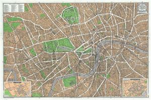
Geographia Pictorial Map of London.
sold
- Digital Map Information
- Suitable for large format printing
- Full resolution TIFF file
- ICC color profile embedded
- Delivered instantly via download link
This is a wonderful plan or pocket map of London published c.1923 by Geographia Ltd. It covers downtown London from the Hammersmith Bridge and Wormwood scrubs eastward past Hyde Park and Buckingham Place to Whitechapel Road and the London Docks. Unlike most ... (more details)
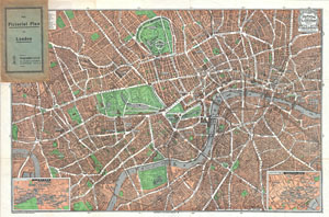
The Pictorial Plan of London.
sold
- Digital Map Information
- Suitable for large format printing
- File Size: 35.63 MB
- File Type: ZIP / TIFF
- ICC color profile embedded
- Delivered instantly via download link
This is a wonderful map of pocket map of London and published in 1923 by Geographia Ltd. Cover downtown London from the Hammersmith Bridge and Wormwood scrubs eastward past Hyde Park and Buckingham Place to Whitechapel Road and the London Docks. Features ... (more details)
Early pictorial map of London, England.
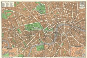
Geographia Pictoria Plan of London.
sold
- Digital Map Information
- Suitable for large format printing
- File Size: 26.7 MB
- File Type: ZIP / TIFF
- ICC color profile embedded
- Delivered instantly via download link
This is a wonderful map of pocket map of London and published c. 1924 by Geographia Ltd. Covers downtown London from the Hammersmith Bridge and Wormwood scrubs eastward past Hyde Park and Buckingham Place to Whitechapel Road and the London Docks. Unlike ... (more details)
Early pictorial map of London, England.
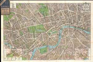
Geographia Pictoria Plan of London.
sold
- Digital Map Information
- Suitable for large format printing
- File Size: 28.37 MB
- File Type: ZIP / TIFF
- ICC color profile embedded
- Delivered instantly via download link
This is a wonderful map of pocket map of London and published c. 1924 by Geographia Ltd. Covers downtown London from the Hammersmith Bridge and Wormwood scrubs eastward past Hyde Park and Buckingham Place to Whitechapel Road and the London Docks. Unlike ... (more details)
A comical pictorial tourist map of London.
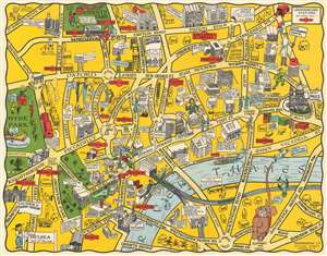
The New Pictorial Map of London.
sold
- Digital Map Information
- Suitable for large format printing
- File Size: 19.43 MB
- File Type: ZIP / TIFF
- ICC color profile embedded
- Delivered instantly via download link
This is a c. 1930 Geographia pictorial city map of London, England. A comical piece, London is depicted from Hyde Park to St. Paul's Cathedral and from Regents Park to St. George's Circus and Elephant and Castle. The creator's creativity is evident, particularly at the bottom left where Elephant and Castle is illustrated as an elephant with a castle on its back. The law courts are noted by a caricature of a jurist, and the zoo in Regent's Park houses a very large, but cheerful, monster. Savile row, the famous street renowned for its bespoke tailoring, is marked by a very tall man being measured for a suit. The client is so tall that the tailor is illustrated standing on a ladder to get the needed measurements. Nelson's Column in Trafalgar Square sits at the center of a merry-go-round of cars. Other locations around the city, such as St. Paul's, the Houses of Parliament, Westminster Abbey, Buckingham Palace, the British Museum, the National Gallery, and the Victoria and Albert Museum, are illustrated in a more conventional monumental manner. London's train stations, Euston, St. Pancras, King's Cross, Charing Cross, and Victoria, are illustrated and labeled as well. The parts of the United Kingdom served by each station are also noted. Tube stations are marked by red signs akin to those used to mark Underground stations throughout London. (more details)
A comical pictorial tourist map of London.
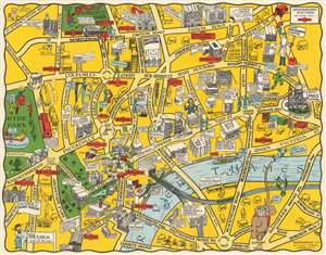
The New Pictorial Map of London.
sold
- Digital Map Information
- Suitable for large format printing
- File Size: 18.63 MB
- File Type: ZIP / TIFF
- ICC color profile embedded
- Delivered instantly via download link
This is a c. 1930 Geographia pictorial city map of London, England. A comical piece, London is depicted from Hyde Park to St. Paul's Cathedral and from Regents Park to St. George's Circus and Elephant and Castle. The creator's creativity is evident, particularly at the bottom left where Elephant and Castle is illustrated as an elephant with a castle on its back. The law courts are noted by a caricature of a jurist, and the zoo in Regent's Park houses a very large, but cheerful, monster. Savile row, the famous street renowned for its bespoke tailoring, is marked by a very tall man being measured for a suit. The client is so tall that the tailor is illustrated standing on a ladder to get the needed measurements. Nelson's Column in Trafalgar Square sits at the center of a merry-go-round of cars. Other locations around the city, such as St. Paul's, the Houses of Parliament, Westminster Abbey, Buckingham Palace, the British Museum, the National Gallery, and the Victoria and Albert Museum, are illustrated in a more conventional monumental manner. London's train stations, Euston, St. Pancras, King's Cross, Charing Cross, and Victoria, are illustrated and labeled as well. The parts of the United Kingdom served by each station are also noted. Tube stations are marked by red signs akin to those used to mark Underground stations throughout London. (more details)
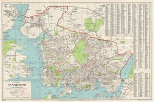
Plan of Plymouth.
sold
- Digital Map Information
- Suitable for large format printing
- File Size: 6.28 MB
- File Type: ZIP / TIFF
- ICC color profile embedded
- Delivered instantly via download link
An uncommon c. 1930 map of Plymouth, england, by Geographia Ltd. The map covers Plymouth from the Hamoaze and Plymouth Sound to the River Plym and Crown Hill. The map identifies all streets, parks, cemeteries, ferries, docks, rail lines, and important ... (more details)
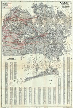
Queens.
sold
- Digital Map Information
- Suitable for large format printing
- File Size: 35.29 MB
- File Type: ZIP / TIFF
- ICC color profile embedded
- Delivered instantly via download link
This is an impressive 1930s map of or plan of Queens, New York, issued by Alexander Gross and published by the Geographia Map Company. The map covers the easternmost of the five boroughs of New York City from Rockaway Point (Breezy Point) northward to ... (more details)
Pictorial fun in Pre-War London!
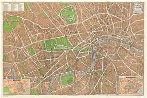
Geographia Pictorial Map of London.
sold
- Digital Map Information
- Suitable for large format printing
- File Size: 54.4 MB
- File Type: ZIP / TIFF
- ICC color profile embedded
- Delivered instantly via download link
This is a wonderful plan or pocket map of London published in August of 1932 by Geographia Ltd. It covers downtown London from the Hammersmith Bridge and Wormwood scrubs eastward past Hyde Park and Buckingham Place to Whitechapel Road and the London Docks. Unlike most English city plans of the period, this map replicates the pictorial style which popular in Paris during the early part of the 20th century.
The map features many of the buildings of London drawn in three dimensions. Gardens and parks are beautifully rendered in green with illustrations of ships sailing in the Thames River. Bridges, museums, cathedrals etc. are also identified. Insets in the lower right and lower left depict Theaterland and Cinemas, respectively. Both insets detail individual establishments as they existed at the time including the Regal, Marblearch Pavilion, The Palladium, the Hippodrome Theater and the Coliseum Theater, among many others. Notes stations on the London Underground. An index in the top left quadrant notes several places of interest. (more details)
The map features many of the buildings of London drawn in three dimensions. Gardens and parks are beautifully rendered in green with illustrations of ships sailing in the Thames River. Bridges, museums, cathedrals etc. are also identified. Insets in the lower right and lower left depict Theaterland and Cinemas, respectively. Both insets detail individual establishments as they existed at the time including the Regal, Marblearch Pavilion, The Palladium, the Hippodrome Theater and the Coliseum Theater, among many others. Notes stations on the London Underground. An index in the top left quadrant notes several places of interest. (more details)
Pictorial fun in Pre-War London!
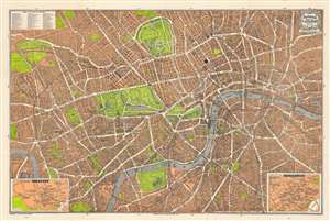
Geographia Pictorial Map of London.
sold
- Digital Map Information
- Suitable for large format printing
- Full resolution TIFF file
- ICC color profile embedded
- Delivered instantly via download link
This is a wonderful pocket map of London published in August of 1934 by Geographia Ltd. It covers downtown London from the Hammersmith Bridge and Wormwood scrubs eastward past Hyde Park and Buckingham Place to Whitechapel Road and the London Docks. Unlike most English city plans of the period, this map replicates the pictorial style which popular in Paris during the early part of the 20th century. (more details)
Navigating Brooklyn.
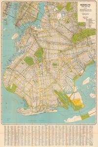
Brooklyn (New York City) Featuring House Numbers, Transit Lines, Playground, Wading Pools, etc.
sold
- Digital Map Information
- Suitable for large format printing
- File Size: 56.76 MB
- File Type: ZIP / TIFF
- ICC color profile embedded
- Delivered instantly via download link
This is a c. 1950 Geographia Map Company city plan or map of Brooklyn, New York. (more details)
Manuscript annotations detailing the NYC operations of the Pennsylvania Railroad.
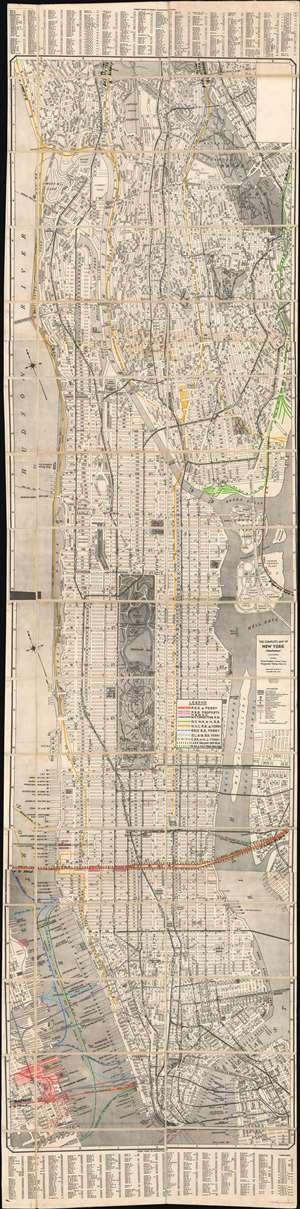
The Complete Map of New York (Manhattan) Featuring House Numbers, Transit Lines, Playgrounds, Wading Pools, etc.
sold
- Digital Map Information
- Suitable for large format printing
- File Size: 88.8 MB
- File Type: ZIP / TIFF
- ICC color profile embedded
- Delivered instantly via download link
This is a unique c. 1939 Geographia city plan or map of Manhattan, New York City with extensive manuscript annotation relating to the infrastructure and operations of the Pennsylvania Railroad. The map’s coverage includes all of Manhattan, as well as adjacent portions of Jersey City, Brooklyn, and the Bronx. The I.R.T., B.M.T., and Independent subway lines are identified. (more details)
New York City on the Eve of World War II.
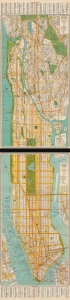
The complete map of New York (Manhattan) / The complete map of New York and Southwestern Bronx.
sold
- Digital Map Information
- Suitable for large format printing
- Full resolution TIFF file
- ICC color profile embedded
- Delivered instantly via download link
A rare, large-format two-sheet 1939 folding map of Manhattan and the southern Bronx issued by the Geographia Map Company. Although falling squarely within the 'age of anxiety' defined by the Great Depression and geopolitical tensions, the map also highlights the great advances made in the city's urban planning and transportation infrastructure in the preceding years. It also coincides with the 1939 - 1940 New York World's Fair, an expensive and well-promoted event that was meant to lift spirits and the economy. (more details)
Large attractive city plan of Manhattan and Bronx, New York City.
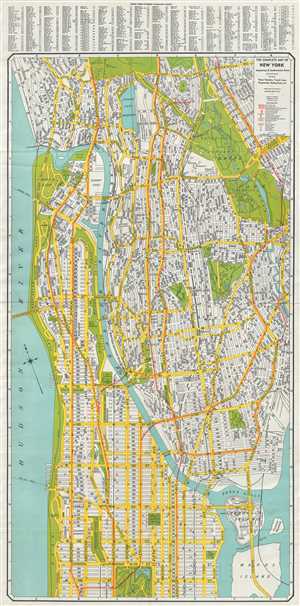
The Complete Map of New York Manhattan and Southwestern Bronx.
sold
- Digital Map Information
- Suitable for large format printing
- File Size: 22.32 MB
- File Type: ZIP / TIFF
- ICC color profile embedded
- Delivered instantly via download link
This is an excellent map of New York City by Alexander Gross dating to c.1940. The map covers the northern portions of the borough of Manhattan from 102nd Street to Inwood. The southwest portion of Bronx is also covered southward from Van Cortlandt ... (more details)
Large attractive city plan of Manhattan, New York City.
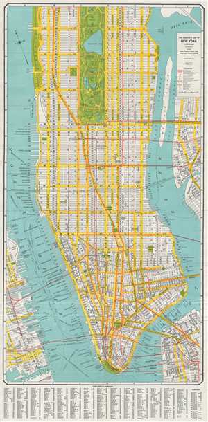
The Complete Map of New York (Manhattan).
sold
- Digital Map Information
- Suitable for large format printing
- File Size: 18.96 MB
- File Type: ZIP / TIFF
- ICC color profile embedded
- Delivered instantly via download link
This is an excellent map of New York City by Alexander Gross dating to c.1940. The map covers the borough of Manhattan from the Battery north as far as 104th street. Parts of Brooklyn and Queens are included, as is Roosevelt Island (at the time ... (more details)
Beautiful early pictorial map of London.
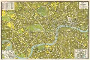
Pictorial Map of London.
sold
- Digital Map Information
- Suitable for large format printing
- Full resolution TIFF file
- ICC color profile embedded
- Delivered instantly via download link
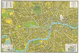
This is a wonderful World War II era city plan or pocket map of London published c.1942 by the Geographia Map Co. Ltd. It covers downtown London from the Hammersmith Bridge and Wormwood scrubs eastward past Hyde Park and Buckingham Place to ... (more details)
Beautiful early pictorial map of London.
Pictorial Map of London.
sold
- Digital Map Information
- Suitable for large format printing
- File Size: 25.99 MB
- File Type: ZIP / TIFF
- ICC color profile embedded
- Delivered instantly via download link
This is a wonderful World War II era city plan or pocket map of London published c.1942 by the Geographia Map Co. Ltd. It covers downtown London from the Hammersmith Bridge and Wormwood scrubs eastward past Hyde Park and Buckingham Place to ... (more details)
Pictorial Map of London.
sold
- Digital Map Information
- Suitable for large format printing
- Full resolution TIFF file
- ICC color profile embedded
- Delivered instantly via download link
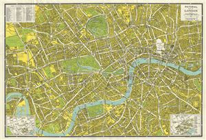
This is a wonderful plan or pocket map of London published c.1942 by Geographia Ltd. It covers downtown London from the Hammersmith Bridge and Wormwood scrubs eastward past Hyde Park and Buckingham Place to Whitechapel Road and the London ... (more details)
A charming post-war city map of New York City featuring small illustrations of the Empire State Building, Rockefeller Center, and other sites around the city.
Visitors Map of New York City.
sold
- Digital Map Information
- Suitable for large format printing
- File Size: 26.79 MB
- File Type: ZIP / TIFF
- ICC color profile embedded
- Delivered instantly via download link
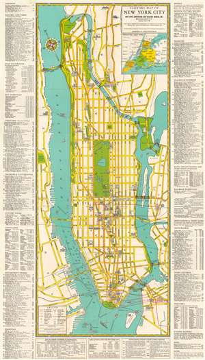
This is a c. 1948 Geographia Map Company city map or plan of Manhattan, New York City. Focusing on the island of Manhattan, pictorial vignettes highlight tourist sites throughout the borough, including the Empire State Building, the Chrysler Building, Rockefeller Center, and Yankee Stadium. Parts of Queens, Brooklyn, and the Bronx are also illustrated, along with the New Jersey waterfront along the Hudson River. The bridges spanning both the Hudson and East Rivers are illustrated in profile and both the Lincoln Tunnel and Holland Tunnel are labeled. Only major streets are depicted in Manhattan, with some of the subway lines illustrated as well. An inset map of the greater New York City area situated in the upper right quadrant, shades in the other four boroughs: Brooklyn, Queens, The Bronx, and Staten Island. It also includes the counties in the vicinity, including Westchester and Nassau Counties. A location index is included along both the left and right borders, with a key to street numbers, figures concerning population, and outstanding events in the city's history situated along the bottom. (more details)