
Marshall, John (sold)

John Marshall (September 24, 1755 - July 6, 1835) was the longest-serving Chief Justice of the United States (1801-35). Marshall's court opinions helped establish the basis for American constitutional law and made the Supreme Court of the United States a coequal branch of government along with the legislative and executive branches. Previously, Marshall had been a leader of the Federalist Party in Virginia and served in the United States House of Representatives from 1799 to 1800. He was Secretary of State under President John Adams from 1800 to 1801. Between 1805 and 1807 Marshall published an influential five-volume biography of George Washington. Marshall's Life of Washington was based on records and papers provided to him by the late president's family. The work reflected Marshall's Federalist principles, and is frequently praised by historians for its accuracy and well-reasoned judgments.
Southern Theater of the American Revolution.
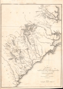
A Map of Those Parts of Virginia, North Carolina, South Carolina and Georgia which were the Scenes of the Most Important Operations of the Southern Armies.
sold
- Digital Map Information
- Suitable for large format printing
- File Size: 5.34 MB
- File Type: ZIP / TIFF
- ICC color profile embedded
- Delivered instantly via download link
A lovely example of Samuel Lewis' map of the Carolinas and Virginia that appeared in the 1806 first London edition of John Marshall's The Life of George Washington. The map depicts the Southern Theater of the American Revolutionary War. (more details)
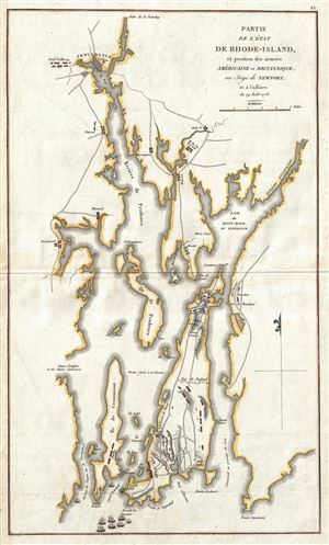
Partie de L'Etat de Rhode-Island et Position des Armees Americaine et Britannique, au Siege de Newport, et a l'affaire de 29 Aout 1778.
sold
- Digital Map Information
- Suitable for large format printing
- Full resolution TIFF file
- ICC color profile embedded
- Delivered instantly via download link
This is a rare map of Narragansett Bay, Rhode Island during the American Revolutionary War issued for the 1807 French edition of John Marshall's The Life of Washington . The map covers the strategically important Narragansett Bay from Newport to Providence. ... (more details)
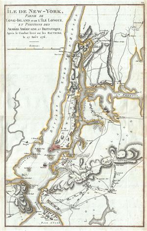
Ile de New York, Partie de Long-Island ou de I'le Longue, et Positions des Armees Americaine et Britannique, Apres le Combat livre sure Hauteurs le 27 Aout 1776.
sold
- Digital Map Information
- Suitable for large format printing
- Full resolution TIFF file
- ICC color profile embedded
- Delivered instantly via download link
This is a rare map of New York City during the American Revolutionary issued for the 1807 French edition of John Marshall's The Life of Washington . The map covers the strategically important Manhattan Island and vicinity, including Staten Island, Brooklyn, ... (more details)
Scarce French map of the Carolina colonies during the American Revolutionary War.
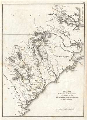
Théâtre des opérations les plus importantes de l'armée du sud, dans la Virginie, dans les deux Carolines, et dans la Géorgie.
sold
- Digital Map Information
- Suitable for large format printing
- Full resolution TIFF file
- ICC color profile embedded
- Delivered instantly via download link
A scarce example of the 1807 map of North Carolina, South Carolina, and Virginia during the Revolutionary War issued for the 1802 French edition of John Marshall's 1832 Life of Washington . The map covers from the Chesapeake Bay and Richmond, Virginia ... (more details)
The Siege of Boston and the Battle of Bunker Hill.
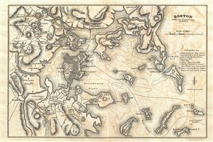
Boston with its Environs.
sold
- Digital Map Information
- Suitable for large format printing
- Full resolution TIFF file
- ICC color profile embedded
- Delivered instantly via download link
This is a rare plan or map of Boston, Massachusetts during the American Revolutionary War issued for John Marshall's 1832 edition of the Life of Washington . The map covers the strategically important city and harbor of Boston, including the ... (more details)
Details the Revolutionary War Battle of Rhode Island.
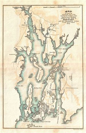
Map of part of Rhode Island Shewing the Positions of the American & British Armies at the Seige of Newport and the subsequent Action on the 29th of August 1778.
sold
- Digital Map Information
- Suitable for large format printing
- Full resolution TIFF file
- ICC color profile embedded
- Delivered instantly via download link
This is a rare map of Narragansett Bay, Rhode Island during the American Revolutionary War issued for John Marshall's 1832 edition of the Life of Washington . The map covers the strategically important Narragansett Bay from Newport to ... (more details)
The vital Hudson River Corridor during the American Revolutionary War.
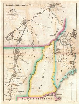
Map of the Country which was the scene of the Northern Army Including the Wilderness through which Gen. Arnold marched to attack Quebec.
sold
- Digital Map Information
- Suitable for large format printing
- Full resolution TIFF file
- ICC color profile embedded
- Delivered instantly via download link
This is a rare map of New York, Vermont, New Hampshire, Maine and Quebec during the American Revolutionary War issued for John Marshall's 1832 edition of the Life of Washington . The map covers the strategically vital Hudson Valley ... (more details)
The vital Hudson River Corridor during the American Revolutionary War.
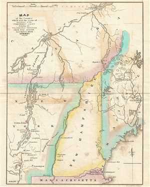
Map of the Country which was the scene of the Northern Army Including the Wilderness through which Gen. Arnold marched to attack Quebec.
sold
- Digital Map Information
- Suitable for large format printing
- Full resolution TIFF file
- ICC color profile embedded
- Delivered instantly via download link
This is a rare map of New York, Vermont, New Hampshire, Maine and Quebec during the American Revolutionary War issued for John Marshall's 1832 edition of the Life of Washington . The map covers the strategically vital Hudson Valley ... (more details)
Illustrates the costly British capture of Philadelphia.
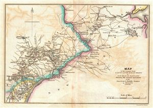
Map of the Country from Raritan River in East Jersey to Elk Head in Maryland Shewing the several Operations of the American and British Arimies in 1776 & 1777.
sold
- Digital Map Information
- Suitable for large format printing
- Full resolution TIFF file
- ICC color profile embedded
- Delivered instantly via download link
This is a rare map of central New Jersey and eastern Pennsylvania during the American Revolutionary War issued for John Marshall's 1832 edition of the Life of Washington . The map covers the lands on both sides of the Delaware ... (more details)
Map of Washington's crossing of the Delaware and the Battle of Trenton.
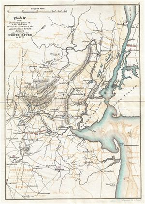
Plan of the Northern part of New Jersey Shewing the Positions of the American & British Armies after crossing the North River in 1776.
sold
- Digital Map Information
- Suitable for large format printing
- Full resolution TIFF file
- ICC color profile embedded
- Delivered instantly via download link
This is a rare map of New York City, Staten Island, and Northern New Jersey during the American Revolutionary War issued for John Marshall's 1832 edition of the Life of Washington . The map covers the strategically important ... (more details)
The Siege of Yorktown - the decisive battle of the American Revolutionary War.
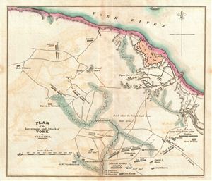
Plan of the Investment and Attack of York in Virginia.
sold
- Digital Map Information
- Suitable for large format printing
- Full resolution TIFF file
- ICC color profile embedded
- Delivered instantly via download link
This is a rare plan or map of Yorktown, Virginia, during the American Revolutionary War issued for John Marshall's 1832 edition of the Life of Washington . The map covers the city of Yorktown (York) and the surrounding ... (more details)
The southern theater of the American Revolutionary War.
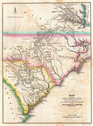
Map of part of Virginia North Carolina South Carolina & Georgia which were the scenes of the most important Operations of the Southern Armies.
sold
- Digital Map Information
- Suitable for large format printing
- Full resolution TIFF file
- ICC color profile embedded
- Delivered instantly via download link
This is a rare map North Carolina, South Carolina, and Virginia during the Revolutionary War issued for John Marshall's 1832 edition of the Life of Washington . The map covers from the Chesapeake Bay and Richmond, ... (more details)
One of the most important battles in the Revolutionary War.
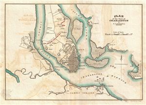
Plan of the Siege of Charleston in S. Carolina.
sold
- Digital Map Information
- Suitable for large format printing
- Full resolution TIFF file
- ICC color profile embedded
- Delivered instantly via download link
This is a rare plan of the Revolutionary War Siege of Charleston, South Carolina, issued for John Marshall's 1832 edition of the Life of Washington . The map covers Charleston Harbor and parts of the Cooper and ... (more details)
Illustrates the British takeover of New York City following Battles of Long Island and Harlem Heights.
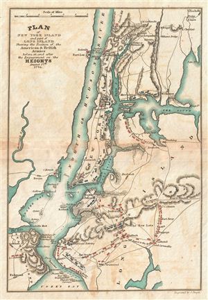
Plan of New York Island and part of Long Island Shewing the Position of the American & British Armies before, at, and after the Engagement on the Heights August 27th 1776.
sold
- Digital Map Information
- Suitable for large format printing
- Full resolution TIFF file
- ICC color profile embedded
- Delivered instantly via download link
This is a rare map of New York City during the American Revolutionary War issued for John Marshall's 1832 edition of the Life of Washington . The map covers the strategically important Manhattan Island and ... (more details)
Details the Battle of White Plains.
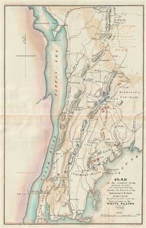
Plan of the Country from Frogs Point to Croton River Shewing the Positions of the American & British Armies from the 12th of Oct. 1776 until the Engagement on the White Plains on the 28th.
sold
- Digital Map Information
- Suitable for large format printing
- DPI: 300
- File Size: 2.06 MB
- File Type: ZIP / TIFF
- ICC color profile embedded
- Delivered instantly via download link
This is a rare map of Westchester County, New York, the Bronx, and upper Manhattan during the American Revolutionary War issued for John Marshall's 1832 edition of the Life of Washington . The map covers ... (more details)