
Perrot, Aristide Michel (sold)

Aristide Michel Perrot (1793 - 1879) was a French geographer, cartographer, and essayist active during the 19th century. Perrot specialized in miniature maps that appear in numerous French atlases. Perrot was also a prolific writer and his works include geographic lexicons and several essays.
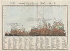
Tableau comparatif des principales hauteurs du globe.
sold
- Digital Map Information
- Suitable for large format printing
- DPI: 300
- File Size: 20.03 MB
- File Type: ZIP / TIFF
- ICC color profile embedded
- Delivered instantly via download link
An unusual, early, and interesting take on the comparative mountains of the world chart. This chart, drawn by Aristide Michel Perrot in 1827, compacts an incredible amount of information in very little space. Perrot's primary goal was to show the relative ... (more details)
Marvelous separate issue chart with outstanding period guache color!
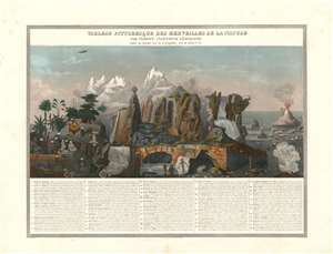
Tableau Pittoresque des Merveilles de la Nature.
sold
- Digital Map Information
- Suitable for large format printing
- DPI: 600
- File Size: 40.11 MB
- File Type: ZIP / TIFF
- ICC color profile embedded
- Delivered instantly via download link
This is a separate issue 1840 Aristide Michel Perrot and Sigismond Himely comparative chart illustrating the marvels of the nature - as they were understood in the 19th century. The present example is notable for its striking gouache color masterfully applied. The chart illustrates 58 numerically identified natural wonders, among them,
- No. 5 - the deep and picturesque Mines of Persberg, Sweden
- No. 8 - a gigantic antediluvian human skeleton fossilized.
- No. 9 - the skeleton of a wooly mammoth.
- no. 30 - the bizarre illusion of giant human beings on the side of a mountain
- no. 29 - Iceland's Mount Hekla volcano.
- No. 18 - the clifftop Corsican city of Bonifacio
- No. 12 - St. Michael's Cave in Gibraltar
The how-to of topographical draftsmanship.
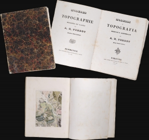
Modèles de Topographie Dessinés et Lavés. / Modelli de Topografia Disegnati e Acquerellati.
sold
This is a fascinating 1840 instruction book in French and Italian describing the methods and techniques of topographical mapmaking and draftsmanship. Such works were used in military academies and civil engineering schools, laying the groundwork for the standardization of draftsmanship and topographic conventions in Europe - a major evolution over the ad hoc methodologies that dominated 18th-century mapmaking, (more details)
Illustrates pterodactyls and plesiosaurs next to wolves, bats, and a pangolin!
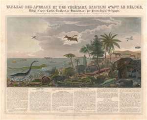
Tableau des Animaux et des Végétaux Éxistans Avant le Déluge, Rédigé d'après Cuvier, Buckland, de Humboldt etc. par Perrot, Ingénr.-Geographe. Dessiné d'après les Végétaux et les Fossiles existants dans les divers Cabinets de l'Europe.
sold
- Digital Map Information
- Suitable for large format printing
- DPI: 600
- File Size: 37.16 MB
- File Type: ZIP / TIFF
- ICC color profile embedded
- Delivered instantly via download link
Filled with strange and unfamiliar creatures, this is 1844 Aristide Michel Perrot chart of antediluvian animals. Seventy-five different animals and plants, dating from the epoch just after primordial times to the era before the last ice age, are depicted here, with Perrot having consulted fossil collections to create this stunning piece. A narrative situated below the chart traces the evolution of these creatures across five historical epochs, presenting the plants and animals illustrated above in a sort of context. Plesiosaurs, ichthyosaurs, and pterodactyls are among the dinosaurs illustrated alongside mastodons and mammoths. Some more familiar animals, such as pangolins, wolves, and bats, are also included. The juxtaposition of the dinosaurs alongside beavers, bats, and herons gives the piece an aura that is both amusing and jarring. (more details)
Illustrates and briefly explains weather phenomena like tornadoes, clouds, and thunder and lightning storms.
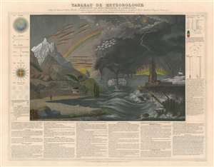
Tableau de Météorologie Représentant les Divers Phénomènes de l'Atmosphère, Tels que le Tonnere, l'Aurore Boréale, Aréolythes, l'Arc-en-ciel, les Trombes, le Feu St. Elme, les Etoiles filantes et Aréolythes, le Halo, les Parhélies, le Mirage, les Marées, etc., etc.
sold
- Digital Map Information
- Suitable for large format printing
- DPI: 600
- File Size: 41.71 MB
- File Type: ZIP / TIFF
- ICC color profile embedded
- Delivered instantly via download link
This is an 1844 Aristide Michel Perrot chart of weather phenomena. The chart combines illustrations of over two dozen different weather phenomena, including lightning, tornadoes, rainbows, the Northern Lights, and clouds. Different phenomena are identified below the central image, with the name of each phenomenon and a short explanation provided, some of which even refer to a specific part of the central image and provide the corresponding number. Various figures are included along the left and right borders, the first of which, the atmosphere, is provided as a basis for understanding of all the phenomena explained in the chart. A wind compass, snowflakes, and a lightning rod are depicted along the left side, while thermometers and the rainbow effect are explained along the right. (more details)
Terrors of mother nature!
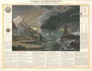
Tableau de Météorologie Représentant les Divers Phénomènes de l'Atmosphère, Tels que le Tonnere, l'Aurore Boréale, Aréolythes, l'Arc-en-ciel, les Trombes, le Feu St. Elme, les Etoiles filantes et Aréolythes, le Halo, les Parhélies, le Mirage, les Marées, etc., etc.
sold
- Digital Map Information
- Suitable for large format printing
- DPI: 600
- File Size: 33.95 MB
- File Type: ZIP / TIFF
- ICC color profile embedded
- Delivered instantly via download link
This is an 1844 Aristide Michel Perrot chart of weather phenomena. The chart combines illustrations of over two dozen different weather phenomena, including lightning, tornadoes, rainbows, the Northern Lights, and clouds. Different phenomena are identified below the central image, with the name of each phenomenon and a short explanation provided, some of which even refer to a specific part of the central image and provide the corresponding number. Various figures are included along the left and right borders, the first of which, the atmosphere, is provided as a basis for understanding of all the phenomena explained in the chart. A wind compass, snowflakes, and a lightning rod are depicted along the left side, while thermometers and the rainbow effect are explained along the right. (more details)
Manuscript color highlights the loss of Alsace and Lorraine.
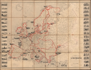
Carte Pittoresque et Maritime de l'Europe Indiquant La division des Etats, let Routes et Chemins de fer...
sold
- Digital Map Information
- Suitable for large format printing
- File Size: 98.04 MB
- File Type: ZIP / TIFF
- ICC color profile embedded
- Delivered instantly via download link
This is a striking 1847 Alexandre Vuillemin and Aristide-Michel Perrot pictorial map of Europe. The map has been updated in orange and gray manuscript to reflect the 1871 treaties that ended the Franco-Prussian War (1870 - 1871). (more details)
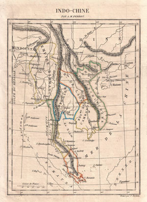
Indo-Chine
sold
- Digital Map Information
- Suitable for large format printing
- Full resolution TIFF file
- ICC color profile embedded
- Delivered instantly via download link
This is a c. 1825 map of Indo-Chine by drawn by French cartographer Aristide Michel Perrot and engraved by P. Tardieu. Covers the area from China in the north to Sumatra in the south, and from the Gulf of Bengal in the west to Canton in the east. Curiously ... (more details)
Promotes the misguided belief that Algeria was a part of France.
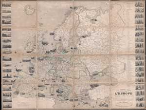
Carte Pittoresque et Maritime de l'Europe indiquant La division des Etats les Routes et Chemins de fer, la distance en kilometres de Paris à toutes les villes importantes, les Productions minerales, végétales et animales de chaque contrée, les Places fortes, les Ports militaires et marchands et l'itinéraire des bateaux à vapeur et paquebots.
sold
- Digital Map Information
- Suitable for large format printing
- DPI: 300
- File Size: 46.19 MB
- File Type: ZIP / TIFF
- ICC color profile embedded
- Delivered instantly via download link
This is an 1851 Alexandre Vuillemin and Aristide Michel Perrot folding map of Europe. The map depicts the region from the Atlantic Ocean to the Ural Mountains and from the Arctic Ocean to the Mediterranean Sea and North Africa. Each of the countries is ... (more details)
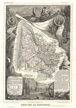
Dept. de la Gironde.
sold
- Digital Map Information
- Suitable for large format printing
- DPI: 300
- File Size: 9.28 MB
- File Type: ZIP / TIFF
- ICC color profile embedded
- Delivered instantly via download link
This is a fascinating 1852 map of the French department of Gironde. This coastal department is the seat of the Bordeaux wine region and produces many of the world's finest reds. Shows numerous vineyards and chateaux . The whole is surrounded by ... (more details)
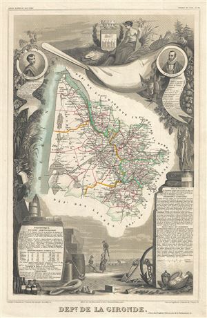
Dept. de la Gironde.
sold
- Digital Map Information
- Suitable for large format printing
- DPI: 300
- File Size: 8.13 MB
- File Type: ZIP / TIFF
- ICC color profile embedded
- Delivered instantly via download link
This is a fascinating 1851 map of the French department of Gironde. This coastal department is the seat of the Bordeaux wine region and produces many of the world's finest reds. Shows numerous vineyards and chateaux . The whole is surrounded ... (more details)
Map of the Bordeaux wine region and the birthplace of Montesquieu.
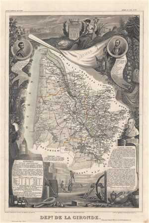
Dept. de la Gironde.
sold
- Digital Map Information
- Suitable for large format printing
- DPI: 300
- File Size: 7.62 MB
- File Type: ZIP / TIFF
- ICC color profile embedded
- Delivered instantly via download link
This is a fascinating 1852 map of the French department of Gironde. This coastal department is the seat of the Bordeaux wine region and produces many of the world's finest reds. The city of Bordeaux is located at center. The map depicts ... (more details)
Map of France's Armagnac brandy region.
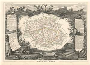
Dept. de Gers.
sold
- Digital Map Information
- Suitable for large format printing
- DPI: 600
- File Size: 18.47 MB
- File Type: ZIP / TIFF
- ICC color profile embedded
- Delivered instantly via download link
This is a fascinating 1852 Victor Levasseur map of the department of Gers, France. This area of is known especially for its production of Armagnac Brandy and Floc de Gascogne, a sweet wine. It is also home to Côtes de Gascogne, a wine-growing district in Gascony producing white wine, and is also famous for its foie gras and wild mushrooms. The whole is surrounded by elaborate decorative engravings designed to illustrate both the natural beauty and trade richness of the land. There is a short textual history of the regions depicted on both the left and right sides of the map (more details)
Illustrates the species of animals, birds, fish, and plants that a French committee could be successfully brought to France from across the world.
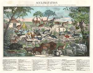
Acclimatation Tableau représentant les Animaux, quadrupèdes, oiseaux, poissons, insectes, - Arbres, fruits et végétaux, propagés par la Société impériale d'Acclimatation.
sold
- Digital Map Information
- Suitable for large format printing
- DPI: 600
- File Size: 41.44 MB
- File Type: ZIP / TIFF
- ICC color profile embedded
- Delivered instantly via download link
This is a rare c. 1854 Aristide Michel Perrot and Oudart map or chart of animals, birds, fish, and trees that the French Société Impériale d'Acclimatation believed could be successfully brought to France from across the world. Seventy-five different species of animals and plants are intermixed and illustrated in brilliant gum arabic color. Some of the animals represented, such as the yak (which is described here as a cow with a horse's tail from Tibet), llama, Merino sheep, and Angora goat had already been domesticated and, in the case of the yak, used as a draft animal. The quagga, a now extinct type of zebra, is illustrated on the left next to the onager, or hemione, a species of wild ass native to Asia. With regard to the birds, the cassowary, ostrich, and rhea are among the more exotic illustrated, while the Indochinese chickens and mallard duck are perhaps the most familiar. A mandarin duck is illustrated sitting on the pond, which our New York City clients will be familiar with after one became a minor celebrity in the city after one appeared in Central Park last year and caused a minor stir among the city's residents. A kangaroo, bison, and water buffalo are also among the species presented. (more details)
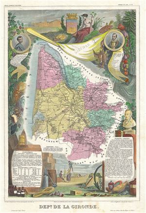
Dept. de la Gironde.
sold
- Digital Map Information
- Suitable for large format printing
- File Size: 9.76 MB
- File Type: ZIP / TIFF
- ICC color profile embedded
- Delivered instantly via download link
This is a fascinating 1861 map of the French department of Gironde. This coastal department is the seat of the Bordeaux wine region and produces many of the world's finest reds. Shows numerous vineyards and chateaux . The whole is ... (more details)