
Sarony, Napoleon (sold)
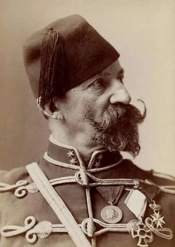
Napoleon Sarony (March 9, 1821 - November 9, 1896) was a dashingly handsome Canadian-American lithographer and publisher active in New York in the mid to late 19th century. Sarony was born in Quebec and emigrated to New York City in 1835. He apprenticed under Henry Robinson (fl. 1830/33 - 1850) before working as a lithograph artist for Nathaniel Currier (1813 - 1888). In 1846, he partnered with Currier's apprentice lithographer Henry B. Major to establish the firm of 'Sarony and Major.' From offices at 117 Futon Street, they published under this imprint until roughly 1853, when Sarony split off on his own under the imprint 'Sarony and Co.', still at 117 Fulton. At the time 'and Co.' probably meant Joseph Fairchild Knapp (1832 - 1891), Sarony's apprentice, and Richard C. Major, possibly Henry Major's son. In 1857, a new imprint was established as 'Sarony, Major and Knapp'. According to an advertisement in the New York Times (Feb 16, 1864), Sarony had invested in the business at founding, but was not an active partner, possibly because he was traveling in Europe. It is unclear why Sarony's name was maintained, possibly to capitalize on his fame, as a honorific, or possibly because he owned a major stake. They published under this imprint until 1863, becoming a major concern at 449 Broadway. Sarony's name was formally removed from the partnership in 1863. At the time he was traveling in Europe, mastering the most advanced color lithography and photographic techniques. He is known to have worked in France, Germany, and England. He returned to New York in the 1860s, establishing a photography company at 37 Union Square that became famous for its portraits of late-19th-century American theater icons. In 1891, Sarony, hoping to capitalize on Sarah Bernhardt's fame as 'Cleopatra', paid the stage actress 1,500 USD to sit for a photo session, the modern-day equivalent of 20,000 USD - suggesting a highly prosperous business. His son, Otto Sarony (1850–1903), continued the family business as a theater and film star photographer. As an aside, Sarony's second wife, Louie Sarony, was a known eccentric who would reportedly dress in elaborate rented costumes to walk around Washington Square each afternoon.
Union Square Park shortly after opening.
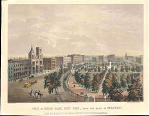
View of Union Park, New York, from the Head of Broadway.
sold
- Digital Map Information
- Suitable for large format printing
- DPI: 600
- File Size: 17.54 MB
- File Type: ZIP / TIFF
- ICC color profile embedded
- Delivered instantly via download link
This is an 1849 James Smillie view of Union Square and Union Square Park - published roughly 6 years after it opened. Union Square Park dominates the right side of the view, with the park's beautiful fountain and tree-lined pathways. Well-dressed New Yorkers stroll along these pathways. The Stringer Institute, the Church of the Puritans, and Abbott's Collegiate Institution for Young Ladies appear in the foreground. Cavalry Church and the Free Academy are illustrated in the distance. (more details)
Philadelphia at the beginning of its industrialization.
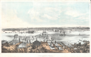
Philadelphia.
sold
- Digital Map Information
- Suitable for large format printing
- Full resolution TIFF file
- ICC color profile embedded
- Delivered instantly via download link
A stunning large-format 1850 panoramic view of Philadelphia from Camden, across the Delaware River. It was drawn by John William Hill and Benjamin Franklin Smith and lithographed by Smith. (more details)
The 'upside down map' of Elizabethtown.
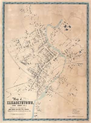
Map of Elizabethtown, Essex County N.J.
sold
- Digital Map Information
- Suitable for large format printing
- DPI: 600
- File Size: 130.17 MB
- File Type: ZIP / TIFF
- ICC color profile embedded
- Delivered instantly via download link
This is a c. 1851 John Bevan wall city plan or map of Elizabethtown, Essex County, New Jersey. Sometimes called the 'upside down map' because it is oriented with south at the top, Bevan's map captures a moment in Elizabethtown's history, identifying many of its residents and buildings. Churches, schools, the post office, and the town's two hotels are labeled. Dry goods stores, groceries, the fish market, and a boot store are marked as well. Carpenters, tailors, butchers, bakers, and cabinet makers are identified by name. More specialty shops, such as a watch maker, the coach factory, and the oil cloth carpet factory enhance the understanding of life in Elizabethtown at this point in time. (more details)
One of the rarest and most important first-hand illustrations of Perry's meeting with Tokugawa Japan - here in a spectacular Elephant Folio.
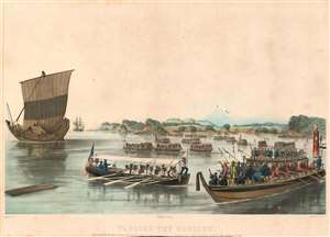
Passing the Rubicon. Lieut. S. Bent in the 'Mississippi's' First Cutter forcing his way through a fleet of Japanese boats while surveying the Bay of Yedo, Japan, July 11th, 1853.
sold
- Digital Map Information
- Suitable for large format printing
- File Size: 42.21 MB
- File Type: ZIP / TIFF
- ICC color profile embedded
- Delivered instantly via download link
A rare and important 1855 Eliphalet Brown and Wilhelm Heine hand-tinted elephant-folio lithograph view of one of the most significant and impactful moment in history - the meeting of East and West, when an American Naval Squadron under Commodore Matthew C. Perry sailed into Edo Harbor and forced Tokugawa Japan to accept foreign embassies and trade, ending 214 years of self-imposed Sakoku (鎖国, 'Closed-Country') isolation. Part of a rare and significant elephant folio set representing a 'holy grail' item for Perry collectors. (more details)
Governor Stevens map of the proposed northern route of the Transcontinental Railroad.
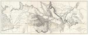
Explorations and Surveys for a Rail Road Route from the Mississippi River to the Pacific Ocean. War Department. Routes near the 47th and 49th Parallels. Milk R. to the Crossing of the Columbia R.
sold
- Digital Map Information
- Suitable for large format printing
- File Size: 33.43 MB
- File Type: ZIP / TIFF
- ICC color profile embedded
- Delivered instantly via download link
This is an 1855 Isaac I. Stevens map of the explorations to discover a proposed northern route of the transcontinental railroad. Carl I. Wheat considers this map so significant that he illustrates it in full. The map depicts from the Yellowstone River in Wyoming ... (more details)
Profiles in Central Park along hypothetical extensions of Sixth and Seventh Avenue.
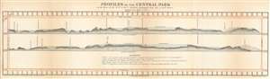
Profiles of the Central Park on the lines of the VIth and VIIt Avenues prolonged from 59th to 110th Street.
sold
- Digital Map Information
- Suitable for large format printing
- File Size: 5.56 MB
- File Type: ZIP / TIFF
- ICC color profile embedded
- Delivered instantly via download link
This 1860 Frederick Law Olmsted and Calvert Vaux profile chart or map of Central Park in New York City provides a glimpse into the wide-ranging topography of one of the world's greatest urban parks. Olmsted and Vaux employ Manhattan's iconic grid system and illustrate the topographic profiles along hypothetical extensions of Sixth and Seventh Avenues. Landmarks within the park, including the transverse roads, the carriage road, the New Reservoir, and The Bluff, are identified. Trees appear along some of the ridges, and higher ground to the west of the defined profiles appear as shadowy masses above the profiles. Manhattan's street grid borders the park on all four sides. (more details)
Extremely rare pocket map of New York's Central Park.
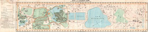
Map of the Central Park Showing the Progress of the Work up to January 1st, 1860.
sold
- Digital Map Information
- Suitable for large format printing
- File Size: 10.13 MB
- File Type: ZIP / TIFF
- ICC color profile embedded
- Delivered instantly via download link
A very attractive 1860 pocket map of New York City's Central Park. This is an extremely rare pocket map variant on the map of Central Park that later appeared in the 1860 Commissioner's Annual Report on the Progress of Central Park . This map is not listed in ... (more details)
Reconnoitering the Northern Rockies.
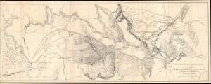
Milk R. to the crossing of the Columbia R.
sold
- Digital Map Information
- Suitable for large format printing
- File Size: 97.68 MB
- File Type: ZIP / TIFF
- ICC color profile embedded
- Delivered instantly via download link
A remarkable, large-format map of central Montana, with portions of northern Idaho and eastern Washington, prepared by Isaac Stevens as part of the expedition he led through the territory in 1853 - 1855 to scout out a potential transcontinental railroad route. When produced, due to its size and detail, it was the most complete map of these lands to date. (more details)
Extremely rare pocket map of New York's Central Park.
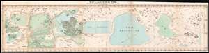
Map of the Central Park Showing the progress of the Work up to January 1st 1860.
sold
- Digital Map Information
- Suitable for large format printing
- File Size: 13.41 MB
- File Type: ZIP / TIFF
- ICC color profile embedded
- Delivered instantly via download link
A very attractive 1860 pocket map of New York City's Central Park. This is an extremely rare pocket map variant on the map of Central Park that later appeared in the 1860 Commissioner's Annual Report on the Progress of Central Park. This map is not listed in Haskell and to our knowledge was not issued to the public in pocket format – only in the Commissioner's Annual Report. Most likely it was available only to those city officials actually involved in the planning and construction of Central Park.
This extraordinary map reveals Central Park as conceived by the landscape architects, and indeed 'artists,' Calvert Vaux and Frederick Law Olmsted. Vaux and Olmsted were awarded the task of designing Central Park in 1853 by the City Common Council. Olmsted's vision drove the overall design while Vaux concentrated his attentions on bridges, buildings, and other structures within the park. The creation of Central Park, which was to consist of some 800 acres of public forest, pathways, promenades, lakes, bridges, and meadows, was a seminal moment in civic urban design. The park itself was designed as a whole with every tree, pond, and bench meticulously planned. Olmsted wrote: 'Every foot of the Park's surface, every tree and bush, as well as every arch, roadway, and walk has been fixed where it is with a purpose.'
Historian Gloria Deak writes,
This extraordinary map reveals Central Park as conceived by the landscape architects, and indeed 'artists,' Calvert Vaux and Frederick Law Olmsted. Vaux and Olmsted were awarded the task of designing Central Park in 1853 by the City Common Council. Olmsted's vision drove the overall design while Vaux concentrated his attentions on bridges, buildings, and other structures within the park. The creation of Central Park, which was to consist of some 800 acres of public forest, pathways, promenades, lakes, bridges, and meadows, was a seminal moment in civic urban design. The park itself was designed as a whole with every tree, pond, and bench meticulously planned. Olmsted wrote: 'Every foot of the Park's surface, every tree and bush, as well as every arch, roadway, and walk has been fixed where it is with a purpose.'
Historian Gloria Deak writes,
There was a staggering amount of work to be done to transform the area into a blend of pastoral and woodland scenery. This involved the design and construction of roadways, tunnels, bridges, arches, stairways, fountains, benches, lamp posts, gates, fences and innumerable other artifacts. It also involved the supervision of an army of about five thousand laborers…Olmsted, to whom most of the credit goes, insisted on seeing the multidimensional project as a single work of art, which he was mandated to create. For this purpose, he ventured to assume to himself the title of ‘artist.'Today, because of Vaux and Olmsted's efforts, New York Yorkers, ourselves included, have the privilege of enjoying what is, perhaps, the finest example of a planned urban public recreation area in the world. (more details)
Rare view of the of Seat of the Civil War around Washington D.C. and the Chesapeake Bay.
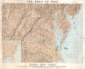
Seat of War. Bird's Eye View of Virginia, Maryland, Delaware and the District of Columbia.
sold
- Digital Map Information
- Suitable for large format printing
- File Size: 29.24 MB
- File Type: ZIP / TIFF
- ICC color profile embedded
- Delivered instantly via download link
A striking 1861 three-color Schedler/Schaus chromolithograph view/map of the Chesapeake Bay region, including Maryland, Virginia, Delaware, and Washington D.C., shortly after the outbreak of the American Civil War (1861 - 1865). Centered on the Chesapeake Bay, the view covers roughly from Gettysburg to Albemarle Sound and from the Ohio River to the Atlantic seaboard. Steam/Sail ships cluster around the mouth of the Chesapeake and Delaware Bays, presumably an attempt to illustrate the ad hoc Union naval blockade of Confederacy. (more details)
Exceptional large folding map of Central Park.
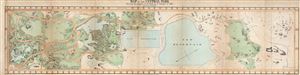
Map of the Central Park Showing the progress of the Work up to January 1st 1861.
sold
- Digital Map Information
- Suitable for large format printing
- File Size: 11.54 MB
- File Type: ZIP / TIFF
- ICC color profile embedded
- Delivered instantly via download link
An altogether extraordinary hand colored map of New York City's Central Park prepared and printed for inclusion in the Fifth Annual Report of the Board of Commissioners of the Central Park . This map first appeared in 1861, with the present example being the ... (more details)
A rare view of a Union Army encampment in North Carolina.
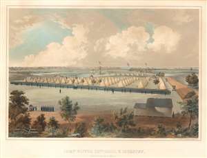
Camp Oliver 25th Mass. V. Inf., New Berne, N.C. 1862-3.
sold
- Digital Map Information
- Suitable for large format printing
- File Size: 13.86 MB
- File Type: ZIP / TIFF
- ICC color profile embedded
- Delivered instantly via download link
This is an extremely rare 1863 Voltaire Combe view of Camp Oliver, North Carolina during the American Civil War. The view depicts the camp when it was occupied by the 25th Massachusetts Volunteer Infantry during its 1862-1863 campaign in North Carolina. Per Joseph Waldo Denny, a veteran of the 25th Massachusetts, Camp Oliver 'was one of the best located and most conveniently arranged places ever occupied by the regiment. It furnished an extensive parade ground and ample room to allow company streets of more than 'Regulation' width, and a camp frontage of almost double the prescribed paces.' Denny also described life in the camp, stating that 'While at Camp Oliver, the regiment was drilled daily, the forenoons being occupied with company, and the afternoons with battalion drill.' Unfortunately, little else is mentioned. (more details)
Central Park - nearly complete!
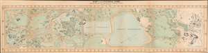
Map of the Central Park Showing the progress of the Work up to January 1st 1864.
sold
- Digital Map Information
- Suitable for large format printing
- File Size: 38.64 MB
- File Type: ZIP / TIFF
- ICC color profile embedded
- Delivered instantly via download link
A very attractive 1864 map of New York City's Central Park. This map was issued for the 1864 Seventh Annual Report to the commissioners on the construction of the park. By 1864, most of the park had been completed, with only the northernmost sections above 103rd street remaining a work in progress. This is here indicated through the lack of wash coloring in the incomplete parts - generally embracing the Great Hill, the North Woods, the Conservatory Garden, Nutter's Battery, and the Harlem Meer.
This extraordinary map reveals Central Park as conceived by the landscape architects, and indeed 'artists,' Calvert Vaux and Frederick Law Olmsted. Vaux and Olmsted were awarded the task of designing Central Park in 1853 by the City Common Council. Olmsted's vision drove the overall design while Vaux concentrated his attentions on bridges, buildings, and other structures within the park. The creation of Central Park, which was to consist of some 800 acres of public forest, pathways, promenades, lakes, bridges, and meadows, was a seminal moment in civic urban design. The park itself was designed as a whole with every tree, pond, and bench meticulously planned. Olmsted wrote: 'Every foot of the Park's surface, every tree and bush, as well as every arch, roadway, and walk has been fixed where it is with a purpose.'
Historian Gloria Deak writes,
This extraordinary map reveals Central Park as conceived by the landscape architects, and indeed 'artists,' Calvert Vaux and Frederick Law Olmsted. Vaux and Olmsted were awarded the task of designing Central Park in 1853 by the City Common Council. Olmsted's vision drove the overall design while Vaux concentrated his attentions on bridges, buildings, and other structures within the park. The creation of Central Park, which was to consist of some 800 acres of public forest, pathways, promenades, lakes, bridges, and meadows, was a seminal moment in civic urban design. The park itself was designed as a whole with every tree, pond, and bench meticulously planned. Olmsted wrote: 'Every foot of the Park's surface, every tree and bush, as well as every arch, roadway, and walk has been fixed where it is with a purpose.'
Historian Gloria Deak writes,
There was a staggering amount of work to be done to transform the area into a blend of pastoral and woodland scenery. This involved the design and construction of roadways, tunnels, bridges, arches, stairways, fountains, benches, lamp posts, gates, fences and innumerable other artifacts. It also involved the supervision of an army of about five thousand laborers…Olmsted, to whom most of the credit goes, insisted on seeing the multidimensional project as a single work of art, which he was mandated to create. For this purpose, he ventured to assume to himself the title of ‘artist.'Today, because of Vaux and Olmsted's efforts, New York Yorkers, ourselves included, have the privilege of enjoying what is, perhaps, the finest example of a planned urban public recreation area in the world. (more details)
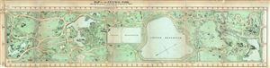
Map of the Central Park Showing the progress of the Work on January 1st 1867.
sold
- Digital Map Information
- Suitable for large format printing
- File Size: 11.33 MB
- File Type: ZIP / TIFF
- ICC color profile embedded
- Delivered instantly via download link
An altogether extraordinary hand colored map of New York City's Central Park prepared and printed for inclusion in the Tenth Annual Report of the Board of Commissioners of the Central Park . This extremely rare variant on the map of Central Park originally ... (more details)
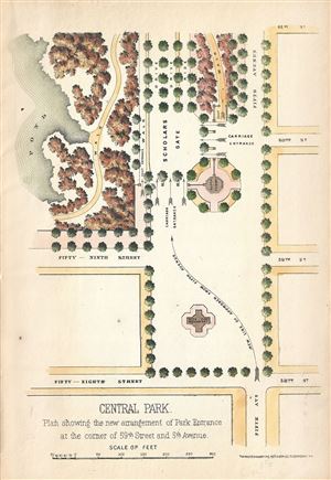
Central Park. Plan showing the new arrangement of Park Entrance at the corner of 59th Street and 5th Avenue.
sold
- Digital Map Information
- Suitable for large format printing
- File Size: 1.27 MB
- File Type: ZIP / TIFF
- ICC color profile embedded
- Delivered instantly via download link
This is a beautiful and unusual little map of the southeastern corner of New York City's Central Park prepared and printed for inclusion in the 1867 Tenth Annual Report of the Board of Commissioners of the Central Park. It depicts from 61st Street south to ... (more details)
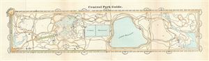
Central Park Guide.
sold
- Digital Map Information
- Suitable for large format printing
- File Size: 2.2 MB
- File Type: ZIP / TIFF
- ICC color profile embedded
- Delivered instantly via download link
An altogether extraordinary 1867 hand colored map of New York City's Central Park prepared and printed for inclusion in the Tenth Annual Report of the Board of Commissioners of the Central Park. This is an extremely rare variant on the map of Central Park ... (more details)
Large folding map of Central Park
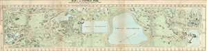
Map of the Central Park Showing the progress of the Work on January 1st 1866.
sold
- Digital Map Information
- Suitable for large format printing
- File Size: 9.94 MB
- File Type: ZIP / TIFF
- ICC color profile embedded
- Delivered instantly via download link
An altogether extraordinary hand colored map of New York City's Central Park prepared and printed for inclusion in the Tenth Annual Report of the Board of Commissioners of the Central Park . This extremely rare variant on the map of Central Park ... (more details)
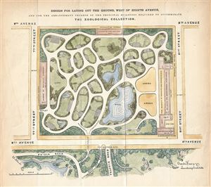
Design for laying out The ground, West of Eight Avenue, and for the arrangement thereon of the principal buildings required to accommodate The Zoological Collection.
sold
- Digital Map Information
- Suitable for large format printing
- File Size: 2.43 MB
- File Type: ZIP / TIFF
- ICC color profile embedded
- Delivered instantly via download link
This is an extraordinary 1867 hand colored map or plan of the grounds that today house the American Museum of Natural History in New York City. It depicts from 77th Street north to the intersection of 81st Street and 8th Avenue (Central Park ... (more details)
Early and unusual map detailing Central Park, Riverside Park, and the Upper West Side to 154th St.
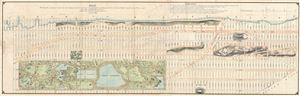
Map Showing the progress made by the Commissioners of the Central Park in laying out Streets, Roads, Public Squares and Places and new Pier and Bulkhead Lines within the district shown thereon.
sold
- Digital Map Information
- Suitable for large format printing
- File Size: 27.11 MB
- File Type: ZIP / TIFF
- ICC color profile embedded
- Delivered instantly via download link
An altogether extraordinary 1868 map of New York City's Central Park and the Upper West Side prepared and printed for inclusion in the Thirteenth Annual Report of the Board of Commissioners of the Central Park . This is an extremely rare ... (more details)
Early and unusual map detailing Central Park, Riverside Park, and the Upper West Side to 154th St.
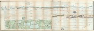
Map Showing the progress made by the Commissioners of the Central Park in laying out Streets, Roads, Public Squares and Places and new Pier and Bulkhead Lines within the district shown thereon.
sold
- Digital Map Information
- Suitable for large format printing
- File Size: 20.58 MB
- File Type: ZIP / TIFF
- ICC color profile embedded
- Delivered instantly via download link
An altogether extraordinary 1868 map of New York City's Central Park and the Upper West Side prepared and printed for inclusion in the Thirteenth Annual Report of the Board of Commissioners of the Central Park . This is an extremely rare ... (more details)
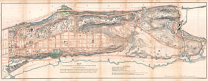
Map of that Part of the City of new York North of 155th Street Showing the progress made in laying out Streets, Roads, Public Squares, and Places, by the Commissioners of the Central Park, under Chap. 565 of Laws of 1865 and of new Pier and Bulkhead lines under Chap. 697 of Laws of 1867.
sold
- Digital Map Information
- Suitable for large format printing
- File Size: 19.6 MB
- File Type: ZIP / TIFF
- ICC color profile embedded
- Delivered instantly via download link
An rare and unusual map of upper Manhattan, New York City, prepared and printed for inclusion in the Thirteenth Annual Report of the Board of Commissioners of the Central Park. Depicts the Island of Manhattan north of 155th street ... (more details)
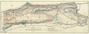
Map of that Part of the City of New York North of 155th Street Showing the progress made in laying out Streets, Roads, Public Squares and Places, by the Commissioners of the Central Park, under Chap. 565 of Laws of 1865 and of new Pier and Bulkhead lines under Chap. 697 of Laws of 1867.
sold
- Digital Map Information
- Suitable for large format printing
- File Size: 20.83 MB
- File Type: ZIP / TIFF
- ICC color profile embedded
- Delivered instantly via download link
A rare and unusual map of upper Manhattan, New York City, prepared and printed for inclusion in the Thirteenth Annual Report of the Board of Commissioners of the Central Park. It depicts the Island of Manhattan north of 155th ... (more details)
An early map of Central Park and the first specific map of the Upper West Side.
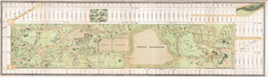
Central Park.
sold
- Digital Map Information
- Suitable for large format printing
- File Size: 5.17 MB
- File Type: ZIP / TIFF
- ICC color profile embedded
- Delivered instantly via download link
An altogether extraordinary hand colored map of New York City's Central Park and the Upper West Side prepared and printed for inclusion in the Thirteenth Annual Report of the Board of Commissioners of the Central Park. This is ... (more details)
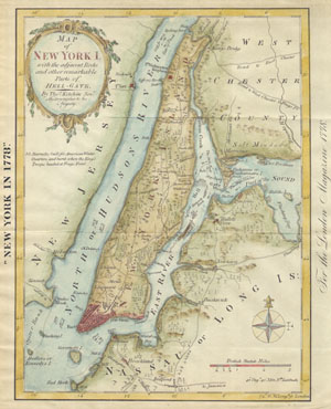
New York in 1778 or Map of New York I.
sold
- Digital Map Information
- Suitable for large format printing
- File Size: 1.38 MB
- File Type: ZIP / TIFF
- ICC color profile embedded
- Delivered instantly via download link
This is an unusual map of New York City in 1778, reduced and reprinted in 1869. The original map was drawn by Thomas Kitchin in his capacity as Hydrographer to His Majesty. It was originally published in The London Magazine. ... (more details)
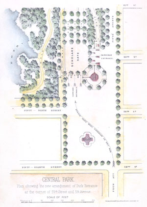
Central Park. Plan showing the new arrangement of Park Entrance at the corner of 59th and 5th Avenue
sold
- Digital Map Information
- Suitable for large format printing
- File Size: 0.85 MB
- File Type: ZIP / TIFF
- ICC color profile embedded
- Delivered instantly via download link
An unusual little map of the southeastern corner of New York City's Central Park. Depicts from 61st Street south to the intersection of 58th street and 5th Avenue . Shows the planned ornamentation and redirection of traffic ... (more details)
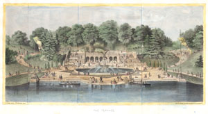
The Terrace
sold
- Digital Map Information
- Suitable for large format printing
- File Size: 4.34 MB
- File Type: ZIP / TIFF
- ICC color profile embedded
- Delivered instantly via download link
An unusual little view of Bethesda Terrace, Central Park. Bethesda Terrace is located at roughly 72nd street in the heart of New York City's Central Park. Depicts the Terrace from a south facing perspective over 'the Lake' ... (more details)
The original map upon which the northern Manhattan street grid is based.
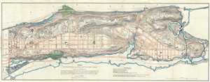
Map of that Part of the City of New York North of 155th Street Showing the progress made in laying out Streets, Roads, Public Squares, and Places, by the Commissioners of the Central Park, under Chap. 565 of Laws of 1865 and of new Pier and Bulkhead lines under Chap. 697 of Laws of 1867.
sold
- Digital Map Information
- Suitable for large format printing
- File Size: 20.07 MB
- File Type: ZIP / TIFF
- ICC color profile embedded
- Delivered instantly via download link
A rare and unusual map of upper Manhattan, New York City, prepared and printed for inclusion in the 1870 Thirteenth Annual Report of the Board of Commissioners of the Central Park. It depicts the island of Manhattan north ... (more details)
The original map upon which the northern Manhattan street grid is based.
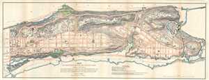
Map of that Part of the City of New York North of 155th Street Showing the progress made in laying out Streets, Roads, Public Squares, and Places, by the Commissioners of the Central Park, under Chap. 565 of Laws of 1865 and of new Pier and Bulkhead lines under Chap. 697 of Laws of 1867.
sold
- Digital Map Information
- Suitable for large format printing
- File Size: 18.08 MB
- File Type: ZIP / TIFF
- ICC color profile embedded
- Delivered instantly via download link
A rare and unusual map of upper Manhattan, New York City, prepared and printed for inclusion in the 1870 Thirteenth Annual Report of the Board of Commissioners of the Central Park. It depicts the island of Manhattan north ... (more details)
The original map upon which the northern Manhattan street grid is based.
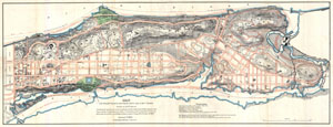
Map of that Part of the City of new York North of 155th Street Showing the progress made in laying out Streets, Roads, Public Squares, and Places, by the Commissioners of the Central Park, under Chap. 565 of Laws of 1865 and of new Pier and Bulkhead lines under Chap. 697 of Laws of 1867.
sold
- Digital Map Information
- Suitable for large format printing
- File Size: 18.31 MB
- File Type: ZIP / TIFF
- ICC color profile embedded
- Delivered instantly via download link
A rare and unusual map of upper Manhattan, New York City, prepared and printed for inclusion in the 1870 Thirteenth Annual Report of the Board of Commissioners of the Central Park. Depicts the island of Manhattan north ... (more details)
Exceptional large folding map of Central Park.
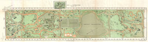
Map of the Central Park January 1st 1870.
sold
- Digital Map Information
- Suitable for large format printing
- File Size: 10.02 MB
- File Type: ZIP / TIFF
- ICC color profile embedded
- Delivered instantly via download link
An altogether extraordinary hand colored map of New York City's Central Park prepared and printed for inclusion in the Thirteenth Annual Report of the Board of Commissioners of the Central Park. This is an extremely rare ... (more details)
Exceptional large folding map of Central Park.
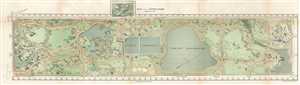
sold
- Digital Map Information
- Suitable for large format printing
- File Size: 9.06 MB
- File Type: ZIP / TIFF
- ICC color profile embedded
- Delivered instantly via download link
An altogether extraordinary hand colored map of New York City's Central Park prepared and printed by Knapp for inclusion in the Thirteenth Annual Report of the Board of Commissioners of the Central Park. This is an ... (more details)
Exceptional large folding map of Central Park.
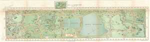
Map of the Central Park January 1st 1870.
sold
- Digital Map Information
- Suitable for large format printing
- File Size: 9.73 MB
- File Type: ZIP / TIFF
- ICC color profile embedded
- Delivered instantly via download link
An altogether extraordinary hand colored map of New York City's Central Park prepared and printed by Knapp for inclusion in the Thirteenth Annual Report of the Board of Commissioners of the Central Park. This is an ... (more details)
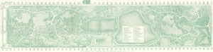
Illustrated and Indexed Map of Central Park.
sold
- Digital Map Information
- Suitable for large format printing
- File Size: 12.31 MB
- File Type: ZIP / TIFF
- ICC color profile embedded
- Delivered instantly via download link
A very attractive 1893 map of New York City's Central Park prepared and printed for inclusion in the Illustrated and Historical Souvenir of Central Park . This is an extremely rare variant on the map of Central ... (more details)