
Seale, Richard William (sold)

Richard William Seale (December 1703 - May 25, 1762) was an English a mapmaker and engraver active in London during the middle part of the 18th century. Seale was the son of Richard and Elizabeth Seale. Richard, his father, was a member of the Stationers Company, suggesting that printing and engraving must have been a family trade. Nonetheless, he did not learn the trade from his father, but rather from Samuel Parker of Clerkenwell, to whom he was apprenticed in 1719. Seale was extremely active as an engraver and publisher from about 1740 until his death in 1762. His cartographic corpus is vast; including pieces engraved for most other notable English cartographers of his period: Willdey, Baron, Toms, Rocque, Basire, Bowles, Benning, among others. In addition to cartographic work, Seale also produce numerous architectural engravings.
California as an Island and the apocryphal inland rivers of Lahontan.
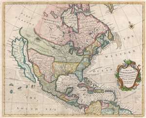
A Map of North America With the European Settlements and whatever else is remarkable in ye West Indies from the latest and best Observations.
sold
- Digital Map Information
- Suitable for large format printing
- DPI: 300
- File Size: 9.77 MB
- File Type: ZIP / TIFF
- ICC color profile embedded
- Delivered instantly via download link
An uncommon 1745 map of North America with California as an island by Richard W. Seale. The map offers much of interest, including a fascinating mapping of sources of the Mississippi River, California as an island, and the apocryphal geography of the Baron Lahontan. It covers all of North America from Atlantic to Pacific and from Baffin Bay to the Spanish Main, inclusive of Central America and the West Indies. Oceanic depths, winds, and currents are illustrated via stippling, shading, annotation, and arrows. A rococo title cartouche appears at right center. (more details)
California as an Island and the apocryphal inland rivers of Lahontan.
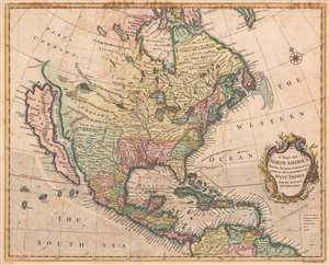
A Map of North America With the European Settlements and whatever else is remarkable in ye West Indies from the latest and best Observations.
sold
- Digital Map Information
- Suitable for large format printing
- DPI: 600
- File Size: 39.36 MB
- File Type: ZIP / TIFF
- ICC color profile embedded
- Delivered instantly via download link
An uncommon 1745 by Richard W. Seale map of North America with California as an island. The map offers much of interest, including a fascinating mapping of the sources of the Mississippi River, California as an island, and the apocryphal geography of the Baron Lahontan. (more details)
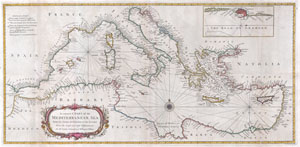
A correct Chart of the Mediterranean Sea, from the Straits of Gibraltar to the Levant; From the latest and best Observations: for Mr. Tindal’s Continuation of Mr. Rapin’s History..
sold
- Digital Map Information
- Suitable for large format printing
- DPI: 300
- File Size: 6.36 MB
- File Type: ZIP / TIFF
- ICC color profile embedded
- Delivered instantly via download link
A large and attractive hand colored 1745 sea chart of the entire Mediterranean region. Drawn in considerable detail with most ports clearly labeled. Large title cartouche in the lower left quadrant. Rumb lines throughout with a decorative compass rose at ... (more details)
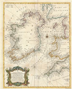
A Correct Chart of St. Georges Channel and the Irish Sea, Including all the Coast of Ireland, and ye West Coast of Great Britain from Cantire to Portland Isle: From the latest & best Observations.
sold
- Digital Map Information
- Suitable for large format printing
- DPI: 300
- File Size: 11.34 MB
- File Type: ZIP / TIFF
- ICC color profile embedded
- Delivered instantly via download link
An extreme attractive 1747 nautical chart or maritime map of Ireland and St. Georges Channel. Engraved by R. W. Seale, this map covers the entirety of Ireland as well as adjacent parts of Scotland, England, and Wales. Being essentially a nautical chart, ... (more details)
Anson's Charts of the Two Ends of the Pacific Ocean
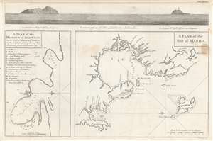
A plan of the harbour of Acapulco on the coast of Mexico in y'e South Sea, in the latitude of 16°45'N and west longitude from London 108°22' ;
A plan of the Bay of Manila.
sold
- Digital Map Information
- Suitable for large format printing
- Full resolution TIFF file
- ICC color profile embedded
- Delivered instantly via download link
This attractive 1748 engraving includes charts of the harbors of Acapulco, Mexico and Manila in the Philippines, the two chief ports for Spanish galleons crossing the Pacific Ocean. They are accompanied, at the top, with a coastal view of the Ladrone Islands: these were the usual midway point for the route between the two charted ports. The map accompanied the 1748 volume describing George Anson's privateering voyage around the world, wherein Anson led eight ships on a mission to disrupt, capture and despoil Spain's holdings in the Pacific. As Acapulco and Manila were essential ports at each end of a Spanish Pacific voyage, the inclusion of these charts in Anson's work was essential. Despite two ships having to return home, and one ship - the Wager - succumbing to mutiny, Anson's venture was a success; he returned to wealth and acclaim. (more details)
A hapless but ultimately successful expedition.
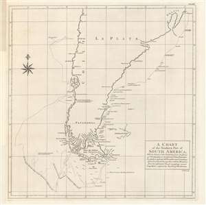
A chart of the southern part of South America, with the track of the Centurion...
sold
- Digital Map Information
- Suitable for large format printing
- DPI: 600
- File Size: 49.82 MB
- File Type: ZIP / TIFF
- ICC color profile embedded
- Delivered instantly via download link
A product of the remarkable Anson expedition and circumnavigation, this 1748 chart was engraved by Richard Seale and appeared in George Anson et al's A Voyage Round the World, in the Years MDCCXL, I, II, III, IV. It depicts the route of Anson's flagship, the Centurion, during the disastrous first phase of the expedition around Cape Horn, before finding rest and refuge at the Juan Fernandez Archipelago. (more details)
An English buccaneer's map of the Philippines.
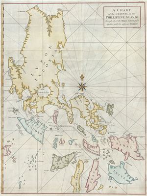
A Chart of the Channel in the Phillippine Islands through which the Manila Galeon passes together with the adjacent Islands.
sold
- Digital Map Information
- Suitable for large format printing
- DPI: 300
- File Size: 18.83 MB
- File Type: ZIP / TIFF
- ICC color profile embedded
- Delivered instantly via download link
Most likely the British buccaneer George Anson's most important published map, this is his important 1748 nautical chart of the Philippine islands (Philippines). The map covers the northern Philippine Islands from Cebu to the northern tip of Luzon. It is ... (more details)
Marks the end of Spanish dominance in the 18th century Pacific.
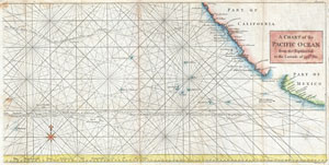
A Chart of the Pacific Ocean from the Equinoctial to the Latitude fo 39 1/2 d. No.
sold
- Digital Map Information
- Suitable for large format printing
- DPI: 300
- File Size: 9.89 MB
- File Type: ZIP / TIFF
- ICC color profile embedded
- Delivered instantly via download link
This is a rare 1748 nautical chart of the Pacific Ocean by George Anson and R. W. Seale. Chart depicts the trade routes used by Spanish Galleons from Acapulco, Mexico heading towards Manila in the Philippines. In particular, this chart depicts the travels ... (more details)
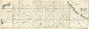
A Chart of the Pacific Ocean from the Equinoctial to the Latitude fo 39 1/2 d. No.
sold
- Digital Map Information
- Suitable for large format printing
- DPI: 300
- File Size: 14.6 MB
- File Type: ZIP / TIFF
- ICC color profile embedded
- Delivered instantly via download link
This is a rare 1748 nautical chart of the Pacific Ocean by the English map publisher R. W. Seale. Chart depicts the trade routes used by Spanish Galleons from Acapulco, Mexico to Manila in the Philippines. In particular, this chart depicts the travels of ... (more details)
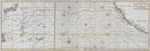
Carte de la Mer du Sud ou Mer Pacifique.
sold
- Digital Map Information
- Suitable for large format printing
- DPI: 300
- File Size: 6.22 MB
- File Type: ZIP / TIFF
- ICC color profile embedded
- Delivered instantly via download link
This is a rare nautical chart of the Pacific ocean by the English map publisher R. W. Seale. Chart depicts the trade routes used by Spanish Galleons from Acapulco, Mexico to Manila in the Philippines. In particular, this chart depicts the travels of ... (more details)
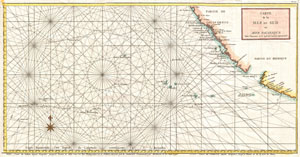
Carte de la Mer du Sud ou Mer Pacifique Entre l'Equateur et le 39 1.2 de Latitude Septentrionale.
sold
- Digital Map Information
- Suitable for large format printing
- DPI: 300
- File Size: 7.44 MB
- File Type: ZIP / TIFF
- ICC color profile embedded
- Delivered instantly via download link
This is a rare 1750 nautical chart of the Pacific Ocean by the French map publisher N. Bellin. Based on a similar chart in English prepared two years earlier by Seale. Chart depicts the trade routes used by Spanish Galleons from Acapulco, Mexico ... (more details)
Marks the end of Spanish dominance in the 18th century Pacific.
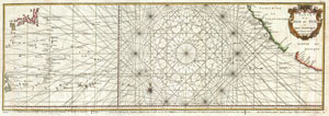
Carte de la Mer du Sud ou Mer Pacifique entre l'Equateur et le 39 1/2 . De Latitude Septentrionale.
sold
- Digital Map Information
- Suitable for large format printing
- DPI: 300
- File Size: 14.38 MB
- File Type: ZIP / TIFF
- ICC color profile embedded
- Delivered instantly via download link
This is a rare 1750 nautical chart of the Pacific Ocean by the French map publisher N. Bellin. Harkens to the great age of Pacific piracy and privateering. Based on a similar chart in English prepared three years earlier by Seale. Chart depicts ... (more details)
A fine 18th century wall map of North America.
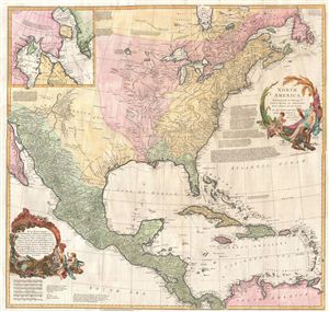
North America.
sold
- Digital Map Information
- Suitable for large format printing
- DPI: 300
- File Size: 40.79 MB
- File Type: ZIP / TIFF
- ICC color profile embedded
- Delivered instantly via download link
This is an exceptionally interesting and beautiful 1752 wall map of North America composed by Malachy Postlethwayte. Postlethwayte, an Englishman, prepared this map for issue in conjunction with the second edition (1752) of his popular ... (more details)
Anglophile edition of D'Anville's East Asia and Southeast Asia.
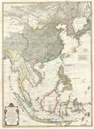
Second part of Asia, being China, part of India and Tartary: the islands of Sonda, Molucka, Philippin, Japan and c.
sold
- Digital Map Information
- Suitable for large format printing
- DPI: 300
- File Size: 31 MB
- File Type: ZIP / TIFF
- ICC color profile embedded
- Delivered instantly via download link
An exceptional 1755 map of East Asia by Malachy Postlethwayte and Solomon Bolton. Centered on the South China Sea, the map covers from Mongolia to java and from the Bay of Bengal to Hokkaido and new Guinea. It includes the countries ... (more details)
An invaluable reference to the 18th century African Slave trade.
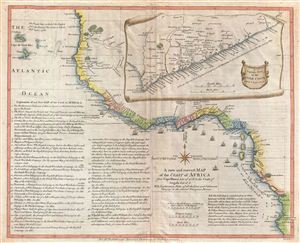
A new and correct Map of the Coast of Africa from Cape Blanco Lat. 20°, 40'. N. to the Coast of Angola, Lat. 11° . S. With Explanatory Notes of all the Forts and Settlements belonging to the several European Powers.
sold
- Digital Map Information
- Suitable for large format printing
- DPI: 300
- File Size: 11.09 MB
- File Type: ZIP / TIFF
- ICC color profile embedded
- Delivered instantly via download link
An important and very interesting 1755 map of western Africa by the english publisher M. Postlethwayte. This map covers the west coast of Africa from Cape Blanco and the Senegal River southwards past Sierra Leone, the Grain Coast, the ... (more details)
An extremely scarce stunning wall map of England and Ireland.
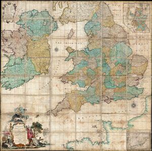
England and Ireland, Containing all the Cities, Boroughs, Market-Towns, & principal Villages, with the Coast of France from Calais to Brest.
sold
- Digital Map Information
- Suitable for large format printing
- Full resolution TIFF file
- ICC color profile embedded
- Delivered instantly via download link
An impressive and extremely scarce folding c. 1760 wall map of england and Ireland by Richard W. Seale. Covers all of england and about 98% of Ireland excepting only a small part of western Kerry and western Connaught. Part of the ... (more details)