
Smith, John Calvin (sold)

John Calvin Smith (1809 – June 11, 1890) was an American surveyor and geographer active in New York during the middle part of the 19th century. He was a charter member of the American Geographical and Statistical Society (American Geographical Society). He worked with other important New York cartographers including John Disturnell (1801 - 1877), George E. Sherman (1812 - 1858), and Samuel Stiles (1796 - 1861), with whom he often published under the Stiles, Sherman & Smith imprint. Stiles may have introduced Smith to J. H. Colton (1800 - 1893), who acquired many of his map plates in 1853. Most of Smith's maps focus on New York counties, but he also issued maps of the United States, Illinois, Texas, and the California gold fields. Despite being an important and prolific cartographer, much of his personal life and history are shrouded in mystery.
The most significant map of Long Island in the 19th century.
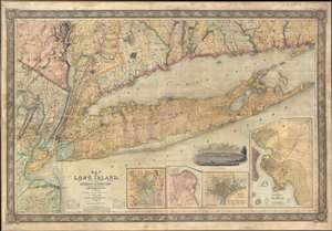
Map of Long Island, with the Environs of New-York and the Southern Part of Connecticut, compiled from Various Surveys and Documents.
sold
- Digital Map Information
- Suitable for large format printing
- DPI: 300
- File Size: 236.68 MB
- File Type: ZIP / TIFF
- ICC color profile embedded
- Delivered instantly via download link
A fine first edition example of John Calvin Smith and J. H. Colton's 1836 map of Long Island – one of Colton's first published maps. This is the largest, most significant, and most beautiful map of Long Island to be issued in the 19th century. Covering all of ... (more details)
Geological Foundation for Long Island’s Development in the Second Half of the 19th Century.
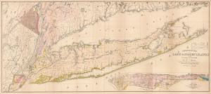
Geological Map of Long and Staten Islands with the Environs of New York.
sold
- Digital Map Information
- Suitable for large format printing
- Full resolution TIFF file
- ICC color profile embedded
- Delivered instantly via download link
The influential 1842 William W. Mather map of Long Island is considered the first comprehensive geological study of the island. Published while the Long Island Rail Road was still under construction, Mather's map captures a landscape that was still overwhelmingly rural, agricultural, and geographically remote from New York City, but whose soils, resources, transportation corridors, and development potential were becoming subjects of intense scientific and commercial interest. Within little more than a decade, the railroad would open vast portions of the island to easier settlement and speculation, initiating a land rush and a process of development that would ultimately transform Long Island into an extension of metropolitan New York. (more details)
A landmark map of Long Island and the earliest Long Island Wall Map.
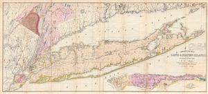
Geological Map of Long & Staten Islands with the Environs of New York.
sold
- Digital Map Information
- Suitable for large format printing
- DPI: 300
- File Size: 36.74 MB
- File Type: ZIP / TIFF
- ICC color profile embedded
- Delivered instantly via download link
Issued prior to the American Civil War and the subsequent Long Island land rush, this is one of the most detailed and attractive large format maps of Long Island to appear in the 19th Century. Covers from New Jersey and Staten Island eastward as Montauk and ... (more details)
A landmark map of Long Island and the earliest Long Island Wall Map.
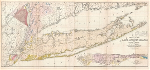
Geological Map of Long & Staten Islands with the Environs of New York.
sold
- Digital Map Information
- Suitable for large format printing
- File Size: 29.38 MB
- File Type: ZIP / TIFF
- ICC color profile embedded
- Delivered instantly via download link
Issued prior to the American Civil War and the subsequent Long Island land rush, this is one of the most detailed and attractive large format maps of Long Island to appear in the 19th Century. It is also the first comprehensivle geological study of Long ... (more details)
A landmark map of Long Island and the earliest Long Island Wall Map.
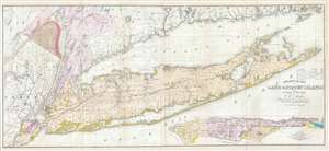
Geological Map of Long & Staten Islands with the Environs of New York.
sold
- Digital Map Information
- Suitable for large format printing
- DPI: 300
- File Size: 28.77 MB
- File Type: ZIP / TIFF
- ICC color profile embedded
- Delivered instantly via download link
Issued prior to the American Civil War and the subsequent Long Island land rush, this is one of the most detailed and attractive large format maps of Long Island to appear in the 19th Century. It is also the first comprehensivle geological study of Long ... (more details)
First geological map of Long Island.
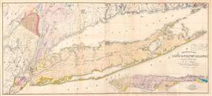
Geological Map of Long and Staten Islands with the Environs of New York.
sold
- Digital Map Information
- Suitable for large format printing
- Full resolution TIFF file
- ICC color profile embedded
- Delivered instantly via download link
A fine example of William W. Mather's 1842 large-scale geographical map of Long Island, New York - the first comprehensive geological study of the island. Issued prior to the completion of the Long Island Railroad and the subsequent Long Island land rush, this one of the largest, most detailed, and attractive maps of Long Island to appear in the 19th century. The map covers from New Jersey and Staten Island eastward as Montauk and Fisher's Island. Includes parts of Westchester, New Jersey, Rockland County, and the Connecticut coastline. A large inset map in the lower right depicts Manhattan with a special focus on geological features and topography. The line of the partially completed Long Island Railroad, which within 15 years would change the demographic of Long Island, is illustrated. Various important Long Island communities including the East Hampton, Bridgehampton, Southampton, Amagansett, Riverhead, and Sag Harbor, among others, are named. In many cases even individual buildings are detailed. The whole is laid out on a grid structure of ten-mile squares. (more details)
Highly decorative map promoted as the 'largest best, and most detaled' map fo the United States to appear as of 1849.
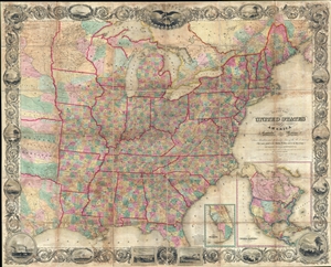
Map of the United States of America Including Canada, and a large portion of Texas, Showing Base Meridian and Township Lines of the U.S. Surveys, Including Lands alotted to the Indian Tribes west of the Mississippi, The various internal improvements.
sold
- Digital Map Information
- Suitable for large format printing
- DPI: 300
- File Size: 147.52 MB
- File Type: ZIP / TIFF
- ICC color profile embedded
- Delivered instantly via download link
A striking large format 1849 case map of the United States by J. Calvin Smith. The map covers from Austin Texas to the eastern seaboard and from Lake Superior to the Gulf of Mexico. When it was introduced, this map was hailed as the largest, best, and ... (more details)
By stage, canal, and railroad from Ohio to Iowa.
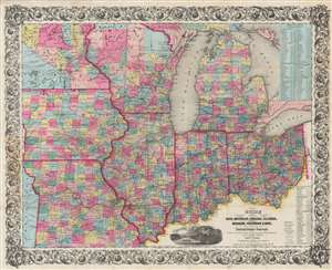
Guide Through Ohio, Michigan, Indiana, Illinois, Missouri, Wisconsin, and Iowa. Showing the Township lines of the United States Surveys, Location of Cities, Towns, Villages, Post Hamlets, Canals, Rail and Stage Roads.
sold
- Digital Map Information
- Suitable for large format printing
- DPI: 600
- File Size: 101.01 MB
- File Type: ZIP / TIFF
- ICC color profile embedded
- Delivered instantly via download link
This is an 1854 John Calvin Smith and John H. Colton map of Ohio, Michigan, Indiana, Illinois, Missouri, Wisconsin, and Iowa, along with part of Minnesota. Counties are shaded and township grids are illustrated where they have been surveyed. Cities and towns are labeled throughout, along with rivers, lakes, and creeks. (more details)
First large-scale commercial map of the Confederacy.
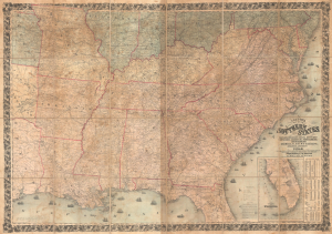
Colton's Map of the Southern States, including Maryland, Delaware, Virginia, Kentucky, Tennessee, Missouri, North Carolina, South Carolina, Georgia, Alabama, Mississippi, Arkansas, Louisiana, and Texas. Showing Also Part of Adjoining States and Territories Locating the Forts and Military Stations of the U. States and Showing all the Rail Roads, R.R. Stations, and other Internal Improvements.
sold
- Digital Map Information
- Suitable for large format printing
- File Size: 198.45 MB
- File Type: ZIP / TIFF
- ICC color profile embedded
- Delivered instantly via download link
This is an 1861 J. H. Colton map of the Confederacy published in the first year of the American Civil War (1861 - 1865). This is the first large-scale commercial map of the Confederacy, published early in 1861, in the immediate wake of the Secession. (more details)
The Civil War - big and bold.
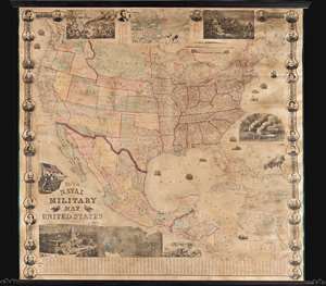
This is a rare 1863 wall map of the United States at the height of the American Civil War (1861 - 1865). The map was issued by John Calvin Smith and Robert Persall Smith during the Civil War to capitalize on general interest in the war among the northern elite. At roughly 70 inches square, this enormous and lavishly produced map covers all of the United States and Mexico. The early state and territory configuration includes the ephemeral Confederate State of Arizona. It is surrounded by images of Union officers and politicians - including Lincoln, Fremont, Wilkes, and Scott. Curiously, these do not include General Grant, as the map's publication in early January of 1863 predates his assumption of overall command on January 29, 1863. The map features multiple vignette scenes including the victory of the Monitor over the Merrimac, the allegorical 'Rescue of the Union', an illustration of 'Camp Life', the Capitol building in Washington, and an overview of the 'Birth of the Union' at Bunker Hill. Of note, the Pacific Telegraph Route is noted running parallel to the Pony Express Route, which is also illustrated. (more details)
Highly decorative map of New England.
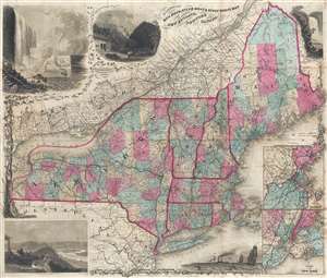
E.P. Dutton and Co.'s Railroad, Steam Boat, and Stage Route Map of New England, New York, and Canada.
sold
- Digital Map Information
- Suitable for large format printing
- File Size: 19.74 MB
- File Type: ZIP / TIFF
- ICC color profile embedded
- Delivered instantly via download link
This is an exceptionally decorative 1866 map of New England and New York issued by Edward Payson Dutton. Centered on Vermont, the map coves from Like Erie to Cape Cod and from Northern Maine to Long Island and New York City. The map was prepared to ... (more details)
An interesting 1876 reprint of a 1782 map of Manhattan.
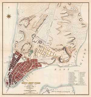
City of New York. Surveyed by J. Hills, 1782. Re-Published by J. Disturnell. 1876.
sold
- Digital Map Information
- Suitable for large format printing
- File Size: 3.26 MB
- File Type: ZIP / TIFF
- ICC color profile embedded
- Delivered instantly via download link
This is an 1876 John Disturnell republication of a 1782 J. Hills city map or plan of New York City. The map depicts the lower half of Manhattan and a small part of Long Island, including Brooklyn. Most of Manhattan is undeveloped. Streets are labeled ... (more details)
An interesting 1876 reprint of a 1782 map of Manhattan.
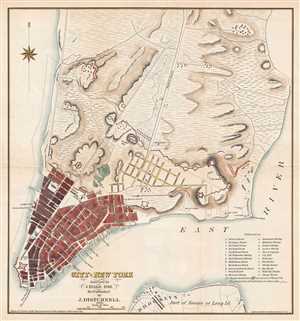
City of New York. Surveyed by J. Hills, 1782. Re-Published by J. Disturnell. 1876.
sold
- Digital Map Information
- Suitable for large format printing
- Full resolution TIFF file
- ICC color profile embedded
- Delivered instantly via download link
This is an 1876 John Disturnell republication of a 1782 J. Hills city map or plan of New York City. The map depicts the lower half of Manhattan and a small part of Long Island, including Brooklyn. Most of Manhattan is undeveloped. Streets are labeled ... (more details)