
Vaux, Calvert (sold)
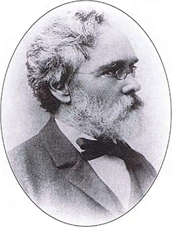
Calvert Vaux (1824 - 1895) was a British architect and landscaper who is best remembered for his co-design, with Frederick Olmstead, of New York City's Central Park. Born in London in 1824, little is known of his early life, though it is recorded that, at 9 he was apprenticed to London architect Lewis Nockalls Cottingham, a proponent of the Gothic Revival Movement. Vaux worked for Cottingham until he was 26 years old, honing his skills and building a reputation as a skilled draftsman. During an exhibition of his watercolors in 1851, Vaux caught the attention of landscape designer Andrew Jackson Downing. Downing was looking for a partner to fulfill his revolutionary vision of urban architectural-landscaping. Dowing recruited Vaux to design buildings, bridges, and structures, while he focused on the overall landscape design. Vaux accompanied Downing to the United States where, in 1854, he gained U.S. citizenship and founded the American Institute of Architects. Vaux's partnership with Downing lasted approximately two years and resulted in a number of significant works, including the grounds of the White and Smithsonian Institute in Washington D.C. In 1852 Downing passed away in a tragic accident. At the time Downing was working on a landscape design for New York City's Central Park. In a decision that would forever change the American urban landscape, Vaux called in the fledgling landscape designer Frederick Olmstead to fill Downing shoes. Though Central Park was their first joint project, Vaux and Olmstead proved a magical combination, creating what many consider to be the finest planed urban recreation area in the world. Following the completion of Central Park, Vaux and Olmstead formed an official business partnership and went on to design Prospect Park in Brooklyn and Morningside Park in upper Manhattan. They planned one of the first suburbs in Chicago, Riverside, and were commissioned to design parks for Buffalo, NY, Milwaukee, WI, and Rockwood Park in Canada, among others. Vaux ended the partnership in 1872 and went on to collaborate with George Kent Radford and Samuel Parsons. However, in 1889 he again joined forces with Olmstead to design Downing Park, as a memorial to his mentor. Vaux tragically passed away on November 19, 1895, when he drowned in Brooklyn, NY.
Remarkable view of Benjamin Waterhouse Hawkins' vision for a Palaeozoic Museum in Central Park. These statues were subsequently destroyed by thugs in the employ of 'Boss' Tweed.
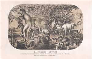
Palaeozoic Museum. Showing the Rehabilitated Forms of Ancient Animal Life in America. Now being constructed in Central Park.
sold
- Digital Map Information
- Suitable for large format printing
- Full resolution TIFF file
- ICC color profile embedded
- Delivered instantly via download link
A wonderful 1870 view of the intended interior of the Central Park Palaeozoic Museum – a precursor of the modern day Natural History Museum. Following the success of Benjamin Waterhouse Hawkins' life-sized concrete dinosaur models created for England's Crystal ... (more details)
Profiles in Central Park along hypothetical extensions of Sixth and Seventh Avenue.
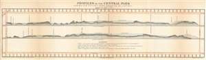
Profiles of the Central Park on the lines of the VIth and VIIt Avenues prolonged from 59th to 110th Street.
sold
- Digital Map Information
- Suitable for large format printing
- File Size: 5.56 MB
- File Type: ZIP / TIFF
- ICC color profile embedded
- Delivered instantly via download link
This 1860 Frederick Law Olmsted and Calvert Vaux profile chart or map of Central Park in New York City provides a glimpse into the wide-ranging topography of one of the world's greatest urban parks. Olmsted and Vaux employ Manhattan's iconic grid system and illustrate the topographic profiles along hypothetical extensions of Sixth and Seventh Avenues. Landmarks within the park, including the transverse roads, the carriage road, the New Reservoir, and The Bluff, are identified. Trees appear along some of the ridges, and higher ground to the west of the defined profiles appear as shadowy masses above the profiles. Manhattan's street grid borders the park on all four sides. (more details)
Extremely rare pocket map of New York's Central Park.
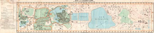
Map of the Central Park Showing the Progress of the Work up to January 1st, 1860.
sold
- Digital Map Information
- Suitable for large format printing
- File Size: 10.13 MB
- File Type: ZIP / TIFF
- ICC color profile embedded
- Delivered instantly via download link
A very attractive 1860 pocket map of New York City's Central Park. This is an extremely rare pocket map variant on the map of Central Park that later appeared in the 1860 Commissioner's Annual Report on the Progress of Central Park . This map is not listed in ... (more details)
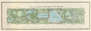
Plan of the Central Park, City of New York, 1860.
sold
- Digital Map Information
- Suitable for large format printing
- File Size: 3.73 MB
- File Type: ZIP / TIFF
- ICC color profile embedded
- Delivered instantly via download link
This is an attractive hand colored map of New York City's Central Park issued in 1860 for Valentine's Manual of the Corporation of New York . Depicts the park as a whole and includes pathways, lakes, buildings, individual trees and rocks. The streets and ... (more details)
Extremely rare pocket map of New York's Central Park.
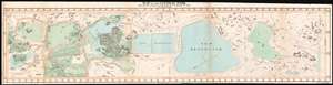
Map of the Central Park Showing the progress of the Work up to January 1st 1860.
sold
- Digital Map Information
- Suitable for large format printing
- File Size: 13.41 MB
- File Type: ZIP / TIFF
- ICC color profile embedded
- Delivered instantly via download link
A very attractive 1860 pocket map of New York City's Central Park. This is an extremely rare pocket map variant on the map of Central Park that later appeared in the 1860 Commissioner's Annual Report on the Progress of Central Park. This map is not listed in Haskell and to our knowledge was not issued to the public in pocket format – only in the Commissioner's Annual Report. Most likely it was available only to those city officials actually involved in the planning and construction of Central Park.
This extraordinary map reveals Central Park as conceived by the landscape architects, and indeed 'artists,' Calvert Vaux and Frederick Law Olmsted. Vaux and Olmsted were awarded the task of designing Central Park in 1853 by the City Common Council. Olmsted's vision drove the overall design while Vaux concentrated his attentions on bridges, buildings, and other structures within the park. The creation of Central Park, which was to consist of some 800 acres of public forest, pathways, promenades, lakes, bridges, and meadows, was a seminal moment in civic urban design. The park itself was designed as a whole with every tree, pond, and bench meticulously planned. Olmsted wrote: 'Every foot of the Park's surface, every tree and bush, as well as every arch, roadway, and walk has been fixed where it is with a purpose.'
Historian Gloria Deak writes,
This extraordinary map reveals Central Park as conceived by the landscape architects, and indeed 'artists,' Calvert Vaux and Frederick Law Olmsted. Vaux and Olmsted were awarded the task of designing Central Park in 1853 by the City Common Council. Olmsted's vision drove the overall design while Vaux concentrated his attentions on bridges, buildings, and other structures within the park. The creation of Central Park, which was to consist of some 800 acres of public forest, pathways, promenades, lakes, bridges, and meadows, was a seminal moment in civic urban design. The park itself was designed as a whole with every tree, pond, and bench meticulously planned. Olmsted wrote: 'Every foot of the Park's surface, every tree and bush, as well as every arch, roadway, and walk has been fixed where it is with a purpose.'
Historian Gloria Deak writes,
There was a staggering amount of work to be done to transform the area into a blend of pastoral and woodland scenery. This involved the design and construction of roadways, tunnels, bridges, arches, stairways, fountains, benches, lamp posts, gates, fences and innumerable other artifacts. It also involved the supervision of an army of about five thousand laborers…Olmsted, to whom most of the credit goes, insisted on seeing the multidimensional project as a single work of art, which he was mandated to create. For this purpose, he ventured to assume to himself the title of ‘artist.'Today, because of Vaux and Olmsted's efforts, New York Yorkers, ourselves included, have the privilege of enjoying what is, perhaps, the finest example of a planned urban public recreation area in the world. (more details)
Vaux's plan of the southwest corner entrance to New York City's Central Park (columbus Circle).
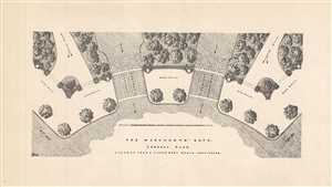
The Merchant's Gate. General Plan.
sold
- Digital Map Information
- Suitable for large format printing
- Full resolution TIFF file
- ICC color profile embedded
- Delivered instantly via download link
This is a c.1860 plan of the Merchant’s Gate in the southwest corner of New York City’s Central Park. It depicts the architect’s plan of the most heavily used entrance of Central Park. Notes the planned ornamentation including sidewalks, walkways, ... (more details)
Exceptional large folding map of Central Park.
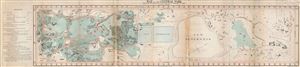
Map of the Central Park Showing the progress of the Work up to January 1st 1861.
sold
- Digital Map Information
- Suitable for large format printing
- File Size: 13.12 MB
- File Type: ZIP / TIFF
- ICC color profile embedded
- Delivered instantly via download link
An altogether extraordinary hand colored map of New York City's Central Park prepared and printed for inclusion in the Fourth Annual Report of the Board of Commissioners of the Central Park . This extremely rare variant on the map of Central Park ... (more details)
Exceptional large folding map of Central Park.
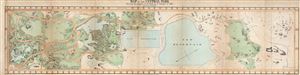
Map of the Central Park Showing the progress of the Work up to January 1st 1861.
sold
- Digital Map Information
- Suitable for large format printing
- File Size: 11.54 MB
- File Type: ZIP / TIFF
- ICC color profile embedded
- Delivered instantly via download link
An altogether extraordinary hand colored map of New York City's Central Park prepared and printed for inclusion in the Fifth Annual Report of the Board of Commissioners of the Central Park . This map first appeared in 1861, with the present ... (more details)
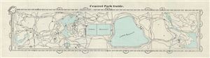
Central Park Guide.
sold
- Digital Map Information
- Suitable for large format printing
- File Size: 2.63 MB
- File Type: ZIP / TIFF
- ICC color profile embedded
- Delivered instantly via download link
An altogether extraordinary 1862 hand colored map of New York City's Central Park prepared and printed for inclusion in the Fifth Annual Report of the Board of Commissioners of the Central Park. It depicts the park as a whole and includes ... (more details)
Central Park - nearly complete!
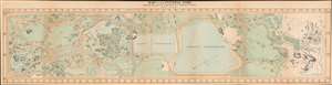
Map of the Central Park Showing the progress of the Work up to January 1st 1864.
sold
- Digital Map Information
- Suitable for large format printing
- File Size: 38.64 MB
- File Type: ZIP / TIFF
- ICC color profile embedded
- Delivered instantly via download link
A very attractive 1864 map of New York City's Central Park. This map was issued for the 1864 Seventh Annual Report to the commissioners on the construction of the park. By 1864, most of the park had been completed, with only the northernmost sections above 103rd street remaining a work in progress. This is here indicated through the lack of wash coloring in the incomplete parts - generally embracing the Great Hill, the North Woods, the Conservatory Garden, Nutter's Battery, and the Harlem Meer.
This extraordinary map reveals Central Park as conceived by the landscape architects, and indeed 'artists,' Calvert Vaux and Frederick Law Olmsted. Vaux and Olmsted were awarded the task of designing Central Park in 1853 by the City Common Council. Olmsted's vision drove the overall design while Vaux concentrated his attentions on bridges, buildings, and other structures within the park. The creation of Central Park, which was to consist of some 800 acres of public forest, pathways, promenades, lakes, bridges, and meadows, was a seminal moment in civic urban design. The park itself was designed as a whole with every tree, pond, and bench meticulously planned. Olmsted wrote: 'Every foot of the Park's surface, every tree and bush, as well as every arch, roadway, and walk has been fixed where it is with a purpose.'
Historian Gloria Deak writes,
This extraordinary map reveals Central Park as conceived by the landscape architects, and indeed 'artists,' Calvert Vaux and Frederick Law Olmsted. Vaux and Olmsted were awarded the task of designing Central Park in 1853 by the City Common Council. Olmsted's vision drove the overall design while Vaux concentrated his attentions on bridges, buildings, and other structures within the park. The creation of Central Park, which was to consist of some 800 acres of public forest, pathways, promenades, lakes, bridges, and meadows, was a seminal moment in civic urban design. The park itself was designed as a whole with every tree, pond, and bench meticulously planned. Olmsted wrote: 'Every foot of the Park's surface, every tree and bush, as well as every arch, roadway, and walk has been fixed where it is with a purpose.'
Historian Gloria Deak writes,
There was a staggering amount of work to be done to transform the area into a blend of pastoral and woodland scenery. This involved the design and construction of roadways, tunnels, bridges, arches, stairways, fountains, benches, lamp posts, gates, fences and innumerable other artifacts. It also involved the supervision of an army of about five thousand laborers…Olmsted, to whom most of the credit goes, insisted on seeing the multidimensional project as a single work of art, which he was mandated to create. For this purpose, he ventured to assume to himself the title of ‘artist.'Today, because of Vaux and Olmsted's efforts, New York Yorkers, ourselves included, have the privilege of enjoying what is, perhaps, the finest example of a planned urban public recreation area in the world. (more details)
Possibly the most beautiful map of Central Park ever published.
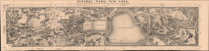
Central Park, New York, A picturesque Guide through the whole Park showing all the improvements up to June 1865.
sold
- Digital Map Information
- Suitable for large format printing
- Full resolution TIFF file
- ICC color profile embedded
- Delivered instantly via download link
An exceptional view map of New York City's Central Park, issued in 1865 by the Boston lithographer Louis Prang. Graced with Prang's exceptional engraving and fine lithography, this is undoubtedly the most beautiful map of Central Park issued in the 19th century. Covering Frederick Law Olmsted's masterpiece in full, Prang's meticulously detailed map illustrates pathways, bridges, lakes, and buildings, along with some individual trees and rocks. (more details)
Possibly the most beautiful map and view of Central Park ever published.
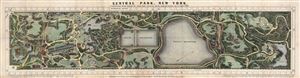
Central Park, New York, A picturesque Guide through the whole Park showing all the improvements up to June 1865.
sold
- Digital Map Information
- Suitable for large format printing
- File Size: 14.56 MB
- File Type: ZIP / TIFF
- ICC color profile embedded
- Delivered instantly via download link
An altogether extraordinary hand colored birds-eye view map of New York City's Central Park prepared and printed in 1865 by the famous Boston lithographer Louis Prang. Graced with Prang's extraordinary engraving and fine lithography, this ... (more details)
Possibly the most beautiful map and view of Central Park ever published.
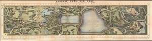
Central Park, New York, A picturesque Guide through the whole Park showing all the improvements up to June 1865.
sold
- Digital Map Information
- Suitable for large format printing
- File Size: 28.74 MB
- File Type: ZIP / TIFF
- ICC color profile embedded
- Delivered instantly via download link
An altogether extraordinary birds-eye view map of New York City's Central Park prepared and printed in 1865 by the famous Boston lithographer Louis Prang. Graced with Prang's exceptional engraving and fine lithography, this is undoubtedly the most beautiful map of Central Park issued in the 19th century. Covering the entire park, Prang's meticulously detailed map illustrates pathways, bridges, lakes, and buildings, along with some individual trees and rocks. All are pictorially rendered in profile. Many of the streets and avenues surrounding the park are also noted. The Park's famous wall, only partially constructed in 1865, is here shown in its completed glory. (more details)
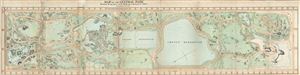
Map of the Central Park Showing the progress of the Work up to January 1st, 1865.
sold
- Digital Map Information
- Suitable for large format printing
- File Size: 9.18 MB
- File Type: ZIP / TIFF
- ICC color profile embedded
- Delivered instantly via download link
An altogether extraordinary hand colored map of New York City's Central Park prepared and printed for inclusion in the Eight Annual Report of the Board of Commissioners of the Central Park . This map first appeared in 1861, with the ... (more details)
Central Park as it was being built.
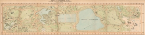
Map of the Central Park Showing the progress of the Work up to January 1st, 1865.
sold
- Digital Map Information
- Suitable for large format printing
- File Size: 12.8 MB
- File Type: ZIP / TIFF
- ICC color profile embedded
- Delivered instantly via download link
A striking 1865 map of New York City's Central Park - issued while the park was still under construction. The landmark construction of Central Parks marked the inauguration of a new era of planned public greenspaces. (more details)
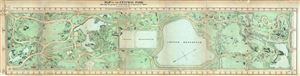
Map of the Central Park Showing the progress of the Work on January 1st 1867.
sold
- Digital Map Information
- Suitable for large format printing
- File Size: 11.33 MB
- File Type: ZIP / TIFF
- ICC color profile embedded
- Delivered instantly via download link
An altogether extraordinary hand colored map of New York City's Central Park prepared and printed for inclusion in the Tenth Annual Report of the Board of Commissioners of the Central Park . This extremely rare variant on the map ... (more details)
Vaux and Olmstead's 1867 redesign of Fort Green Park, Brooklyn
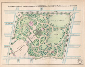
Design for the Laying Out of the Grounds known as Fort Green or Washington Park, in the City of Brooklyn.
sold
- Digital Map Information
- Suitable for large format printing
- File Size: 2.86 MB
- File Type: ZIP / TIFF
- ICC color profile embedded
- Delivered instantly via download link
A rare 1867 example Vaux and Olmsted's map of Washington Park or, as it is now known, Fort Greene Park, Brooklyn. Oriented to the east, the map depicts the park as a whole and includes pathways, lakes, buildings, individual trees, rocks, and elevation measurements. The streets and avenues surrounding the park are also noted. The layout of Fort Greene Park shown here reflects Vaux and Olmsted's 1867 redesign. (more details)
Vaux and Olmstead's 1867 redesign of Fort Green Park, Brooklyn
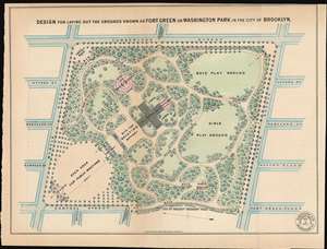
Design for the Laying Out of the Grounds known as Fort Green or Washington Park, in the City of Brooklyn.
sold
- Digital Map Information
- Suitable for large format printing
- File Size: 8.68 MB
- File Type: ZIP / TIFF
- ICC color profile embedded
- Delivered instantly via download link
A rare 1867 example Vaux and Olmsted's map of Washington Park or, as it is now known, Fort Greene Park, Brooklyn. Oriented to the east, the map depicts the park as a whole and includes pathways, lakes, buildings, individual trees, rocks, and elevation measurements. The streets and avenues surrounding the park are also noted. The layout of Fort Greene Park shown here reflects Vaux and Olmsted's 1867 redesign. (more details)
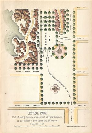
Central Park. Plan showing the new arrangement of Park Entrance at the corner of 59th Street and 5th Avenue.
sold
- Digital Map Information
- Suitable for large format printing
- File Size: 1.27 MB
- File Type: ZIP / TIFF
- ICC color profile embedded
- Delivered instantly via download link
This is a beautiful and unusual little map of the southeastern corner of New York City's Central Park prepared and printed for inclusion in the 1867 Tenth Annual Report of the Board of Commissioners of the Central Park. It ... (more details)
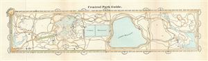
Central Park Guide.
sold
- Digital Map Information
- Suitable for large format printing
- File Size: 2.2 MB
- File Type: ZIP / TIFF
- ICC color profile embedded
- Delivered instantly via download link
An altogether extraordinary 1867 hand colored map of New York City's Central Park prepared and printed for inclusion in the Tenth Annual Report of the Board of Commissioners of the Central Park. This is an extremely rare ... (more details)
Large folding map of Central Park
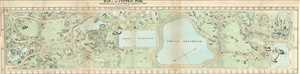
Map of the Central Park Showing the progress of the Work on January 1st 1866.
sold
- Digital Map Information
- Suitable for large format printing
- File Size: 9.94 MB
- File Type: ZIP / TIFF
- ICC color profile embedded
- Delivered instantly via download link
An altogether extraordinary hand colored map of New York City's Central Park prepared and printed for inclusion in the Tenth Annual Report of the Board of Commissioners of the Central Park . This extremely rare variant ... (more details)
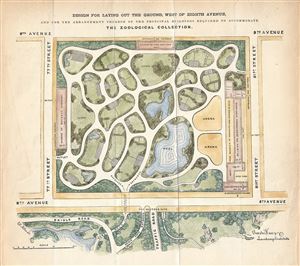
Design for laying out The ground, West of Eight Avenue, and for the arrangement thereon of the principal buildings required to accommodate The Zoological Collection.
sold
- Digital Map Information
- Suitable for large format printing
- File Size: 2.43 MB
- File Type: ZIP / TIFF
- ICC color profile embedded
- Delivered instantly via download link
This is an extraordinary 1867 hand colored map or plan of the grounds that today house the American Museum of Natural History in New York City. It depicts from 77th Street north to the intersection of 81st Street and ... (more details)
An early map of Central Park and the first specific map of the Upper West Side.
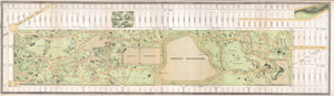
Central Park.
sold
- Digital Map Information
- Suitable for large format printing
- File Size: 5.17 MB
- File Type: ZIP / TIFF
- ICC color profile embedded
- Delivered instantly via download link
An altogether extraordinary hand colored map of New York City's Central Park and the Upper West Side prepared and printed for inclusion in the Thirteenth Annual Report of the Board of Commissioners of the Central ... (more details)
Possibly the first published map of Prospect Park.
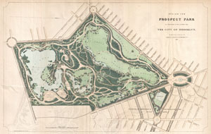
Design for Prospect Park as Proposed to be Laid Out for The City of Brooklyn.
sold
- Digital Map Information
- Suitable for large format printing
- File Size: 6.87 MB
- File Type: ZIP / TIFF
- ICC color profile embedded
- Delivered instantly via download link
A rare 1868 first edition of Vaux & Olmsted's map of Prospect Park, Brooklyn. Issued just months after its October 1867 completion, this is one of the first published maps to depict the design of Prospect Park. ... (more details)
One of the first maps of Prospect Park.
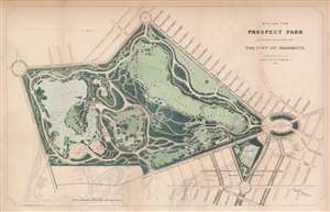
Design for Prospect Park as Proposed to be Laid Out for The City of Brooklyn.
sold
- Digital Map Information
- Suitable for large format printing
- Full resolution TIFF file
- ICC color profile embedded
- Delivered instantly via download link
A rare 1868 first edition of Calvert Vaux and Frederick Law Olmsted's map of Prospect Park, Brooklyn. Issued just months after its October 1867 completion, this is one of the first published maps to depict the design of Prospect Park. The map depicts the park as a whole and includes pathways, lakes, buildings, individual trees, rocks, and elevation measurements. The streets and avenues surrounding the park are also noted. (more details)
Possibly the first published map of Prospect Park.
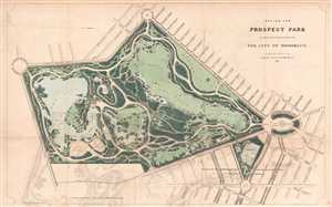
Design for Prospect Park as Proposed to be Laid Out for The City of Brooklyn.
sold
- Digital Map Information
- Suitable for large format printing
- File Size: 4.71 MB
- File Type: ZIP / TIFF
- ICC color profile embedded
- Delivered instantly via download link
A rare 1868 first edition of Vaux and Olmsted's map of Prospect Park, Brooklyn. Issued just months after its October 1867 completion, this is one of the first published maps to depict the design of Prospect ... (more details)
Possibly the first published map of Prospect Park.
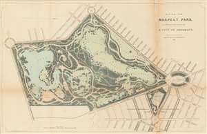
Design for Prospect Park as Proposed to be Laid Out for The City of Brooklyn.
sold
- Digital Map Information
- Suitable for large format printing
- File Size: 14.64 MB
- File Type: ZIP / TIFF
- ICC color profile embedded
- Delivered instantly via download link
A rare 1868 first edition of Vaux and Olmsted's map of Prospect Park, Brooklyn. Issued just months after its October 1867 completion, this is one of the first published maps to depict the design of Prospect Park. The map depicts the park as a whole and includes pathways, lakes, buildings, individual trees, rocks, and elevation measurements. The streets and avenues surrounding the park are also noted. (more details)
One of the first maps of Prospect Park.
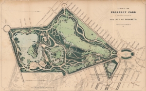
Design for Prospect Park as Proposed to be Laid Out for The City of Brooklyn.
sold
- Digital Map Information
- Suitable for large format printing
- File Size: 13 MB
- File Type: ZIP / TIFF
- ICC color profile embedded
- Delivered instantly via download link
A rare 1868 first edition of Calvert Vaux and Frederick Law Olmsted's map of Prospect Park, Brooklyn. Issued just months after its October 1867 completion, this is one of the first published maps to depict the design of Prospect Park. The map depicts the park as a whole and includes pathways, lakes, buildings, individual trees, rocks, and elevation measurements. The streets and avenues surrounding the park are also noted. (more details)
First year of construction of Prospect Park.
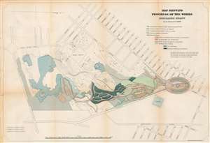
Map Showing Progress of the Works Indicated Below. Up to January 1st, 1868.
sold
- Digital Map Information
- Suitable for large format printing
- File Size: 13.33 MB
- File Type: ZIP / TIFF
- ICC color profile embedded
- Delivered instantly via download link
A rare 1868 Calvert Vaux and Frederick Law Olmsted map of Prospect Park, Brooklyn. Illustrating progress made on the park between its opening in 1867 and January 1868, the map depicts the park as a work in progress. Light green shaded areas represent completed areas. Diagonal green lines represent areas where work was in progress. White zones are coded for planned development. The original topography is illustrated as well. Roads (both in progress and finished), walks and bridle roads (both in progress and finished), and 'water surfaces' (both in progress and finished) are illustrated.. (more details)
Map of Brooklyn's Eastern Parkway - the world's first Parkway.
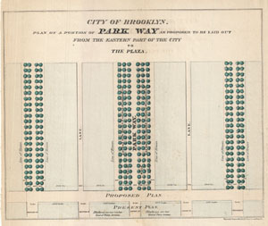
City of Brooklyn. Plan of a Portion of Park Way as Proposed to be Laid out From the Eastern Part of the City to The Plaza.
sold
- Digital Map Information
- Suitable for large format printing
- File Size: 1.77 MB
- File Type: ZIP / TIFF
- ICC color profile embedded
- Delivered instantly via download link
A rare 1868 example Vaux & Olmsted's preliminary plan for Eastern Parkway, Brooklyn. This may well be the first published plan of Eastern Parkway, which began construction about 2 years after this initial ... (more details)
The first map of any parkway, anywhere - in this case Brookln's Eastern Parkway.
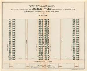
City of Brooklyn. Plan of a Portion of Park Way as Proposed to be Laid out From the Eastern Part of the City to The Plaza.
sold
- Digital Map Information
- Suitable for large format printing
- File Size: 2.9 MB
- File Type: ZIP / TIFF
- ICC color profile embedded
- Delivered instantly via download link
A rare 1868 example Vaux and Olmsted's preliminary plan for Eastern Parkway, Brooklyn. This may well be the first published plan of Eastern Parkway, and indeed any parkway anywhere, which began construction about 2 years after this initial layout was published. (more details)
Possibly the first published map of the Prospect Park Parade Ground.
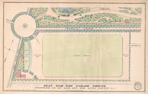
Plan for the Parade Ground Proposed to be Laid out for Kings County L. I.
sold
- Digital Map Information
- Suitable for large format printing
- File Size: 2.08 MB
- File Type: ZIP / TIFF
- ICC color profile embedded
- Delivered instantly via download link
An extremely scarce example of Vaux and Olmsted's map of the King County Parade Ground (today known as the Prospect Park Parade Ground, or the Prospect Park Base Ball Grounds). The Parade Ground is ... (more details)
Remarkable 1869 map or plan of Prospect Park, Brooklyn.
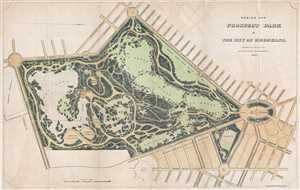
Design for Prospect Park in the City of Brooklyn.
sold
- Digital Map Information
- Suitable for large format printing
- File Size: 5.63 MB
- File Type: ZIP / TIFF
- ICC color profile embedded
- Delivered instantly via download link
This is a rare 1869 edition of Calvert Vaux and Frederick Law Olmsted's map of Prospect Park, Brooklyn. The map depicts the park as a whole and includes pathways, lakes, buildings, individual trees, ... (more details)
Remarkable 1869 map or plan of Prospect Park, Brooklyn.
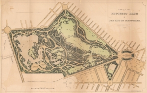
Design for Prospect Park in the City of Brooklyn.
sold
- Digital Map Information
- Suitable for large format printing
- File Size: 11.59 MB
- File Type: ZIP / TIFF
- ICC color profile embedded
- Delivered instantly via download link
This is a rare 1869 edition of Calvert Vaux and Frederick Law Olmsted's map of Prospect Park, Brooklyn. The map depicts the park as a whole and includes pathways, lakes, buildings, individual trees, rocks, and elevation measurements. The streets and avenues surrounding the park are also noted. (more details)
Exceptional large folding map of Central Park.
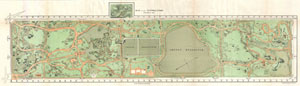
Map of the Central Park January 1st 1870.
sold
- Digital Map Information
- Suitable for large format printing
- File Size: 10.02 MB
- File Type: ZIP / TIFF
- ICC color profile embedded
- Delivered instantly via download link
An altogether extraordinary hand colored map of New York City's Central Park prepared and printed for inclusion in the Thirteenth Annual Report of the Board of Commissioners of the Central Park. ... (more details)
Exceptional large folding map of Central Park.
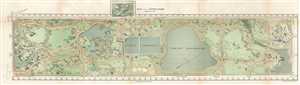
sold
- Digital Map Information
- Suitable for large format printing
- File Size: 9.06 MB
- File Type: ZIP / TIFF
- ICC color profile embedded
- Delivered instantly via download link
An altogether extraordinary hand colored map of New York City's Central Park prepared and printed by Knapp for inclusion in the Thirteenth Annual Report of the Board of Commissioners of the ... (more details)
Exceptional large folding map of Central Park.
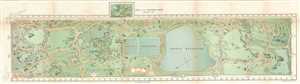
Map of the Central Park January 1st 1870.
sold
- Digital Map Information
- Suitable for large format printing
- File Size: 9.73 MB
- File Type: ZIP / TIFF
- ICC color profile embedded
- Delivered instantly via download link
An altogether extraordinary hand colored map of New York City's Central Park prepared and printed by Knapp for inclusion in the Thirteenth Annual Report of the Board of Commissioners of the ... (more details)
A very early planning map of Prospect Park.
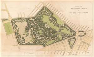
Design for Prospect Park in the City of Brooklyn.
sold
- Digital Map Information
- Suitable for large format printing
- File Size: 17.86 MB
- File Type: ZIP / TIFF
- ICC color profile embedded
- Delivered instantly via download link
This is a rare 1870 edition of Calvert Vaux and Frederick Law Olmsted's map of Prospect Park, Brooklyn. The map depicts the park as a whole and includes pathways, lakes, buildings, individual trees, rocks, and elevation measurements. The streets and avenues surrounding the park are also noted. (more details)
Planning map of Prosepct Park, Brooklyn's finest park.
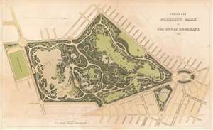
Design for Prospect Park in the City of Brooklyn.
sold
- Digital Map Information
- Suitable for large format printing
- File Size: 3.46 MB
- File Type: ZIP / TIFF
- ICC color profile embedded
- Delivered instantly via download link
This is a rare 1870 edition of Calvert Vaux and Frederick Law Olmsted's map of Prospect Park, Brooklyn. The map depicts the park as a whole and includes pathways, lakes, buildings, individual trees, rocks, and elevation measurements. The streets and avenues surrounding the park are also noted. (more details)
Olmsted's greatest park.
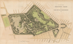
Design for Prospect Park in the City of Brooklyn.
sold
- Digital Map Information
- Suitable for large format printing
- File Size: 32.05 MB
- File Type: ZIP / TIFF
- ICC color profile embedded
- Delivered instantly via download link
This is the 1870 edition of Calvert Vaux and Frederick Law Olmsted's map of Prospect Park, Brooklyn. The map presents a comprehensive overview of the park during its initial construction phases. Although operable by 1870, Prospect Park was not officially finished until 1895. (more details)
1871 Kellogg and Pilat Map of the Southeast Corner of Central Park (Grand Army Plaza), New York City
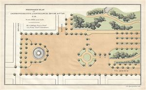
Proposed Plan of Improvements of Entrance 59th St. and Vth Av. C.P.
sold
- Digital Map Information
- Suitable for large format printing
- Full resolution TIFF file
- ICC color profile embedded
- Delivered instantly via download link
This is a beautiful and unusual little map of the southeastern corner of New York City's Central Park by Kellogg and Pilat dating to 1871. It depicts the southeast corner of Central Park ... (more details)
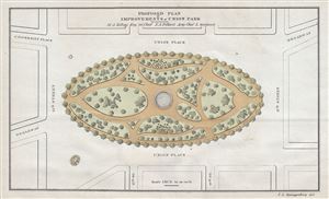
Proposed Plan of Improvements of Union Park.
sold
- Digital Map Information
- Suitable for large format printing
- Full resolution TIFF file
- ICC color profile embedded
- Delivered instantly via download link
This is a rare and important 1871 example of Kellogg and Pollard Map or plan of Union Square, New York City. The Commissioners' Plan of 1811 united Bowery Road (now 4th Avenue) and ... (more details)
World's greatest urban park.
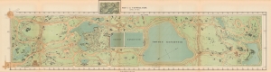
Map of the Central Park April 20th 1871.
sold
- Digital Map Information
- Suitable for large format printing
- File Size: 15.57 MB
- File Type: ZIP / TIFF
- ICC color profile embedded
- Delivered instantly via download link
This 1871 map of Central Park, a rare gem printed by Knapp, stands out for its unique depiction of the park in a completed state. It showcases the intricate pathways, serene lakes, majestic buildings, individual trees, rugged rocks, and varying elevations, offering a comprehensive overview of the park's design. (more details)
A very early planning map of Prospect Park.
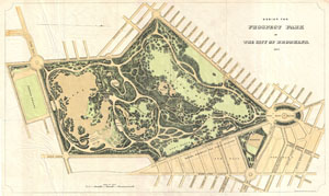
Design for Prospect Park as Proposed to be Laid Out for The City of Brooklyn.
sold
- Digital Map Information
- Suitable for large format printing
- File Size: 7.27 MB
- File Type: ZIP / TIFF
- ICC color profile embedded
- Delivered instantly via download link
A rare 1871 example of Vaux & Olmsted's map of Prospect Park, Brooklyn. Issued shortly after its 1867 completion, this is one of the first published maps to focus on the design of ... (more details)
Rare early planning map of the Wollman Rink and Concert Grove part of Prospect Park, Brooklyn.
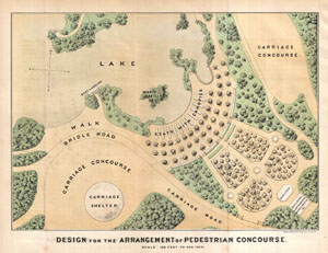
Design for the Arrangement of Pedestrian Concourse.
sold
- Digital Map Information
- Suitable for large format printing
- File Size: 2.72 MB
- File Type: ZIP / TIFF
- ICC color profile embedded
- Delivered instantly via download link
A rare 1871 example Vaux & Olmsted's map of part of Prospect Park, Brooklyn. His map focuses on the section of Prospect Park now occupied by Wollman Rink and the adjacent Concert ... (more details)
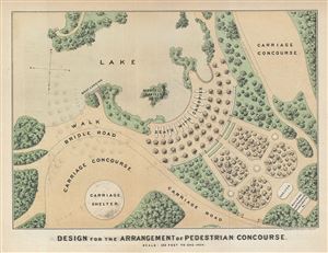
Design for the Arrangement of Pedestrian Concourse.
sold
- Digital Map Information
- Suitable for large format printing
- Full resolution TIFF file
- ICC color profile embedded
- Delivered instantly via download link
This is a rare 1871 example Vaux & Olmsted's map of part of Prospect Park, Brooklyn. His map focuses on the section of Prospect Park now occupied by Wollman Rink and the adjacent ... (more details)
An early plannin map of Von King Park, Brooklyn.
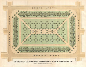
Design for the Laying Out Tompkins Park - Brooklyn.
sold
- Digital Map Information
- Suitable for large format printing
- File Size: 1.87 MB
- File Type: ZIP / TIFF
- ICC color profile embedded
- Delivered instantly via download link
A rare 1871 example Vaux & Olmsted's map of Tompkins Park or, as it is now known, Herbert von King Park, Bedford-Stuyvesant, Brooklyn. Von King Park is one of Brooklyn's earliest ... (more details)
Perhaps the Greatest Ever Map of Central Park.
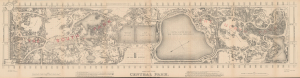
Map of the Central Park.
sold
- Digital Map Information
- Suitable for large format printing
- Full resolution TIFF file
- ICC color profile embedded
- Delivered instantly via download link
This is a rare, very large format c. 1873 administrative map of Central Park in New York City, prepared by draughtsman Otto Sibeth. The size and the level of detail allowed for by the large scale easily make it one of the finest maps of Central Park ever prepared. The map also presents the park as it neared completion (officially completed in 1876), including early renderings of the planned sites for the Metropolitan Museum of Art and the American Museum of Natural History. (more details)
The largest and most detailed published map of Central Park to appear in the 19th century.
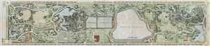
Central Park, New York City. Official map, By the courtesy of the Department of Parks of the City of New York.
sold
- Digital Map Information
- Suitable for large format printing
- File Size: 339.23 MB
- File Type: ZIP / TIFF
- ICC color profile embedded
- Delivered instantly via download link
Measuring over six feet long, this is the largest known 19th century published map of Central Park, New York City. An altogether extraordinary fine, this rarity is a hand colored ... (more details)